Environmental Assessment for a Proposed Ski Resort
Summary
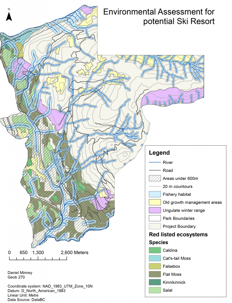
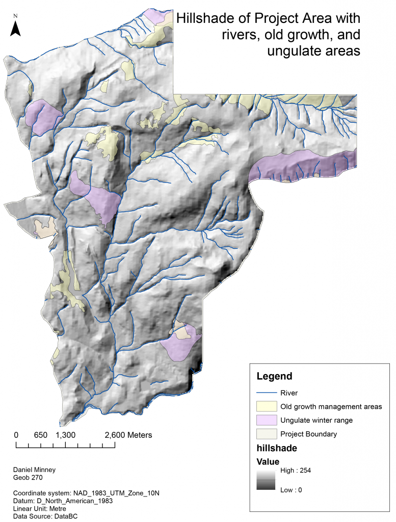
The two maps above have been created as a tool to help visualize the area around Brohm Ridge which has been proposed as a site for the construction of a potential ski-resort. Various key components have been considered for environmental assessment of the proposed area. The following are the key components:
- Rivers;
- Roads;
- Areas under 600m;
- Fishery habitats;
- Old growth management areas;
- Ungulate winter range;
- Park Boundaries;
- and Red listed ecosystems.
Various steps have been taken to analyze the data. The first was parsing the data, done by creating a geodatabase in ArcView and then renaming and organizing the data so that is easier to view and access. The next step was to filter out the data, done by clipping the vector and raster data to the project boundary. Once both these steps had been completed the data could now be analyzed by using spatial analyst tools such as reclassifying, and using the attribute tables. As a result, I was able to calculate the total percentage of the proposed area that will be lower than 600m of vertical, has old growth forest, has Mule Deer winter habitat and Mountain Goat winter habitat, red listed ecosystems, fish bearing streams and the total of all these. These are as follows:
- Area lower than 600m of vertical: 31.7%;
- Old growth forest: 6.8%;
- Mule Deer winter habitat: 4.2%;
- Mountain Goat winter habitat: 3.7%;
- Red listed ecosystems: 24.8%;
- Fish bearing streams: 28.4%
- and Total protected area within the project area: 53.7%.
The two greatest environmental concerns of the project are the Red listed ecosystems and the fish bearing streams. Both covering around ~25% of the proposed project area, there is a high possibility that these areas could experience negative effects from the construction of a ski-resort and the users of the ski-resort. Restricting the resort to areas higher than 600m will negate a majority of the danger to the red listed ecosystems as most of them inhabit areas below 600m as can be seen on the map. However, protecting the fish bearing streams would be a task that would result in restricting the size and area of the ski-resort, and may not even be possible considering how extensive these streams are. One way to mitigate the damage on these streams would to ensure there is no run-off of byproducts from the construction process, and that these streams become protected and surrounded by a boundary restricting users of the resort from entering the area.
I do not believe that the project should be allowed to proceed with construction given the significant area that the fish bearing streams and red listed ecosystems cover.
Accomplishments
Independently acquired spatial datasets using online catalogues, and gained knowledge on how to parse and filter data. Further established map creating skills to communicate a clear idea, alongside a short memo.