Final Project – An Assessment of Translink’s 10-Year Vision
Summary
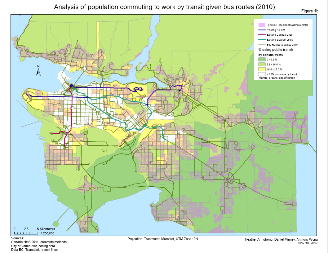
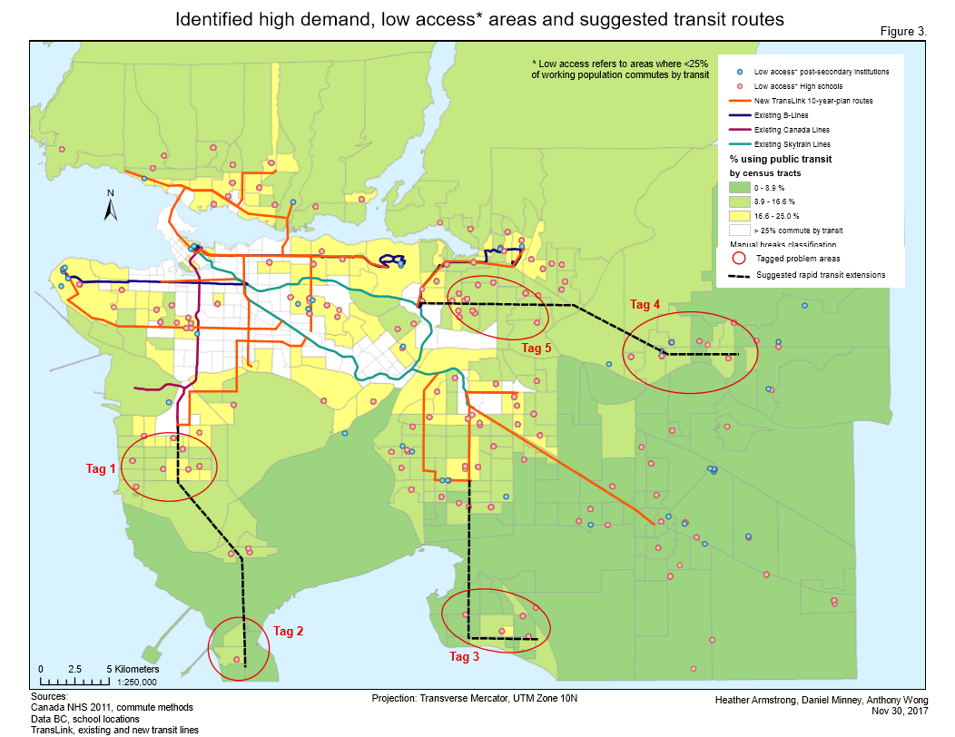
The goal of this project was to analyze whether Translink’s 10-year Vision to improve public transportation across Metro Vancouver assesses the current lack of rapid transit in the region. The project focused on ‘Phase Two’ of the 10-year Vision, which includes the implementation of the Broadway Corridor Subway and Surrey & Langley Light Rail. The project used data publicly available from various sources, and primarily utilized data about the mode of transportation used by residents from the 2011 NHS. Existing rapid transit routes were used alongside the proposed routes and key points of interest, specifically high-schools and post-secondary institutions. The project discovered distinct areas where there are low amounts of public transit users (<25%). Specifically, these areas included South Delta, Surrey, White Rock, Langley, and Coquitlam. Unsurprisingly, these areas also lacked rapid transit such as express busses or train systems such as a skytrain or underground train. The 10-year Vision assesses these problems in Surrey, Langley, and Port Coquitlam, however the other cities lack planning for new rapid transit, and only plan to implement new busses or increase current route frequency.
As a group, we separated various asepcts of the project, however one of the group members and myself primarily developed and worked on the maps that would provide us with the data that would then need to be analyzed to understand. Techniques utilized included using the intersect tool, joining tabular data with spatial data, classifying data using natural breaks to display commute census data, and converting data with tabular with x,y coordinates into point data. Subseuquently as I had worked on creating the maps, I wrote out the methodology of analysis, and created a flowchart to visualize the steps taken to gain our results. Data management was fairly straightfowards as we made sure to establish which data would be used for the project, and made sure that it was publicly accessible before beginning the project. Map packaging also made it easy to share completed maps with other group members.
Unfortunately, Translink’s data on congestion and traffic for specific public transit routes was unavailable to the public, which would have been useful in establishing if certain rapid transit routes, or reuglar bus routes, were too congested and therefore caused people to use other methods of transportation instead.
Maps