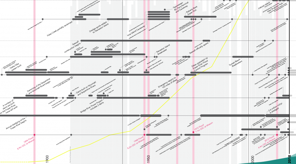
The timeline visualizes interrelationships between key flood events, infrastructure developments, shoreline transformations, and legislation. This timeline integrates information gathered from hundreds of planning reports, policy documents, archival resources and municipal websites.
The x-axis (horizontal) organizes information according to time; from precolonial to present-day, and projecting into the future. The line at the bottom documents major flood events, key legislative decisions as well as important studies that were undertaken/organization that were formed to deal specifically with the issue of flood management. The other horizontal lines map the history of flood control measures that have been implemented in the region, each line representing a different solution: 1) dredging, 2) dams, 3) dikes, 4) groins/jetties/breakwaters, 5) seawalls, as well as, 6) the reuse of dredge spoils, and 7) habitat restoration/nature-based solutions. The y-axis (vertical) maps the peak discharge volumes of the Fraser River, with major flood events highlighted in magenta. The yellow line represents the population growth of Metro Vancouver.
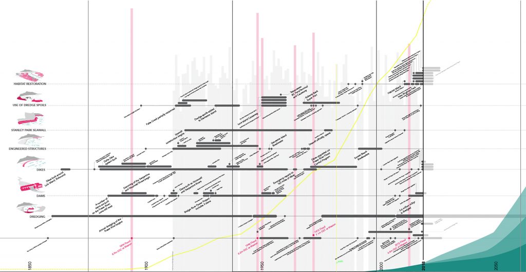
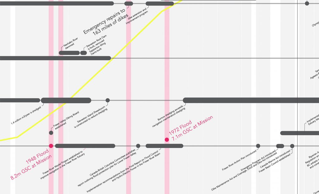
Overall, the timeline reveals the extent to which the delta and its shorelines been transformed and manipulated over time. It also shows that, with the exception of some dike upgrades, the majority of flood control measures in the region were completed by 1970. This not only underlines the fact that current flood protection is reaching the end of its lifespan, but also that few of these infrastructures would likely meet current design standards. Other insights and findings include the emergence, albeit at a relatively small scale, of habitat restoration and nature-based solutions over the last decade. Additionally, there is a strong correlation between flood events and the subsequent adoption of legislation and/or the establishment of special projects. One such example is the Fraser River Model Project Office (1948-1963), which was established in direct response to the flood of 1948, and enabled the construction of a large scale hydraulic, erodible-bed, tidal river model to test and improve flood management and navigation in the Fraser River Delta.