
The final project explores the spatial pattern of fatal traffic accidents in Toronto during 2007 to 2017. We first list several spatial and temporal variables that may connected to the traffic fatality. Through Chi-square analysis by R studio, we identify factors including times of a day, road location and speeding that impact on the traffic severity. Then, The Moran’s I result indicates all the variables show a strong positive spatial autocorrelation of fatal concurrency. Next steps contain the representation of hot spots and spatial distribution of the fatal accidents according to different variables, and a grouping analysis accompanied with the zoning to test the correlation between fatal accidents and land use.
Through the Logistic and GIS analysis, we found that the spatial patterns of fatal accidents could be very different based on different factors. The morning and evening rush hours present totally different hotspots. Fatal accidents involving speeding issue only concentrated in some specific area, but the fatal accidents at intersections are widely distributed in the whole Toronto. Land use does not show specific correlation with the fatal traffic accidents, but the road structure may impact on. Downtown and Scarborough are two area where the hotspots and high frequency of fatal accidents happened. The high road density in downtown could be one causation of the large number of concurrency, while the complex dendritic road system may make the suburban Scarborough dangerous.
Click here to see the whole Final Project.
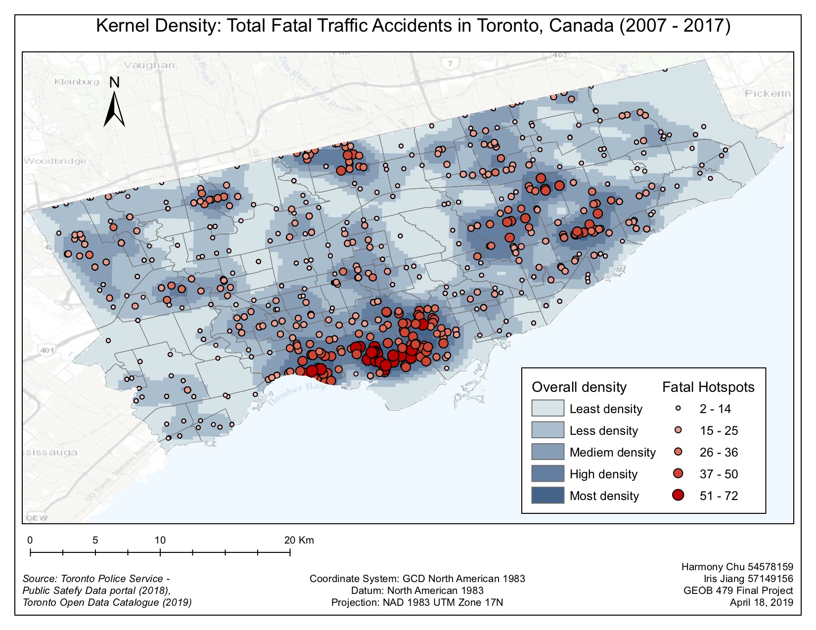
Figure 1. Total Fatal Traffic Accidents in Toronto