Geo-literacy focuses on the interconnections, interactions and implications of the dynamic processes that make up our society and environment. Geo-literacy is a lens in which you see the world, a lens that asks you to be critical, creative and above all problematize what seems simple, mundane or natural. Engaging in geo-literacy with your students means that they will gain the skills required for 21st century thinking and employment.
Below are two examples of geo-literacy in the classroom:
1) An Urban Tour of Vancouver- Studying the processes of urbanization in MEDC’s. Included are a few examples of students powerpoint projects related to the Urban Tour and urbanization terminology. Discussion on geo-literacy below.
Kevin Chang and Tony Liu – Geography Urban Tour
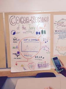
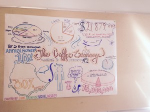
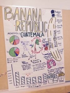
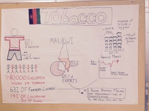
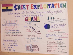
2) Infographics- activity taken from EDUC 432. Included is a very similar assignment I did in my undergraduate degree that is based on the same premise of this activity and provides an example of a more intensive summative assessment that could accompany this activity. Discussion on geo-literacy below.
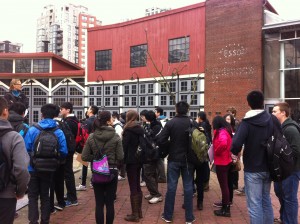
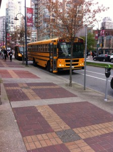
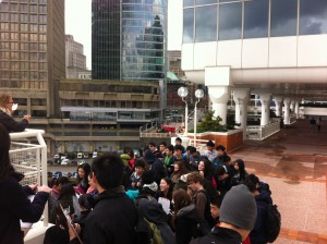
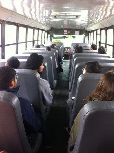
1) Urban Bus Tour of Vancouver and Geo-Literacy:
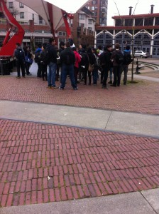
On my practicum I taught IB geography in which I covered processes of urbanization in both LEDC’s and MEDC’s. During the unit we focused on two major case studies that included Bangladesh and Vancouver. For the Vancouver case study I took my class on an urban bus tour of Vancouver, which intended to highlight the different processes of urbanization that typically occur in more economically developed cities. Over the course of the field trip we visited many different Vancouver neighborhoods and talked about the implication of the history of each neighborhood (ex. Shaughnessy as an expensive residential neighborhood because of rich CRP developers), who lived their now and why (ex. Yaletown railway yard become hip and trendy) and the implications the neighborhood has on the rest of the city (poverty in the downtown east side). While most of the field trip was us chatting about the different neighborhoods that we drove through or stopped at, it was also included inquiry driven elements, for example I left the students to wander though the financial district, Gastown, Chinatown and the DTES with a partner apart from me or others in the class in order to try and make sense of the changes between one place and the next. I asked the students to think why and how different political, economic and social pockets exist in a city instead of being just one homogenized zone. I asked them about the implications of immigration, pollution and real estate values (for example) to the urban environment in Vancouver.
I believe that this field trip, in many ways, asked students to engage in modern geographic thinking along with fitting into both the new BC curriculum and the IB curriculum. Chiefly, this activity asked students to critically assess what they see everyday and encouraged them to ask questions about the city that provides the backdrop for their everyday life. The tour activity was to match urbanization terminology with a photograph and to explain what this term means to the city of Vancouver. The assignment was completed in pairs and showcased communication between the partners and the creative thinking/ challenge of visual representation of complex and interconnected processes.
Lastly, getting students outside and tangibly seeing and making sense of the complex urban environment that beforehand seemed to just naturally exist was a neat experience for me. Students came to life, became investigators and inquirers. Their questions were being answered with more questions and the interconnection and interactions of city life and development were explored. Later we discussed the implications of MEDC cities like Vancouver have on other parts of the world, like in our other case study of Bangladesh.
2) Infographics on Commodity Chains and Geo-Literacy:
The infographic activity that asks students to study a particular commodity and its impacts socially, economically, environmentally and politically, on both national and international scales provides an excellent opportunity to engage in 21st century geographic thinking. What I love about this activity is that it asks the students to inquire into a commodity that they have everyday contact with, immediately as the students begin to investigate (increasing digital literacy) they are able to situate themselves into a larger story of interconnections and implications of their actions as a consumer. This activity engages students with the complexities of globalization and the entanglement of positive and negative impacts that accompany it. This task invites students to collaborate with each other in order to sort through a variety of facts and statistics to find what is meaningful and valid. It also asks students to be creative as they take stand-alone facts and pieces of information to form and represent a larger narrative of a dynamic process in a visual way. This activity fits in with the new curriculum in nearly every way as it invites students to be communicative, critical, and creative while also asking them to define their own actions in terms of their relationships with others across the world.
One thing I noticed during this course and in this activity in particular is that guided inquiry and using geo-literacy takes a lot of time in the classroom. It took our group quite a bit of time to focus our lens on interconnections, interactions and implications before we really could dig into the subject matter and engage in critical and creative thinking. Going through the process of this activity helped me to process how I would utilize this in a classroom and how much time I would grant for meaningful work using geo-literacy skills.