Preliminary maps were created for the purpose of visualizing the spatial data for crimes occurring in relation to street lights, parks and SkyTrain transit stations. The data from the ensuing maps was then used to create the four final maps which can be found under the section Final Maps.
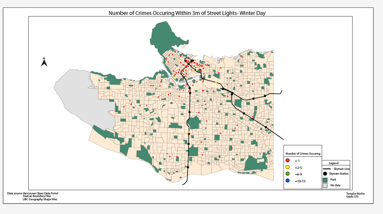
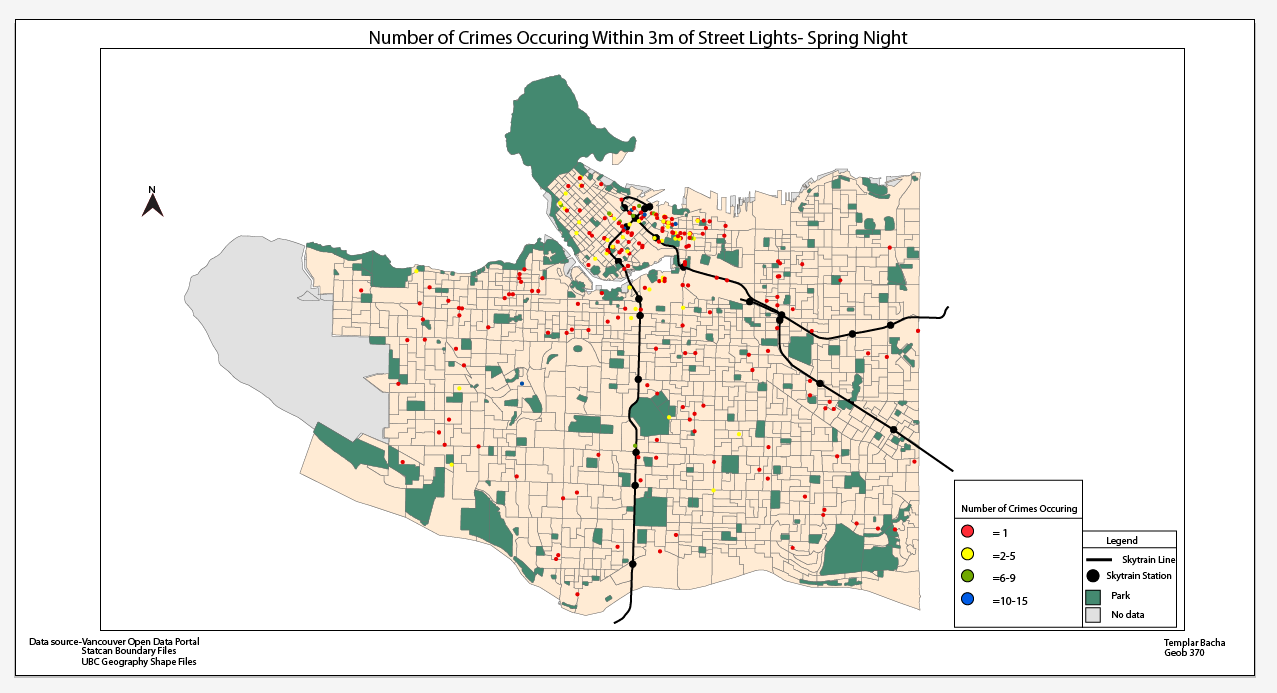
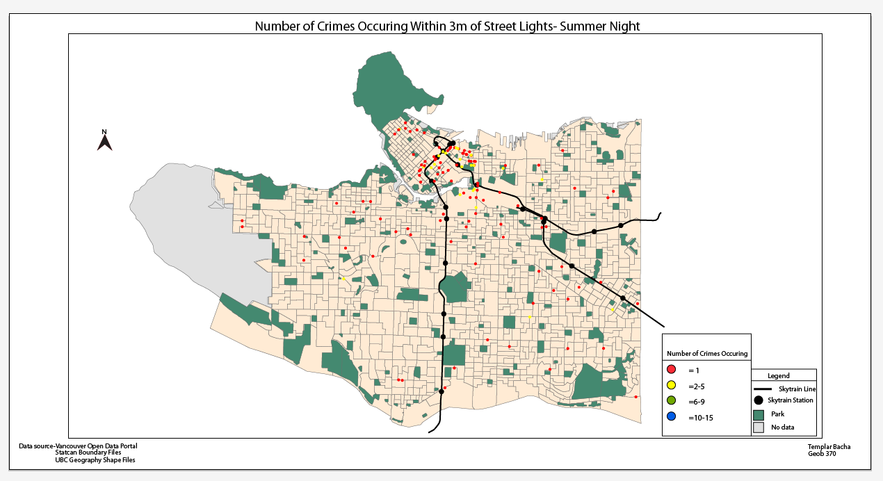
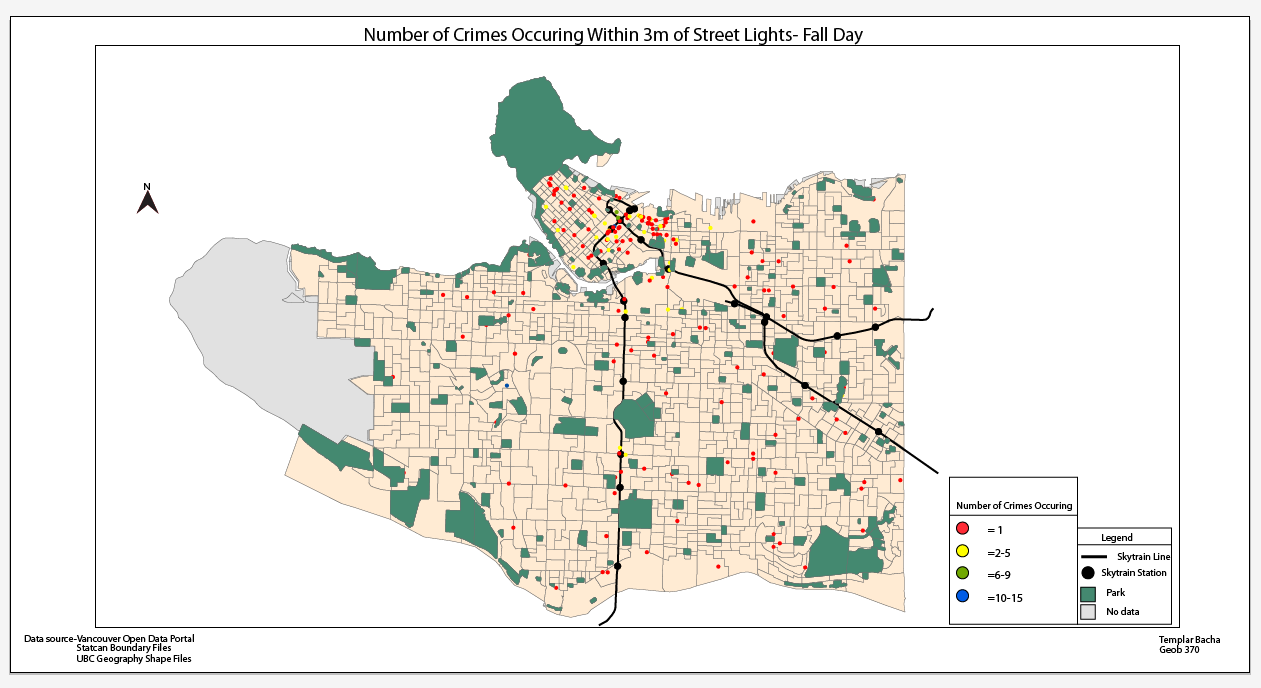
Number of Crimes Occurring Under Street Lights (3m) Buffer.
Top to bottom ( Winter,Spring,Summer,Fall). Left to right (Day,Night)


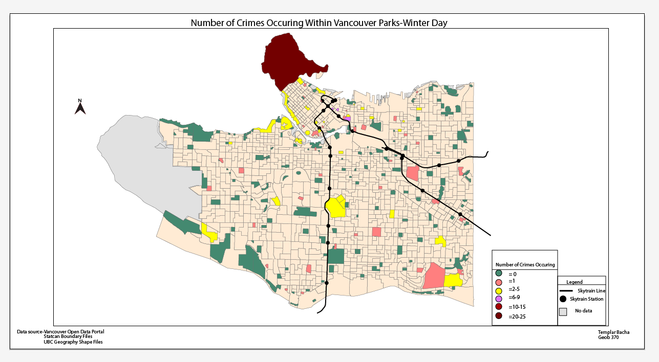
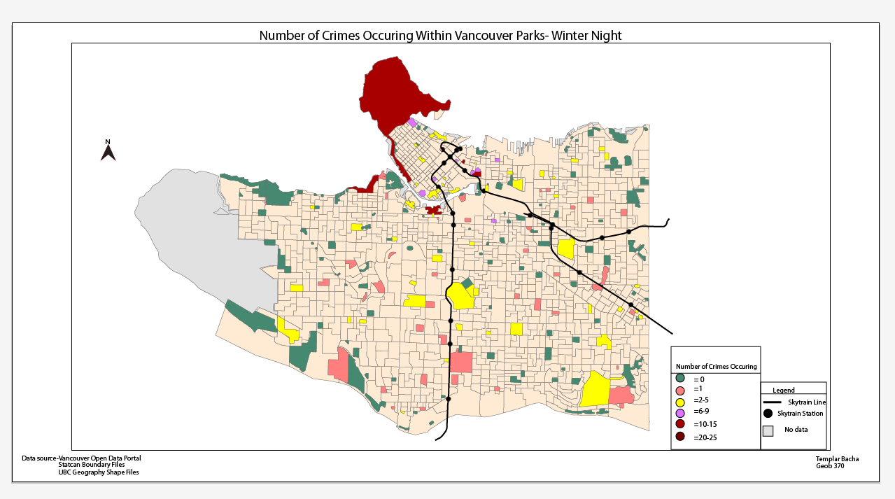
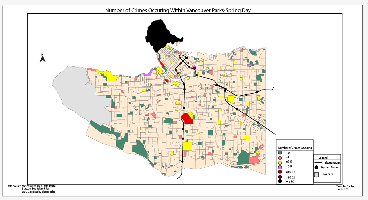
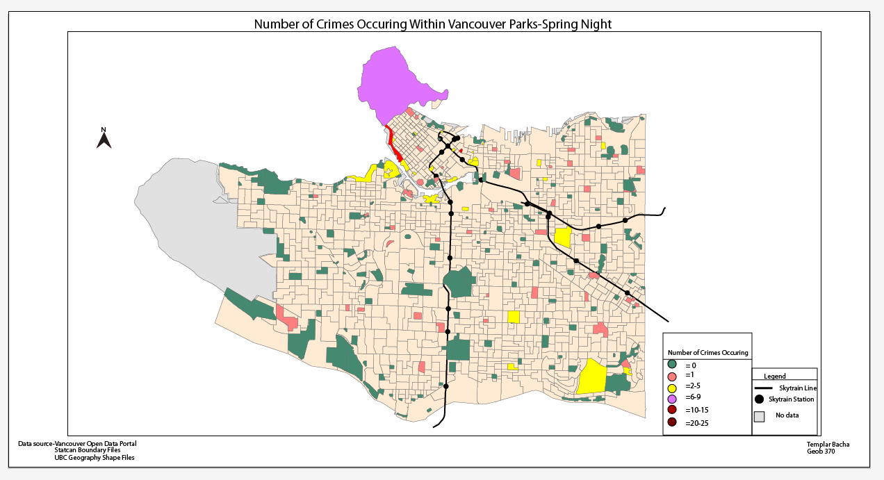
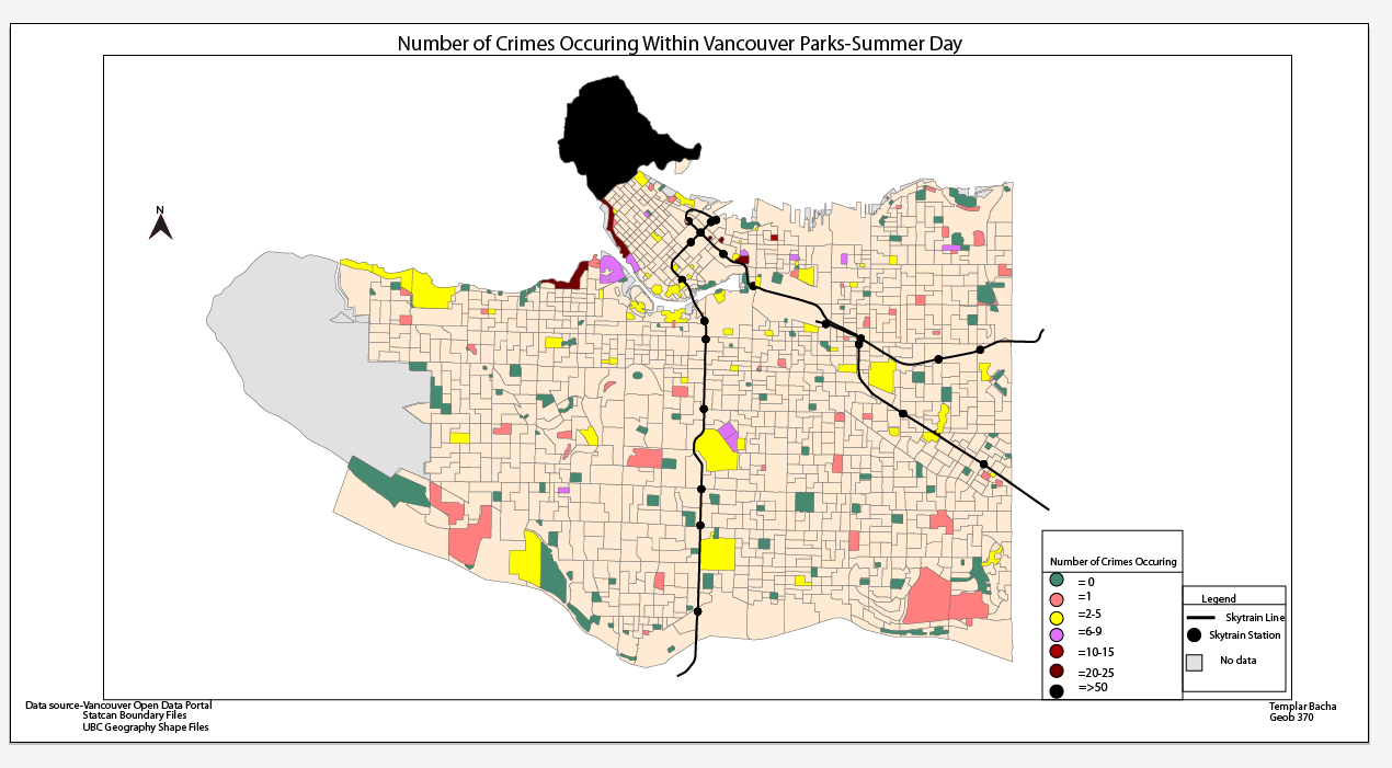
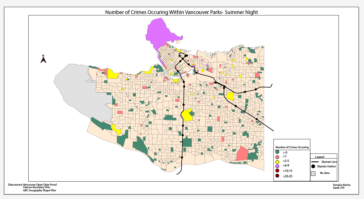
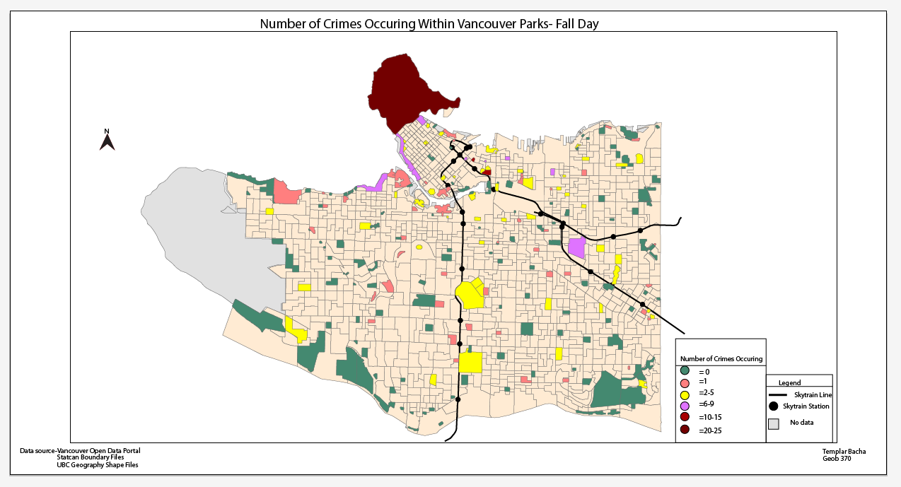
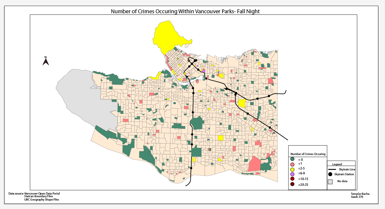
Number of Crimes Occurring in Vancouver Parks (20m) Buffer.
Top to bottom ( Winter,Spring,Summer,Fall). Left to right (Day,Night)
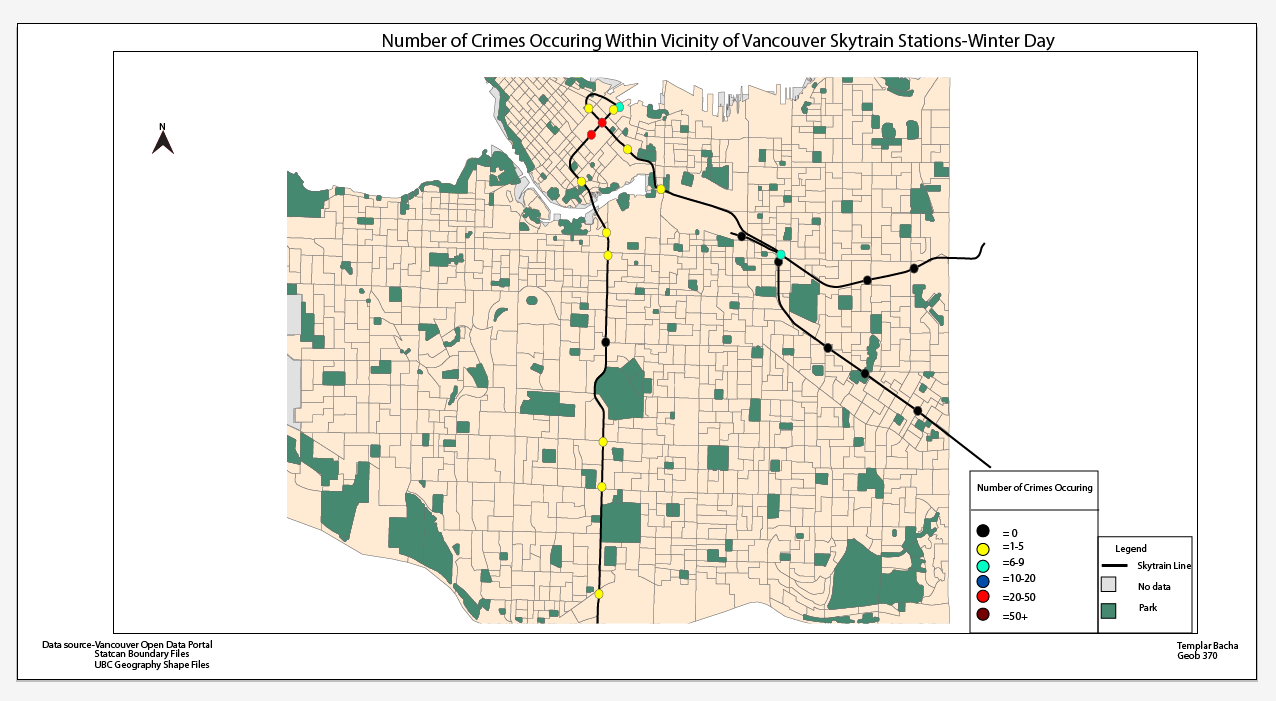
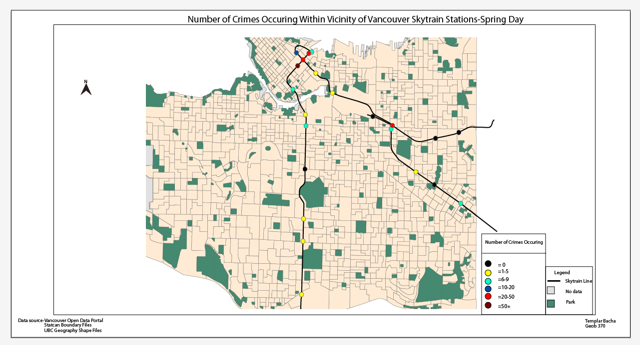
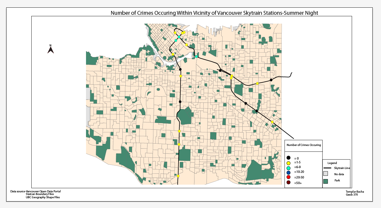
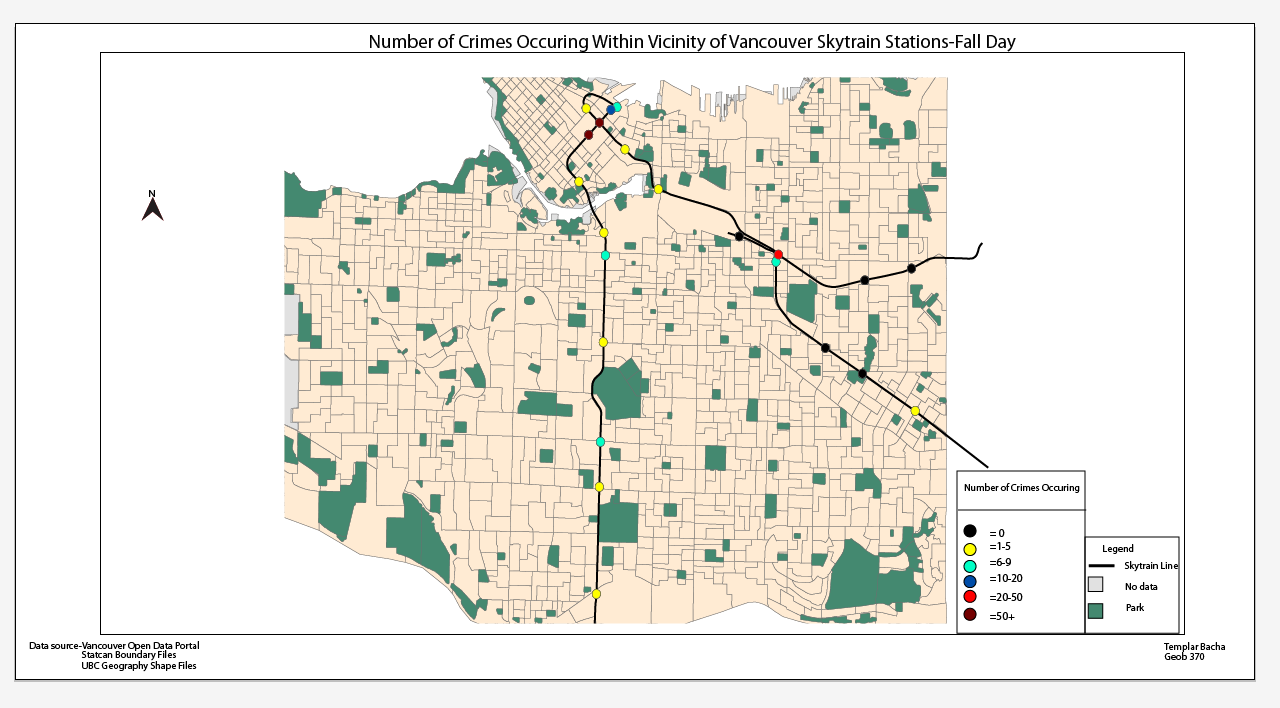
Number of Crimes Occurring Within SkyTrain Transit Stations (80m) Buffer
Top to bottom ( Winter,Spring,Summer,Fall). Left to right (Day,Night)