Intertidal Zones

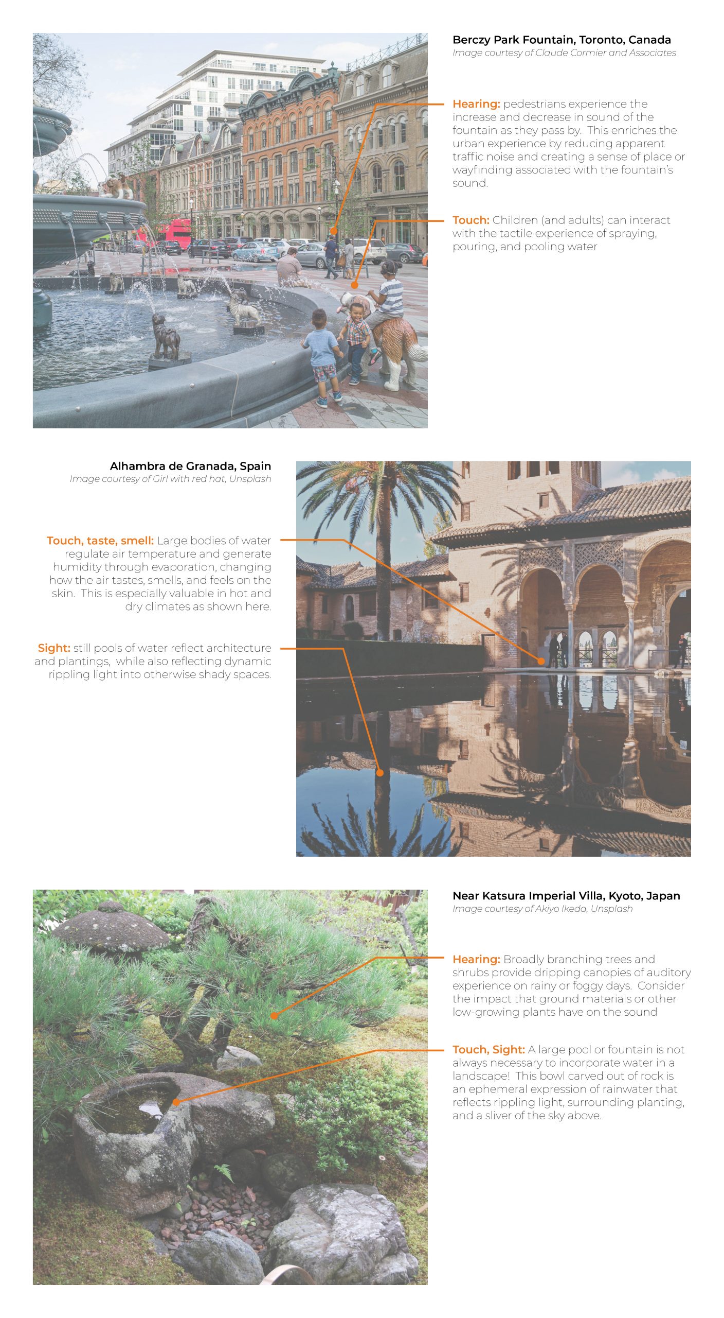
The intertidal zone is the ever-changing area where the land meets the sea, bound by the highest and lowest tides.  It is divided into three elevation zones: high intertidal zone, middle intertidal zone, and low intertidal zone. Each zone represents distinct characteristics acting along a spectrum that relates to the amount of time spent above or below the water line during a given tide cycle. The intertidal zone is under constant change due to tidal cycles, seasonal patterns, current-driven water temperature shifts, and erosion, thus creating a delicately balanced habitat for the plant and animal species living there.  

What are the properties of water within intertidal zones? 

Along with changes in the presence and absence of water, the intertidal zone is characterized by shifts in salinity, temperature, and movement.  

Salinity: Evaporation of water at the upper intertidal zone increasing the salinity, while precipitation inversely decreases it1.  

Temperature: The regulating effect of water on temperature influences the habitability of the intertidal zone.  While low intertidal zone organisms benefit from more consistent inundation and tend to be more sensitive to temperature change (eg, coral reefs) organisms in the high intertidal zone must be especially resilient to temperature swings.  in coastal British Columbia in 2021, very low tides and a record breaking heat wave coincided, causing mass die-offs of intertidal species due to temperature and increased rates of evaporation2

Movement:  the mechanics of water in currents and wave action influence the habitability of in intertidal area.  While some organisms such as eel grass and sand dollars grow best in sheltered locations, other organisms such as Chiton and Green anemones thrive where wave action is the strongest3.  Water movement in the form of tidal fluctuation dramatically influences biodiversity. On some rocky coastlines, stratified layers of biological communities at different tidal levels can be easily visible, while in mudflats and tidal marshes, these layers may occur below the sand and out of site4.  Currents and wave action are also the primary source of life in the intertidal zone, refreshing the water with food, regulating temperature, and clearing away harmful contaminants.  

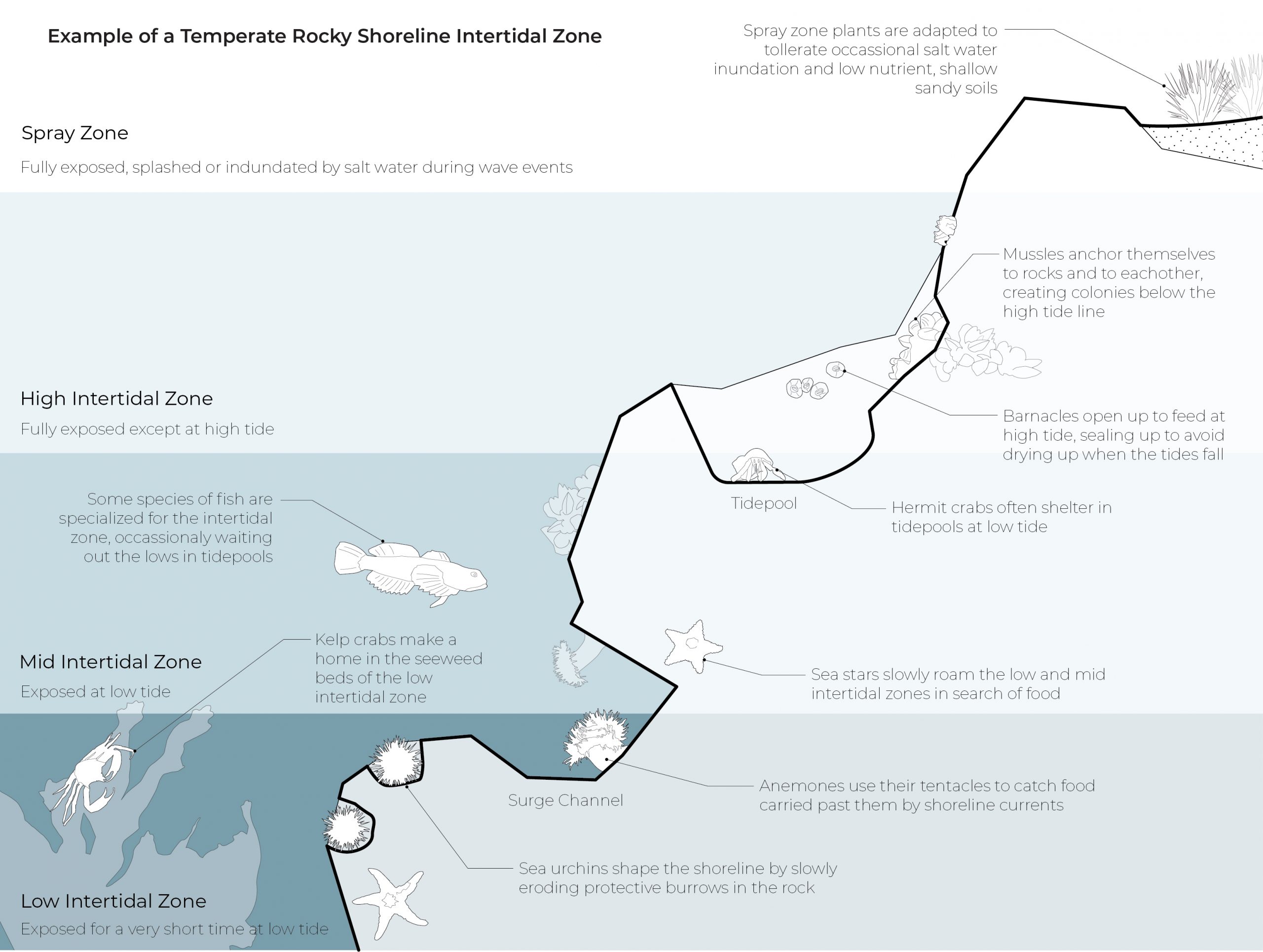
Figure 1: Example of a Temperate Rocky Shoreline Intertidal Zone


[1] Geng, Boufadel, and Jackson, “Evidence of Salt Accumulation in Beach Intertidal Zone Due to Evaporation.”

[2] Migdal, “More than a Billion Seashore Animals May Have Cooked to Death in B.C. Heat Wave…”

[3] DiNenno, “On the Edge.”

[4] “Biodiversity on Rocky Coasts.”

What are the benefits provided by intertidal zones? 

Intertidal zones house a variety of plant and animal species that are specifically suited to this somewhat inhospitable environment, which in turn act as food for both off-shore aquatic animals and on-shore mammals and birds: a critical nutrient pathway between the sea and the land that is exemplified by the impacts of intertidal herring spawning in the North Pacific and its impact on terrestrial ecosystems1.  

The intertidal zone also serves as natural shoreline protection, regulating and shaping erosion, influencing saltwater incursion and inundation, and protecting low-lying areas from flooding in extreme weather events2.

Beyond the above ecosystem services, intertidal zones are often the gateway for the general public to experience and interact with marine ecosystems in a positive and educational way. The multisensorial experience of exploring tidepools and wading at the waters edge cultivates wonder and appreciation for the richness that lies below the high-tide line.


[1] Walters, “Protecting (Marine) Subsidies.”

[2] “Intertidal Zone.”

How are intertidal zones at risk?

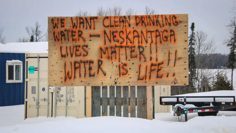
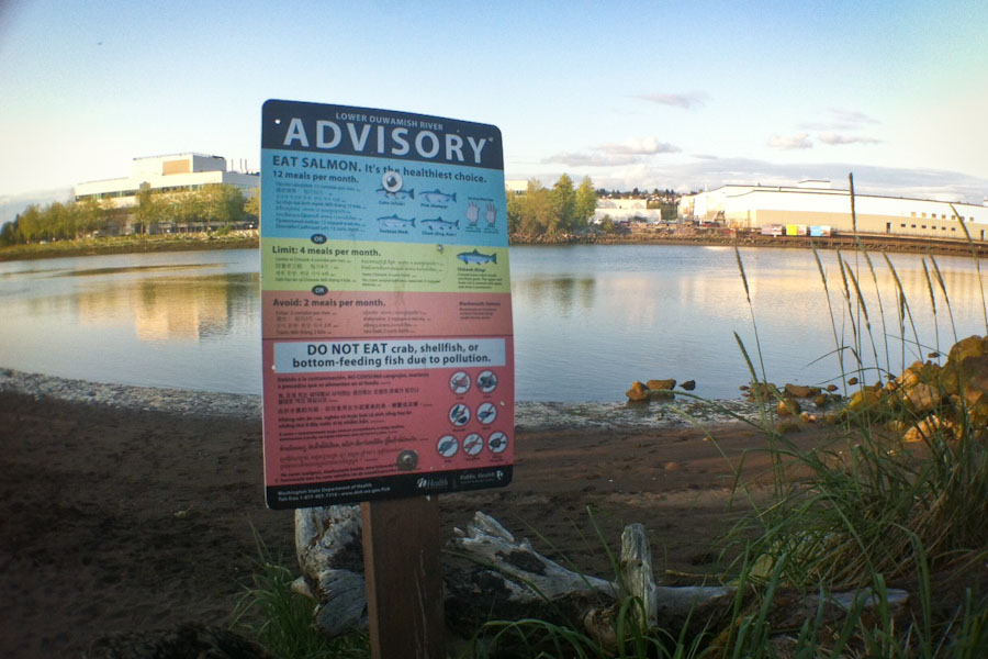
Massive environmental change and degradation has been wrought in and around our coastal cities.  Intertidal ecosystems are constantly under threat from development of housing, infrastructure, and industry – Many of our coastal cities are built on artificial land extending beyond the historic shoreline.  Robbed of natural protection from waves and erosion, the new shoreline requires significant protective measures, further degrading habitat and costing significant sums in installation and maintenance.  The water in these intertidal zones is prone to contamination from run-off, sewage, and industry, causing heavy-metal buildup and algal blooms that ravage delicate ecological balance and dramatically reduce biodiversity.  Because the intertidal zone links terrestrial and aquatic ecosystems, the effects of this degradation extend far beyond the intertidal zone. Knowledge of this has prompted environmental designers to develop new ways of revitalizing and regenerating our urban intertidal zones across scales in ways that aim to integrate ecology and the resulting ecosystem services into our urban fabric.

Even non-urban coastlines are at risk from pollution, resource extraction, infrastructure, global warming and sea level rise (refer to Water Quality and Sea Level Rise for further information). Understanding the history of a coastline and any interventions that have occurred is critical at the outset of any project within the intertidal zone.

How can environmental designers care for, restore, or create intertidal conditions?  

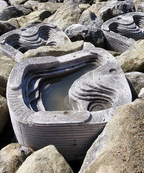
Figure 2 (left): ECOncrete’s tidepool creations at installation. Designboom.

Figure 3 (right): ECOncrete’s tidepool creations after colonization by intertidal species. ECOncrete.

With the ongoing and increasing threat of climate change impacts in the form of sea level rise and intense storm surges, intertidal zones are seen by many as the front-lines in a battle against nature. Environmental designers, equipped with an understanding of of the intertidal zone, are in a critical position to work with nature and the changing climate, rather than against it, in order to keep people and ecosystems safe. In parallel to the nature-based solutions to rainwater management presented in LID (see the Rainwater Management blog page), nature based solutions to urban intertidal conditions is a way forward that shows great promise. This can manifest in engineered solutions such as ECOncrete’s shoreline protection products that provide habitat for intertidal life1, as naturalized shoreline interventions such as Mithun’s Sea2City competition entry in False Creek, Vancouver, or as combined naturalized and engineered projects such as SCAPE’s well-known “Oystertexture” proposal for New York City3. Along with the environmental designer(s)’s extensive site-specific research, Interventions within the intertidal zone should involve ecologists, biologists and geotechnical engineers that are experts in local intertidal zone specifics: what may work in one location may be harmful in another.

Sources

DiNenno, Natalie. “On the Edge: The Curious Lives of Intertidal Organisms and How We Monitor Them.” U.S. National Park Service, 2022. https://www.nps.gov/articles/000/on-the-edge-the-curious-lives-of-intertidal-organisms-and-how-we-monitor-them.htm.

ECOncrete. “Shoreline Protection.” https://econcretetech.com/applications/shoreline-protection/.

Encyclopedia of the Environment. “Biodiversity on Rocky Coasts: Zoning and Ecological Relationships,” May 29, 2017. https://www.encyclopedie-environnement.org/en/life/biodiversity-on-rocky-coasts-zoning-and-ecological-relationships/.

Geng, Xiaolong, Michel C. Boufadel, and Nancy L. Jackson. “Evidence of Salt Accumulation in Beach Intertidal Zone Due to Evaporation.” Scientific Reports 6 (August 11, 2016): 31486. https://doi.org/10.1038/srep31486.

Migdal, Alex “More than a Billion Seashore Animals May Have Cooked to Death in B.C. Heat Wave, Says UBC Researcher | CBC News.” CBC, July 5, 2021. https://www.cbc.ca/news/canada/british-columbia/intertidal-animals-ubc-research-1.6090774.

Mithun. “Sea2City Design Challenge.” https://mithun.com/project/sea2city-design-challenge/.

National Geographic Education. “Intertidal Zone.” https://education.nationalgeographic.org/resource/intertidal-zone.

SCAPE. “Oyster-Tecture.” https://www.scapestudio.com/projects/oyster-tecture/.

Walters, Kristen. “Protecting (Marine) Subsidies: Nutrient Flows from Ocean to Land.” Raincoast Conservation Foundation, May 29, 2018. https://www.raincoast.org/2018/05/protecting-marine-subsidies-nutrient-flows-from-ocean-to-land/.

Images

Figure 1: Author’s work

Figure 2: Designboom, Lea Zeitoun. “ECOncrete® Blocks Are Bio-Enhanced Materials for Sustainable Marine Construction.” designboom | architecture & design magazine, February 9, 2022. https://www.designboom.com/technology/econcrete-coastalock-bio-enhanced-material-marine-construction-02-09-2022/.

Figure 3: ECOncrete. “Our Technology.” https://econcretetech.com/econcrete-technology/.

Additional Resources

“Explore the Rocky Shore and Stanley Park.” Vancouver Natural History Society, 2009. https://naturevancouver.ca/wp-content/uploads/2018/12/Nature_Vancouver_Intertidal_Pamphlet.pdf.

Field guides and similar documents can be very helpful when designing for specific organisms and communities of organisms in the intertidal zone, as they often include information on habitat and relationships between species. This example is focused on the rocky shore of Stanley Park, Vancouver.


Thom, Ronald M., Heida L. Diefenderfer, John Vavrinec, and Amy B. Borde. “Restoring Resiliency: Case Studies from Pacific Northwest Estuarine Eelgrass (Zostera Marina L.) Ecosystems.” Estuaries and Coasts 35, no. 1 (January 1, 2012): 78–91. https://doi.org/10.1007/s12237-011-9430-6.

Eelgrass meadows are an important intertidal and subtidal ecosystem not covered significantly in this blog post. This research article is a helpful resource for those specifically interested in this.


Valiela, Ivan, Marci L. Cole, James Mcclelland, Jennifer Hauxwell, Just Cebrian, and Samantha B. Joye. “Role of Salt Marshes as Part of Coastal Landscapes.” In Concepts and Controversies in Tidal Marsh Ecology, edited by Michael P. Weinstein and Daniel A. Kreeger, 23–36. Dordrecht: Springer Netherlands, 2000. https://doi.org/10.1007/0-306-47534-0_3.

Access this article for further information on salt marshes, a critical intertidal ecosystem.


Raffaelli, David, and Stephen Hawkins. Intertidal Ecology. Springer Science & Business Media, 1996. https://link.springer.com/book/10.1007/978-94-009-1489-6.

This book is a helpful overview resource on intertidal ecology.
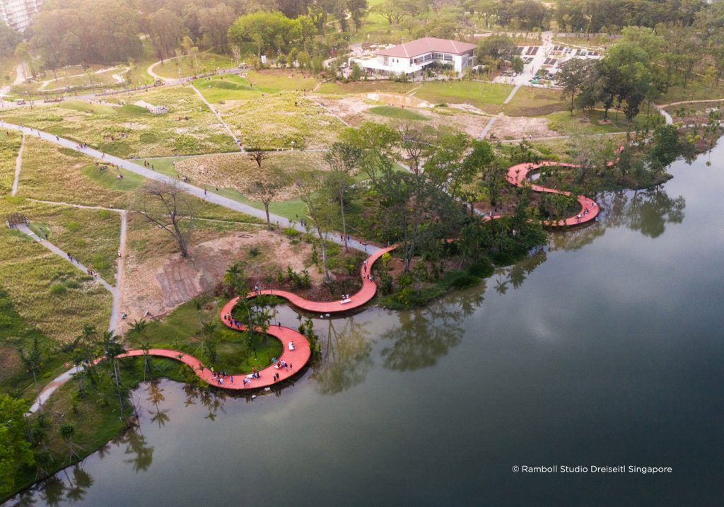
Precedents

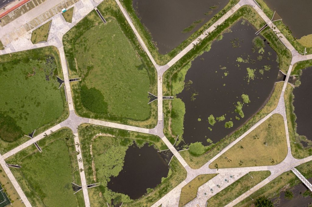
Oyster-tecture: SCAPE

Location: Brooklyn, New York, USA

In the face of sea level rise and other climate change impacts, Oyster-tecture imagines working with the constructive nature of oysters to calm wave action, shelter shorelines, and clean contaminated water.

This project can be viewed here, or listen to 99% Invisible’s podcast on the project here.


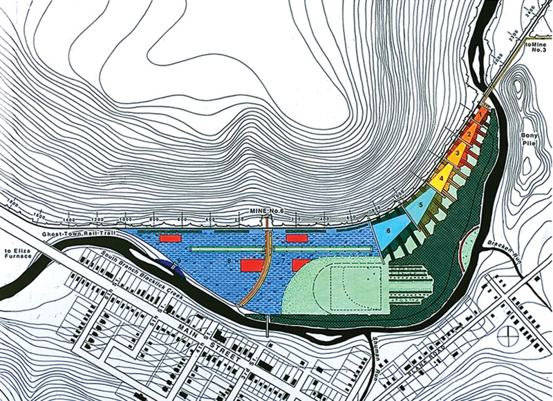
New Brighton Salt Marsh: Connect Landscape Architecture
Vancouver, BC, Canada

The salt marsh restoration viewed from above, with the adjacent public park and pool to the right. Photo credit Connect Landscape Architecture.

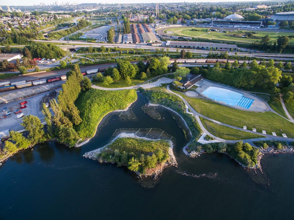
An integration of a restored tidal salt marsh with public park and swimming pool in a complex urban/industrial area of Vancouver.

This project can be viewed here.

Still and Slow Water

Lentic ecosystems is a term encompassing a range of slow or still waters and includes waterbodies such as lakes, reservoirs, ponds, swamps, and marshes.1


[1] Marsh and Fairbridge, “Lentic and Lotic Ecosystems.”

What role do lentic ecosystems play in their environment?

Lakes are formed by the filling of geological depressions or the containment of water by dams. Characteristics such as the depth, shape, and shoreline of lakes help to determine the hydrology and biology of their respective ecosystems.1  They are important ecosystems as they provide many services including the provision of drinking water, irrigation supply, flood control, hydropower, transportation, biodiversity conservation, recreation, and aesthetics.2 Marshes, however, go through cycles of flooding and drying, and inland marshes specifically can be characterized by their emergent vegetation, grasses, rushes, and sedges.3 Further information about marshes can be found under wetlands.


[1] Suring, “Lentic Freshwater.”

[2] Jørgensen, “Freshwater Lakes.”

[3] Craft, “Inland Marshes.”

What are the (anthropogenic) impacts on these waterbodies?

Lakes and ponds

Anthropogenic activity around lakes causes various concerns, particularly surrounding water quality. Eutrophication is a primary concern of lake health as wastewater, industrial or agricultural drainage, and/or runoff causes the inflow of excess nutrients into lakes, ultimately damaging the lake’s ecosystem through the impact on oxygen levels and subsequently the aquatic species affected by the chemical change. Runoff and wastewater also have the potential to transfer pathogens into the lakes, thus impacting the safe consumption of lake water. Another impact on lakes is large changes in water levels caused by the diversion of incoming water or by the removal or use of large quantities of water from these waterbodies. Changes in water level have the potential to trigger other processes such as eutrophication or salinization, or impact the ecosystem in other ways, for instance, through the reduction of fish spawning habitat caused by siltation.1 Additional impacts include fishing, noise and light pollution, and the introduction of invasive species.2 Ultimately, it’s important to understand that activities associated with lakes and ponds, and those upland of these waterbodies, will have an impact on the water quality and therefore need to be properly managed to minimize disruptions to these ecosystems.


[1] Jørgensen, “Freshwater Lakes.”

[2] Strecker, McGrew, and Chiapella, “Lake and Pond Ecosystems.”

What are the design considerations for lentic ecosystems?

In lakes and reservoirs where the water has been negatively impacted, restoration processes can be implemented to help bring back the natural potential of the waterbody. The primary methods of lake restoration include the removal of contaminants, the reduction/prevention of agricultural runoff and wastewater from entering to prevent processes such as eutrophication, and the overall improvement of water quality and aquatic ecosystems. Methods of lake restoration should be carried out at a watershed scale as water is interconnected in its different forms throughout the water cycle.1


[1] Dhir, “Wetland, Watershed, and Lake Restoration.”

Sources

Craft, Christopher. “Inland Marshes.” In Creating and Restoring Wetlands, 117–61. Elsevier, 2022. https://doi.org/10.1016/B978-0-12-823981-0.00014-9.

Dhir, Bhupinder. “Wetland, Watershed, and Lake Restoration.” In Handbook of Ecological and Ecosystem Engineering, edited by Majeti Narasimha Vara Prasad, 1st ed., 247–59. Wiley, 2021. https://doi.org/10.1002/9781119678595.ch13.

Jørgensen, Sven E. “Freshwater Lakes.” In Encyclopedia of Ecology, 509–13. Elsevier, 2008. https://doi.org/10.1016/B978-0-444-63768-0.00339-5.

Marsh, G. Alex, and Rhodes W. Fairbridge. “Lentic and Lotic Ecosystems.” In Environmental Geology, 381–88. Encyclopedia of Earth Science. Dordrecht: Kluwer Academic Publishers, 1999. https://doi.org/10.1007/1-4020-4494-1_204.

Strecker, Angela L., Alicia McGrew, and Ariana Chiapella. “Lake and Pond Ecosystems.” In Reference Module in Life Sciences, B9780128225622000700. Elsevier, 2022. https://doi.org/10.1016/B978-0-12-822562-2.00070-0.

Suring, Lowell H. “Lentic Freshwater: Lakes.” In Encyclopedia of the World’s Biomes, 121–30. Elsevier, 2020. https://doi.org/10.1016/B978-0-12-409548-9.12074-3.

Additional Resources

Precedents

Lakeside Garden: Henning Larsen

Location: Singapore

“Identified as the first phase of development of Jurong Lake Gardens, Singapore’s third national garden and the first in the heartlands, Lakeside Garden is a 53-hecare site that looks to restore the landscape heritage of the freshwater swamp forest as a canvas for recreation and community activities. The development is envisioned to be a “people’s garden” accessible to all segments of the community and is a conscious effort to bring back the nature that was once unique to the area.”

This project can be accessed on Landezine and the firm’s website.


Baton Rouge Lakes: SWA Group and CARBO Landscape Architecture

Location: Baton Rouge, USA

“The Baton Rouge Lakes project recognizes opportunity in crisis. The 275 acre lakes system is a series of six lakes in central Baton Rouge…Based on sound ecological underpinnings, the Lakes Master Plan uses restoration techniques and nature as a catalyst for healthy living where man and water exist in equilibrium.”

This project can be viewed through ASLA and through SWA’s website.

Flowing Water

Lotic ecosystems refer to flowing water, and thus encompass rivers, creeks, and streams. The first civilizations were formed around floodplain rivers as rivers provided drinking water, opportunities for transportation, and cultural value. The floodplains around rivers contained nutrient-rich sediments that supported fruitful food production, and the river valleys were used for their soils, as well as for settlements and industry.1


[1] Hildrew and Giller, The Biology and Ecology of Streams and Rivers.

What role do lotic ecosystems play within their environment?

Rivers then and today have many functions, including the generation of electricity, the supply of water, transportation, the harvesting and cultivation of fish, recreational uses, and the transportation of sediment.1,2

Streams and rivers are formed as rainfall travels as surface runoff into the channels of streams and rivers or through groundwater stores in which groundwater emerges from springs onto the surface. As water emerges from groundwater springs and merges into other streams, the width of the channel and the water flow generally increases, and as it increases in size, the stream may be identified as a river.3 (As noted by Hildrew and Giller, “There is really no formal definition of this change, and terminology is largely a point of view and culturally determined”).4


[1] Dhir, “Wetland, Watershed, and Lake Restoration.”

[2] Marsh and Fairbridge, “Lentic and Lotic Ecosystems.”

[3] Hildrew and Giller, The Biology and Ecology of Streams and Rivers.

[4] Hildrew and Giller.

What are the (anthropogenic) impacts on these waterbodies?

The various factors affecting the natural functioning of rivers include water pollution, the extraction and increased demand of water, the manipulation of stream channels, the use of water for hydropower, expansion of agriculture, overfishing, introduction of alien species, and artificial light and noise, which disrupt the normal behaviour of aquatic species. Additionally, climate change, especially its associated increased temperatures, is threatening freshwater ecosystems through diminished areas of these waterbodies, altered precipitation patterns, and more frequent flooding and drought events.1

Water pollution comes from various agricultural and industrial sources, and incorporates many contaminants, which range from pesticides to plastic particles and endocrine disruptors. Additionally, agriculture contributes to increased sedimentation as soil erosion washes sediments into nearby streams.2

In urban regions, the area of impervious surfaces is much greater, leading to decreased infiltration and increased amounts of runoff that makes its way into streams. Urban streams therefore have more frequent flooding events than forested streams. They also typically have higher concentrations of chemicals that are received from wastewater, storms sewers, and runoff. Additionally, since many cities have combined sewer and stormwater pipes, rainstorms will contribute to sewer overflows, resulting in effluents released into urban streams.3


[1] Hildrew and Giller.

[2] Hildrew and Giller.

[3] Meyer, “Urban Aquatic Ecosystems.”

What are the design considerations for lotic ecosystems?

With the factors influencing lotic ecosystems, restoration is an important consideration for streams and rivers. Streams are often impacted by the modification of its channels, and restoration therefore involves the reversal of these changes, such as the widening of the stream’s channels and the regrowth of its riparian vegetation.1 The restoration of streams and rivers is often much more intricate though, and includes not only structural modifications, but also physical, chemical, and biological methods to alter water flow and restore plants and aquatic species. Restoration of rivers and streams aims to promote channel-floodplain connectivity and restore the natural water and sediment dynamics, which can be done in a multitude of different ways. These methods, however, involve many different stakeholders and a comprehensive understanding of the respective watershed.2


[1] Dhir, “Wetland, Watershed, and Lake Restoration.”

[2] Dhir.

Additional Resources

Sources

Dhir, Bhupinder. “Wetland, Watershed, and Lake Restoration.” In Handbook of Ecological and Ecosystem Engineering, edited by Majeti Narasimha Vara Prasad, 1st ed., 247–59. Wiley, 2021. https://doi.org/10.1002/9781119678595.ch13.

Hildrew, Alan, and Paul Giller. The Biology and Ecology of Streams and Rivers. 2nd ed. Oxford University PressOxford, 2023. https://doi.org/10.1093/oso/9780198516101.001.0001.

Marsh, G. Alex, and Rhodes W. Fairbridge. “Lentic and Lotic Ecosystems.” In Environmental Geology, 381–88. Encyclopedia of Earth Science. Dordrecht: Kluwer Academic Publishers, 1999. https://doi.org/10.1007/1-4020-4494-1_204. Meyer, J.L. “Urban Aquatic Ecosystems.” In Encyclopedia of Inland Waters, 367–77. Elsevier, 2009. https://doi.org/10.1016/B978-012370626-3.00236-2.

Precedents

River Aire: Superpositions & Atelier Descombes Rampini

Location: Geneva, Switzerland

“The most poetic element is the grid of sand – a platform for the river – a natural force that expresses itself through decomposition. Designed as a ruin, the project is the process; full of play between the grid and the river, man and nature. Renaturalisation is not brought in by force; it occurs. One can imagine the river entering the grid for the first time, like an animal released from captivity, figuring out which way to go and where to settle. The power of this work lies in its honesty, taking us to a much deeper thinking about the relation between man and nature in the age of the Anthropocene.”

This project can be viewed on Landezine and The Architectural Review.


Wild Mile Chicago: Skidmore, Owings & Merrill, Urban Rivers

Location: Chicago, USA

“The Wild Mile is planned to be a mile-long, interactive and immersive floating eco-park located in the North Branch Canal and Turning Basin of the Chicago River. Situated between Goose Island and the Near North Side neighborhood, this stretch of river is a unique destination and an accessible community open space that promote habitat first and an outdoor educational amenity for all.”

This project and its framework plan can be viewed on the Wild Mile website and on ArchDaily.

Glaciers

Glaciers are a slow-moving mass of ice that are created through the accumulation and compression of snow on mountains or near polar regions. Glaciers are dynamic and recharge each year, melting during the summer and then capturing snow, which then compacts and turns to ice, during the winter. This process is referred to as diagenesis1.


[1] Taillant, Glaciers: The Politics of Ice.

Why are glaciers important?

Glaciers have a variety of important functions, including:

The storage and provision of water. Glaciers store water and feed rivers and groundwater that is then used for human and industrial use.

The survival of their respective native vegetation. The melting of glaciers provides water for vegetation near glaciated areas, especially in elevated environments where water is scarce.

Aesthetics and recreation. Glaciers contribute to a variety of outdoor recreational activities such as mountaineering, hiking, or skiing.

They provide a glimpse into history. As glaciers are formed by layers of ice layering year by year, the sampling of ice provides insight into atmosphere conditions of the past1.


[1] Taillant.

What are the different types of glaciers?

Ice sheets. These are large masses of glacial ice that are also referred to as continental glaciers. There are two major ice sheets that currently exist, one in Greenland and one in Antarctica, each covering tens of thousands of square kilometers of land1.

Ice shelves. These are floating ice sheets that extend from land masses. They create a barrier around land that slows the migration of ice sheets into the ocean and may contribute to the slowing of sea level rise due to this function2.

Icebergs. These are not a type of glacier, but rather pieces of a glacier that are broken off ice shelves in a range of sizes. They provide nutrients as they melt that act to nourish plankton, fish, and other aquatic life3.

Additionally, while not a glacier itself, there is another region with large amounts of stored ice called the periglacial environment. These environments store these quantities of ice below the surface of the earth. During the winter, the periglacial environment freezes, capturing humidity underneath and storing it as ice. It subsequently warms and melts in the summer, releasing water to the lower ecosystem. Some portions called permafrost, however, are continuously frozen, or frozen for a large percentage of the time. A characteristic of the periglacial environment is a lack of vegetation, as plants have difficulty surviving in the thaw-freeze cycles. These environments will survive beyond the melting of glaciers, and therefore may play an important role in water provision4.


[1] Knight, Glaciers.

[2] “Glaciers, Ice Sheets, and More: A Primer on the Different Types of Polar Ice.”

[3] “Glaciers, Ice Sheets, and More: A Primer on the Different Types of Polar Ice.”

[4] Taillant, Glaciers: The Politics of Ice.

What are the current impacts on glaciers?

Due to rising temperatures, spurred by climate change, glaciers are shrinking and being pushed up vertically as they move to cooler environments. As the climate becomes too warm, glaciers will melt altogether, and will no longer serve their important role of storing and releasing water back into the environment1.

Other anthropogenic activities have an impact on glaciers, with increased industrial activity near glaciers being one of them, as they alter the microclimates around glaciers. The dust and particles from industry can also contaminate glaciers and provoke glacial melt. The activities of industry emit carbon as well, interfering and darkening the surface, triggering temperature changes2.


[1] Taillant.

[2] Taillant.

What are the impacts of disappearing glaciers?

As glaciers melt, chunks of ice may fall into lakes and valleys below. They can also dam lakes, which, when melted, will release large amounts of water rapidly into downstream areas and tributaries1.

The vanishing of glaciers will cause environments that were once protected by ice to be susceptible to erosion which will impact biodiversity within these regions. There will also be a strain on hydroelectric power supplies, agricultural water supplies, and of course, drinking water. If glaciers melt altogether, snow melt will be the primary provider for rivers, but will ultimately be seasonal as it too will melt in warmer weather, creating prolonged dry periods throughout the year. Rivers will be seasonal and basins that rely on glaciers for their water supply will go dry, prompting water shortages for hundreds of millions of people2.


[1] Taillant.

[2] Taillant.

Sources

“Glaciers, Ice Sheets, and More: A Primer on the Different Types of Polar Ice.” https://news.climate.columbia.edu/2018/02/05/glaciers-ice-sheets-polar-ice/.

Knight, Peter G. Glaciers. Stanley Thornes, 1999. https://read.kortext.com/reader/pdf/494836/4.

Taillant, Jorge Daniel. Glaciers: The Politics of Ice. Oxford University Press, 2015. https://ebookcentral.proquest.com/lib/ubc/reader.action?docID=2033574.

Additional resources

Glaciers: The Politics of Ice by Jorge Daniel Taillant

This book provides an understanding of glaciers, their role in the environment, and the various types of glaciers and ice. It also introduces the periglacial environment and the importance of this ecosystem. Going beyond this, it addresses how climate change currently is- and will continue to- melt glaciers and what the subsequent impacts of receding glaciers are. There is, however, hope offered through the story of the enactment of a glacial protection law, as well as examples of how individuals are working to preserve or create glaciers, which may be accessed within Chapter 8 “Amazing Glacier Stuff”.

Precedents

Glacier Skywalk: Sturgess Architecture

Location: Jasper, Canada

“The natural landscape was the inspiration for the design and also informed the materiality. The thrust-fault geological movement in the area has created a fractal landscape, influencing the architectural form. The angular forms, rusted hues, and warm texture of the Corten steel finish relate to the rocky outcroppings of the surrounding mountains. The glazing mimics the glacial flow below.”

This project can be viewed on the firm’s website and on ArchDaily.


Tribute to a Glacier: Alex van Zyl

MSc Landscape Architecture Thesis (2019) : Wageningen University

“This thesis explores and demonstrates that landscape architecture, a field that is, until now, uninvolved in retreating glacial landscapes, has the capacity to address the psychological experience of glacier retreat in order to foster engagement with environmental degradation.”

This thesis can be viewed here.

Watersheds

A watershed, also known as a drainage basin, is comprised of an area of land in which all precipitation and runoff drains towards the same body of water. A watershed is divided by its topographic ridge, or area of highest elevation, which acts to direct the flow of water to its basin outlet1.


[1] Letsinger et al., “Geohydrology.”

What are the components of a watershed?

The flow of water through the watershed is dictated by many characteristics, including the shape of the watershed, the topography, the geology, the soil composition, and land use and cover. Due to these variables, the composition of watersheds will vary, but includes streams, tributaries, groundwater, a receiving waterbody or basin outlet, and often sub-basins.1

Water is inputted into the watershed through precipitation or snowmelt, and then subsequently stored, converted into other forms, or diverted via runoff and streamflow. When water is stored, it occurs through water uptake by plants, through storage at the surface of soil, and via groundwater recharge. Water uptake occurs in varying capacities according to the amount or type of vegetative cover. A portion of the water uptake is later released into the water cycle through evaporation, transpiration, or evapotranspiration.2


[1] Letsinger et al., “Geohydrology.”

[2] Letsinger et al.

What are the current impacts on watersheds?

The urban environment has a tremendous impact on the functioning of watersheds, with the following stresses being induced:

  • The loss of natural habitat, thus threatening biodiversity
  • Heat islands
  • The alteration of hydrological and biogeochemical cycles
  • The introduction of pollutants into ground and surface water1
  • Increased vulnerability in the event of natural disasters such as storms, floods, droughts, and landslides2

[1] Huang et al., “Patterns and Distributions of Urban Expansion in Global Watersheds.”

[2] Huang et al., “Patterns and Distributions of Urban Expansion in Global Watersheds.”

Why is it important to be aware of watersheds when designing?

The management of a watershed requires a multi-disciplinary approach, and because of this, it’s important as a designer to be aware of the broader system (watershed) that designs are situated within, as well as the impacts facing each respective watershed as each are unique in their composition. The link HERE provides the delineations of the watersheds within Canada at various scales.

As the impacts on watersheds are often experienced during pronounced climatic events, it is important to consider how designs will respond to such events, as the timing and intensity of these weather patterns themselves cannot be controlled. During periods of precipitation, for example, water can be taken up by plants, recharge groundwater, accumulate in areas where the water table is already high and the soil is saturated, or contribute to runoff.1 As such, below are a few important considerations:

  • The placement of vegetation. Increased infiltration of water (through methods such as planting) helps reduce runoff, mitigate flooding, and increases the groundwater levels to reduce drought during periods of low precipitation. This is critical in areas of steep terrain as fast-moving water and instable slopes create the risk of landslides (insert hyperlink to landslide blog here). It is also critical along riparian buffers that intercept the runoff that will flow into aquatic systems2.
  • Land use considerations. This includes both the topography (steepness of terrain in particular) and the varying land types that comprise watersheds. Some of the land types included in this assessment are agricultural land, forest land, urban areas, riparian zones, and waterbodies. The various land types are unique in their composition, yet all impact the health of the watershed and should therefore be considered holistically when undergoing watershed management. For example, agricultural lands are often high in water consumption and contribute pollutants into the watershed through their fertilization requirements. Interventions in agricultural lands may include vegetated filter strips to slow runoff and the movement of pollutants, as well as cover crops to improve soil health. They should be appropriately placed in consideration of the adjacent land type within the watershed3.
  • Impermeable surfaces and the use of blue-green infrastructure. Urban development increases the amount and area of impermeable surfaces. This then diverts and increases runoff as water is unable to permeate through soil. Soil compaction is also increased, which similarly reduces infiltration and thus increases runoff. To mitigate these effects, designs can incorporate architectural solutions such as permeable surfaces and blue-green infrastructure4.

[1] Tomer, “Watershed Management.”

[2] Letsinger et al., “Geohydrology.”

[3] Tomer, “Watershed Management.”

[4] Tomer.

Sources

Huang, Qingxu, Han Zhang, Jasper Van Vliet, Qiang Ren, Raymond Yu Wang, Shiqiang Du, Zhifeng Liu, and Chunyang He. “Patterns and Distributions of Urban Expansion in Global Watersheds.” Earth’s Future 9, no. 8 (August 2021): e2021EF002062. https://doi.org/10.1029/2021EF002062.

Letsinger, Sally L., Allison Balberg, Elias Hanna, and Erin K. Hiatt. “Geohydrology: Watershed Hydrology.” In Encyclopedia of Geology, 442–56. Elsevier, 2021. https://doi.org/10.1016/B978-0-12-409548-9.12389-9.

Tomer, M.D. “Watershed Management.” In Reference Module in Earth Systems and Environmental Sciences, B978012409548909117X. Elsevier, 2014. https://doi.org/10.1016/B978-0-12-409548-9.09117-X.

Additional Resources

Watershed Characterization: City of Vancouver

This document that provides an overview of the City of Vancouver’s urban watersheds as well as insight into the various factors affecting their health and management.


Watershed Management by M.D. Tomer

This article provides an overview of the factors affecting watershed health, with an emphasis on how the role of water quality and land use contribute to and are affected by climatic events. In summarizing the complexity of issues facing watersheds, as well as the importance of considering local conditions, it provides an insight into watershed assessment and a brief methodology for how watershed management may be approached.

Precedents

San Francisco Bay Delta Watershed

Location: California, USA

“EPA addresses water pollution from the watershed approach, a comprehensive framework for addressing water resource challenges….Restoring water quality is most effective when pollution sources, stressors and solutions are identified for the entire watershed.”

This project can be accessed here.


Erhai Lake Ecological Restoration Project: Arcplus & Zeho

Location: Dali, China

“The developed masterplan uses dynamic measures and methods in diverse scales to limit poor development practices and respond to social challenges, achieving maximal ecological benefit with minimal human intervention. With a multitude of government and local players, the project reinvigorates and monitors the entire watershed with waterscape management.”

This project can be accessed on Landezine or via the IWA website.

Water Quality

While issues of water quality are often seen as a large-scale problem for engineers and planners, designers working in landscape and architecture have a significant role to play.  It is critical to understand that the quality of water is not only determined by the presence or absence of contaminants, but also by temperature, presence or absence of valuable nutrients and minerals, and even the speed of flow or current.  

Why is Water Quality Important? 

Ecosystems and the organisms within them affect and are affected by water quality.  Changes to a healthy water quality regime – or to the surrounding ecosystem – almost always result in detrimental, trickle-down impacts. 

For example, numerically minor changes to ocean temperature, salinity, and pH balance brought about by global warming have been responsible for major bleaching events of coral, to the extent that some experts believe the unique reef ecosystems they uphold may disappear within our lifetime1.   

Along the pacific coast of North America, research has shown that overfishing may not be the prime culprit in the depletion and destruction of local salmon fisheries.  Rather, 200 years of colonial industry, damming, forestry, and agriculture with insufficient regulation have contaminated, blocked, rerouted, increased water temperature, and introduced significant sediment loads to watersheds, upsetting the delicate habitat that salmon require to spawn2

For humans, fresh water is one of the most valuable resources in the world.  We rely on potable, fresh water not just for our life, health and hygiene, but also for industry, technology, and agriculture.  A key global indicator of wealth and poverty – and in turn, of marginalization and power – is the level of access to clean drinking water (see The Ethics of Water).  Billions of dollars and significant amounts of energy are spent each year on active purification of water for drinking, usually through complex, engineered systems of varying scales.   

Landscape Architects and Architects have a responsibility to design spaces that contribute to ideal water quality for humans and the ecosystems in which we inhabit. 


1. Moseman, “What Would Happen If We Lost All Coral Reefs?”

2. Lichatowich, Salmon without Rivers: A History of the Pacific Salmon Crisis.

What factors contribute to water quality reduction? 

Reduction in water quality can be caused by numerous factors.  The following examples are not exhaustive but provide a starting point for inquiry into a site’s water quality history. 

Contamination: For Designers, contamination by human sources is one of the most critical concerns.  Water is one of the primary vehicles by which contaminants spread from a single source location.  Gas stations, dry cleaners, mechanics, industrial facilities, agriculture, and resource extraction operations are well-known producers of water-born contaminants; however, research has shown that roadways, home cleaning supplies, and lawncare contributes significantly to a watershed’s contaminant load1.  See the following table for a list of water-borne contaminants associated with likely sources. 

One of the most typical contaminant sources in urban areas is the sewer system.  For thousands of years, humans have used rivers and tides to carry away human waste, and despite technological advancement, many sewer systems today are outdated and under stress from population growth.  Combined storm-sewer systems often have emergency outfalls in oceans, rivers, or lakes.  In rainfall or flooding events that overload the water treatment facility, these outfalls discharge an untreated mixture of contaminated runoff and sewage into these natural waterways causing catastrophic outcomes. 

Nutrient levels: nutrient levels in bodies of water must be balanced according to the needs of the ecosystem.  Nutrient depletion can occur when activity around a watershed prevents some sort of typical nutrient input.  Overabundance of nutrients, also called eutrophication, can occur when activity around a watershed adds additional nutrient inputs to the system.  One common cause of eutrophication in watersheds is high-intensity agriculture, wherein nitrogen and phosphorous applied to fields as fertilizer make their way through run-off into surrounding water bodies.  Another cause is human or animal waste finding its way into waterways from septic systems, livestock farms, and water treatment facilities.  A typical sign of eutrophication in water is the presence of algae blooms, which feed on overabundant nutrients and can in turn wreak havoc on aquatic ecosystems. 

Oxygen: Dissolved oxygen in water is critical for the health of aquatic organisms.  After algae blooms caused by eutrophication, decomposing algae is fed on by bacteria that can quickly use up dissolved oxygen.  Water with resulting very low oxygen levels is called hypoxic2. Oxygen is dissolved in water through surface water movement and the release of oxygen from aquatic plants performing photosynthesis3.  Damming or channeling of moving water, or removal of aquatic plants can also reduce oxygen levels 

Sediment Loads: Disturbance in riparian areas due to resource extraction, development, and agriculture can result in watersheds being choked by sediment.  Many aquatic organisms rely on specific balances of sediment for habitat, sunlight, visibility, food sources, and reproduction, and changes to these balances can be catastrophic.  Sediment in flowing water also has the potential to carry contaminants long distances from sources before releasing them4

Temperature change: Water temperature is a very important aspect of ecosystem balance.  Small changes of water temperature over short time scales can even result in ecosystem collapse.  These temperature changes can occur as a result of global warming, heat waves, and sediment loads.  A major culprit in increased water temperature in streams and rivers is the reduction of shade from trees and other plants in riparian areas that leave shallow water exposed to direct sun for longer portions of the day. (Bowler et al. 2012) 


1. Kennen and Kirkwood, Phyto: Principles and Resources for Site Remediation and Landscape Design.

2. “Nutrients and Eutrophication.”

3. Marcy et al., “Dissolved Oxygen.”

4. Canada, “Water Pollution.”

5. Bowler et al., “What Are the Effects of Wooded Riparian Zones on Stream Temperature?”

What factors contribute to remediation? 

In many cases, landscape architects and architects must actively remediate existing contaminants and contaminant sources through design.  Even small-scale projects can have a significant impact on the health of watersheds and coastal ecosystems (see precedents below).  The following strategies, among others, are at a designer’s disposal: 

Mechanical filtration: This is the most common method used to prevent contaminants, especially larger, visible contaminants, from entering water bodies or drinking water.  There are hundreds of filtration systems used in applications from rainwater management to pool filtration.  Sediment traps, which can be manufactured elements or simple depressions in the landscape are used in rainwater management to prevent large debris and silt in run-off from entering the watershed.  Sand and activated charcoal filters are commonly used in pools and water treatment facilities to filter out suspended particles and organic compounds.  Membrane filtration is often used in drinking water treatment and wastewater treatment as it is also able to remove bacteria and viruses. 

Phytoremediation: The use of plants to clean water and soil, or phytoremediation, has seen renewed interest in recent years.  Research has shown that certain plants have unique abilities to extract, store, and even disable contaminants.  Typical applications include bioswales and engineered wetlands, where specific plant combinations are selected to filter out contaminants from urban runoff.  Phytoremediation can also be applied more specifically, by understanding the contaminants present on site and selecting plants that are uniquely suited to manage those specific compounds or elements.  Additional reading in Phyto: Principles and Resources for Site Remediation and Landscape Design1 is highly recommended as a starting point to understand this complex yet promising new area of research.   

Phytoremediation is also a present factor in the burgeoning field of natural swimming pools.  Here, aquatic plants are used alongside mechanical filtration systems to re-cycle pool water, removing contaminants and particles along the way without the use of harmful chemicals such as chlorine2

Purification: purification of water is usually only required when the water must be potable.  To purify water, chemicals or additional processes are introduced alongside mechanical filtration to ensure contaminants and microscopic organisms are removed.  Many of the chemicals used to improve the quality of drinking water are contaminants themselves when released into natural systems, highlighting that water quality is always relative according to context. 


1. Kennen and Kirkwood, Phyto: Principles and Resources for Site Remediation and Landscape Design.

2. HCMA, “Natural Swimming Pools: The Future of Public Swimming without Chlorine.”

What factors contribute to maintaining good water quality? 

On all sites, including those that are not contaminated, landscape architects and architects have a responsibility to do no harm to existing water quality through their work. The following strategies should be employed in the design process: 

Understanding water regime: It is critical that designers have a thorough understanding of the way water moves above, at, and below grade at – and around – each unique site.  During preliminary design, the impact of interventions on the water regime should be examined.   

Respecting Riparian Areas: If a given site is located close to a body of water, riparian ecological areas should be protected or enhanced.  Most jurisdictions have extensive requirements associated with development alongside water bodies that aim to protect water quality and surrounding ecosystems.  In many cases, designers will work alongside registered environmental professionals and biologists to ensure that their work complies.  Protection of existing vegetation or planting of additional vegetation along streams is particularly important, as plants help shade shallow water, provide habitat for the prey of aquatic animals, maintain bank stability, and reduce sediment levels in runoff. 

Preventing spread of waterborne contaminants: Though a site may not contain water-borne contaminants, it is important to take steps to ensure that any contaminants from surrounding sites, future contamination, or novel sources are not able to pass through.  Vegetation cover is particularly useful for preventing the spread of unexpected contamination into ground water.  Green roofs and bioswales filter surface run-off for potential contaminants from roofing materials and paved surfaces.  Certain trees such as poplars have a high transpiration rate and deep roots, which can slow and lessen the flow of groundwater that has the potential to carry contaminants.  Otherwise, simply managing water at grade rather than in pipes below ground helps maintain visibility of water on site (see Rainwater Management), leading to easier discovery of possible contaminants. 

Ensuring optimal oxygen and nutrient levels:  Certain aquatic ecosystems require specific oxygen and nutrient levels, and there are many methods by which environmental designers can increase or decrease these levels through intervention and maintenance plans.  For example, if oxygen levels are low, introducing aquatic plants (ensure these are not invasive), installing bubblers and fountains, or designing waterfalls and rapids can increase levels to a healthy point.  If nutrient levels in a pond are too high, consider maintenance regimes that reduce the amount of decomposing plant matter in the water, and plant species that do not require additional fertilization in areas upslope from the pond. 

Figure 1: Planting for Water Quality.

Sources

“Nutrients and Eutrophication | U.S. Geological Survey.” https://www.usgs.gov/mission-areas/water-resources/science/nutrients-and-eutrophication

Atlas Scientific. “Water Purification Methods,” May 24, 2022. https://atlas-scientific.com/blog/water-purification-methods/

Canada, Environment and Climate Change. “Water Pollution: Erosion and Sedimentation.” Guidance, January 9, 2007. https://www.canada.ca/en/environment-climate-change/services/water-overview/pollution-causes-effects/erosion-sedimentation.html. 

Moseman, Andrew. “What Would Happen If We Lost All Coral Reefs? | MIT Climate Portal.” MIT Climate Portal, November 16, 2023. https://climate.mit.edu/ask-mit/what-would-happen-if-we-lost-all-coral-reefs. 

Lichatowich, James A. Salmon without rivers: A history of the pacific salmon crisis. Washington, DC: Island Press, 1999. 

Kennen, Kate, and Niall Kirkwood. Phyto: Principles and resources for site remediation and landscape design. New York: Routledge, 2017. 

Marcy, Suzanne M, Glenn Suter II, and Susan Cormier. “Dissolved Oxygen.” US EPA Data and Tools, November 4, 2015. https://www.epa.gov/caddis-vol2/dissolved-oxygen. 

HCMA.  Natural Swimming Pools: The Future of Public Swimming without Chlorine.  HCMA, 2016.  https://hcma.ca/wp-content/uploads/2016/04/Natural-Swimming-Pools-Report_HCMA.pdf 

Bowler, Diana E., Rebecca Mant, Harriet Orr, David M. Hannah, and Andrew S. Pullin. “What Are the Effects of Wooded Riparian Zones on Stream Temperature?” Environmental Evidence 1, no. 1 (May 1, 2012): 3. https://doi.org/10.1186/2047-2382-1-3

Additional Resources

Kennen, Kate, and Niall Kirkwood. Phyto: Principles and resources for site remediation and landscape design. New York: Routledge, 2017. 

This is a highly recommended resource for all environmental designers, outlining the science of phytoremediation to its cutting edge (including plant lists, contaminant tables, and precedents), while providing practical takeaways for environmental designers with beautiful and informative graphics.


HCMA.  Natural Swimming Pools: The Future of Public Swimming without Chlorine.  HCMA, 2016.  https://hcma.ca/wp-content/uploads/2016/04/Natural-Swimming-Pools-Report_HCMA.pdf 

Natural swimming pools are a continuously developing technology that this document outlines in an easy-to-understand way.

Precedents

Vintondale Reclamation Park: DIRT Studio

Vintondale, Pennsylvania, USA

A drawing from DIRT studio showing a series of remediation basins adjacent to the town of Vintondale. Image credit DIRT Studio

Vintondale Reclamation Park seeks to make visible the process by which toxic acid mine drainage is cleaned from the waters of Blacklick Creek, at the site of an abandoned coal mine.

The project can be viewed here.


Parque Rachel de Queiroz: Architectus S/S
Fortaleza, Brazil

A series of ponds remediate water from the Riacho Cachoeirinha. Photo credit Joana França via ArchDaily.

Parque Rachel de Queiroz interweaves recreation and water quality and flooding control in the middle of an urban center. “After intensive hydrological studies, nine interconnected ponds were proposed to perform a natural water filtering process through decanting and phytoremediation. This process is conducted by microorganisms fixed both on the surface of the soil and on the roots of aquatic plants in the ponds.”

The project can be viewed here.

The Ethics of Water

Access to clean drinking and water is an issue of life or death for many across the globe.  Beyond this, access to healthy salt and freshwater ecosystems are important for food, wellbeing, hygiene, and cultural significance.  Issues of power, jurisdiction, drought, pollution, and conflict result in billions of people around the world that do not have the access to water that they need.  Even countries that are considered wealthy or affluent have serious issues of water ethics occurring today.  As landscape architects and designers, viewing the complexity of humankind’s relationship to water in the landscape from a sociological and justice perspective should critically inform our practice. 

What are some examples of current water ethics issues? 

World Health Organization (WHO) estimated in 2019 that 1/3 of people globally – or 2.2 billion people – do not have access to clean water for drinking1.  Lack of clean drinking water has been shown to perpetuate further inequalities: for example, UNICEF and WHO have found that women and girls in areas without nearby water sources are significantly more likely to be responsible for retrieving water often over significant distances, both putting them at risk and taking their time away from work, education, and family2.   

Figure 1: Share of Population with Access to Improved Drinking Water Map. ReliefWeb.

For areas of the world that struggle with significant drought along with poor access to potable water, climate change has the potential to add additional stress to water supplies, further exacerbating existing inequalities.  Establishment of infrastructure, policies, and practices now that will provide people with life-giving water during future extreme heat and drought is an urgent need3

It is often assumed that lack of potable water is an issue exclusively experienced in developing countries, however this is not true.   In Canada, there are ongoing boil water advisories in indigenous communities that in some cases have lasted decades, even in communities immediately adjacent to significant cities.  According to one 2019 article, people living on First Nations reserves are 90 times more likely to be without running water than people living elsewhere in the country, and are also significantly more likely to experience water-borne illnesses4.  Federal government promises to solve this extensive issue by 2021 were not kept, and many communities are still without clean drinking water. 

Figure 2. Sign at Neskantaga First Nation, Ontario. CBC.

Figure 3. Advisories for seafood consumption at the Duwamish River, Seattle. This now highly contaminated Superfund site has been relied upon for food by the Duwamish people for thousands of years. KUOW/John Ryan.

Beyond drinking water, access to shorelines is a global issue beset by injustice and inequality.  For example, In urban New York and New Jersey, lack of access to the shore is most likely to be experienced by those living in the poorest neighbourhoods5.   

These are just a few of the contemporary issues of water equity, covered in brief.  Please be sure to research issues specific to the location and time of your project.   It is also important to understand any history of water inequity that may still be impacting and site and the people who engage with it.  Explore the following areas for a holistic picture: Drinking water, recreational access, cultural access, and water quality. 


1. “1 in 3 People Globally Do Not Have Access to Safe Drinking Water – UNICEF, WHO.”

2. “Drinking-Water.”

3. “Water – at the Center of the Climate Crisis | United Nations.”

4. Swampy and Black, “Tip of the Iceberg: The True State of Drinking Water Advisories in First Nations.”

5. Mortice, “Everybody In.”

What role do landscape architects and designers play in promoting ethical access to water? 

There are several areas in which Landscape architects, planners, and designers can promote just access to water in the landscape.   

First, through awareness and education: this field has unique skills for visualizing and processing data on water in the landscape that can lead to better-informed policy decisions and practices that support equitable water use and access.  Interpretive design interventions that reveal the invisible network of relationships with water on a site are an example of how this can be pursued.  This first requires that the environmental designer is thoroughly knowledgeable about the issues at hand and committed to the process of learning and staying up-to-date. 

Second, through activism: landscape architects and designers have platforms and relationships that can – and should – be leveraged to effect change. 

Finally, through design: it is critical that our projects understand and reflect site-specific issues of justice, rights, and access to avoid perpetuating water injustice.  This may manifest in interventions that clean contaminants from water bodies, provide physical access points for fishing, recreation, and washing or prioritize the rights and wellbeing of marginalized groups over the desires of powerful corporations and organizations.   

Sources

“1 in 3 People Globally Do Not Have Access to Safe Drinking Water – UNICEF, WHO.” https://www.who.int/news/item/18-06-2019-1-in-3-people-globally-do-not-have-access-to-safe-drinking-water-unicef-who.

“Drinking-Water.” World Health Organization. https://www.who.int/news-room/fact-sheets/detail/drinking-water.

Mortice, Zach. “Everybody In.” Landscape Architecture Magazine, June 22, 2020. https://landscapearchitecturemagazine.org/2020/06/22/everybody-in/.

Swampy, Mario, and Kerry Black. “Tip of the Iceberg: The True State of Drinking Water Advisories in First Nations.” UCalgary News. https://ucalgary.ca/news/tip-iceberg-true-state-drinking-water-advisories-first-nations.

United Nations. “Water – at the Center of the Climate Crisis | United Nations.” https://www.un.org/en/climatechange/science/climate-issues/water.

Images:

Figure 1: “World: Access to Safe Drinking Water – World | ReliefWeb,” August 6, 2008. https://reliefweb.int/map/world/world-access-safe-drinking-water.

Figure 2: News ·, Olivia Stefanovich · CBC. “Ontario Should Stop Playing ‘jurisdictional Ping Pong’ with First Nations’ Water Crisis, Says NDP MPP | CBC News.” CBC, December 22, 2020. https://www.cbc.ca/news/politics/sol-mamakwa-ontario-government-neskantaga-1.5849929.

Figure 3: The Seattle Times. “Toxic Legacy of Seattle’s Only River Could Cost Boeing, Taxpayers $1 Billion. Talks over Who Pays More Are Secret,” September 24, 2023. https://www.seattletimes.com/seattle-news/times-watchdog/toxic-legacy-of-duwamish-river-could-cost-boeing-taxpayers-1-billion/.

Additional Resources

“Drinking-Water.” World Health Organization. https://www.who.int/news-room/fact-sheets/detail/drinking-water.

A concise fact sheet outlining global water issues through statistics. Links on the page provide potentially helpful avenues for more detailed research


Boelens, Rutgerd, Tom Perreault, and Jeroen Vos, eds. Water Justice. Cambridge: Cambridge University Press, 2018. https://doi.org/10.1017/9781316831847.

An extensive resource on water justice, providing a detailed, recent overview of issues facing us today around the world. This is a highly recommended read.

Precedents

Confluence: Maya Lin, others

Series of locations in Washington and Oregon, USA, along the Columbia River

Confluence is a combination of landscape architecture, art, and community engagement programs that seeks to restore a cultural connection and access “to the history, living cultures, and ecology of the Columbia River system through Indigenous voices”.

This project can be viewed here.


Rwampara Wetland: Rwanda Environment Management Authority
Kigali, Rwanda

As the city of Kigali expands rapidly, the wetlands that support agriculture and water access in the city have been compromised, also leading to flooding and other hardships in low lying areas. The Rwanda Environment Management Authority is in the process of supporting managed retreat from wetland areas in the city, while transforming the area around the wetland into biodiverse public space, promoting equitable water access and stewarding one of the cities greatest resources.

Study for the wetland rehabilitation can be found here. Also see “Kigali, Rwanda: city of hills and wetlands” in Out There: Landscape architecture on global terrain.

The Experience of Water

Water, perhaps more than any other single element, is an inherently multisensorial part of the landscape. 

What are some examples of the multisensorial experience of water to consider in design?

SOUND: water drips, splashes, rushes, ripples, and swirls, generating a varied range of sounds.  Water also impacts the transmission of other sounds: the sound of flowing water or crashing waves may block out urban noise, while still water surfaces can reflect small sounds over great distances. 

SMELL: Water impacts the experience of smell in its immediate surroundings.  Imagine the smell of a damp forest compared to a dry one.  Fast-moving water or mist often makes the surrounding air feel and smell fresh.  

TOUCH: Our nerves do not have the ability to “feel” wetness, rather, they feel the difference in temperature between our skin and the moisture it comes in contact with (CITE).  Submerging oneself in cool water or warm water has a very different effect, the former invigorating and the latter relaxing.  The experience of moisture in the air, as well as the feeling of moving water passing through one’s fingers are important experiences to consider in the landscape. 

TASTE: While not all water in the landscape can be tasted, some is intended for drinking and its taste may be considered as part of the purification process.  Otherwise, there is a certain flavor to moisture in the air that is experienced in tandem with its smell. 

SIGHT: Watching water ripple, rush, and form waves is an experience that offers relaxation.  For hundreds of years, environmental designers have considered and revered water’s ability to reflect light – and therefore images.  Many architects have used reflecting pools to cast ephemeral, rippling reflected light onto ceilings and walls.  Water sparkles, forms droplets on leaves, freezes in frosty dustings or snowy white blankets, and dynamically images its surroundings. 

Figure 1: Examples of Multisensorial Experience in Designed Landscapes

What are the benefits of proximity to water in the landscape in relation to wellbeing? 

The multisensorial nature of water contributes to wellbeing throughout the human lifecycle.  At a young age, the multisensorial nature of water applied to play aids in sensorial integration, an important milestone in infancy.  As children grow, play, explore, and learn in water and wet, “messy” places, they develop motor skills and attention skills while encouraging imaginative play1.  Engagement with wildlife that is drawn to watery landscapes further benefits childhood development2

For adults in urban areas, water in natural landscapes contributes to wellbeing by encouraging passive attention, which has been studied as a way of reducing attention fatigue from the active attention required by the working urban life3.  The sound of water is particularly good at masking urban noise, helping to create a sense of peace even in small city spaces.   

Water in its various forms has been shown to be a critical aspect of encouraging biodiversity in the landscape (see the Water and Biodiversity blog post).  Engaging with biodiverse landscapes and their active wildlife is also excellent for passive attention. 

The concept of therapeutic landscapes, derived from the aforementioned active/passive attention theories, has been popularized since the 1990’s, and has intersections with culture and history, especially when related to water4.  In many cultures and religions, water or certain bodies of water are considered sacred, and may be connected to concepts of healing and wellness.  It is important to understand that water’s impact on wellbeing may go beyond universal science of the human body into the realm of more place-specific cultural and spiritual influences. 


[1] Herrington and Brussoni, “Beyond Physical Activity.”

[2] White and Stoecklin, “Nurturing Children’s Biophilia.”

[3] Mooney, Planting Design: Connecting People and Place.

[4] Marques et al., “Therapeutic Landscapes.”

How can Environmental designers promote wellbeing through water-based interventions? 

Environmental designers are in a unique position to incorporate water into their work in a way that promotes wellbeing.  By understanding the intersections between universal and site-specific needs landscape architects can provide spaces to encounter water in the landscape that are accessible, variable, and biodiverse. 

Environmental designers must endeavor to make water accessible (See also The Ethics of Water blog page).  On an urban planning scale, this means ensuring that everyone is in close proximity to natural landscapes that include water.  It is especially important that children have access to water that they can play in and near throughout their most critical developmental stages.  At a smaller scale, environmental designers can design watery landscapes to be fully inclusive so that all members of a community can benefit from proximity to water.  Interventions may be centered on the issue of access, for example, returning industrial properties along a river to public shoreline and constructing areas for recreation, fishing, or swimming.  Water quality is a big part of ensuring accessibility, and should be considered in tandem.

When designing with water, employ variability in such a way that promotes a variety of multisensorial experiences. Consider how each of these experiences is felt and perceived by the visitor: for example, some sounds of water can be relaxing while others are energizing or even bothersome. Variability of sensory water experiences can be used to create a sense of place and aid in wayfinding.

Finally, note that the experience of water extends beyond the water itself to that which it affords in the landscape. One of these is the experience of biodiversity, which is becoming an increasingly important consideration for environmental designers. For more information on the importance of biodiversity in design, and how water plays a significant role, please visit the Water and Biodiversity blog page.

Sources

Marques, Bruno, Jacqueline McIntosh, Hayley Webber, Bruno Marques, Jacqueline McIntosh, and Hayley Webber. “Therapeutic Landscapes: A Natural Weaving of Culture, Health and Land.” In Landscape Architecture Framed from an Environmental and Ecological Perspective. IntechOpen, 2021. https://doi.org/10.5772/intechopen.99272.

Mooney, Patrick F. Planting Design: Connecting People and Place. Routledge, 2020.

Zhang, Xindi, Yixin Zhang, Jun Zhai, Yongfa Wu, and Anyuan Mao. “Waterscapes for Promoting Mental Health in the General Population.” International Journal of Environmental Research and Public Health 18, no. 22 (January 2021): 11792. https://doi.org/10.3390/ijerph182211792.

Herrington, Susan, and Mariana Brussoni. “Beyond Physical Activity: The Importance of Play and Nature-Based Play Spaces for Children’s Health and Development.” Current Obesity Reports 4, no. 4 (December 1, 2015): 477–83. https://doi.org/10.1007/s13679-015-0179-2.

White, Randy, and Vicki L. Stoecklin. “Nurturing Children’s Biophilia: Developmentaly Appropriate Environmental Education for Young Children.” Collage: Resources for Early Childhood Educators, November 2008. http://psichenatura.it/fileadmin/img/R._White__V._L._Stoecklin_Nurturing_Children_s_Biophilia.pdf.

Additional Resources

Roehr, Daniel. Multisensory Landscape Design: A Designer’s Guide for Seeing. London: Routledge, 2022. https://doi.org/10.4324/9780429504389.

A helpful resource for designing with all the senses in mind – not just sight. Water is shown to play a role in multisensorial landscapes especially in Chapter 3: Sensewalks.


Zhang, Xindi, Yixin Zhang, Jun Zhai, Yongfa Wu, and Anyuan Mao. “Waterscapes for Promoting Mental Health in the General Population.” International Journal of Environmental Research and Public Health 18, no. 22 (January 2021): 11792. https://doi.org/10.3390/ijerph182211792.

A research paper detailing the impacts of water in the landscape on human wellbeing through “mitigation (e.g., reduced urban heat island), instoration (e.g., physical activity and state of nature connectedness), and restoration (e.g., reduced anxiety/attentional fatigue)”.

Precedents

Fin Garden

Location: Kashan, Iran

A gravity-fed water feature at Fin Garden, Kashan, Iran. Photo credit Visit Iran.

A 16th century Persian garden recognized by UNESCO. Fin Garden’s extensive water features, run entirely on gravity, create a multisensorial wonderland of sound and touch, smell, and sight.

View Iran’s tourism site for the garden here, or see pages 67-70 in Daniel Roehr’s Multisensory Landscape Design (see Additional Resources) for a multisensorial breakdown.


Garden City Playscape

Richmond, BC, Canada

A sluice gate allows kids to alter the flow of water through the play space. Photo credit Space2place.

A natural playscape incorporating channelized and messy water: the range of ways for kids (and adults) to interact directly with water in this park illustrate how significantly water can contribute to multisensorial play and childhood wellbeing.

This project can be viewed here.

Spam prevention powered by Akismet