Sam

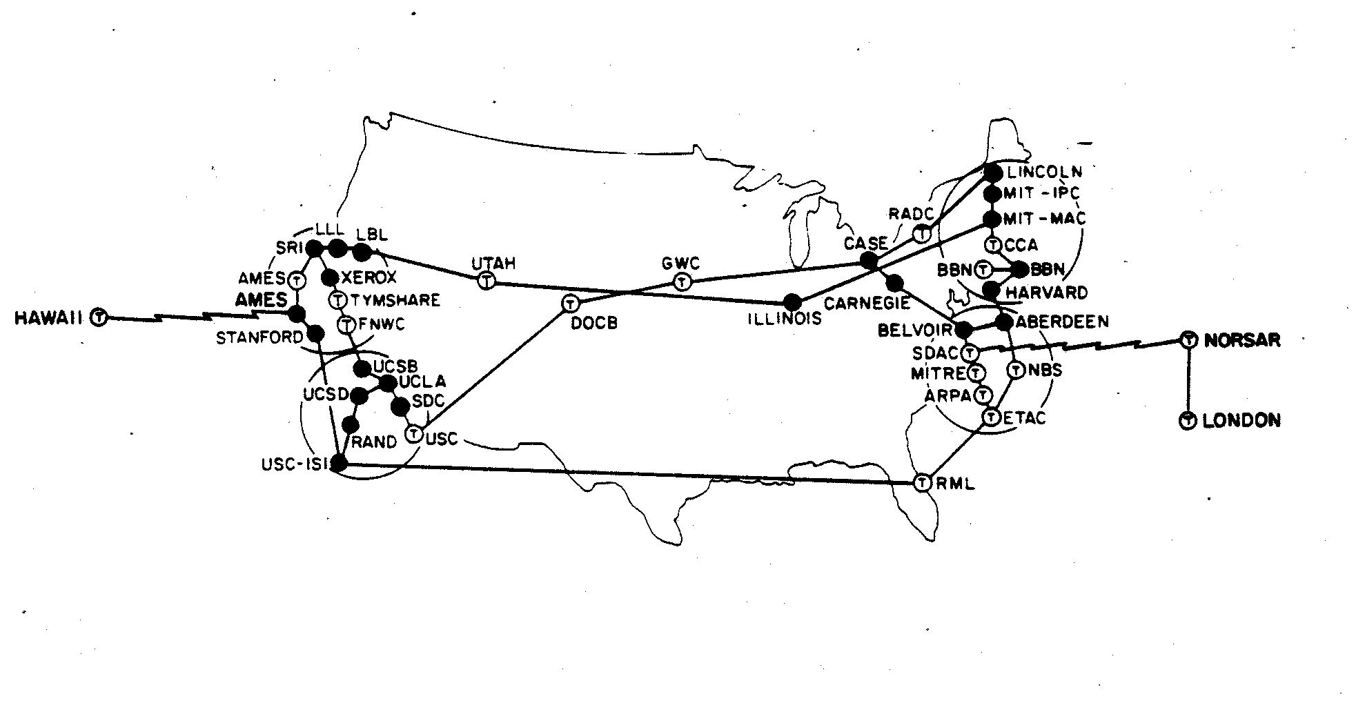
Also, related to this here is a geographically depicted map of the map above. The First Map of the Internet:
Sam
In relation to our discussion about the use of photography and the use of symbols in how to depict Africa as a continent, I thought this was an interesting piece of content to bring to light. What happens when one individual is used to depict a geographical area?
Sam
From the Canadian Gay and Lesbian Archives if anyone is interested in what I have been referencing:
Sam
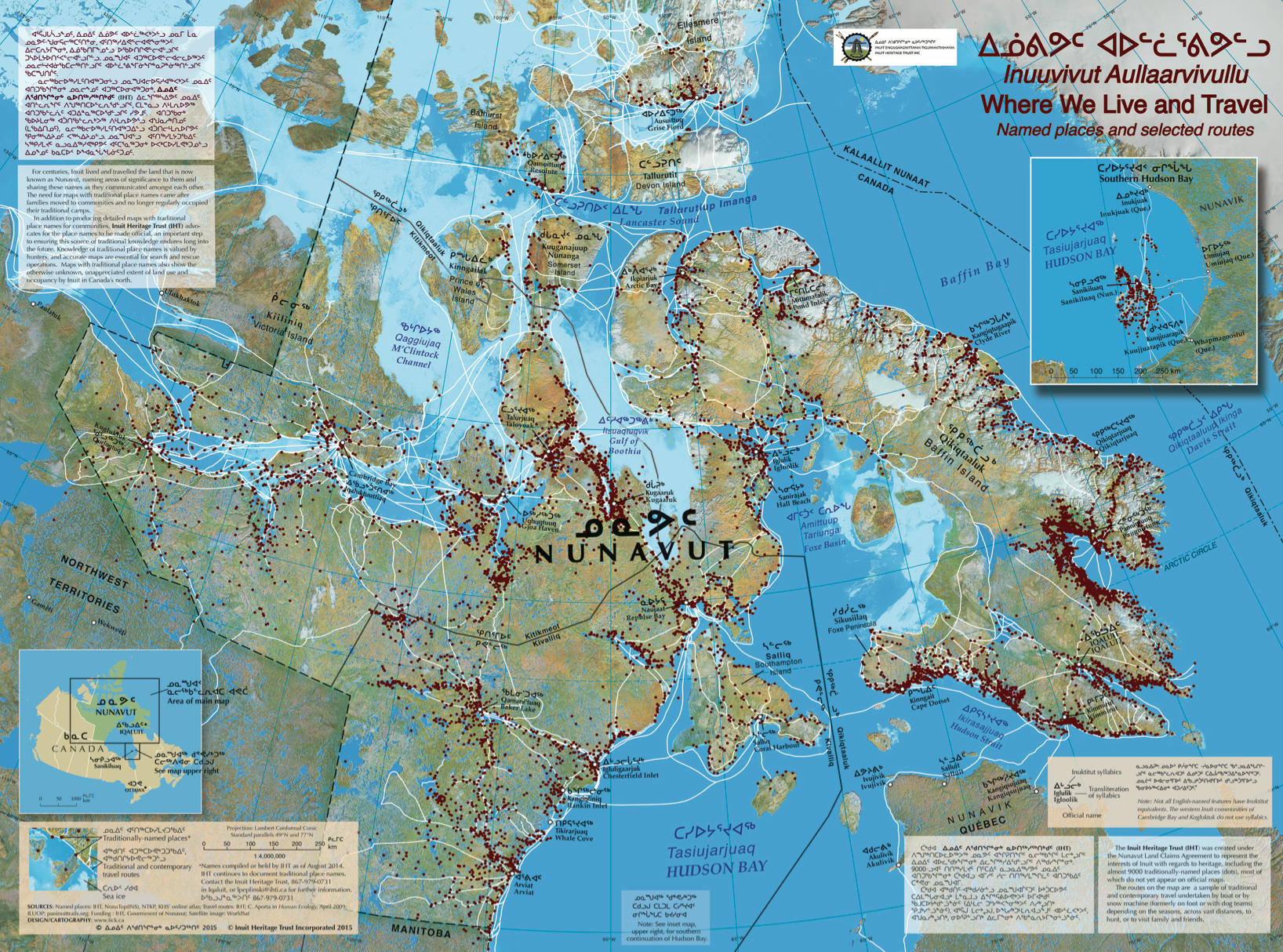
This is a map giving the travel routes, current and historical, and placenames of the Inuit and Northern Peoples in Nunavut.
Sam
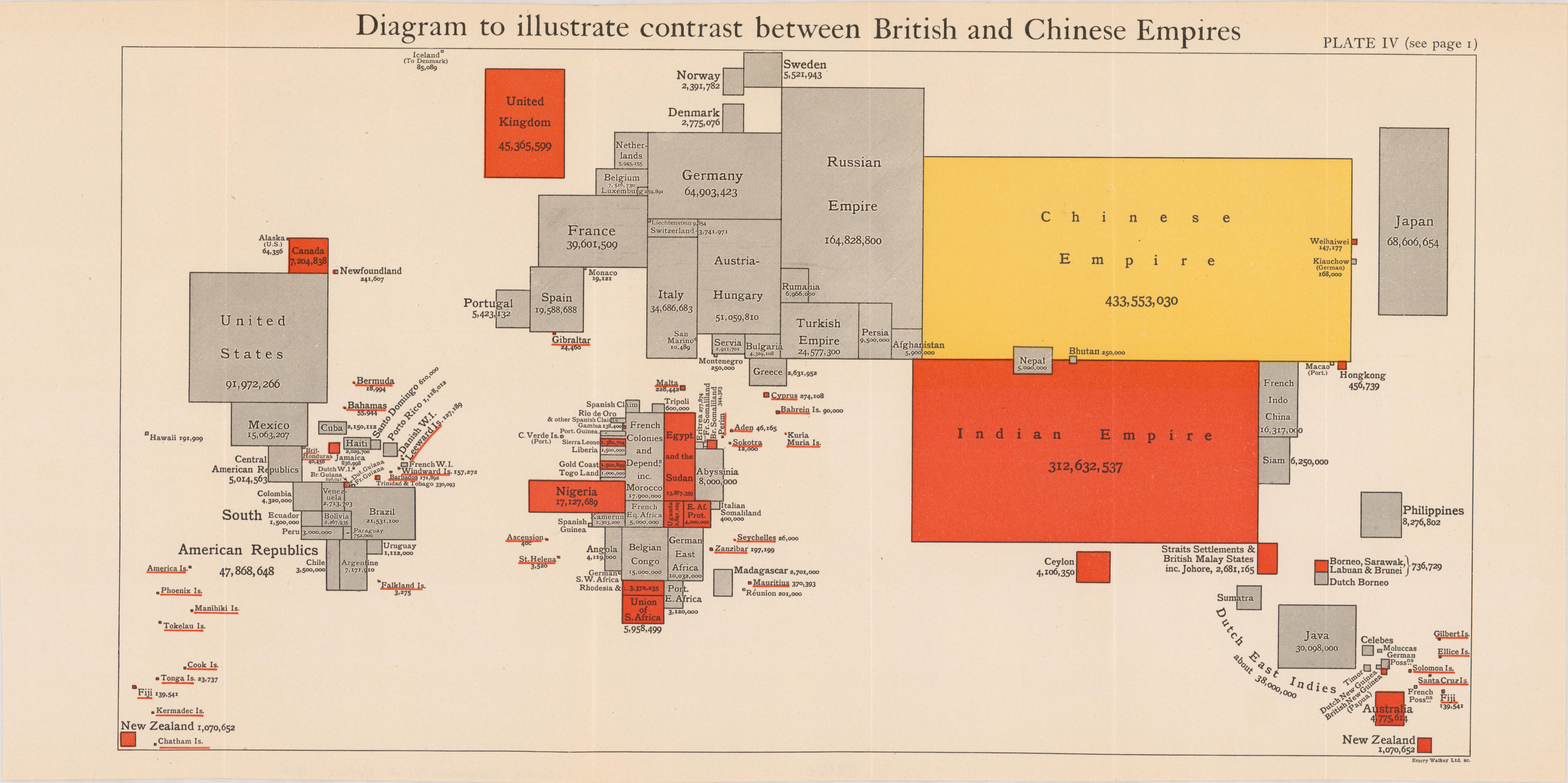
Can a cartogram be a map? Can population by area in proportional relation to one another can be a form of mapping, and as such, a form of territorializing?
Sam
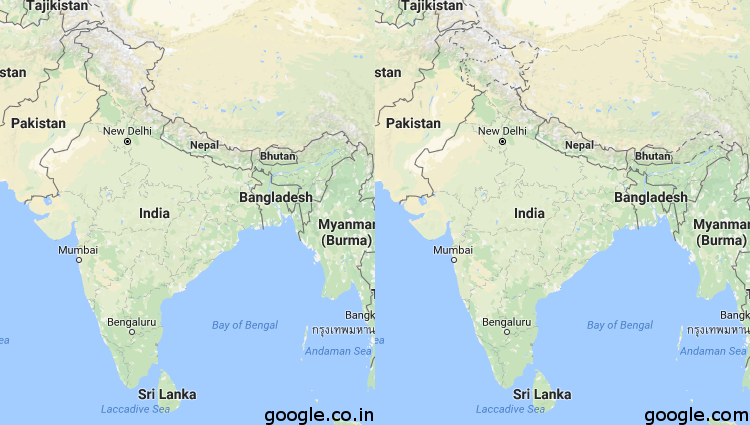
These two maps reflect the Indian Northern Border as depicted on Google.com (the American reflection of Google Maps) and Google.co.in (the Indian reflection of Google Maps). This ambiguity is hugely important and affects huge amounts of people. What are the implications when we take maps the Google maps to be objective and true?
Sam
https://i.redditmedia.com/Y9_kGExGF1M8Rjx_KdiRQgG9aeOO8dPuUoGaR5YiSfg.png?w=750&s=7503e960fa5b2fb16d751900801cc6e2
Here is a map of Hans Island and an interesting read below:
http://media.mnn.com/assets/images/2015/11/Nares_strait_border_(Kennedy_channel).png.838x0_q80.jpg
http://www.mnn.com/earth-matters/wilderness-resources/blogs/canada-denmark-wage-whisky-war-on-rocks
A mistake in mapping; Hans Island is divided perfectly in half between Canada and Denmark. Both countries claim it as their own. As a contested space in the north, the control of Hans Island could mean the control of the channel in which it sits and majorly affect the inclusion of the Northwest Passage as either being included in Canada’s internal waters or as an internationally recognized free trade route. The control of this tiny island has, for a long time, been somewhat of a joke between these two countries, with the claim of it changing every number of years. Each time doing so the opposing country leaving a bottle of whiskey in its lighthouse for the new captors.
Sam
An interesting read about how the Athabasca-Mackenzie River Basin was photographed and documented. What are the implications of this form of mapping? Could the way this area was mapped have lead to the rise of the resource exploitation of the Alberta tarsands (which this area is now known for)?
http://www.aupress.ca/books/120176/ebook/04_Finkel_et_al_2010-West_and_Beyond.pdf
http://www.firstvoices.com/en/Hlgaagilda-Xaayda-Kil/stories
(the exact story I presented is not located on this website as it was obtained first hand and the file is not able to be posted – alternatively other Haida – Hlg̱aagilda X̱aayda Kil – stories are provided above)
https://www.google.com/maps/d/viewer?ll=48.99545253486705%2C-123.7910270736084&spn=0.120051%2C0.207195&dg=feature&msa=0&mid=1E_H17pirVICYyT2wMpojCU8O0H8&z=13
_________________________________
“Colonizers produce knowledge of a territory within a specific framework that allows them to understand and ‘know’ place on their own terms. The ‘imaginary geography’ justifies possession over space by privileging the colonizer’s representations of territory.”
– Matthew Dyce
“Modernity constructs it’s other as a way of privileging itself”
– Edward Said
“Indigenous place names are not simply geographic identifiers; they are houses for layers of information, including cultural and historical knowledge, environmental conditions, availability of resources, and Aboriginal identity”
– Müller-Wille, 1989; Thorton, 1997; Cruikshank, 1990
Sam McFaul
 Follow