In this lab we were tasked with identifying the areas of Metro Vancouver at risk of flooding in a storm surge or sea level rise scenario. To accomplish this task, identifying areas of low elevation was first necessary. In this lab, I reclassified spatial data to show areas prone to flooding in Metro Vancouver and combined this with tabular data to show the major roadways at risk in the event of flooding.
The areas at risk for flooding in the event of a 10m storm surge or sea level rise are shown in Map 1 and Map 2. The areas in shades of blue are under 10 m elevation and at risk of flooding. The area at risk was further narrowed to include low elevation areas within 1 km of the coastline (Map 3).
[Click on any map to enlarge]
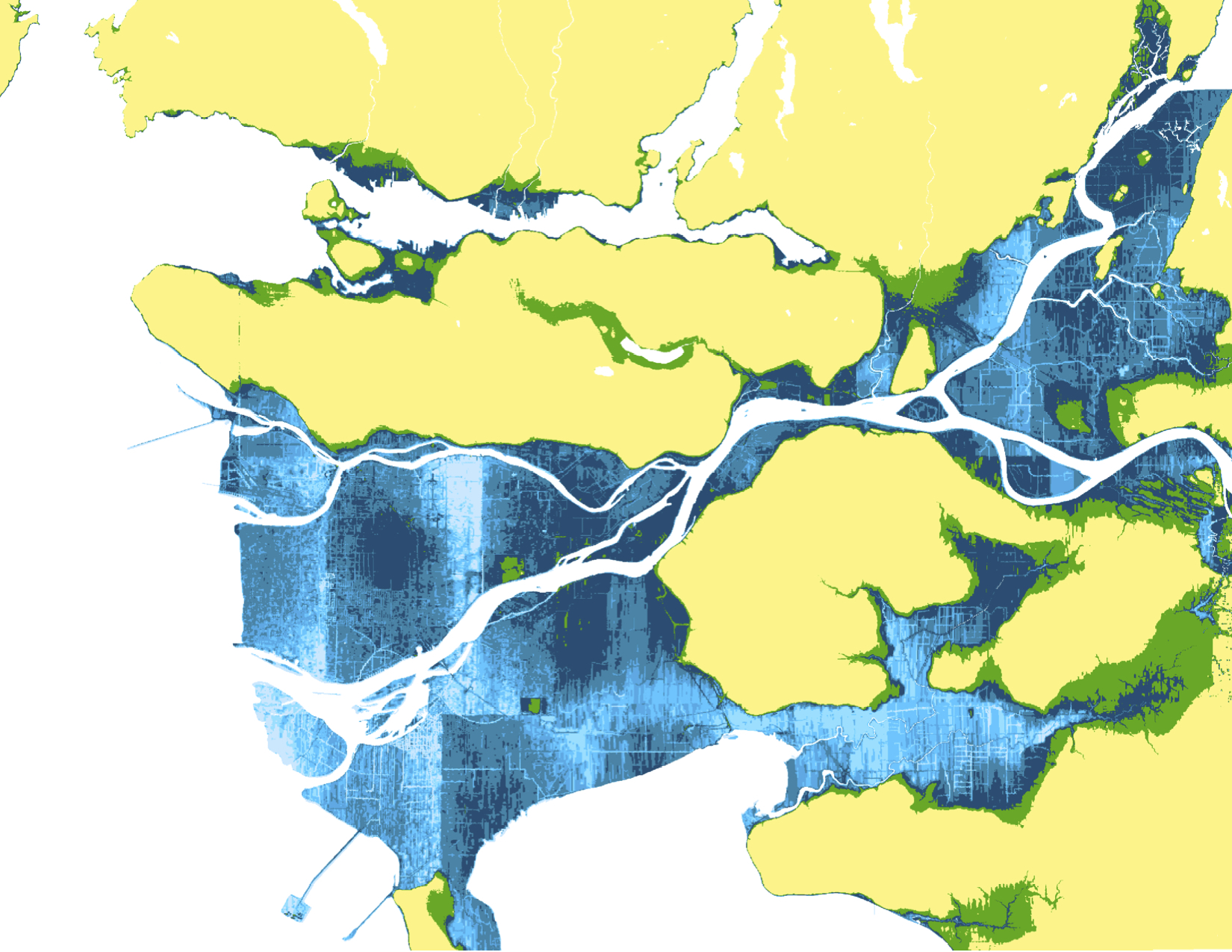
Map 1: Areas of low elevation in Metro Vancouver
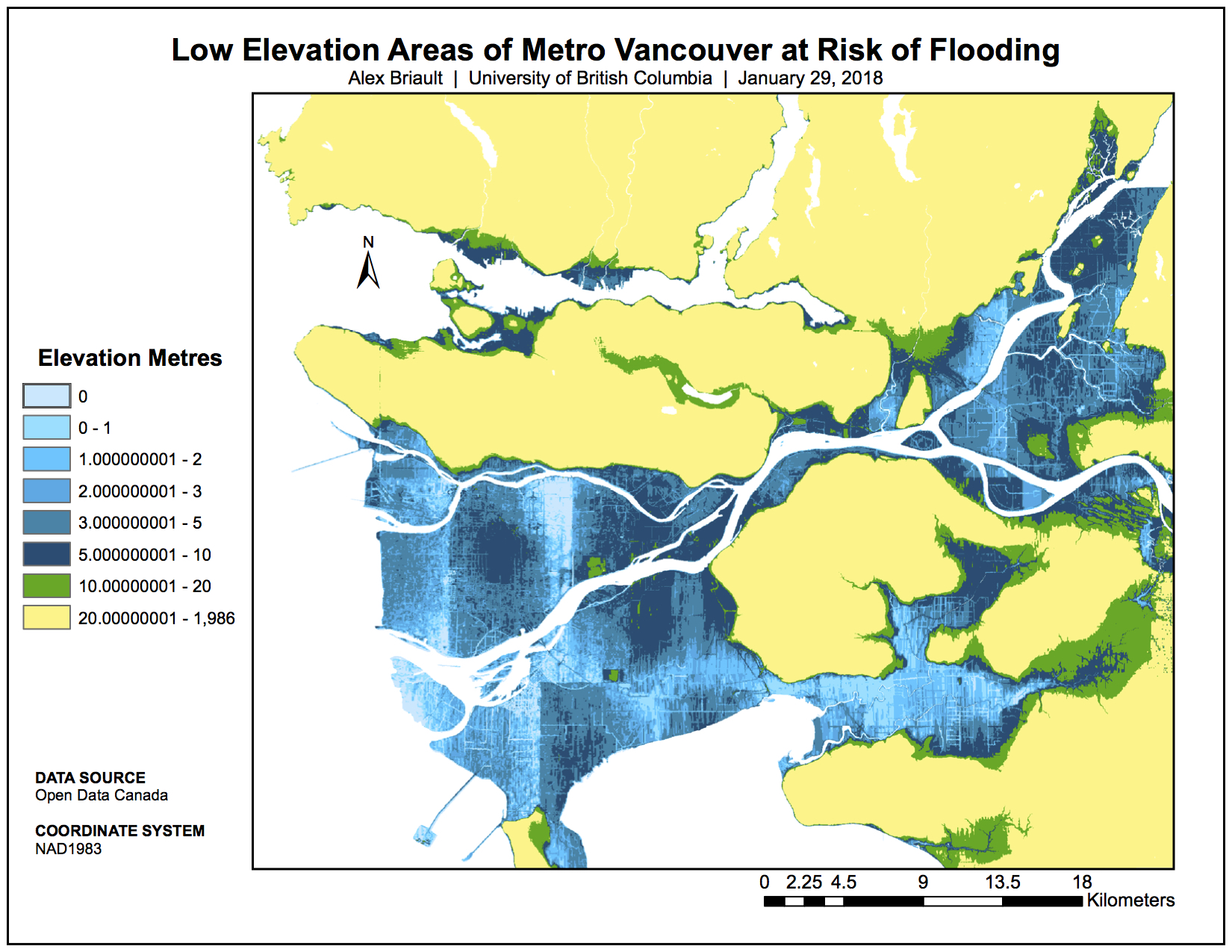
Map 2: Low Elevation Areas of Metro Vancouver at Risk of Flooding with Legend
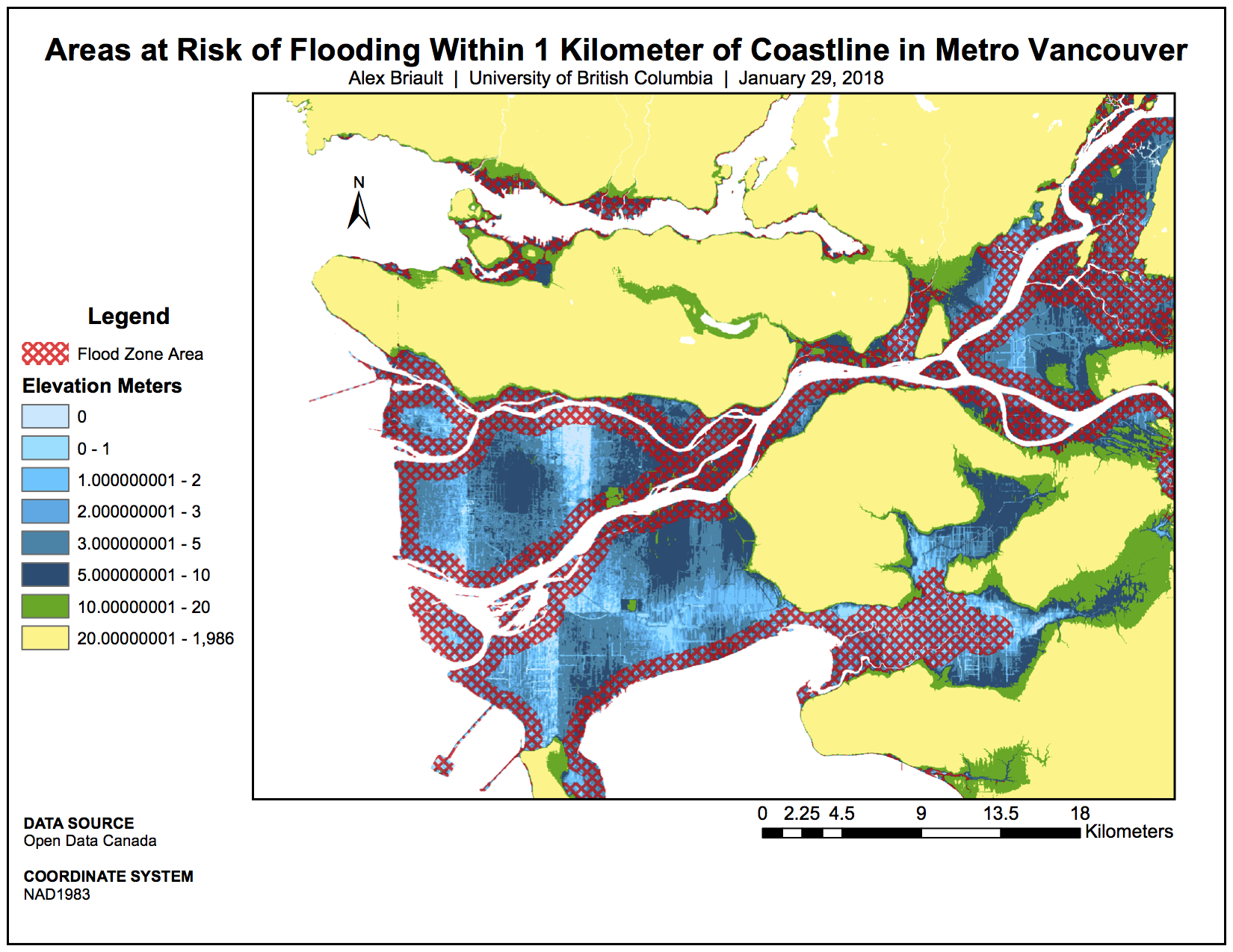
Map 3: Areas at Risk of Flooding Within 1 Kilometre of Coastline in Metro Vancouver
Map 4 shows the roads and highways within this 1 km zone that are at risk due to flooding. Knowing which of the major highways and expressways are at risk of flooding is important to disaster response planning for the region.
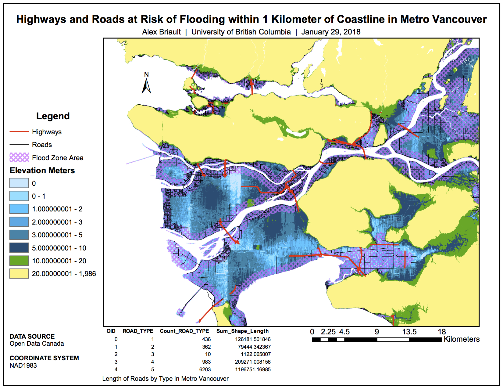
Map 4: Highways and Roads at Risk of Flooding Within 1 Kilometre of Coastline in Metro Vancouver
In Map 5, the new site of St. Paul’s Hospital on the False Creek Flats is shown along with the location of schools in the area. As with the other maps in this series, areas shown in shade of blue are 10 m or less in elevation and thus at high risk of flooding in the event of a storm surge or sea level rise.
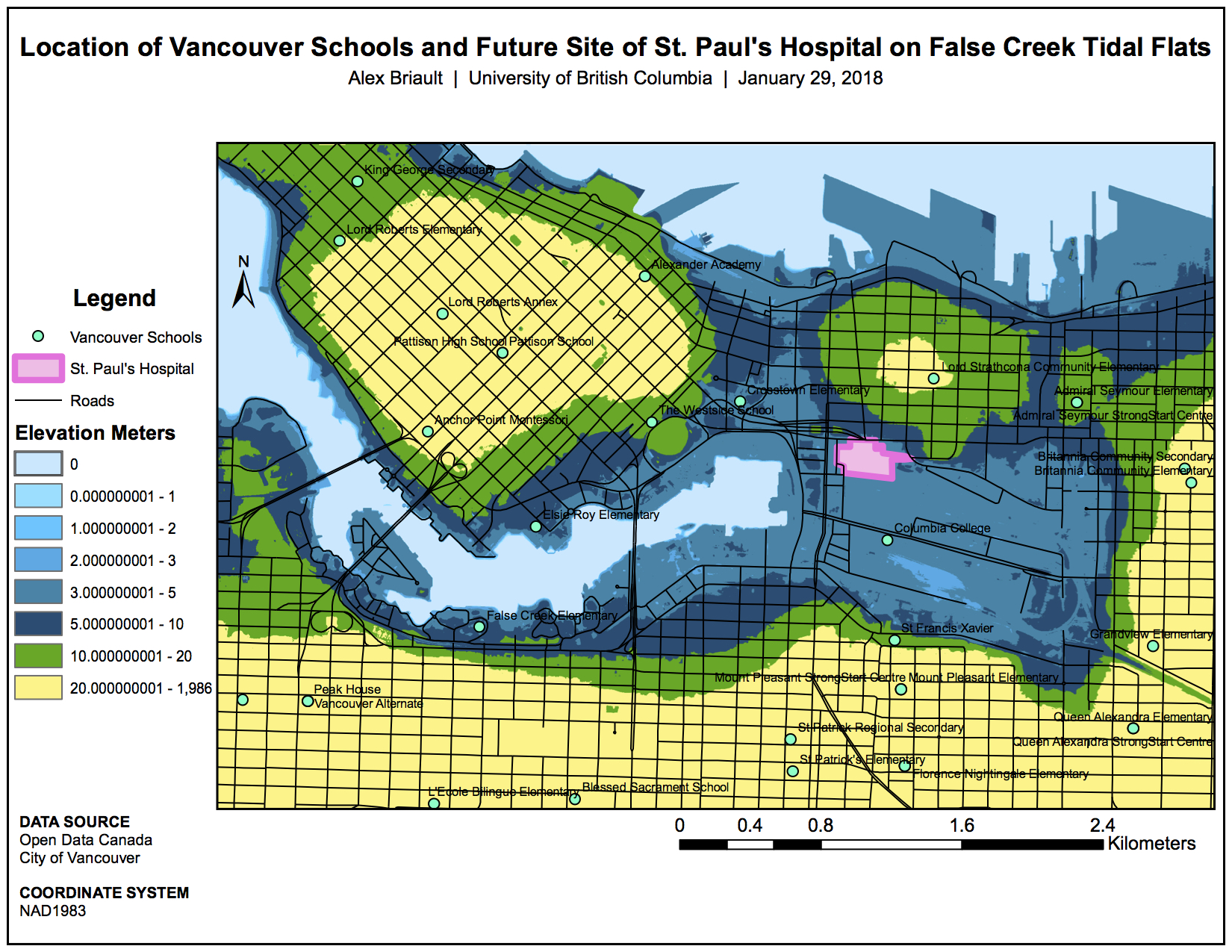
Map 5: Location of Schools and Future Site of St. Paul’s Hospital on False Creek Flats