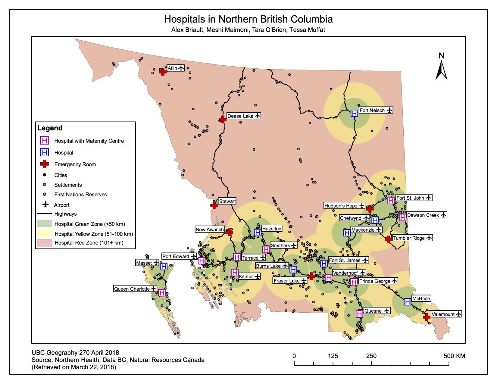
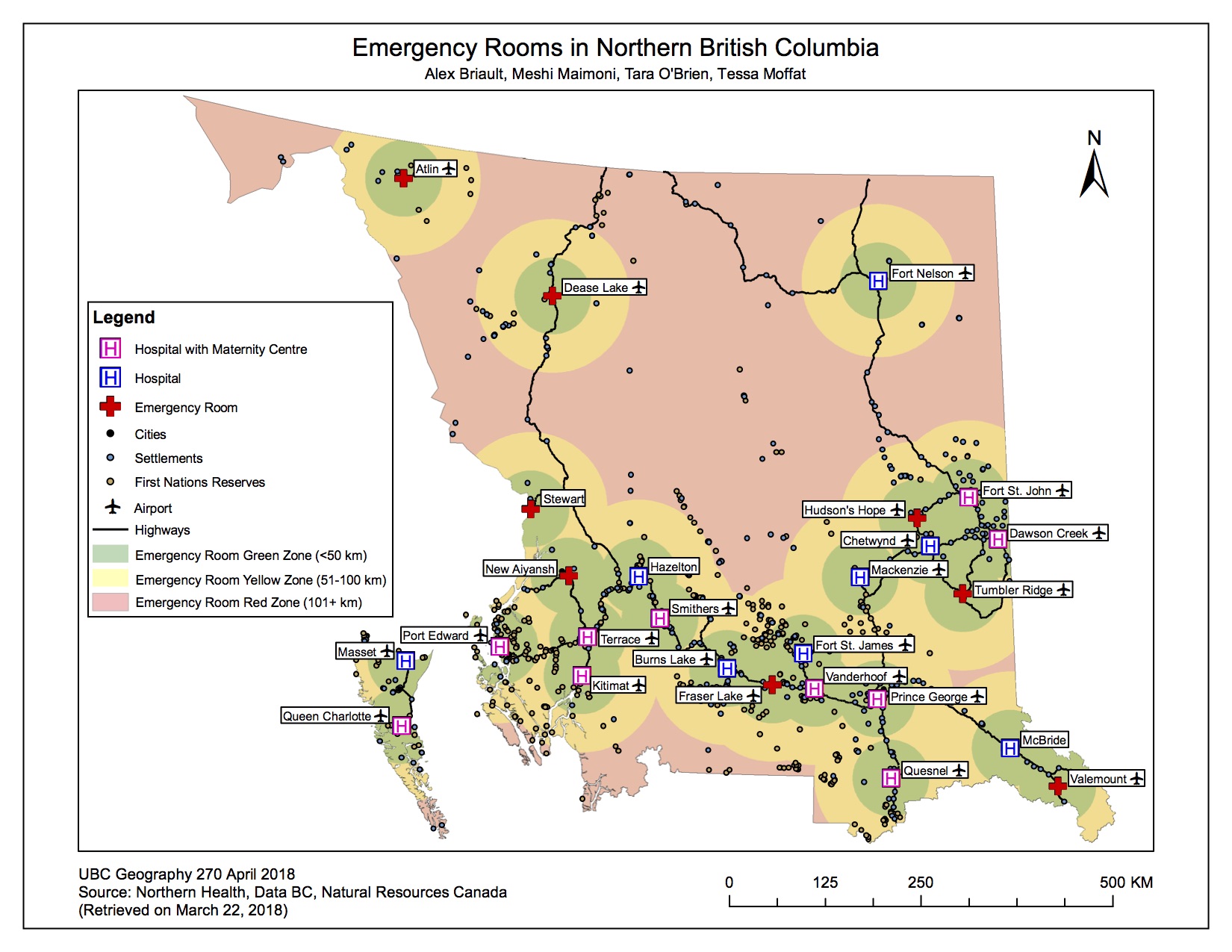
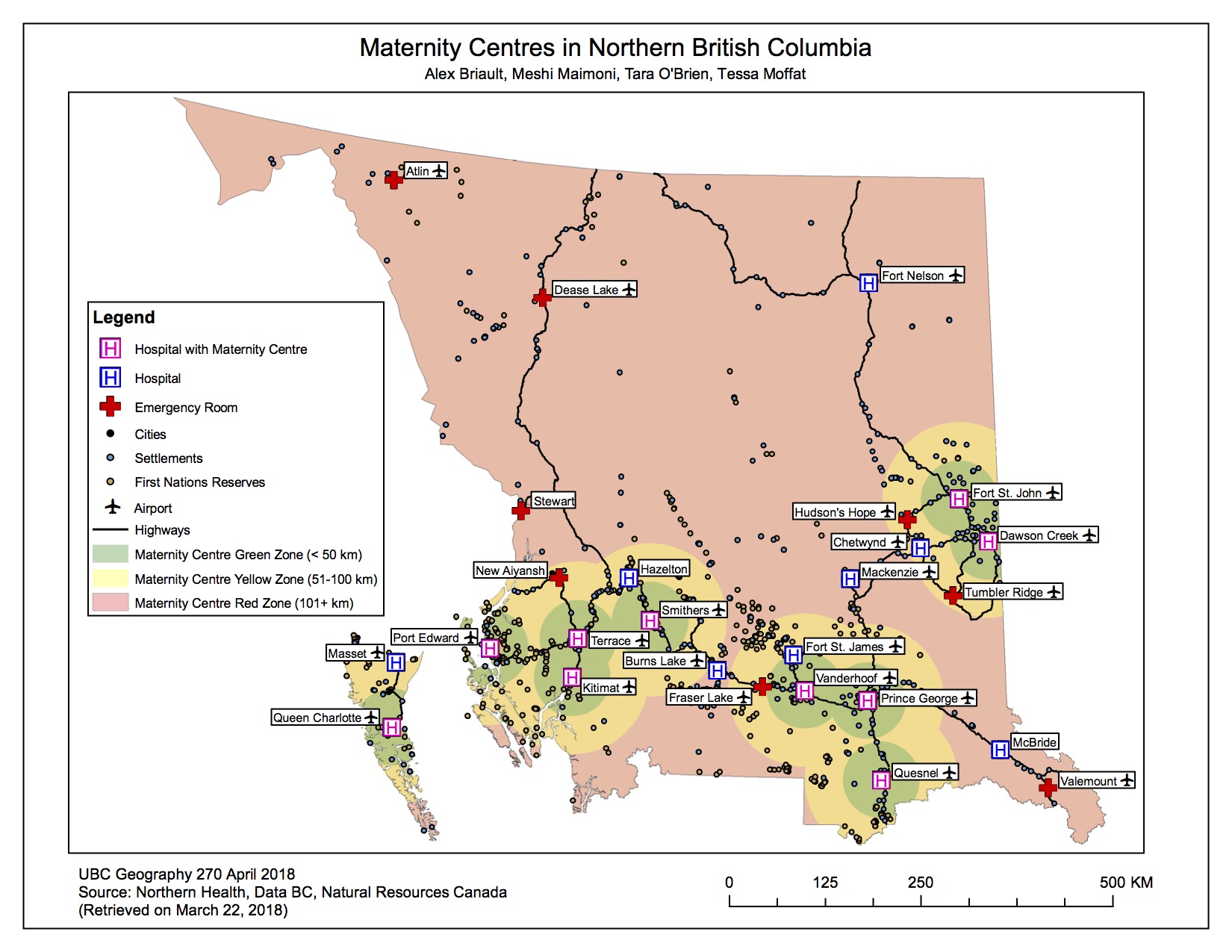
Our team proposed mapping hospitals, hospitals with dedicated maternity centres, and emergency rooms in relation to cities and small communities in Northern BC. We aimed to determine how many communities are within key travel distances to healthcare centres and how many communities lack access to these facilities based on that distance. To accomplish our goal, our group divided data acquisition amongst ourselves and then worked jointly to create the maps and final report.
The results of this project show that nearly 50% of northern BC communities are over 50km from a hospital facility. Just over one-third (35%) of northern BC communities are within 50km of a hospital with dedicated maternity centres. This is alarming because the BC Ministry of Health determines 50 aerial kilometres to be an acceptable distance to live from a hospital facility. This means that nearly two-thirds of communities in northern BC face significant barriers in accessing maternity care and nearly half face significant barriers in accessing hospital care.
Working with a group on this project allowed for the division of tasks and labour in a manageable fashion. This project would have been overwhelming for one person to do in a short amount of time. Communication between group members was key to ensuring that all part of the project were completed and that no part was done in duplicated. Establishing a preferred method of communication and sticking to it throughout the project work is key! Working with data between four people was difficult because we had to figure out how to share our data and maps between each other and across computers. While not perfect, we were able to make this work without too much difficulty by using Google Drive. Sharing a USB drive or somehow sharing data with each other via the Geography computers may have made the process smoother.
Most of our data came from DataBC and all other data came from publicly available data so we did not encounter many problems accessing and downloading the data.
To view our final project report as a PDF, click here
[Click on any image or map to enlarge]
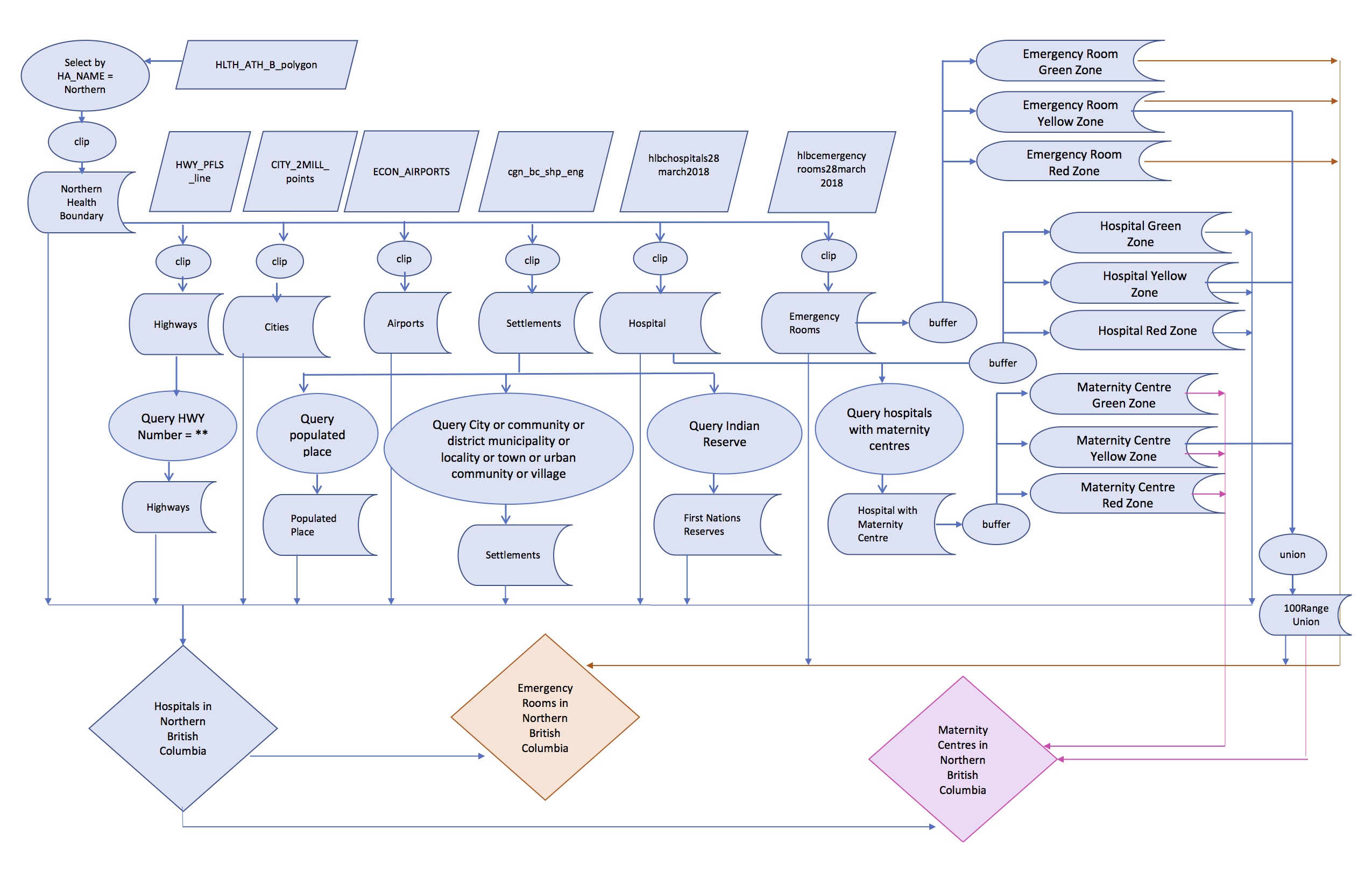
Flowchart showing steps to create Maps