
The lab conducted an analysis of land use change in Edomonton during 1966-1976 accompanies with the tools of ArcGIS, Excel, and Fragstats. The 10 years witnessed a rapid urban expansion in Edmonton. The city has expanded 3 times by transforming cropland, unimproved pasture land, productive and unproductive woodland. When we cheer for the achievement of the urbanization, more problems come to the front. First, the city showed a tendency of urban sprawling. The new built-up area had extended to the minefield. We should pay attention to the livelihood suitability for the residential area near the minefield. Also, the river passing through minefield may be polluted. Hence, water quality monitoring should be enhanced. Furthermore, the urban designer should also consider whether the fragmentation of woodland would affect the local biodiversity, and respond appropriately according to the condition.
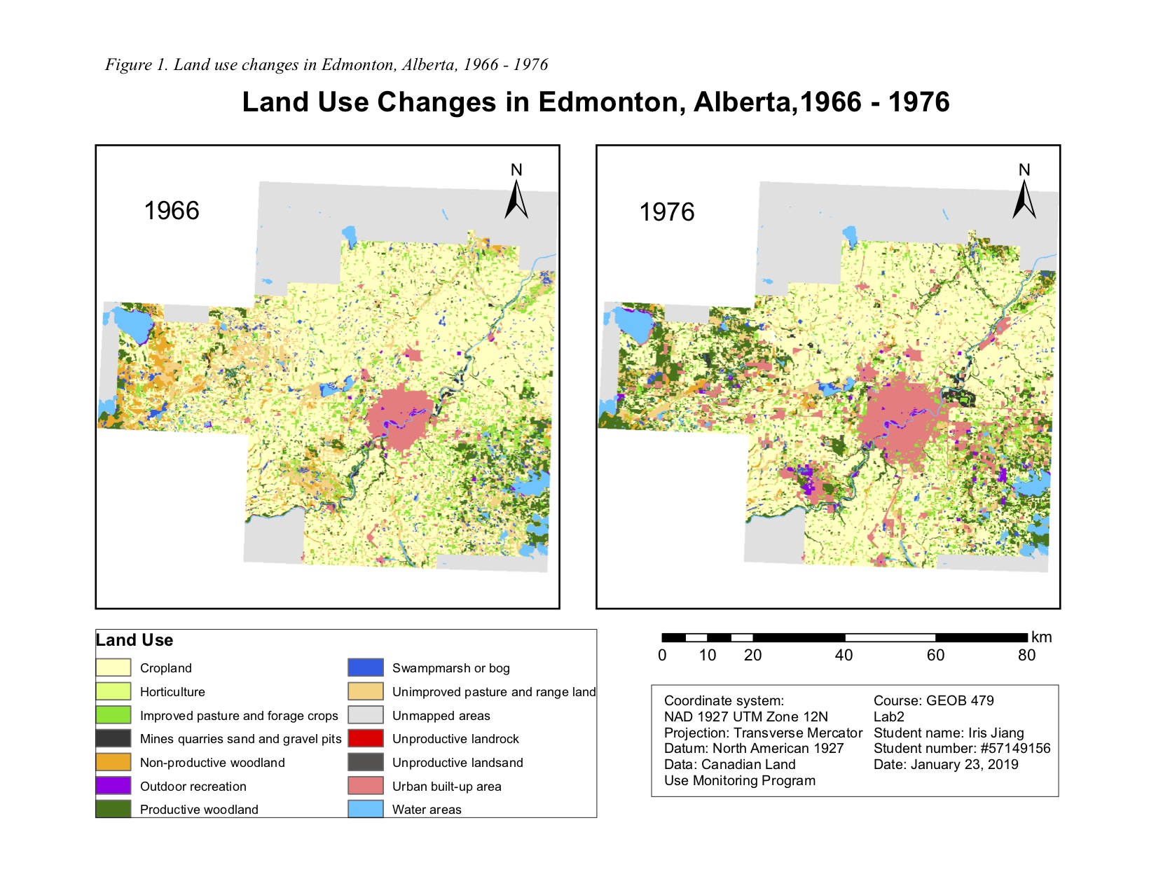
Figure 1. Land use changes in Edmonton, Alberta 1966-1976