This section contains a collection of resources, scientific articles, journal articles and books, related to the topic of landslides and often cited in the literature. The purpose of their inclusion in this blog is to facilitate the search of other design professionals interested in this field, by providing for each article a brief summary of the content, scope and potential relevance for the field of landscape architecture.
The professionals specializing in landslides include experts in the fields of geology, soil physics or chemistry, pedology and earth science, to name a few. The articles in this bibliography relate to some extent on these scientific fields, but only to a degree where their content can be understood by an interested reader with a basic amount of knowledge on the topic of earth sciences. The goal here is to support and empower design professionals in their initial research to better understand the landslide phenomenon; not to turn them into geologists or soil scientists.
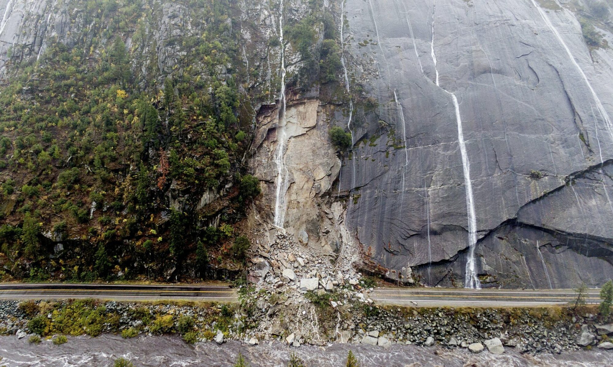
Basic concepts of landslides / mass movements classification
Blais-Stevens, A., Behnia, P., & Castagner, A. (2018). Historical landslides that have resulted in fatalities in Canada (1771–2018). Open File, 8392.
This article represents an expanded and more detailed version of the above web page by the same author. A map of historical Canadian landslides causing fatalities from 1771-2018 has been compiled. The map is updated regularly based on technical and scientific reports, newspaper articles and provincial websites available as sources of information.The compilation revealed that 774 people have died in Canada since 1771. British Columbia (BC) has the highest number of deaths at 339 (44%), and the 2nd highest is Quebec (Qc) at 246 (32%) people. These deaths were due to landslides triggered primarily in the mountains in BC and in glaciomarine sensitive clays in Quebec. The greatest number of deaths associated with landslides occurred between the 1880s and 1920s, when major infrastructure corridors and towns were being developed, but the risks were less well understood. In short, since the 1920s, the study of landslides and their potential triggers has led to several mitigation measures and fewer deaths per decade per event.
Chatwin, S. C. (Ed.). (1994). A guide for management of landslide-prone terrain in the Pacific Northwest (No. 18). Ministry of Forests.
This handbook was created in 1994 by the Ministry of Forests of B.C, and was prepared for agency and industry personnel who are operating in areas with existing or potential stability problems. It is intended for use in the coastal areas of the Pacific Northwest, even though the principles may be applicable to other locations in North America. The guide addresses four topics:
• Slope movement processes and characteristics.
• An office/field technique for recognizing landslide-prone terrain
• Measures to manage unstable terrain during forestry activities.
• Road deactivation and revegetation of unstable terrain.
Although it is a bit dated, it is a clearly written, well-illustrated, and detailed enough guide for those new to the subject. The first two chapters are the most relevant to landscape architects.
Clague, J. J., Huggel, C., KOrup, O., & MCguire, B. (2012). Climate change and hazardous processes in high mountains. Revista de la Asociación Geológica Argentina, 69(3), 328-338.
This short paper examines how the recent and continuing reduction in glacier ice cover in high mountains and thaw of alpine permafrost may have an impact on many potentially hazardous processes. As temperatures are warming in high altitudes, slopes are increasingly destabilized, exacerbating the loss of rock and soil material due to glacier downwasting and retreat. Lakes damned by glaciers and moraines are also draining alarmingly fast in warming climates, leading to considerably destructive downstream impacts, including increased frequency of landslides, especially debris avalanches, debris flows and lahars. The paper provides a good theoretical argument for the need to anticipate an increased number of landslides in areas adjacent to mountain environments, such as in British Columbia. Everything we need from it is included in the conclusion, and a sentence or two of its contents will probably be sufficient for our own paper
Geertsema, M., & Pojar, J. J. (2007). Influence of landslides on biophysical diversity—a perspective from British Columbia. Geomorphology, 89(1-2), 55-69.
Landslides’ importance as natural disturbance agents, as well as their role in maintaining biological diversity, has been largely ignored in the literature. This paper aims to “provide a western Canadian (British Columbian) perspective on the influences of landslides on biophysical diversity, which is related in several ways to biological diversity.” Several types of biophysical/ecological diversity are considered, including: site diversity, soil diversity, and the derivative habitat or ecosystem (including aquatic ecosystems) diversity.
Landslides influence biophysical diversity (which is linked to biological diversity) in a number of ways. They redistribute materials and change surface expression, thus creating complex microtopographies. Portions of landslides with exposed parent material are set back to the initial stages of soil development and ecological succession.They can change soil density, structure, porosity, surface texture, chemistry and microclimate. Overall, by changing site and soil, landslides also influence habitat and habitat diversity, by a mosaic of seral stages (often both primary and secondary.
Reading this article provides another often ignored and interesting angle on the significance of landslides as a natural phenomenon.
Government of Canada, Natural Resources Canada. Canadian Fatal Landslides Mapped. May 2021. https://www.nrcan.gc.ca/simply-science/canadian-fatal-landslides-mapped/23659#shr-pg0. Accessed May 19th 2022
A Government of Canada web page disclosing some information on landslides across the country, and presenting a map of all landslides in Canada that have caused fatalities from 1771 to 2019. The information in this paper is included in the Blais-Stevens article also found under this annotated bibliography. Landslides are common in Canada — thousands occur across the country every year. Most of them aren’t fatal, but at least 786 Canadians have perished in landslides in Canada since 1771. British Columbia fatalities due to landslides total 356, followed by Quebec at 239. Newfoundland is third at 103 fatalities. May 4, 2021 was the 50th anniversary of a fatal landslide in Saint-Jean-Vianney, where 31 people were killed. This information has been mapped and documented by the author on a map that’s available for free on the webpage.
Highland, L. (2004). Landslide types and processes (No. 2004-3072).
This short 4-page document is written by Lynn Highland, one of the principal authors of the Landslide handbook document cited above. It is a very short summary of the landslide classification method used by the USGS (based on Varnes [1978] which we also adapted for this blog), as well as a brief overview of some parameters that can affect landslides (water, seismic activity, and volcanic activity). Far too short to be a satisfactory introduction to landslide issues, it can nevertheless be an interesting front-line educational resource for the general public, given its length and the extent of the illustrations and diagrams included.
Highland, L., & Bobrowsky, P. T. (2008). The landslide handbook: a guide to understanding landslides. Reston: US Geological Survey.
Written for the USGS, this guide is arguably one of the most comprehensive and relevant guides on the topic of landslides in North America, while remaining accessible to the general public. It consists of 3 primary sections (Basic Information about Landslides, Evaluating and Communicating Landslide Hazard, and Mitigation Concepts and Approaches) as well as a series of extensive appendices, numerous illustrations and diagrams, a glossary, and a rich bibliography. Much of the information in this blog is taken from that document, particularly Appendix C (Introduction to Landslide Stabilization and Mitigation).
Jakob, M., & Lambert, S. (2009). Climate change effects on landslides along the southwest coast of British Columbia. Geomorphology, 107(3-4), 275-284.
A concise, detailed and clear paper on the contribution of precipitation (antecedent and short-term) on the temporal occurrence of landslides. Its objective is to analyze and evaluate the reliability of selected precipitation models in order to investigate the effects of climate warming on the relative frequency of landslides in coastal British Columbia. In addition to the study’s findings on the reliability of some models relative to others, the authors draw conclusions about the increase in precipitation due to climate change:
“Averaged over all the models and the three scenarios, the increase in antecedent precipitation was slightly over 10%. In spite of the fact that there is a great deal of intermodel variability, the models agree rather well in a qualitative sense in that there are very few simulations that show a decrease in precipitation and that an increase in greenhouse gas concentration leads to increased precipitation change. (…) it is reasonable to expect that landslide frequency along the southwest coast of British Columbia will increase during the twenty-first century. ”
Keegan, Matthew. “How Hong Kong protects people from dangerous landslides”. BBC, February 28th, 2022. https://www.bbc.com/future/article/20220225-how-hong-kong-protects-people-from-its-deadly-landslides. Accessed May 19th, 2022
An easy-to-read BBC article explaining the various scientific advances since the 1970s in terms of prevention, control, and management of the risks associated with landslides. Although not scientific, the article is interesting for the neophyte as it introduces the concepts of early warning systems, their genesis, their relevance in the Hong Kong context, and their international derivations. It also explains simply how landslide risk can be assessed with physical meteorological tools as well as by simulations. Finally, the article links to a variety of scientific articles and online resources related to landslides.
Oliveira, S. C., Zêzere, J. L., Guillard-Gonçalves, C., Garcia, R. A., & Pereira, S. (2017). Integration of landslide susceptibility maps for land use planning and civil protection emergency management. In Workshop on World Landslide Forum (pp. 543-553). Springer, Cham.
This paper is a case study on the integration of landslide susceptibility indices for urban planning. Using 7 parameters applied to a set of landslides identified and mapped in a small region of Portugal, the authors have established a classification of risk areas in order to analyze the civil infrastructures located there, and thus requiring special attention. The development of the decision support tool is clearly explained and seems easy to replicate. However, it is difficult to know to what extent it is replicable and applicable to our needs, since it does not lead to design solutions as such, but rather to a categorization of risk zones.
Popescu, M. E. (2002). Landslide causal factors and landslide remediatial options. In 3rd International Conference on Landslides, Slope Stability and Safety of Infra-Structures (pp. 61-81). CI-Premier PTE LTD Singapore.
Produced for a conference organized by the World Academy of Sciences, this paper aims to discuss some of the issues related to the causes and remedies of landslides using the Black Sea shore in Romania as a case study. The paper provides an excellent discussion of the causes of landslides (noting that it is more appropriate to discuss causal factors, which include conditions and processes, rather than “causes” alone) by introducing the concept of factor of safety. Tables 1 and 2 of the article, listing the causes and remedies for landslides, are remarkably clear and simple, and the section on Back Analysis, while much more extensive and technical, is still very interesting and useful from a planning perspective.
Srivastava, P. K., Singh, S. K., Mohanty, U. C., & Murty, T. (Eds.). (2020). Techniques for Disaster Risk Management and Mitigation. John Wiley & Sons.
This book chapter is an introduction to the phenomenon of landslides, their causes, classification, morphology, measurement, and prevention. Very clear and short (less than 15 pages), it is remarkably useful as a summary of the problem and the main existing solutions to remedy it. The classification method used is similar to the one used for this blog (that of Varnes [1978] and used by the USGS), but the categorization of landslide causes differs significantly from the one we used. The portion of the text on landslide measurements is particularly edifying and is not commonly found in other introductory texts on the same topic.
Varnes, D. J. (1978). Slope movement types and processes. Special report, 176, 11-33.
This article, which is actually a chapter of a report commissioned for the Transportation Research Board of the National Research Council of Washington, D.C., is one of the most widely cited works in the literature on the subject of landslide classification. This classification is still one of the most widely used in the world and is used in many scientific reports and articles, including this blog. It describes in depth the causes and physical processes underlying the many types of landslides identified and classified. The document is quite technical and requires some prior knowledge of the phenomenon as well as some geological concepts. Although more up-to-date and accessible versions of this document exist today, it remains a primary reference in the field of landslide outreach.
Core principles and tools of LID
Ahiablame, L. M., Engel, B. A., & Chaubey, I. (2012). Effectiveness of low impact development practices: literature review and suggestions for future research. Water, Air, & Soil Pollution, 223(7), 4253-4273.
This paper provides an excellent literature review of current low impact design (LID) practices along with the uncertainties surrounding them, however it is important to note it was written in 2012. It offers concise definitions and principles of LID and conventional development (CD) and argues the importance of implementing LID strategies as much as possible. It also offers important articles and authors on LID that should be read over. Lastly, it provides other terms used outside of the US and Canada such as Water Sensitive Urban Design (WSUD) and Sustainable Drainage Systems (SUDS).
Davis, A. P. (2005). Green engineering principles promote low-impact development. Environmental Science & Technology, 39(16), 338A-344A
Allen P. Davis is one of the most prominent researchers in LID and is referenced in almost every article about the topic. This article is an easy to understand summary of the early research, definitions, application, and issues of LID. Despite it being an older source, the information is still very relevant and useful. This should be our primary article for general information about LID practices.
Eckart, K., McPhee, Z., & Bolisetti, T. (2017). Performance and implementation of low impact development – A review. The Science of the Total Environment, 607-608, 413-432.
This paper provides a very robust overview of LID, discussing in depth the history, alternatives, potential issues, need, computer modeling techniques, cost of implementation, and potential barriers (including perspectives – see Gimenez-Maranges, Breuste & Hof (2020)). It is similar to Ahiablame, Engel & Chaubey’s (2012) article, however it is less a literature review and more an approachable overview of LID as a field of research.
Gimenez-Maranges, M., Breuste, J., & Hof, A. (2020). Sustainable drainage systems for transitioning to sustainable urban flood management in the European union: A review. Journal of Cleaner Production, 255, 120191.
While this article addresses the potential of LID/SuDS to mitigate the risk of flooding in Europe, many of the problems discussed in regards to implementing these designs are most likely present in North America as well. It provides a literature review of 80 scientific papers on the implementation of SuDS within the EU, and provides important conclusions that should be considered during our research. Some of these are: going beyond the technical trap of stormwater management research, exploring the dynamics occurring beyond the project scale, and overall perspectives of LID that influence decisions to implement these designs at various scales.
Haugen, B. D. (2017). A design method for landslide surface water drainage control. Environmental & Engineering Geoscience, 23(4), 275-289.
This paper should be helpful while discussing potential designs to mitigate the impact of landslides. It argues that in many instances surface drainage is sufficient and preferable over subsurface drains. It provides a brief list of pre-design considerations and details a design process. While the article is quite technical, it will be useful as an additional method to reduce landslide risk along with LID practices.
Landslide simulation tools / susceptibility assessments
Assilzadeh, H., Levy, J. K., & Wang, X. (2010). Landslide catastrophes and disaster risk reduction: A GIS framework for landslide prevention and management. Remote Sensing, 2(9), 2259-2273. doi:https://doi.org/10.3390/rs2092259
Assilzadeh et al.’s article puts forward a GIS-based decision system in order to better prepare emergency response teams as well as creating more resilient and resistant society via modelling, monitoring and management. The paper focuses on being able to model areas of risk and communicate information to user efficiently in order to asses areas of high risk as well as addressing emergency management and damage analysis. The system is based on four main pillars; a central repository if data, disaster modelling, a command and control system, portal management system. The paper concludes by stating the implementation of its system was successful in predicting areas of risk as well as communicating information to emergency services via a web portal. While the paper offers insight into the world of emergency response using GIS software it has limited usefulness in design, development and adoption due to a lower resolution and access issues due to software and hardware requirements. While the paper does mention there are uses for the GIS-based decision system for future development it fails to discuss how, where and why to implement the system in fields beyond emergency response and risk assessment.
Bathrellos, G. D., Kalivas, D. P., & Skilodimou, H. D. (2009). GIS-based landslide susceptibility mapping models applied to natural and urban planning in trikala, central greece. Estudios geológicos (Madrid), 65(1), 49-65. https://doi.org/10.3989/egeol.08642.036
This article evaluates two different base methods for developing a landslide susceptibility GIS tool. It’s goal is to evaluate a statistical method and a logical method as the methods to develop a slope stability map for the region of western Greece. The statistical model is based off a regression curve with averaged values for specific cells being attributed to a specific category on the regression curve from 1-5 (low to very high). The the Logical method is based on the assumption that any cell with 2 or more very high values is automatically deemed a very high susceptibility cell. The paper concludes by stating that the logical method yielded better results and was easier to implement. Both these methods, though slightly dated, are still an effective way of creating a landslide susceptibility map. The data and software required to run such analyses is easily accessible making it a suitable analysis for regions without access to data. This paper provides useful starting points for more developed but easily accessible, modern, GIS tools.
Berti, M., & Simoni, A. (2014). DFLOWZ; a free program to evaluate the area potentially inundated by a debris flow. Computers & Geosciences, 67, 14-23. https://doi.org/10.1016/j.cageo.2014.02.002
This paper by Berti & Simoni summarizes the DFLOWZ program by running an exemplary debris flow runout model. The program is based on pre-established empirical methods for runout modelling. This article demonstrates the programs efficacy in predicting debris and other mass movement runout as well as it’s success as an accessible program available for free and ready to use and doesn’t require advanced knowledge in computing or mass movement physics. While the paper successful demonstrates it’s strengths there are some shortcoming to the program and the paper. Mainly the paper lacks to acknowledge that the program isn’t integrated in a GIS interface via a plugin like TauDEM. It also requires additional software to run in the form of MATLAB. Despite this it is simple to use and it’s real limitation is that there are a few uncertainties in the results. Due to being based on an imperial model the results aren’t as accurate or detailed. While this is an advantage as one can change parameters easily the user must be aware of the limitations. Additionally, though not as importantly, the program doesn’t return any information on mass movement thickness. Despite these shortcoming this is a promising program to further evaluate and potentially use as another base or part of an easy to use GIS workflow.
Bourenane, H., & Bouhadad, Y. (2021). Impact of land use changes on landslides occurrence in urban area: the case of the Constantine City (NE Algeria). Geotechnical and Geological Engineering, 39(6), 1-21.
The goals of this study were: a) to evaluate the effect of land use changes on the spatial distribution of landslide hazard occurrence and b) give an example of landslide hazard assessment as a useful tool within the context of long-term land use planning in the urban area of Constantine. A spatial database was constructed detailing the historical landslides, land use, building and population density, and a landslide inventory and land use map was built for the period of 1970 to 2011 based on the analysis of aerial photographs, high resolution satellite images, historical records and field observations. A landslide hazard map was obtained using the Frequency Ratio (FR) under GIS data. The obtained results show a clear impact of the changed land use where human action is an important triggering and/or accelerating factor of landslides in the urban area of Constantine. A well-written and relevant article raising awareness of the growing nature of landslides in rapidly urbanizing areas.
Chaturvedi, P., Arora, A., & Dutt, V. (2017). Interactive landslide simulator: a tool for landslide risk assessment and communication. In Advances in Applied Digital Human Modeling and Simulation (pp. 231-243). Springer, Cham.
A short and simple paper on the development of a web-based Interactive Landslide Simulator (ILS) microworld and its utility for communicating landslide hazards to the public. Simulation tools (also called microworlds) which are able to integrate human factors in landslide risk mitigation in addition to physical factors are, according to the authors, a promising way of improving existing risk communication among Early Warning Systems.
The ILS model proposed by the authors focuses on calculation of total probability of landslides (due to natural factors and due to anthropogenic factors, i.e., investments made by people against landslides). The model is also capable of simulating types of damages caused by landslides and their effects on people’s earnings. The resulting product is a web page, where a decision maker’s goal is to maximize one’s economic level following multiple investment decisions regarding preventive landslides infrastructures. A lab-based experiment, where the tool was used with participants, was also performed in order to showcase the effectiveness of the tool. The results confirmed the expectations that participants will invest more and improve their understanding about landslides in the high-affect conditions (i.e. high probability of death, injury, and property due to a landslide) compared to the low-affect condition. The article is useful because it demonstrates that an interactive tool made with very simple means can still improve public awareness of landslides.
Ciampalini, A., Raspini, F., Lagomarsino, D., Catani, F., & Casagli, N. (2016). Landslide susceptibility map refinement using PSInSAR data. Remote Sensing of Environment, 184, 302-315. https://doi.org/10.1016/j.rse.2016.07.018
Ciampalini et al.’s paper takes a unique approach to landslide susceptibility mapping by seeking to improve the analysis’ overall accuracy by reducing the amount of false negatives (a false negative indicates a Type II error where a slope that isn’t stable is classified as stable). Using PSInSAR (Permanent Scatterer Interferometric Synthetic Aperture Radar) data, which detects slow moving slopes by measuring its elevation relative to a starting point, the paper concludes that the accuracy of landslide susceptibility maps can be increased by being able to detect slope that may seem stable by taking into account temporal factors of slow moving slopes. While the concepts of reducing false negatives should be foundational to any landslide susceptibility map the complexity of conducting an analysis using PSInSAR data is complex. PSInSAR data requires a higher level of computation needing the proper knowledge and instrumentation to conduct. Further more PSInSAR data isn’t available everywhere and maybe hard to access. Furthermore it isn’t always at a high enough resolution to be able to conduct a smaller scale analysis. While the analysis conducted by Ciampalini et al.’s analysis provides important guidelines to follow it’s complexity limits its usefulness and accessibility.
Claghorn, J., & Werthmann, C. (2015). Shifting ground: Landslide risk mitigation through community-based landscape interventions. Journal of Landscape Architecture, 10(1), 6-15.
This article describes a collaboration between German landscape architects and urbanists from the region of Medellín, Colombia. The project is a research and implementation proposal aimed to anticipate and mitigate risk in low-income settlements on Medellín’s mountainous urban periphery, and is part of a broader research initiative. The first phase of research produced the report Shifting Ground (Echeverri Restrepo et al. 2012), which examined the spatial distribution and causes of landslides in the metropolitan region of Medellín. A second phase of research took a detailed look at two particular neighborhoods that could serve as a testing ground for potential mitigation and growth anticipation strategies. The findings of these first two phases are the focus of this paper. A third phase of research, which is the testing of many of the most promising strategies in small pilot projects, is currently being developed. A fourth and final phase is planned, where recommendations will be made for up-scaling the strategies developed in the pilot projects back to the overall metropolitan region.
For this paper, after identifying the study areas (La Cruz and La Honda neighborhoods) and developing the experimental approach through a 3-strategy process(mitigating risk situations in existing neighborhoods, anticipate future occupation, and resettlement of people in the most dangerous sites) the team have proposed five pilot projects to test strategies of risk alleviation through a) monitoring and early warning systems, b) drainage improvements, c) micro-farming, d) slope forestation, and e) through developing sites with supplied services. The concepts, their reasoning, their mode and limits of application, are brilliantly explained in the context where each project is implemented. This paper, superbly illustrated, is of phenomenal use for landscape architects interested in intervening using a pluridisciplinary approach.
Guinau, M., Vilajosana, I., & Vilaplana, J. M. (2007). GIS-based debris flow source and runout susceptibility assessment from DEM data; a case study in NW nicaragua. Natural Hazards and Earth System Sciences, 7(6), 703-716. https://doi.org/10.5194/nhess-7-703-2007
Guinau et al.’s paper is a guiding reference for the development of a low cost, easily accessible GIS tool that can be accessed by anyone to do a preliminary risk analysis of landslide runout. The paper focuses on a study are in Nicaragua and using GIS and TauDEM mapped runout areas based on 4 terrain factors. The paper was successful in modelling runout. While the paper uses a larger scale (which is often the only data available in developing regions) this analysis could be recreated using any scale data. The only shortcoming of this paper is it’s technicality and lack of workflow explanation making it hard to recreate if one isn’t familiar with GIS tools, workflows and plugins. That being said for the development of our tool this provides a resourceful starting point to developing a tool easily accessed and usable by any especially if given a workflow.
Jaboyedoff, M., & Labiouse, V. (2011). Technical note: Preliminary estimation of rockfall runout zones. Natural Hazards and Earth System Sciences, 11(3), 819-828. https://doi.org/10.5194/nhess-11-819-2011
This article by Jaboyedoff and Labiouse provided similar insight to McDougall (2011) article by providing overviews of empirical methods already established. Notably, following the summary of empirical methods the paper explained processing behind runout modelling and how empirical methods played a role in the programs. This paper mainly provided background to be used when making the GIS tool.
Kim, H. G., Lee, D. K., Park, C., Ahn, Y., Kil, S., Sung, S., & Biging, G. S. (2018). Estimating landslide susceptibility areas considering the uncertainty inherent in modeling methods. Stochastic Environmental Research and Risk Assessment, 32(11), 2987-3019. https://doi.org/10.1007/s00477-018-1609-y
This article look is more of an evaluation of different models than it as a development of a tool. It uses the Inje-gun region of South Korea to evaluate these models by comparing their results using a matrix with levels of susceptibility and level of accuracy as well as by using the different methods to create a map so that the tools could be compared visually. The article concludes by stating that tools with low uncertainty provide important information as expected but more importantly what the second conclusion that came from the study finding that each model had similar spatial patterns but different detail patterns. This means that generally the areas of risk were generally distributed similarly in all models but that the details such as extent of risk and level of risk varied which the article stated was a problem for decision makers. Finally it states an ensemble models where multiple models are viewed at the same time should be used in order to minimize faulty decision making. While this article doesn’t pervade in any advances in the creation of a tool it is useful in order to be able to compare future tools to previous tools in order to reduce uncertainty.
Lan, H. X., Martin, C. D., Froese, C. R., Kim, T. H., Morgan, A. J., Chao, D., & Chowdhury, S. (2009). A web-based GIS for managing and assessing landslide data for the town of peace river, canada. Natural Hazards and Earth System Sciences, 9(4), 1433-1443. https://doi.org/10.5194/nhess-9-1433-2009
This article takes an in-depth look at landslide hazards using the community of peace river as its case study. The study uses a variety of different tools in order to asses the stability of a slope such as borehole monitors, inclinometers and piezometers. The culmination is a sophisticated data set which is the turned into an online hazard analysis map of Peace River. This system is a successful example of the creation of a tool to analyze areas of high risk. That being said the studies major limitation is its complexity. The study has access to highly sophisticated instrumentation and software which limits its usefulness in several aspects. Implementing this type of analysis is impossible in areas which don’t have instrumentation in place or available greatly limiting where a tool like this could be developed. Additionally the knowledge to create this advanced GIS tool require advances knowledge in GIS, Physics, Computation and even Engineering. While the analysis gives an excellent overview and is an exemplary example of what is hopefully achieved it’s technicality greatly limits its usefulness.
McDougall, S. (2014) Canadian Geotechnical Colloquium: Landslide runout analysis — current practice and challenges. Canadian Geotechnical Journal. 54(5): 605-620. https://doi.org/10.1139/cgj-2016-0104
McDougall’s entry for the Canadian Geotechnical Journal is one of the most wholistic and well-rounded articles surrounding current practices in GIS for estimating runout. It recaps essential knowledge and physics surrounding landslides simply in order to understand how models to simulate landslide runout should be created and why they are so difficult to program. The article also has a compendium of all available run-out models at the date of publication. It furthers its usefulness by evaluating these models and by presenting several methods to improve current models as well as presenting new models. In his discussion and presentation of methods of improving models, he underscores the complexity that landslide runout models try to encompass; the variables and physics make for a hard-to-solve problem. Nonetheless, McDougall’s articles provide bountiful information as well as a great understanding of the current state of knowledge and technology.
Melsom, J., Girot, C., & Hurkxkens, I. (2015). Directed deposition: exploring the roles of simulation and design in erosion and landslide processes.
This paper discusses the roles of landscape and architectural designers in the implementation of mitigation measures for landslides, taking hillsides above the urbanised alpine town of Davos as a test case scenario. Its focus is to create a ‘functional link and workflow’ between common design software with highly specialized GIS oriented simulation packages. The design software chosen was Rhinoceros 3D, and the simulation solution consists of several stand-alone simulation modules based around the RAMMS (Rapid Mass Movement Simulation) platform, which has been developed by Swiss government research institutions. Although the implementation of data and modeling in Rhinoceros has shown satisfactory results according to the study, multiple avenues of improvement have been listed with respect to the linkage between the simulation platforms and the 3D modeling software. T. The article is useful since it raises, and addresses, a real problem, i.e. the lack of translatability between the working tools of environmental engineers and scientists and those of designers. Despite the fact that it is quite technical, it is clear enough to form a very useful starting point for architects/landscape architects tempted to replicate, or push, the software development process indicated in the article.
Mihai, B., Savulescu, I., Sandric, I., & Chitu, Z. (2014). Integration of landslide susceptibility assessment in urban development: a case study in Predeal town, Romanian Carpathians. Area, 46(4), 377-388.
The primary objective of this study was to provide a simple and reliable tool for urban planning purposes that integrated scientific expertise regarding landslide susceptibility within the urban development decision making framework. The case study for this tool was the town of Predeal, Romania, the highest altitude urban settlement in the Romanian Carpathians and a famous skiing resort. The recent urban extension of that settlement to areas previously covered by landslides represents a key issue and potential hazard for future urban development. Maps integrating proposed urban developments and landslide susceptibility were thus developed to provide planners with a scenario of the potential urban configuration in the future. The landslide susceptibility assessment was performed using an expert-based method integrated with digital data, and from this assessment, landslide susceptibility classes were defined on a probabilistic scale adapted according to the threshold for triggering landslides.
The development of the tool used ARCGIS software and followed a similar process as we used for the tool discussed on this blog. The Landslide susceptibility mapping coefficients and their corresponding weights were particularly useful in developing our tool and can provide other designers with an alternative methodology to achieve similar means.
Piciullo, L., Calvello, M., & Cepeda, J. M. (2018). Territorial early warning systems for rainfall-induced landslides. Earth-Science Reviews, 179, 228-247.
This paper reviews, describes and discusses the main components of 24 territorial landslide early warning systems (Te-LEWS), following an original conceptual model based on four main tiles: setting, modeling, warning and response. A distinction is made between Systems addressing single landslides at slope scale (referred to as local LEWSs, or Lo-LEWSs), and systems dealing with the possible occurrence of multiple landslides at regional scale (Te-LEWS); the latter slowly becoming a commonly used risk mitigation option, employed worldwide, for landslide risk management over wide areas since the 21st century. Considerations and insights on key-points for the success or the failure of Te-LEWSs are presented, differentiating among issues related to the efficiency and the effectiveness of the system. Although this study is not directly applicable to the type of research we are doing for this blog, it may be interesting to consider from a larger scale land management or urban development perspective.
Saldivar-Sali, A., & Einstein, H. H. (2007). A landslide risk rating system for baguio, philippines. Engineering Geology, 91(2-4), 85-99. https://doi.org/10.1016/j.enggeo.2006.11.006
Salvidar-Sali and Einstein’s paper is a lower-tech but just as effective landslide risk or susceptibility rating system. The study area of Bugio, Philippines was evaluated using a taking into account a variety off different geophysical factors collected at a field level. The conclusion of the paper evaluates the regions landslide risk using a matrix model based on the geophysical factors. Salvidar-Sali and Einstein’s marts method is a great way to preliminarily evaluate a regions risk, as a base for a GIS tool or a an alternate option to evaluate regions which don’t have data available.
Sassa, K., Mikoš, M., & Yin, Y. (Eds.). (2017). Advancing Culture of Living with Landslides: Volumes 1-5 . Springer.
This monumental collection of scientific papers on landslides, published in five full-color volumes, is an initiative of the International Consortium on Landslides (supported actively by UNESCO), created to advance research and build capacities for mitigating the risks of landslides around the world. Led by the Consortium, the Landslide Forum is a triennial milestone event that brings together scientists, engineers, practitioners, and policy makers from across the world—all working in the area of landslide technology, landslide disaster investigation, and landslide remediation. Each volume of the series Advancing culture of living with landslides contains articles from these forums. The reports include state-of-the-art research on landslides, integrate knowledge on multiple aspects of such hazards, and highlight good practices and recommendations on reducing risks.
Wilde, M., Günther, A., Reichenbach, P., Malet, J., & Hervás, J. (2018). Pan-european landslide susceptibility mapping: ELSUS version 2. Journal of Maps, 14(2), 97-104. https://doi.org/10.1080/17445647.2018.1432511
Günther et al.’s article summarizes the updated ELSUS system which is the European landslide susceptibility system; an online resource that can be accessed by registered users for general information on landslide susceptibility in their region. The updated tool features a higher resolution of 200mx200m as well as extended spatial coverage now including regions such as Cypress. As the paper is a summary it concludes by recounting the new data it is based on as well as stating its accuracy has increased by an estimated 8%. The use of this article however are its resources, citations, and use of alternative software in place of ESRI systems. Like most regional, national, or large-scale analyses it uses a MCE based on an AHP but unlike most other analyses it uses ILWIS and SAGA GIS software. This software is open source and capable of analysis comparable to this of ESRI’s ArcGIS and ArcGIS Pro. The importance of the use of this software is that it presents a highly accurate result that can be more easily accessible than others while still being able to conduct a high-quality analysis.
Zhou, W., Minnick, M. D., Chen, J., Garrett, J., & Acikalin, E. (2021). GIS-based landslide susceptibility analyses: Case studies at different scales. Natural Hazards Review, 22(3)https://doi.org/10.1061/(ASCE)NH.1527-6996.0000485
Zhou et al.’s conducts a GIS based analysis to evaluate landslide susceptibility at three different scales using basic data attainable to most. The states that it’s goal is to look at susceptibility models at different scales as different scales require different data sets and analyses for various reasons. This analysis was encouraged by the fact that scale comparison is rarely viewed within the field. The study concludes by stating the importance of knowing the history of landslides in the area, the factors of safety for each location based on scale and type of landslide likely as well as knowing the data resolution and analytical method. The study although simple is extremely useful as it outlines analyses done at different scales. A small scale study tends to be the least common done as landslide analysis are usually conducted at a regional level. The study provides several examples of dataset, figures, factors of safety as well as analytical processes of which the key one to note is Bishops Simplified Method of Slices. The paper also notes that for small scale analysis there is a large importance on conducting a field or site analysis.
Landslide risk management
Evans, S. G., Cruden, D. M., Bobrowsky, P. T., Guthrie, R. H., Keegan, T. R., Liverman, D. G. E., & Perret, D. (2005). Landslide risk assessment in Canada; a review of recent developments. Landslide risk management, 361-374.
This article is originally part of the monumental book by Hiungr et al, Landslide risk management. It discusses advances in landslide risk assessment in Canada and the implementation of formal risk reduction in some jurisdictions. In previous publications (by the same authors), the regions most susceptible to landslide hazard have been defined (the Canadian Cordillera and the Eastern Canada Lowlands of Quebec and Ontario), the most damaging landslides have been identified, and national and regional assessments of damage both in terms of loss of life and economic impact have been attempted. The current article follows up on these observations by highlighting some of the regional and thematic developments in the assessment of landslide risk in Canada including, among other, new approaches to quantitative hazard assessment (the development and use of magnitude and frequency relations) and the evaluation and management of landslide risk along linear infrastructure (e.g, the Canadian National railway system). The Canada Landslide Inventory, an interactive web-based tool which allows users to select an area in Canada (at any scale) and view the record of landslides recorded for that region, is also introduced.
The paper suggests that from a national perspective, the understanding of landslide hazard is sufficiently well developed that it now provides an entry to quantitative risk assessment at the regional level and the design of robust risk-reduction measures in the most landslide-prone areas.
Hungr, O., Fell, R., Couture, R., & Eberhardt, E. (Eds.). (2005). Landslide risk management. CRC Press.
This collection of scientific articles, often cited in the literature, gathers more than fifty papers on the topic of landslide risk management. It is divided into 9 categories, each consisting of several papers from experts around the world:
• State of the art and invited papers,
• National landslide risk strategies,
• Case histories in hazard characterization, risk assessment and management,
• Linear projects and individual landslide projects in hazard and risk assessment,
• Methodology in hazard characterization, and
• Remedial works and early warning systems.
The chapter on methodologies in hazard characterization is particularly useful for landscape architects wishing to be involved in the development of design tools as we have done in this blog. In addition, the article by Fell et al., ‘A framework for landslide risk assessment and management‘, provides very useful terminology when discussing the risks associated with natural hazards such as landslides.
Porter, M., Jakob, M., Holm, K., & McDougall, S. (2017, June). Risk-based landslide safety assessments in Canada. In Proceedings of the North American Symposium on Landslides, Roanoke, Virginia (Vol. 2017, pp. 4-8).
This paper summarizes key concepts presented in two chapters being developed for the Canadian Technical Guidelines and Best Practices related to Landslides: [a] risk Management, and [b] landslide risk evaluation. It provides an overview of methods used to conduct landslide safety assessments in Canada and highlights case histories where Quantitative Risk Assessments (QRAs) have been successfully applied. Risk concepts and input parameters for landslide QRAs are also defined. Canadian and international landslide risk tolerance criteria are reviewed and compared with criteria commonly used to guide the management of dam safety in Canada and the United States.
The risk management framework presented in the study is useful for landscape architects to know the roles, interventions, and potential interactions for each step of the process. The landslide safety assessment methods, as well as the landslide risk estimates, are useful resources for design professionals working in high-risk areas. Finally, examples of the application of QRAs for landslide assessments are clearly explained and easily replicable in other high-risk locations.
Porter, M., & Morgenstern, N. (2013). Landslide risk evaluation: Canadian technical guidelines and best practices related to landslides: a national initiative for loss reduction. Natural Resources Canada.
This paper is part of a series developed by the Geological Survey of Canada and forms the basis of the Canadian Technical Guidelines and Best Practices related to Landslides: a national initiative for loss reduction. It is a more detailed exploration of the concept of landslide hazard assessment, summarized in the paper by the same lead author presented above. It introduces the reader to the general principles and approaches of evaluating different measures of landslide risk, with particular attention to those associated with existing and proposed residential development. General principles such as individual or societal risk, voluntary or involuntary, tolerable or acceptable, economic risk, and qualitative risk assessment are presented. This is followed by a presentation of some published indicators of landslide safety across the country, and a brief discussion of risk communication and stakeholder consultation. This is an essential article for design professionals working in the field to understand the basic terminology and methods associated with landslide risk management.