Galindez Slope and Pau Casals Square | Bilbao, Spain
As the Bilbao grew during the post-war period, dwellings for the working class were constructed up the mountain-sides that surround the city. These peripheral areas have insufficient services and infrastructures due to rapid and disorderly development. The outskirts around Bilbao are at an increased risk of landslides during heavy rainfall as it is predicted that the frequency and intensity of rainfall will increase (RESIN, 2022). To make matters worse, in many areas there are stability issues that cause continuous small landslides.
Knowing this, Bilbao City Council has undertaken reforestation of the slopes around the city to anchor the unstable slopes and has planted more than 41,000 trees since 2007 (RESIN, 2022). As more major projects to improve infrastructure in the centre of the city, mostly for climate adaptation, Bilbao City Council has also committed to several on the outskirts in order to:
- Improve the conditions of the urban space of a number of different outlying areas.
- Eliminate physical barriers and improve accessibility to these areas, which are almost always located on steep slopes.
- Eliminate social barriers and improve the conditions of these areas in order to bring them up to the level of urban quality of the center of the city (IDOM, 2008).
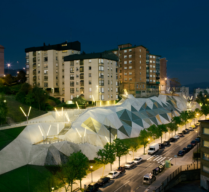
One site of intervention was the rocky embankment on Jesús Galíndez Avenue as it was unstable and divided the districts of Txurdínaga and Otxarcoaga both physically and socially. Below is a description of the project by the architects:
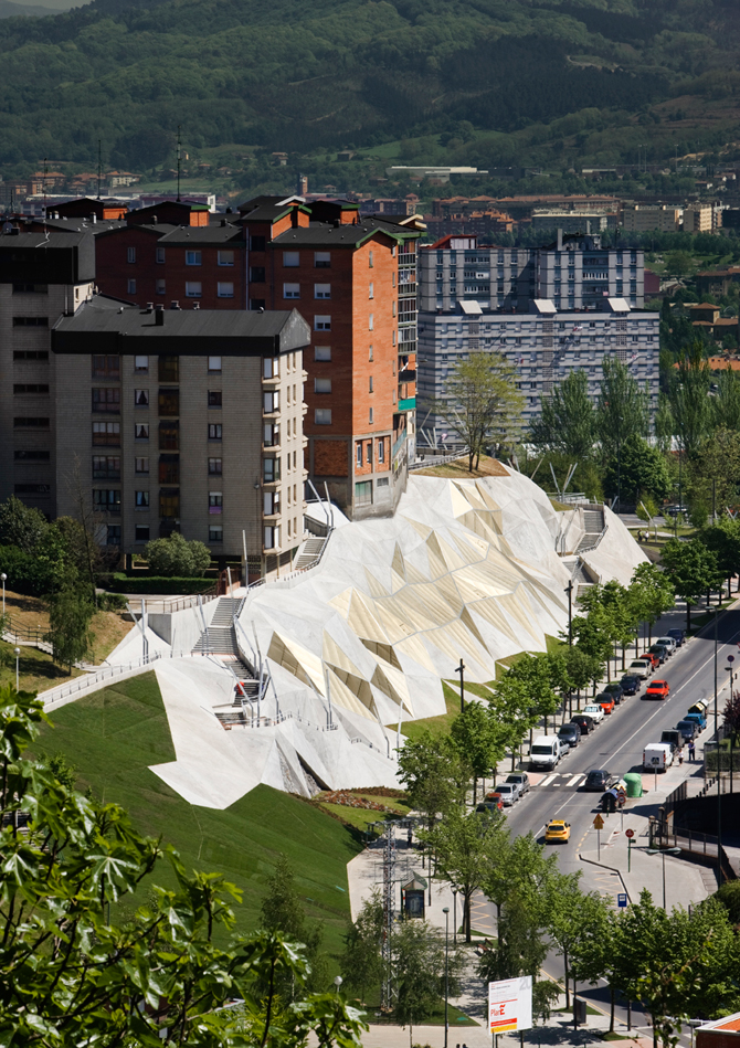
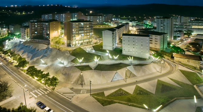
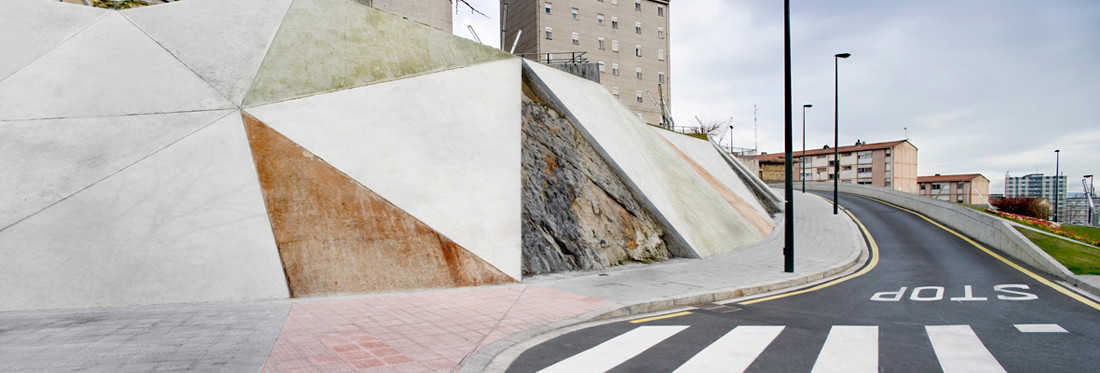
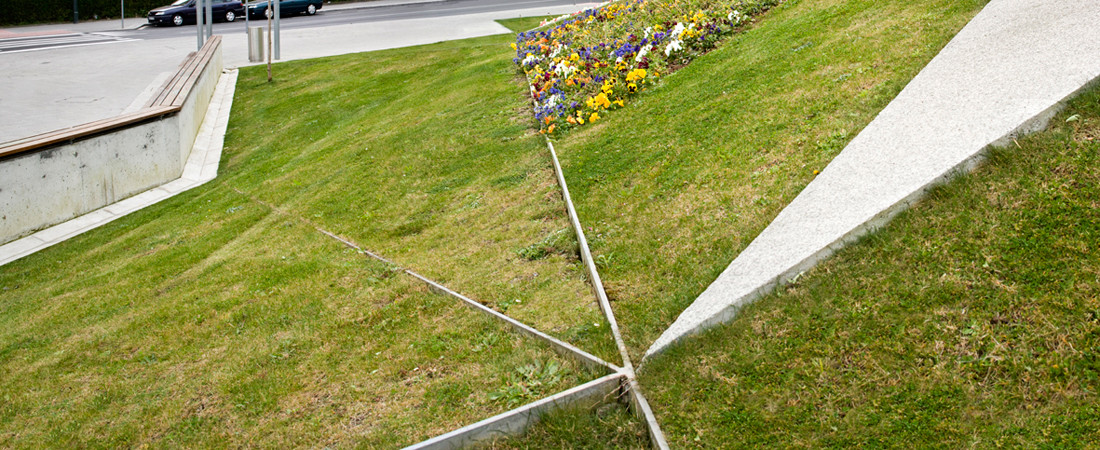
“The aim of the project is to consolidate the embankment and recover this derelict area, which acts like a physical barrier and disintegrating element in the city. To achieve this goal, the project shapes the embankment by using sloped planes of different materials, which reveal their strange topography to the city.
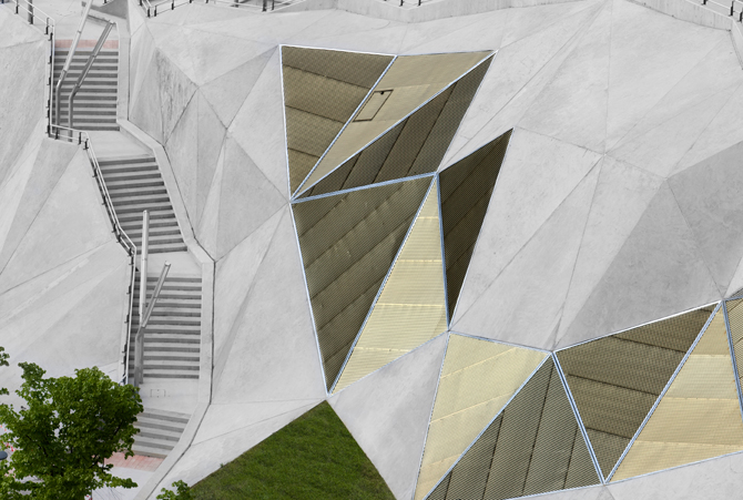
The triangular planes are formed by different materials: the existing rock; vegetation of different colors; concrete in those areas which required consolidation; and light defining their silhouette at night.
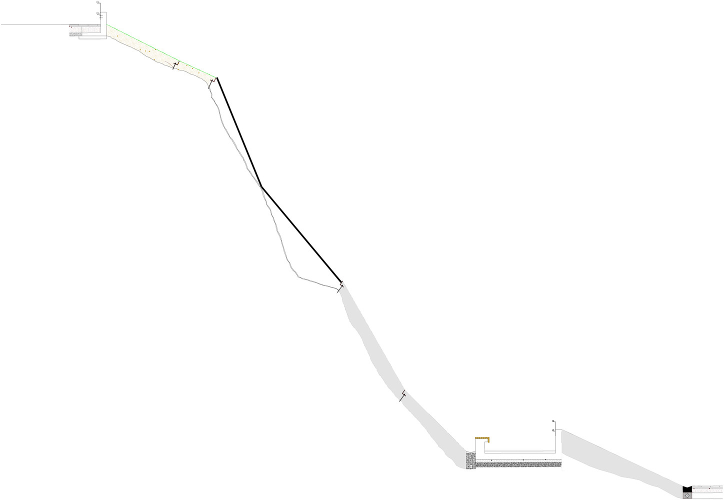
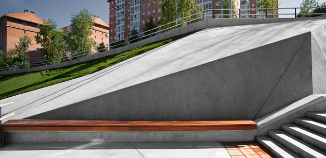
The project creates and connects areas between the top and bottom levels to lessen the impact of the embankment as a physical barrier in the city, as well as create a horizontal viewing platform to take advantage of the height of this area of the city. All the elements in the project are part of this recreated topography and part of a single fold: the stairways, the sitting areas, and the public toilets.
Cut in the rock by means of planes of different materials, a gently sloping stairway joins the two levels of this district. It is used by large numbers of pedestrians who choose this as an alternative path instead of the much longer existing routes that run around the embankment.
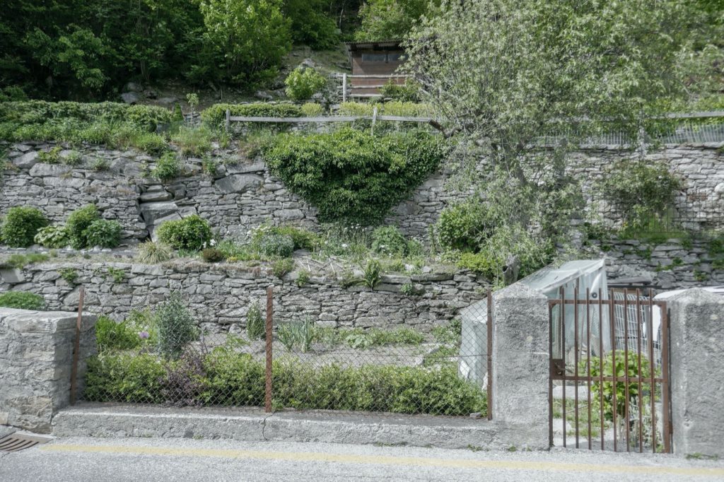
Following the embankment project, we were commissioned to develop the Pau Casals Square next to the embankment project and create a children’s play area over a former electricity substation. For this second project, we once again used triangular planes. In the children’s playing area, the planes are soft: grass, rubber, and flowers. The area also features built-in slides. The old substation is now part of the topography wrapped in a fold of wooden slabs.
In the Pau Casals Square, the folds wrap a retaining wall and generate a space defined by gentle slopes where formerly there had been a crossroads. There are planting planes between the existing trees in the old central reserve, as well as planes of colored concrete and planes of water to sit next to.
A former rocky embankment that represented a barrier in the city is now a connecting element for sitting and public use. Furthermore, it has become a landscaping element that has improved the quality of the surrounding urban space.”
IDOM Group, 2020
Sources & Resources:
IDOM Group. (2020, May 7). Jesús Galíndez slope and Paul Casals Square. MAS CONTEXT. Retrieved from https://www.mascontext.com/issues/30-31-bilbao/jesus-galindez-slope-and-paul-casals-square/
RESIN. (2022). Tier 1 Cities – Bilbao. RESIN. Retrieved from https://resin-cities.eu/cities/tier1/bilbao/
Saieh, N. (2008, November 17). Galindez slope and Pau Casals Square / ACXT. ArchDaily. Retrieved from https://www.archdaily.com/9093/galindez-slope-and-pau-casals-square-acxt
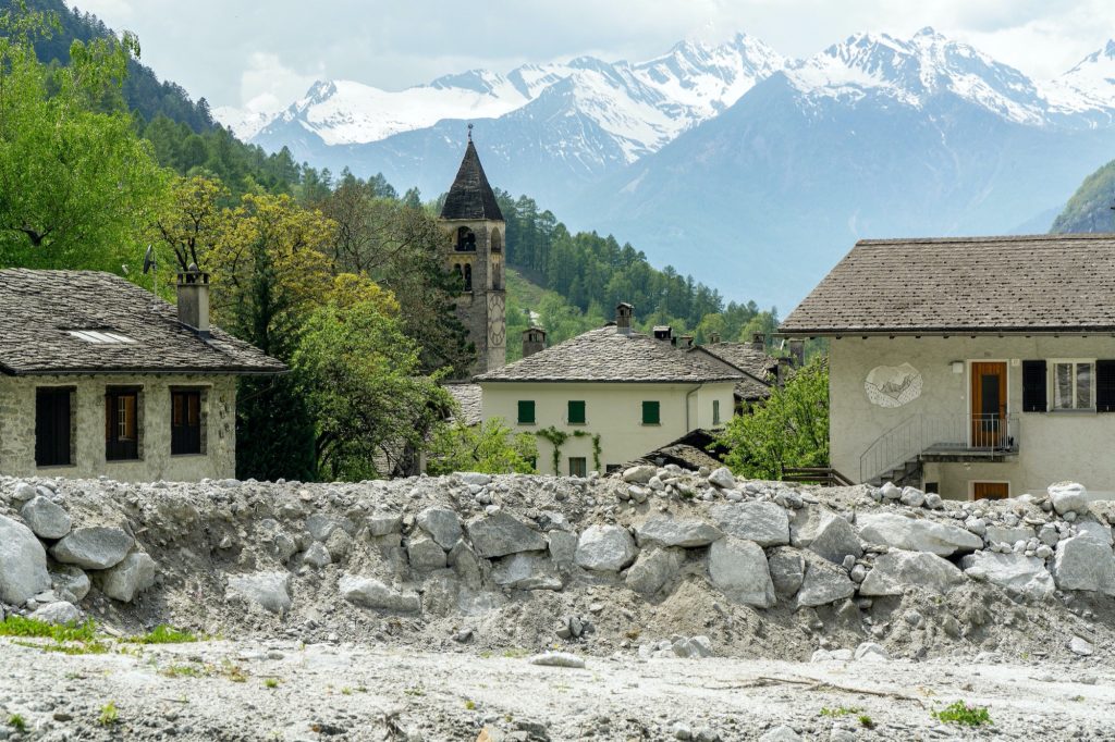
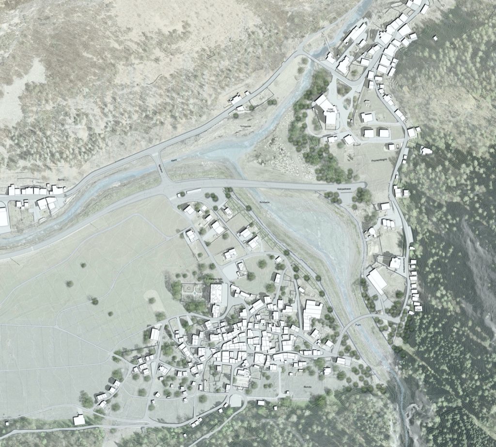
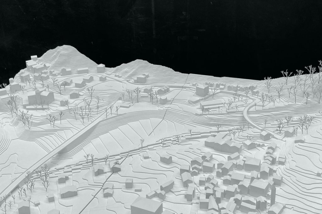
Bondo – Bondasca Redesign and Maira Protective Dams
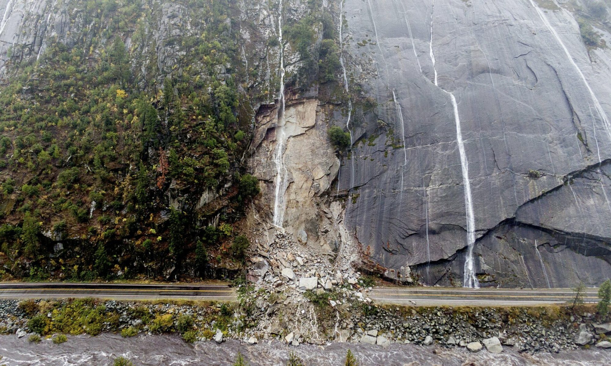
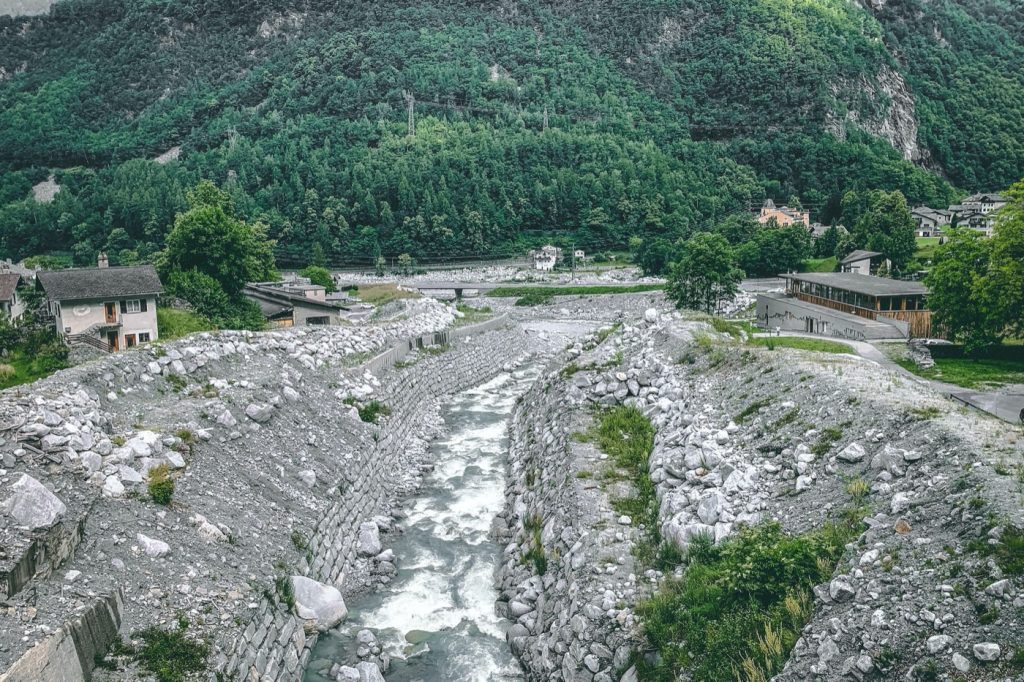
On August 23rd, 2017, three million cubic meters of rock and debris slid down the side of Piz Cengalo and hurled into the Bondasca valley where the communities of Bondo, Promotogno, and Spino reside. When the landslide reached Bondo, it destroyed an old stone bridge, houses and barns, as well as overflowed the catchment basin designed to mitigate an event like this. Everyone in the town was able to evacuate thanks to an early warning system that gave people enough time to get to nearby villages or to higher ground. However, eight people who were hiking the slopes above the town were killed by the landslide.
What made the landslide so powerful was the sequence of events that took place. A dry rock fall landed on a small glacier, instantly transforming its ice into water that turned the rock fall into a mudslide (McClanahan, 2022). Geohazard chains like this are very difficult to predict and will likely become more frequent with climate change, particularly with more intense rainfall, permafrost thawing, and the rapid increase of glacial melting.
The reconstruction of Bondo created an opportunity to make the cultural-historical significant communities more resilient to landslides in the future. This opportunity prompted the municipality and canton to launch a first ever competition for interdisciplinary teams to reestablish and reimagine Bondo’s resilience to natural hazards. mavo Landschaften won the competition and describes their project below:
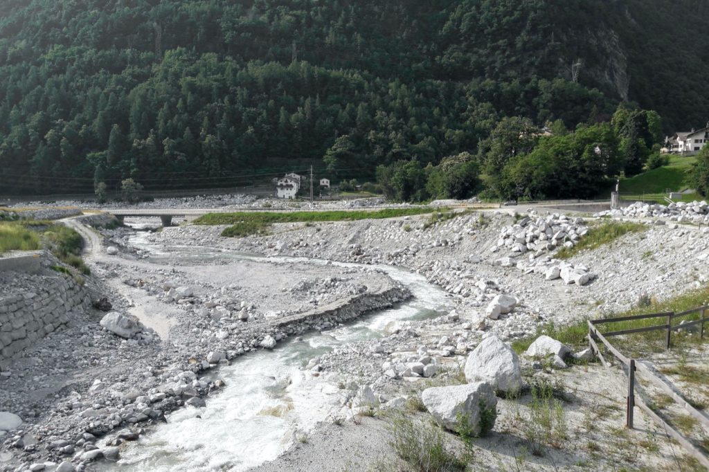
“The project proposal of the winning strata team continues the DNA of this unique cultural landscape: clear artefacts enter into dialogue with the impressive natural landscape – walls, terracing and protective dams/structures are the means to naturally embed the new infrastructure buildings. The newly elevated cantonal road, for example, plays the role of shielding barrier, while the protective walls on the village side are adapted to the texture of the site by means of fine garden terracing.
The carefully integrated protective structures should also generate added value for the everyday life of the population: The tops of the embankments will be used to connect pedestrians, for example between the new bus stop and via the striking new Punt bridge to the Crotti, the multi-purpose hall and the community centre, where the Chestnut Festival will take place in the future.”
mavo Landschaften, 2021
Sources & Resources:
Hurkxkens, I., Kowalewski, B., & Girot, C. (2020). Informing Topology: Performative Landscapes with Rapid Mass Movement Simulation. Journal of Digital Landscape Architecture, 130–137.
Kohl, P. (2021, December 17). Bondo-Neugestaltung Verbauungen Bondasca, Maira und Neue Verkehrsanlagen. mavo Landschaften. Retrieved from https://mavo.la/projekte/bondo-
mavo Landschaften. (2022, January 20). Bondo – redesign of Bondasca and Maira protective dams. Landezine. Retrieved from https://landezine.com/bondo-redesign-of-bondasca-and-maira-protective-dams-by-mavo/
McClanahan, P. (2022, May 12). The Bondo Landslide and the Future of Climate Disasters. Outside. Retrieved from https://www.outsideonline.com/outdoor-adventure/environment/bondo-switzerland-landslide-climate-change/
Pini. (2021). Pini – debris flow, Bondo 2017, Restoration Project. Pini Group SA. Retrieved from https://www.pini.group/pini/expertise/environment-water/bondo.html