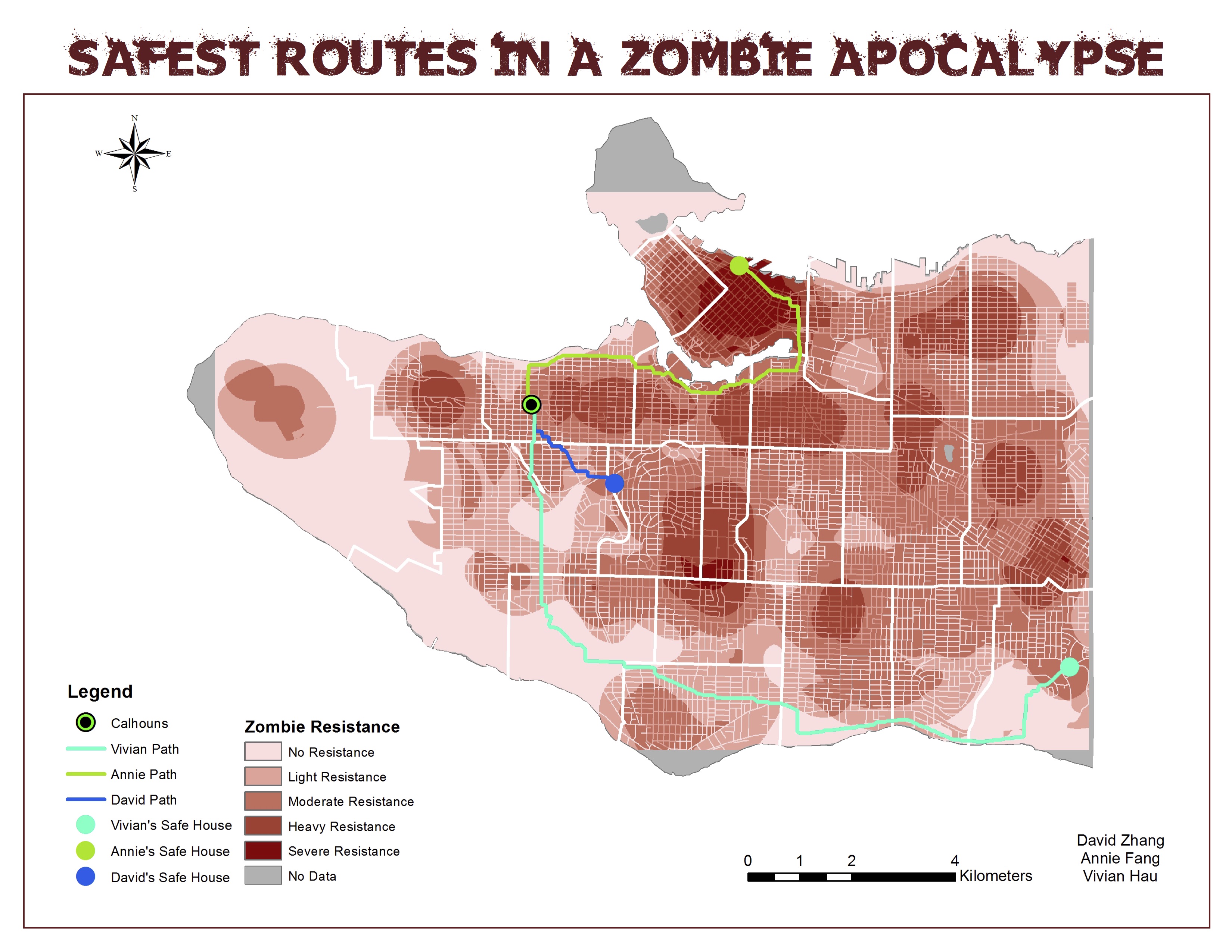
This map shows the safest routes home by bike for each project partner, overlaid on a heat map of areas of severe to no zombie resistance. To identify the safest routes, friction values were assigned to locations that we predicted to have the most zombie resistance. The cost path tool was then used to map out the path of least resistance.
Based on our classification of zombie resistance, we were able to identify the level of zombie resistance each project partner would encounter on their route home. The average resistance (friction value) for each route was calculated by dividing the total cost of the route by the total distance of the route.
Vivian’s Path: The total cost was 264203, and the total distance 17097 meters. The average friction is was 15. Vivian would experience light resistance on her way home.
David’s Path: The total cost was 58603, and the total distance 2720 meters. The average friction is was 22. David would experience moderate resistance on his way home.
Annie’s Path: The total cost was 320975, and the total distance 9408. The average friction value is 34. Annie would experience moderate to heavy resistance on her way home.
In addition to identifying the safest routes, “hot spots” of zombie resistance (dangerous areas) were also determined from the final map. By identifying the most dangerous areas, we identified several survival tactics an individual could use when navigating through the city. On the heat map, areas along the coast lines were generally considered more safe. This was due to the lower density of locations in these areas. Travelling across parks was also found to be more safe, as cutting diagonally across a park would reduce the distance travelled.
Friction values on roads were reduced, and friction values for the areas in between the roads were increased. This encouraged the use of roads because each project partner was travelling by bike. Travel through parks would be inconvenient as we would have to climb over fences and bushes.
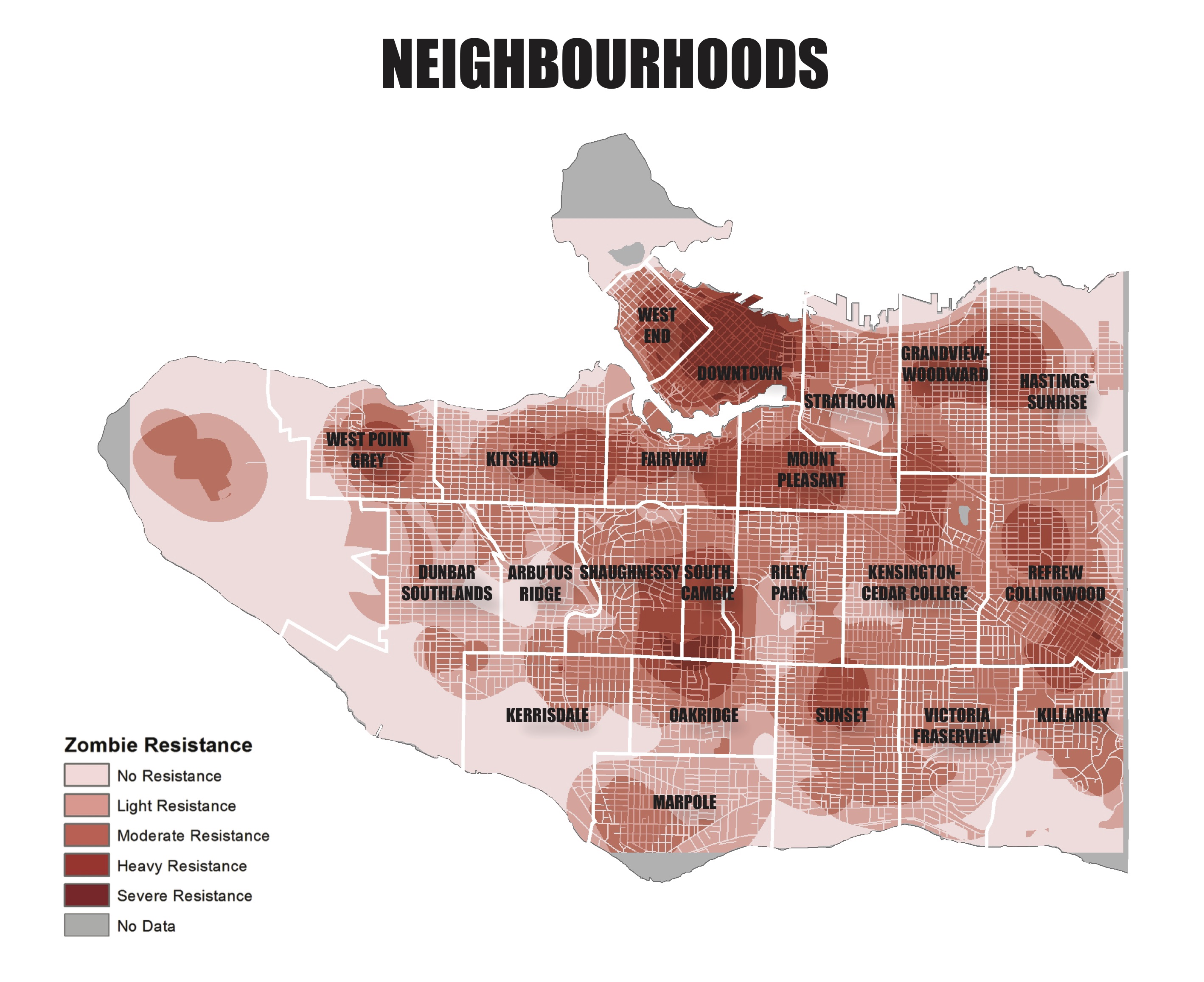
To help identify the danger zones, we have provided a neighbourhood map for reference below.