BikeMaps.Org
A Crowdsource Tool for Global Mapping
of Cycling Safety
May 2007 to May 2017
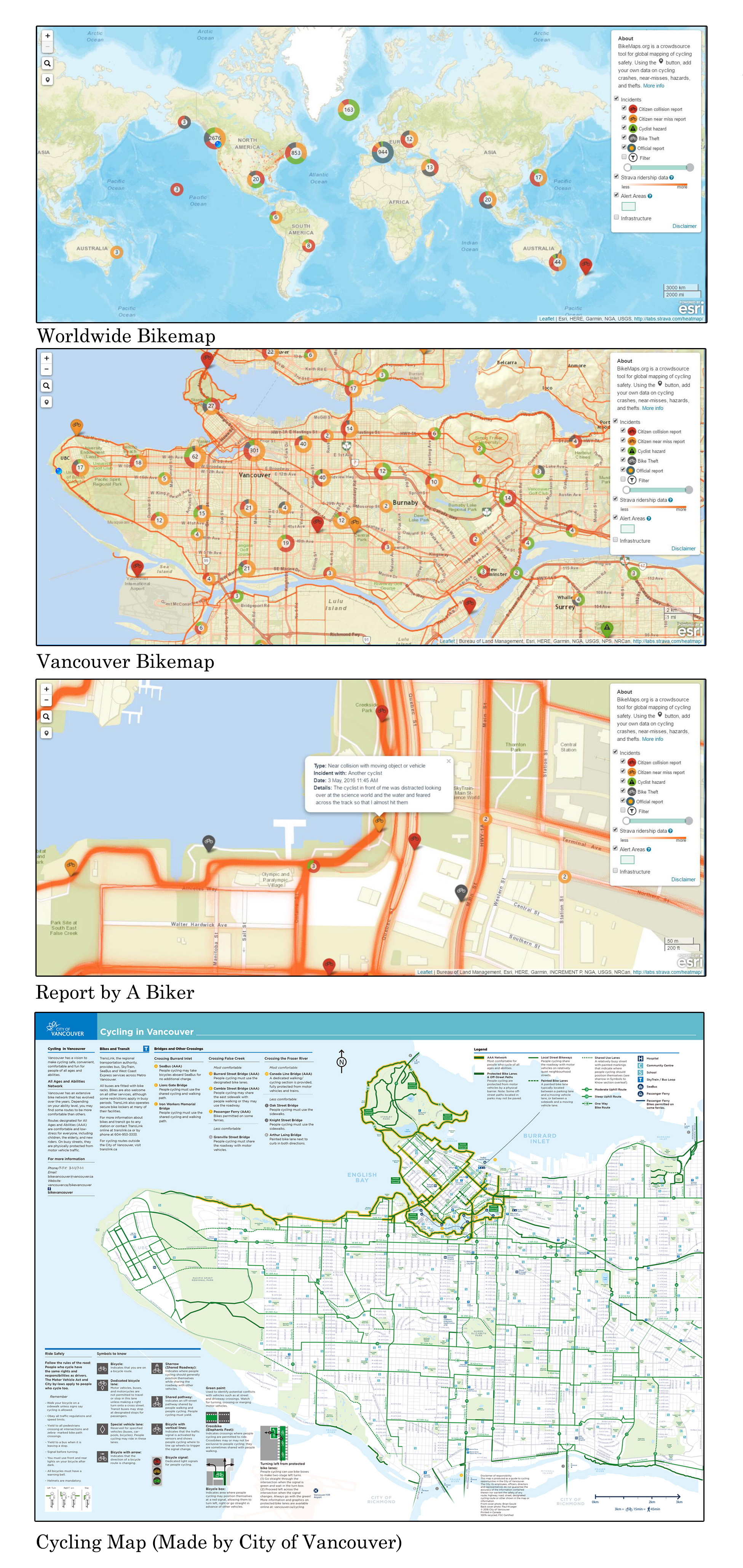
BikeMaps.org is a website that bikers can share their cycling experience through this website. This website collects the information about cycling safety, hazards and bike thefts
and then uses GIS and statistics to identify hot spots of cycling safety, risk, and crime.
Excepting for the hot spots of incidents, this website also shows rider density data. This data comes directly from the Strava cycling and running mobile tracker application. Using Strava, bikers can track their commutes and recreational rides using their Android and
iPhone. This website can show data that collected in recent ten years and the map shows data reported by bikers and official report(such as ICBC report).
Compared with the cycling map made by Vancouver government. I think the advantages of bikemaps website are that the website keep updating the latest data and bikers are able to find the real-time density in the bikeways.
link:
http:// bikemaps.org
http://vancouver.ca/streets-transportation/cycling-routes-maps-and-trip-planner.aspx

 Follow