Designer: Architecture Drawing Studio
Year:2014
Size:40×40 in.
Location: Haikou, Hainan Province, China
110.351325N, 20.049624E
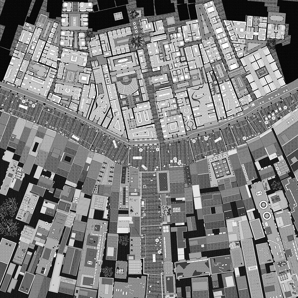
Invited by the the 2nd Haikou International Youth Experimental Art Festival in 2014, Drawing architecture studio created drawings for the Qilou Old Street in Haikou. Qilou Old Street was built by Chinese businessmen who traveled overseas in 19th century. The architecture here is a fusion of European and Asian styles and is also influenced by Indian and Arabian architecture. Chinese government today tries to protect these heritages but their protection work is only focusing on the elevation. But the studio was more interested about the life happening inside buildings. However, they couldn’t make further research since there was a time limit and they were not allowed in.
The author was inspired by Piranesi’s Campo Marzio plan, which was created by a combination of imagination and archaeology. Thus they envisioned an indoor & outdoor urban space based on the architectural outlines extracted from their survey, which can be seen at the upper half of the map. The lower half of Zhongshan Road depicts the plans of the roofs with the figure-ground method from Nolli Map. But the boarders between the figures and grounds are blurred by the inversion of black and white.
The combination forms of two different style Roman maps represent two different ways to read about cities. One is to explore the city from the ground floor plan, showing more about space inside buildings. One is to explore the city from the roof plan, showing more about space between buildings. This studio also intended to record everyday life happening in the buildings. So they added a lot of detail elements like furniture and cars to indicate the local’s activities. For example, we can see the street is in a messy state with tables, chairs, beach umbrellas and cars, which give us a sense that life here is busy and alive. And these furniture also help readers to know the scale of the place.
Image credit from: http://www.d-a-s.cn/en/projectdetail.php?currcategory=drawing&page=5

