
Project link: https://479stlouis.home.blog
For the final project, we explored the spatial patterns of violent crimes in St. Louis City. The crime analysis used several methods including: kernel density, hot spot analysis, space-time analysis, grouping analysis and GWR. Our project was to determine the most dangerous areas of the city by looking at several variables including education institutions, bar locations, poverty rates and median household data.
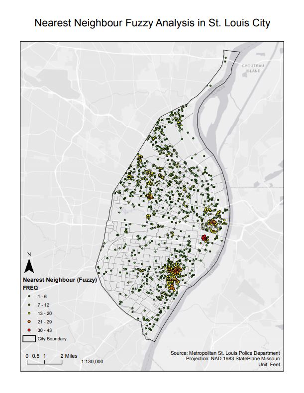

These results show that there are spatial patterns where there are common occurrences of violent crimes. East and South of the city sees a cluster of crimes whereas the Northern cluster is not able to be explained with the data we gathered and analyzed.