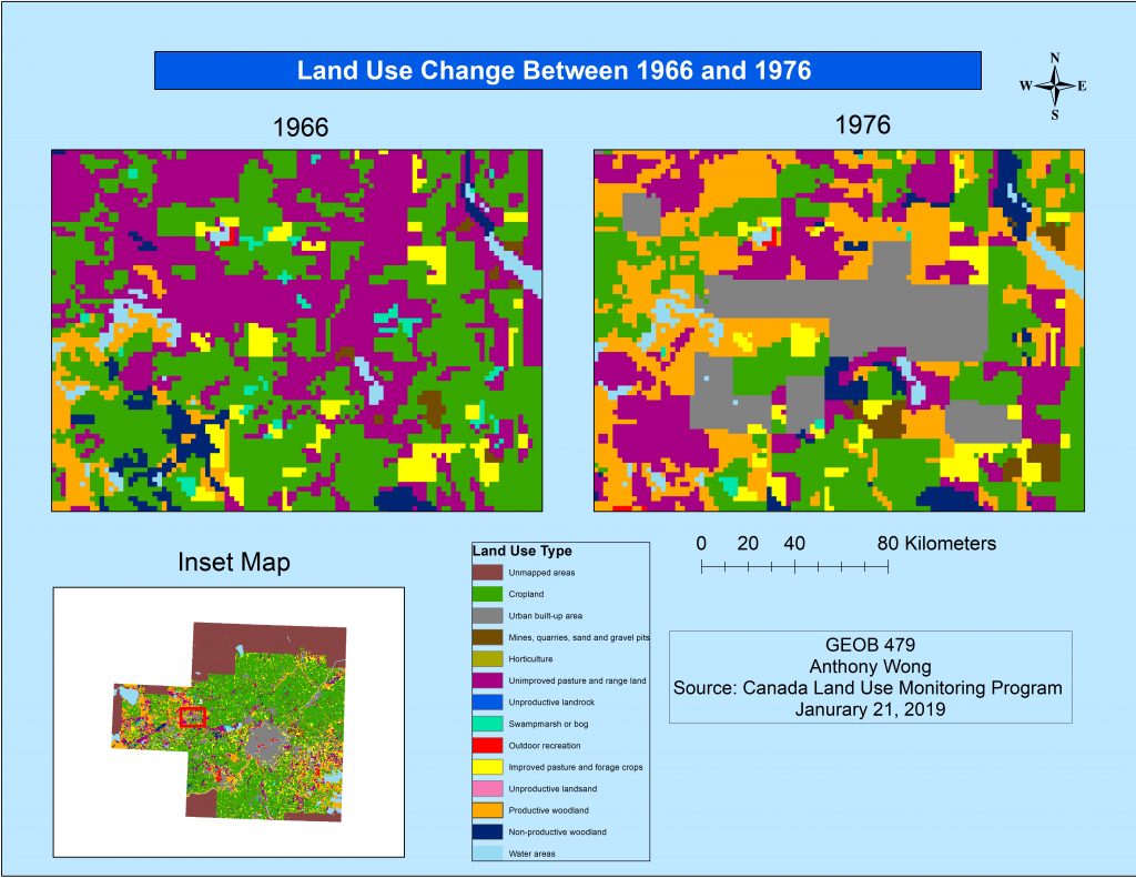
The first lab was an introduction to the FRAGSTATS program (University of Massachusetts). I analyzed the land use change of the Edmonton area over a 10 year period from 1966 to 1976. The land use data used provided by the Canadian Land Use Monitoring Program.
Analysis steps:
- Download CLUMP data from Geogratis
- Import and organize data in ArcMap
- Add the metadata that will be used in FRAGSTATS
- Analyze the data in FRAGSTATS
- Create a transition matrix
The results showed a transition from cropland, unimproved pasture and landscape to urban built-up areas. The maps produced show the trend towards development in the Edmonton area.