Feed on
Posts
Comments

The following is a comment on a blog entry by George Hoberg and Andrea Rivers.

The Northern Gateway tanker route passes almost totally through the lands and waters of the Gitxaala Nation (see map)

I suspect that the primary legal challenge to the tanker route will come from Gitxaala – of all the various intervenors Gitxaala has singlehandedly submitted written evidence the scale of which is more normal in a rights and title case. Which, ultimately, is what the gateway project will become.

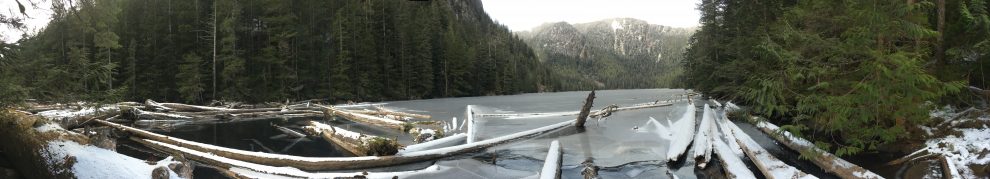
The tanker route passes through some of the most amazing marine waters of the BC coast. I’ve been there many times – in fact, I grew up there. But it’s not just a nature wonderland, it’s the cultural and historical heart of the Gitxaala Nation. Over the course of many years I have conducted field reserach with Gitxaala and within Gitxaala territory. This is a difficult area for most people to get to. One needs a boat and the time to move.

What we have documented is an amazing richness of cultural heritage. Ancient villages more than 4,000 years old; tidal stone traps and modifications of the foreshore that demonstrate millennia of use and management by Gitxaala people. This all could be lost by one simple human error or machine breakdown. And for what? feeding the bank accounts of the 1% and building the industry of China’s rising capitalist class. The rest of us stand to lose a priceless cultural and ecological treasure.

In the south-central area of Laxyuup Gitxaała, on the south east of Pitt Island in behind the Cherry Islets, is Citeyats (IR #9 established July 10, 1891 by Commissioner Peter O’Reilly) a large Gitxaała village site.  Our archaeological research here has identified the surface features of up to 26 house depression including at least five large plank houses along the water front described by Jacinto Caamano during his 1792 visit.[1]  Recent C14 (carbon 14) dates provide decisive evidence that Citeyats has been continuously inhabitant  for at least 4,000 years before present.[2]  Our percussion core tests and auger test samples, conducted in a systematic grid pattern, clearly show evidence of continuous human occupation from the surface of the village site to the sterile soil and bedrock an average of 3-4 meters below the surface. Careful examination of these samples shows no evidence of breaks in occupation of this amazing village.

The historical evidence of this village can be found in Caamano’s detailed account of his month long stay stormbound off the village and his visit ashore as a guest of honour of Smoygyat Homstits in 1792.  Caamano had a range of adventures while at anchor, including an occasion in which a number of his crew found themselves stranded, nude on the beach, as the local inhabitants made off with the sailors’ clothes.  The crew did get their clothing back and Caamano received an invitation to what is likely the earliest European record of a Gitxaała feast.

This is an area that is directly in the path of the Northern Gateway proposed tanker route.  Large scale opposition to the pipeline and tankers might not save this place from development.  Villages like Citeyats are simultaneously ancient heritage sites AND actively used places for harvesting and critical cultural practices.  It would be shame to find this amazing landscape covered in tar sands oil due to an Exon Valdez like accident.


[1] It is interesting to note that of the reserves established by Inidan Lands Commissioner Peter O’Reilly only two were primary village sites – Lach Klan and Citeyats.  A third, Klapthon (IR #5 & #5A) was proposed as a new primary village closer to the steamship travel. The other reserves are all fisheries stations, though at least three have midden or remains of middens within the reserve boundaries.  The selection of these fishing stations as reserves reflects the active decisions of Gitxaała chiefs to maintain access to critical fisheries as they ensured a future for their community in the face of increased industrial and colonial encroachment.

[2]  As of December 16, 2011 we have received 8 C14 dates from the University of Arizona NSF Arizona AMS Laboratory.

3-0040 GITXAAŁA LAXYUUP (KITKATLA NATION): TRACING GITXAALA HISTORY AND CULTURE THROUGH ARCHAEOLOGY AND ANTHROPOLOGY.
Thursday, November 17, 2011: 08:00-09:45


Abstract is available to registrants only. Please log in or register to view abstract text.

This session would be of particular interest to:
Those involved in mentoring activities, Students, Teachers of Anthropology in Community Colleges, Practicing and Applied Anthropologists

Organizers:  Charles R Menzies (UBC) and Caroline F Butler (Gitxaala Environmental Monitoring)
Chairs:  Charles R Menzies (UBC)
Discussants:  Caroline F Butler (Gitxaala Environmental Monitoring)
08:15
08:45
Preliminary Results of Lithic Analyses atTs’uwaanłm Galts’ap, Laxyuup Gitxaała.

Kenzie Jessome (University of British Columbia and In Situ Anthropological Consulting)
09:00
Gitxaala Marine Use Planning – An Indigenous Authority and Jurisdiction

Morgan E Moffitt (University of British Columbia)
09:15
09:30
Discussant

Caroline F Butler (Gitxaala Environmental Monitoring)

« Newer Posts - Older Posts »

Spam prevention powered by Akismet