Assignment 3 – Critiquing a Crime Analysis Paper Using GIS
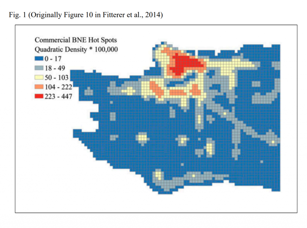
Fitterer, Nelson and Nathoo (2014) analyzed the patterns for breaking and entering (BNE) crime data in Vancouver from 2001 to 2012 to inform two models, with one model incorporating spatial data of the environment and socio-economic features and the other strictly using BNE crime data. Their goal is to eventually be able to create a predictive model for future property crimes in Vancouver. I gave their research a 5/10 because they were able to effectively model the relationship between breaking and entering (BNE) crimes and other BNE crimes that took place within certain time frames after and within certain distances, but they acknowledged that their models are at a high risk of predicting some likelihood of breaking and entering crimes where in reality none may exist.
Attached below is my full critique of their study and use of GIS.
This figure was extracted from their study and shows their results for predicting commercial breaking and entering crimes in Vancouver.
Assignment 2 – Critiquing a Health Geography Study Using GIS
Fiona Lawson, Nadine Schuurman, Lisa Oliver, and Avery Nathens (2013) employed GIS to research the accessibility of trauma centers for people that suffered severe injuries between 2001 and 2006 in Canada. They found that 68.5% of the population that experienced major trauma in this window were within a one hour drive to a Level I or II trauma center. I gave this study a 7 out of 10 because Lawson et al. appropriately justified their parameters, applied an origin-destination cost matrix to most of Canada as comprehensively as they could, and devoted a great deal of their discussion to potential limitations in their study.
Attached Below is my full critique of their study and use of GIS.
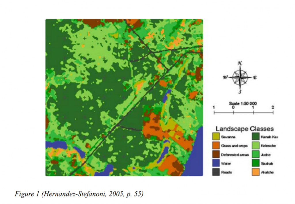
Assignment 1 – Critiquing a Landscape Ecology Study Using GIS
J. Luis Hernandez-Stefanoni’s research aimed to distinguish how different metrics of landscape fragmentation relate to biodiversity by analyzing the predictive power of different groups of landscape metrics on plant diversity in the tropical forest region surrounding Quintana Roo, Mexico. His use of GIS software was minimal, but I gave this study a score of 8 out 10 because his study was exemplary of what a full spatial analysis process entails.
Attached below is my critique of his assessment and use of GIS.
This is a map of landscape fragmentation produced by Hernandez-Stefanoni.