This week, I have been working on creating three map layers for the Craters of the Moon and surrounding areas to determine the best route to access the five interesting lava flows that we have narrowed down to visit in August. The first map layer includes U.S. Route 26 and the paved loop road that runs throughout a small portion of the park. The second includes existing hiking trails that run throughout the park. The third is a layer containing all other roadways, some appear to be possibly roadways used to access farmland on the southern parts of the lava flow.
Finding out where the existing roadways and hiking paths currently exist is the first step to creating a traverse plan. I created these layers using the National Agriculture Imagery Program (NAIP) high resolution data in conjunction with Google Earth imagery and a map from the national park service website depicting all of the hiking trails and roadways. I traced out the roadways using the Editor feature in ArcMap to create the map below.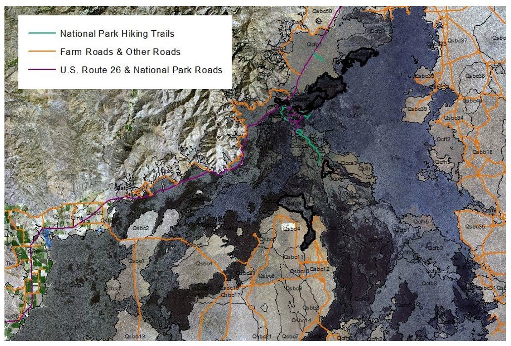 This map overlays the three road/ trail layers that I made this week over the geologic units and NAIP layers. The borders of the various areas of interest are bolded. One of the units we are very interested in visiting that is a bit out of the way is Qcfc5, South Echo Flow. It appears this area can be accessed by traveling down the Wilderness Trail to Echo Crater, a 4 mile hike from the road that will not require a lot of difficult traversing over lava.
A close up view of the trail to South Echo Flow is here:
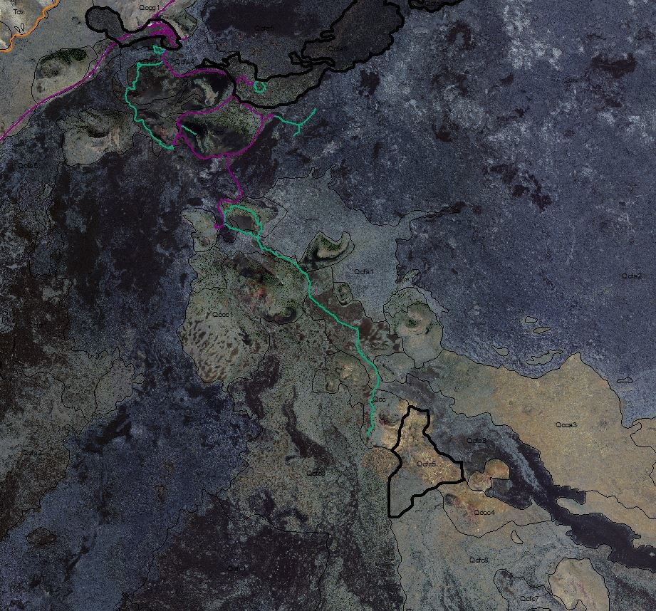
To get to this flow, we would travel down U.S. Route 26, then enter the park road and follow the loop road all the way to the southernmost part of the road (these roads are magenta in the map above). From there, we would follow the Wilderness Trail almost all the way to its end as it will take us to Echo Crater, which is very close to South Echo Flow. In order to figure out how we are going to make the rest of the trek to South Echo Flow, I referenced other remote sensing data sets to find the shortest path to the flow with the least (or no) vegetation that was also the smoothest. To do this I referenced the Landsat 8 Shortwave Infrared band combination map. This map is very good at highlighting vegetated areas as they show up in bright red. I noticed that this area is not a very heavily vegetated part of Craters of the Moon so I looked at the Circular Polarization Ratio map to determine where the smoothest area surrounding the flow is located. From the AIRSAR L-Band map below, I determined that the path in magenta would be a smooth and short path giving us access to the flow. Although it is difficult to see the hiking path because it is in bright green in this map, the magenta pathway follows the blue area around Echo Crater, representing a very low CPR and therefore a smooth surface. 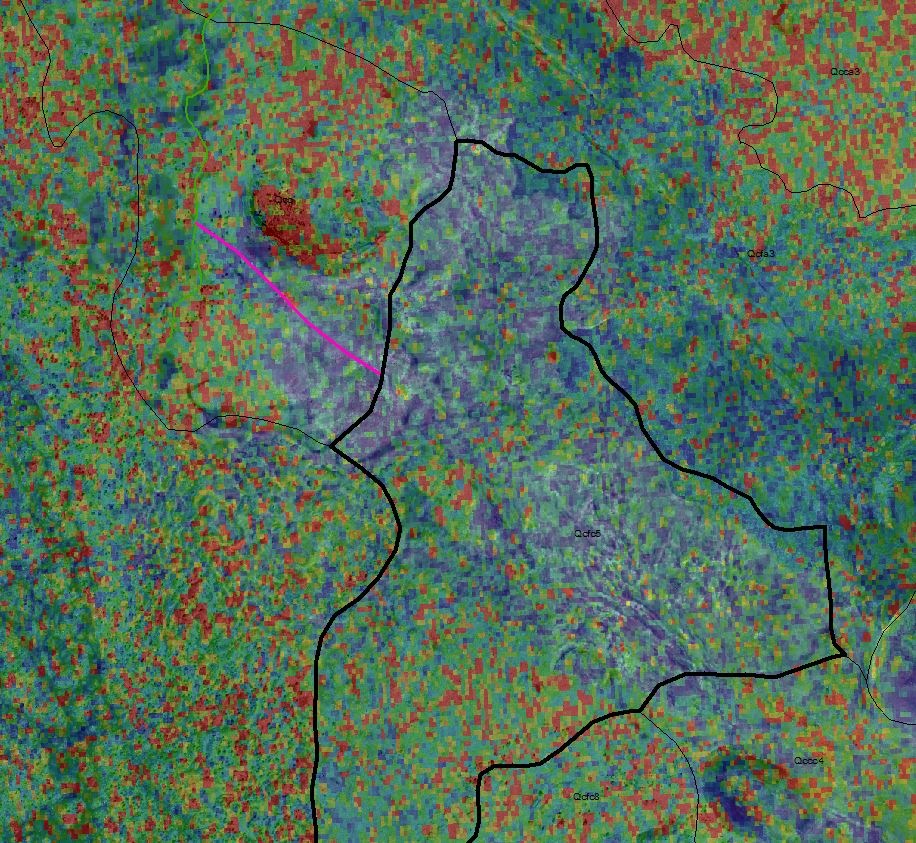
I will repeat this exercise for the other geologic units at Craters of the Moon and include traverse maps in the Field Guide that we will bring with us in August.