One of the tasks I have been working on this week is creating a new layer in ArcMap containing all of the lava tubes at Craters of the Moon. Lava tubes form from flowing lava that has an outer layer that is exposed to the surface and cools, while an inner layer of lava keeps flowing through. The top layer provides insulation for the inner layer, allowing it to retain its heat and flow great distances. Lava tubes are found all over Earth as well as on Mars and the Moon. They are of great interest to planetary scientists, thought to be some of the best places to search for life in the unforgiving environments of extraterrestrial bodies. Lava tubes could provide protection from the extreme temperatures and damaging cosmic radiation that any organism would be subject to on Mars and the Moon due to their lack of a magnetic field and thick atmosphere like we have on Earth.
There are over 400 caves at Craters of the Moon that are of three main types: lava tubes (the overwhelming majority of the caves), fissure caves and differential weathering caves (these are quite rare). The four main caves at Craters of the Moon are Indian Tunnel, Dewdrop, Boy Scout and Beauty Caves and can be easily spotted on a park map and accessed by a short hiking trail (the Caves Trail).
My goal was to create a layer in ArcMap that includes all of the known lava tubes and what appear to be lava tubes at Craters of the Moon. I began with locating the first four caves using the optical imagery that I have and realized that they are much more difficult to pick out in the National Agriculture Imagery Program (NAIP) imagery than in Google earth imagery. For comparison, an NAIP image of the area containing the main four caves in the park is below, followed by a much higher resolution photo of the google earth imagery underneath it. 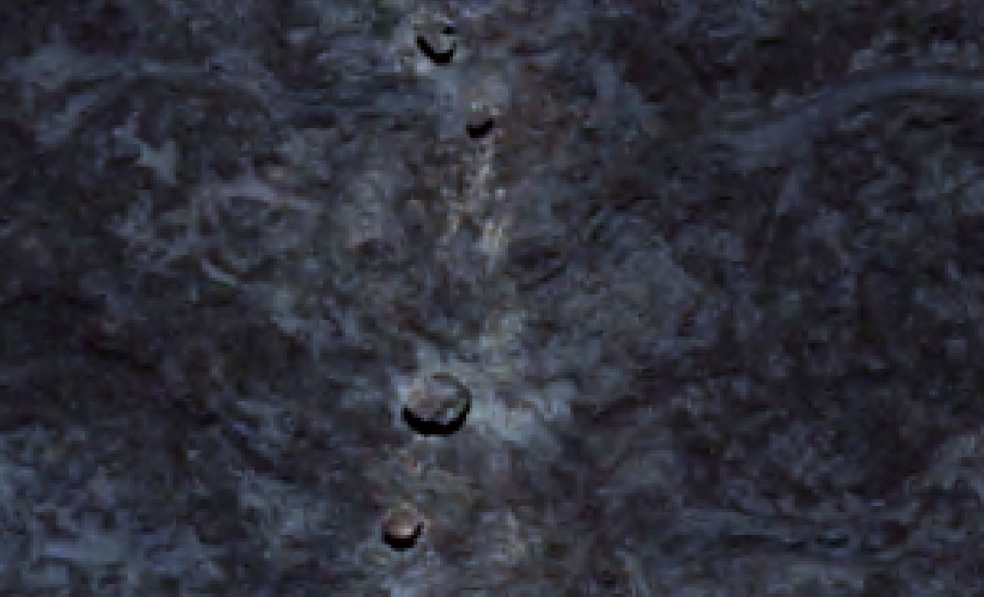
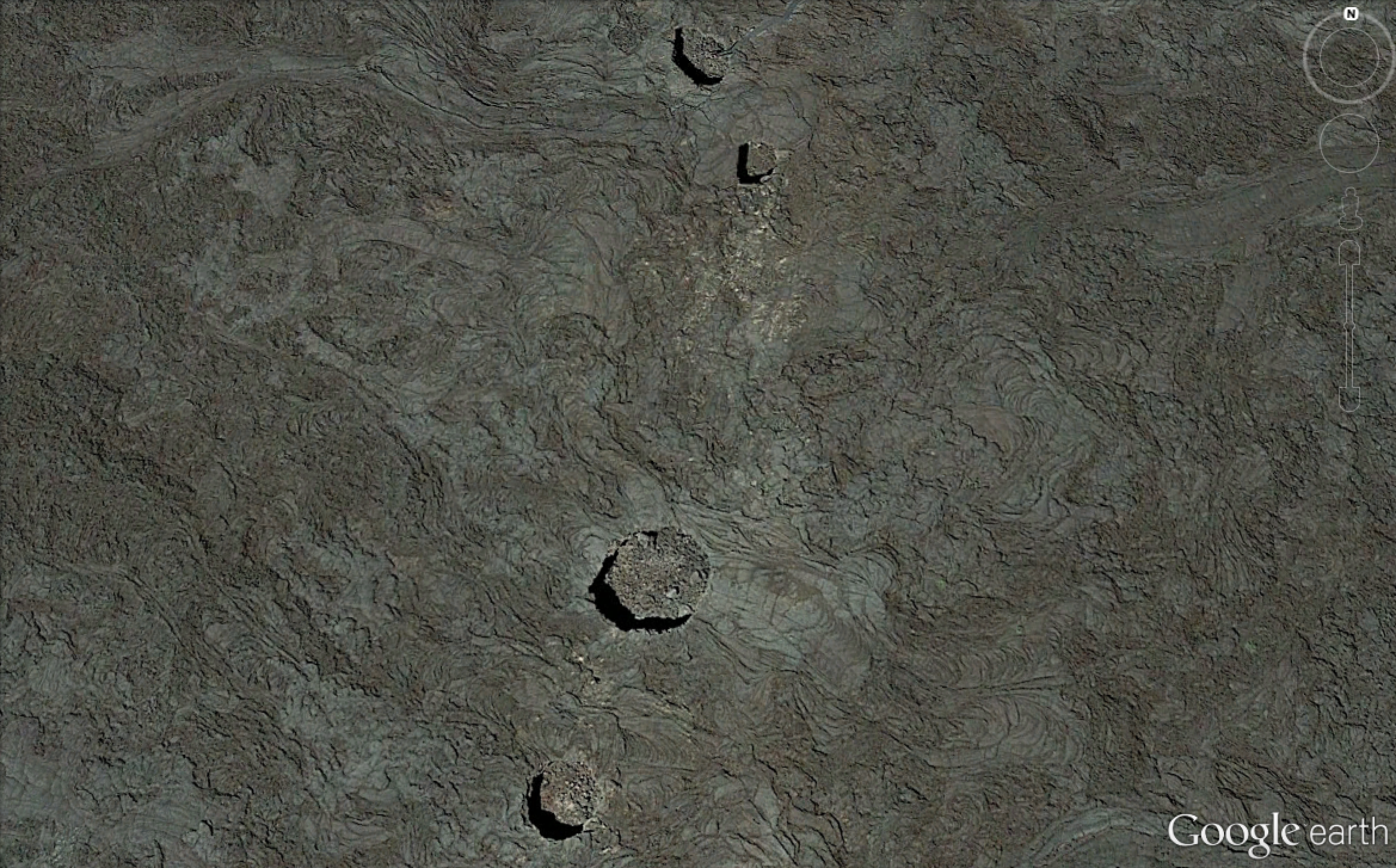 What I picked out in the imagery were the circular features with shadows in them, skylights, that formed when part of the lava tube collapses and forms an entrance to the tube. Since there is no existing map of the lava tubes or caves in the park, I looked for potential lava tubes by searching for depressions that are roughly circular and have shadowing like the features shown in the images above. This technique is one that has been applied to skylights of lava tubes found on the Moon and in Hawaii. Initially, I was marking what appeared to be skylights by drawing a polygon around them, but this made them difficult to see at far distances. The largest skylight I found is about 20 meters in diameter. Although this will appear large on the ground, it is difficult to pick out in the remote sensing images when viewed at the full extent of the Craters of the Moon area, about 1,600 kilometres squared. In order to better pick out the potential cave locations later, I switched to place marking the lava tubes with pins.
Once I finished locating all of the potential lava tubes, I still needed to find a way to bring the new layer I created into the map I have been adding layers to in ArcMap. I have all of the place marked lava tubes saved as separate KMZ files, which is the file format used by Google earth. Fortunately, there is a tool in the ArcToolbox under Conversion Tools called ‘KML to Layer’ that easily converts the KML or KMZ files into shape files that can be read and displayed in ArcMap.
I am hoping this work will be useful in locating lava tubes to study that have faced little to no affect by humans. I feel that this will be particularly important for biological studies of tubes as they have the greatest chance of finding unaffected life living in these tubes as opposed to Indian Tunnel, which is readily accessed by many park visitors every year. This being said, I recognize that there are limitations to this layer as I speculate some ‘tubes’ that I marked may in fact be caves (fissure or other types of caves) and will not be useful for studies of lava tubes.