A4 – Remi Landry Yuan

Sketch of site. CBY building at UOttawa, looking to examine the relationship between the different options of circulation and relation to perception of ground level.
West Elevation of the building. We can begin to see the difference between the upper entry and lower entry, with car and road access.
Axonometric drawing mapping an imaginary dividing plane between the main floor and the lower level (street level)
Water irrigation done through series of rooftop drains. The plan provide a view of the main circulation from the campus on the north, and the secondary circulation from the adjacent neighborhoods to the east.
Long Elevation showing the relationship of the building to the rest of the campus topography. With the dip in the path from the north side, pedestrians perceive the main entrance (above street level) to be the lowest level.
In this section, we can see that the open area at the main entrance is covered in grass, serving as a method of water irrigation and further pushing perception of it being the lowest level.
Full site plan. Red circulation indicates paths from main campus, where the main entrance is perceived as the lowest level. The gray dotted circulation comes from the neighborhoods and street side, perceiving this main entrance as the second level.
Long section demonstrating the variance in topography.
In class exercise

A4_Wenting Yang

Stormwater study in Nest at UBC Oct. 6th 2020

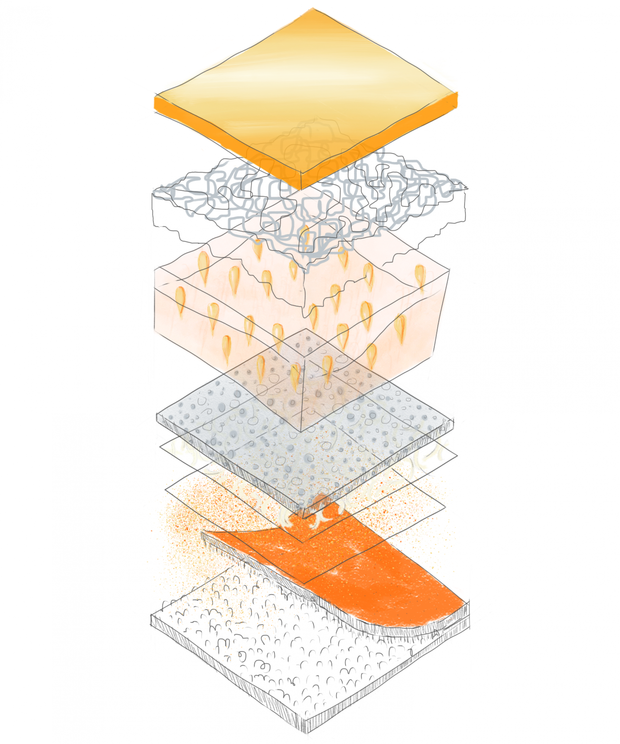
Sections show the stormwater collection system in Nest.
When I walked in the building, I found out the stormwater pipeline runs on the ceiling of the main floor. Also, the direction is from upstairs to two directions, West and East. One pipe is connected with downstairs from a pizza restaurant, another connects with the ceiling of RBC and directs to the exterior.

In class study of drainage system

The black points show the pipe areas which connect with the gutters.

In Class Work

A4- Above, At & Below Ground

Katie Hunks

In Class Analysis of Drainage System

The Life Sciences Institute Building, UBC

Examining techniques for water management
Examining movement and context of site in plan

A4: Above, At & Below Ground | Vicky Cen

In-class exercise

Rainwater flow

Rough version

Refined version

Block scale plan

Assignment 4

Sir James Douglas Elementary School

Base Plan

Green vs grey analysis

Green vs Grey + Program analysis

Green vs Grey + Program + Circulation analysis

Vegetation type analysis

Rainwater flow analysis

Long section showing scale of building in relation to adjacent landscape

Section showing relationship between building and road, also underground utilities

Ground level perspective showing materials and use of space

Axonometric showing the experience of the road, sidewalk, and the entrance.

Spam prevention powered by Akismet