To determine the placement for new public washrooms, the service areas for existing infrastructure had to be determined. I took data from the City of Vancouver on existing public washrooms, and public facilities that provide washrooms (Libraries and community centers). I merged this data to determine where existing public washrooms are located. Firstly, I tried using the network analyst function to do determine the gaps in between public washrooms, as this tool would be able to provide distance and time estimations along existing roadways. The tool did not provide any useable outputs, as important, unattainable data was needed. There is further discussion on the use of the network analyst tool in the network analysis section of website. To achieve the same goal of using the network analyst tool, I created a buffer of 250 meters around each washroom to determine it’s reach of accessibility. Unlike the network analyst tool, buffers do not provide distances or time estimations along dedicated networks, thus providing a rougher estimate of distance to a washroom. To compensate for this, I used a smaller buffer, as it would take longer than 250 meters to walk from the edge of the buffer to a washroom at the center.
Park Washrooms
The first way to address gaps in Vancouver’s public washroom infrastructure, was to use the city’s Parks Washroom Strategy (2020), with the goal of providing washrooms in as many public parks as possible. Following these guidelines, I found every park without a public washroom with an area over 1 Hectare, as these parks have the capacity and need for public washrooms, compared to the small greenspaces under 1 Hectare. This resulted in the potential for new park washrooms scattered throughout the city, which provides more equitable and dispersed access to washrooms, which is in line with the goals outlined in the Vancouver Parks Washroom Strategy.
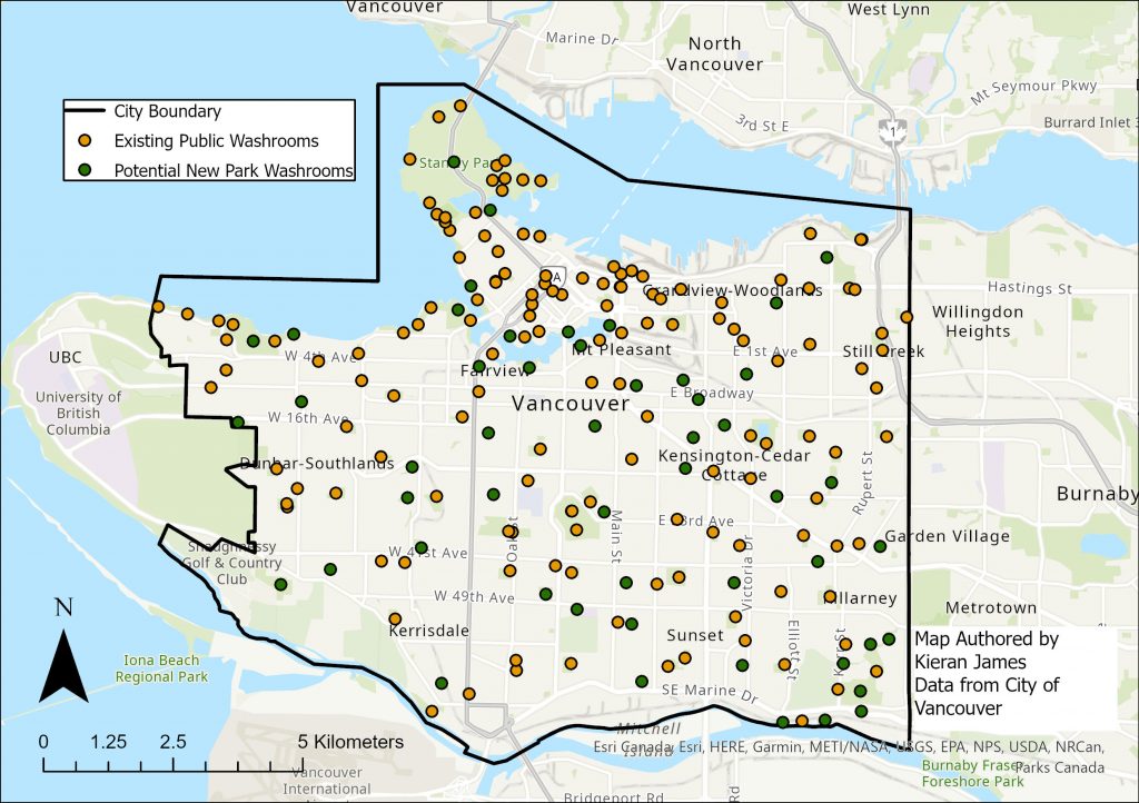
A map of the existing and proposed public washrooms in Vancouver’s Parks
Transit Hub Washrooms
The next step was to assign a potential public washroom to each rapid public transit station. As rapid transit is an integral part of movement around the city, the associated stations see high volumes of people and in turn must be able to address their washroom needs (Greed, 2012).
A map of Vancouver’s Transit Stations in relation to the existing public washroom network.
Commercial and Historical Zones
Besides transit stations, commercial centers are hubs of human activity, which as highlighted in the Covid-19 pandemic, do not always provide public washrooms. Using the City of Vancouver’s Zoning plan, I found commercial and historical zones, that were without access to existing public washrooms. Besides examining existing washrooms, I also buffered 250 meters from the new potential parks and transit public washrooms. This avoids overlap with existing and newly proposed washrooms, to help provide a more dispersed and complete washroom network. I placed proposed washrooms in the determined commercial and historical zones, where they intersected with Vancouver’s roadway arterials and secondary arterials. This helps determine major intersections with more human traffic, thus providing a washroom for more people.
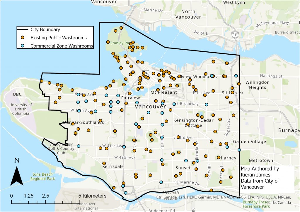
A map of proposed public washrooms in commercial and historical zoned areas in Vancouver.
Greenway Washrooms
To determine the final locations for public washrooms, I used Vancouver’s greenway network, as this network sees heavy traffic of cyclists and pedestrians, both of whom have greater difficulties finding a washroom in a timely manner than an automobile (Greed, 2012). With the addition of newly proposed commercial zone washrooms, I used the same methodology as before to fill holes in the existing washroom infrastructure along Vancouver’s greenways.
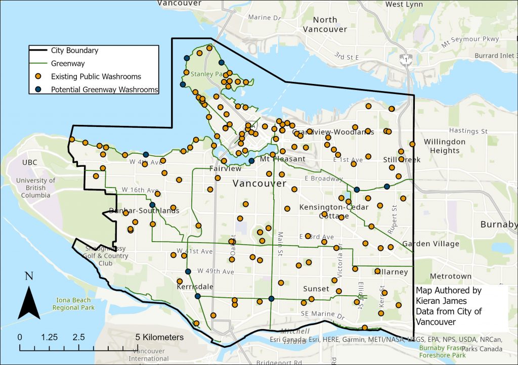
A map of proposed public washrooms along Vancouver’s greenway network.