Overall, the results are not entirely surprising. Ten stations that have moderate to high potential for TOD intensification are identified:
- Expo Line: Commercial-Broadway, Nanaimo, 29th Avenue, Joyce-Collingwood;
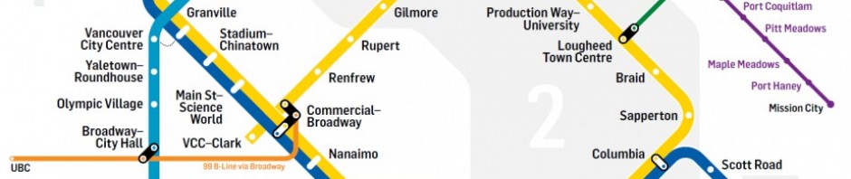
- Millennium Line: VCC-Clark, Renfrew, Rupert;
- Canada Line: Oakridge-41st Avenue, Langara-49th Avenue, Marine Drive.
Density is a contentious topic in the city, earmarked by neighbourhood opposition and discussions over housing affordability, gentrification, and neighbourhood character. These types of high-density developments are especially met with apprehension by the communities directly affected by such transformations. By using evidence-based planning rationale, employing effective cartography, ensuring transparency, and setting discussions in the context of climate change planning, the results can contribute to fostering informed community dialogue around the role of increased density.
Examination of the results should be concerned with the general trend of TOD potential around a station, and not at a fine scale due to the irregular shapes of census DAs. For the Expo Line, Nanaimo and 29th Avenue scored high for TOD intensification potential. Given that the two stations opened in 1985—27 years ago as of 2012—much can be done in these areas to encourage new, mixed use development to take advantage of rapid transit such as incremental upzoning from single-family to multiple residential dwelling, and/or mixed commercial. These stations are currently more characteristic of transit-adjacent development than TOD.
Similarly, land use surrounding VCC-Clark, Renfrew and Rupert station along the Millennium Line are at risk of remaining relatively static and not fully capitalizing on TOD possibilities. However, given discussions over extending the Millennium Line at VCC-Clark to the University of British Columbia and the completion of a 17-acre business park at Renfrew, this may change future assessments.
At Joyce-Collingwood station, the Collingwood Village TOD is considered a successful marriage of land use and transportation planning with a mix of high-rise and mid-rise buildings (Berelowitz, 2005). The community has been well documented for its success of social inclusion of immigrants and low-income individuals and families through the Collingwood Neighbourhood House (Sandercock and Attili, 2010). However, the general area around the station scored high for TOD potential attributed to the large number of single-family dwellings engulfing the immediate area surrounding the village. This may prompt a revisit of long-term community planning to maximize the area’s proximity to rapid transit.
Opportunities for optimizing stations for TOD may be hampered by existing land use barriers. The Commercial-Broadway station functions as a key transit junction for the entire Vancouver region, with a bus rapid transit line taking commuters to the region’s second largest employment centre along Central Broadway and to a rapidly growing university campus. The 99 B-Line is the busiest bus route in North America, serving 50,000 passengers per day with a total ridership of 100,000 for the entire Broadway corridor when considering all bus routes (City of Vancouver, 2011b). While the area north of the station along Commercial Drive is known for its vibrant entertainment and cultural district, south of the station is much less so with a noticeable drop in lively street and pedestrian activity. A current barrier is the lack of a catalyst that has yet to come to fruition to spur vibrant commercial development. While the food retailer Safeway is not interested in selling the parcel it currently occupies, its existing location and accompanying parking lot beside the station would be a highly valuable parcel for the City and TransLink to acquire (personal conversation with city planner, 20 August 2011).
Lastly, the MCE identified Marine Drive to have the highest potential for TOD intensification in Vancouver. In response to the introduction of the Canada Line in 2009, the City passed the Cambie Corridor Plan in early 2011 as a coordinated planning strategy for the entire corridor. Representing the largest and most complex planning exercise ever outside the downtown core, the plan is the successor to the Vancouverism model and emphasizes mid-rise urbanism and the integration of land use, transportation, and energy through district and neighbourhood energy sources and systems (Villagomez, 2011; City of Vancouver, 2011a). As part of the plan, the Marine Gateway development proposal was offered for the station and eventually passed by council. The 876,000 sq. ft. mixed-use development will provide residential, office, retail, and entertainment space (City of Vancouver, 2011b).
The Cambie Corridor Plan has been controversial for local residents and generated intense public discussion over the question of density. The Cambie corridor has traditionally been a single-family neighbourhood, punctuated by a large shopping mall and a community college. Community concerns have been sparked by the dramatic increase in property values along the corridor, increased building heights, potential overshadowing, and the dramatic change to the neighbourhood character and identity. In relation to Foth (2010)’s findings, concerted effort must be exercised to ensure sufficient stock of affordable and rental housing are available along the corridor to prevent displacement. The city’s heated real estate market will likely exert downward pressure on affordability as it becomes more lucrative to sell units at market rates. This may impede individuals and families in the city looking to rent or purchase, and affect local residents such as seniors, immigrants, and young families.
Prioritizing densification along transit corridors will be beneficial for long-term urban sustainability. Concentrating resources towards creating successful TODs will serve as useful precedents to deepen public acceptance of more sustainable urban forms, especially given that concerns regarding neighbourhood character preservation often run high in single-family districts. Notwithstanding, these types of transformations will need to acknowledge geographic circumstance and contingency. New development will inevitably take on different forms and emphasize a certain land use mix through a consideration of context and desired planning outcomes. There is no single formula for achieving ideal TOD. Hence, the selected criteria in the MCE aimed to capture social and physical dimensions of an ideal TOD. Accordingly, planning decisions should be guided by sound land use, transportation, energy, and design rationale; and alignment with environmental, economic, and social sustainability principles.