Transit-oriented development (TOD) is emerging as a popular and influential planning idea across North American cities as a means of sustainable urban development. TOD is generally defined as moderate to high-density, mixed-use residential and commercial development located around a transit station or corridor. Representing the full integration of land use and transportation planning (Jacobson & Forsyth, 2008), it encourages a compact and pedestrian-oriented form that provides enhanced access to residential, retail, office, and community uses nearby. This encourages less automobile dependency and reduces greenhouse gas emissions. Effective TOD can thus maximize node and place functionality, where TOD serves as both a node within a larger transportation network, and as a place where vibrant urban life occurs (Chorus & Bertolini, 2011). Given current concerns of urban sprawl and high ecological footprints, pursuing TOD has proven to be an effective way of concentrating growth on brownfields for energy-efficient urbanism while generating and attracting transit ridership to shift mode share (Dittmar & Ohland 1, 2004; Lund, 2006; Petsch, Guhathakurta, & Hagen, 2010).
TODs are typically laid out in circular or nodal arrangements, located within a radius of 400 to 800 meters, equivalent to a 5 to 10 minute walk (1300 to 2600 feet) from a rail-based transit stop (Muley, Bunker, & Ferreira, 2007). A distinction is made between transit-oriented development and transit-adjacent development (TAD) (see Table 1). The latter is “physically near transit [but] fails to capitalize upon this proximity… [It] lacks any functional connectivity to transit, whether in terms of land-use composition, means of station access or site design” (Cervero, Ferrell, and Murphy, 2002). Instead of promoting a more vibrant and sustainable urban form, TAD is described as conventional, automobile-oriented development located near transit stations. An example would be a transit station located in a single-family zoned neighbourhood with little to no amenities nearby.
| Transit-Oriented Development | Transit-Adjacent Development |
|
|
Despite clear environmental advantages, there are equity concerns associated with TOD that may conflict with social justice goals. Foth (2010) conducted a shift-share analysis on the long-term demographic changes of census tracts within the proximity of SkyTrain stations. She found lower-earning and less-educated occupants were displaced from 1981 to 2006 due to new development spurred by the introduction of transit. TOD can disproportionately favour individuals and families who are able to pay the extra premium to live in valuable real estate proximate to rapid transit. Subsequently, lower income households have limited locational choices as they get pushed further away from better served transit areas, resulting in less equitable transit access for the less affluent (Foth, 2010; Garrett & Taylor, 1999; Grengs, 2004).
The Vancouver Context
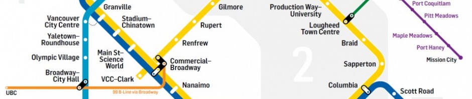
The region’s three major SkyTrain rapid transit lines—Expo, Millennium, and Canada—service Vancouver with 20 stations present within the city boundaries. The Expo Line opened in 1985 for Expo 86, the Millennium Line opened in 2002, and the Canada Line in 2009 for the 2010 Winter Olympics. According to TransLink’s 2004 Trip Diary Survey, for the city overall, walking and transit each make up 17 per cent of all trips while cycling accounts for 3 per cent (City of Vancouver, 2010). For trips to downtown, transit accounts for 30 per cent, walking is 27 per cent, and 3 per cent is biking (personal communication with city engineer, February 22, 2012).
While development to capitalize on rapid transit in the downtown core has been successful, stations beyond the peninsula have yet to pursue TOD to its full potential. With a projected population increase in the city from about 578,000 in 2006 to 740,000 by 2041 (Metro Vancouver, 2010), future growth can be concentrated along transit corridors where neighbourhoods within station catchment areas would be able to benefit from a more complete and intense mix of residential, retail, office, and community uses. More pertinently, as automobile dependency decreases and transit ridership increases through smarter land use and transportation planning, multi-scalar greenhouse gas reduction and sustainable mode share targets are more attainable at the provincial (2007 BC Greenhouse Gas Reductions Target Act), regional (2011 Regional Growth Strategy), and municipal (1997 Transportation Plan, Greenest City 2020 Action Plan) level.
Accordingly, assessing areas to improve and/or optimize TOD in the city is becoming increasingly important for long-term sustainability and climate change planning. Towards this end, a Geographic Information System (GIS) was used to conduct a multi-criteria evaluation to assess TOD performance in Vancouver and identify potential stations that would benefit from intensifying and optimizing TOD.