By Sarah Davidson
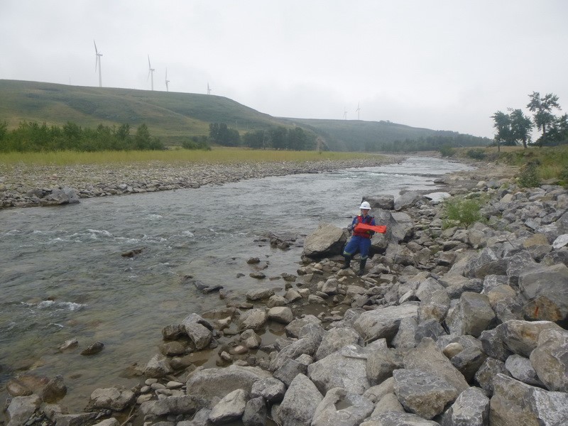
It’s 7:30am and my field partner, Jack, and I are packing up for a long walk through the grassy rangelands of southwestern Alberta, in the Rocky Mountain foothills. We’ve driven our truck as far as we can through a bumpy farmer’s field but have reached a steep, impassable gully. We’ll have to continue on foot from here – it’s a hot August day and a fire ban forced us to cancel our ATV rentals at the last minute. We load our bags with our lunches, several bottles of Gatorade, and an extensive list of equipment: a laser rangefinder, transmitter and pipe locator, tape measure, chest waders, life jackets, field books, and an iPad. Over the course of the day we’ll assess 15 gullies, streams, and hillslopes looking for signs of erosion and slope instability.

Figure 1. Assessing the condition of riprap in a river in the rangelands of southern Alberta. Photo credit: Jack Park.
I first realized I wanted to be a geoscientist on a visit to the UBC geography department in the spring of 2009. I was on campus to meet my future Master’s supervisor, Brett Eaton, when I spotted a poster for the environmental geoscience requirements for APEGBC (now EGBC). The poster featured a glossy picture of a helicopter perched on a gravel bar and asked: “Do you want a career as a geoscientist?” I was immediately sold. I’d completed a Bachelor’s degree in environmental science at McGill University, though, and had had no idea at the time that geoscience existed. The history, political science, and economics courses that I’d completed for my minor in international development, while very interesting, were not featured on the APEG geoscience syllabus. During our first meeting that day I sheepishly admitted to Brett that I’d perhaps chosen the wrong undergraduate program and that I wanted to complete the geoscience requirements rather than a Master’s degree. Thankfully he assured me that I could do both (perhaps not realizing that I needed to complete 15(!) additional undergraduate courses).
 Follow


