Erosion of the Point Grey Cliffs: Causes and Adaptation Pathways
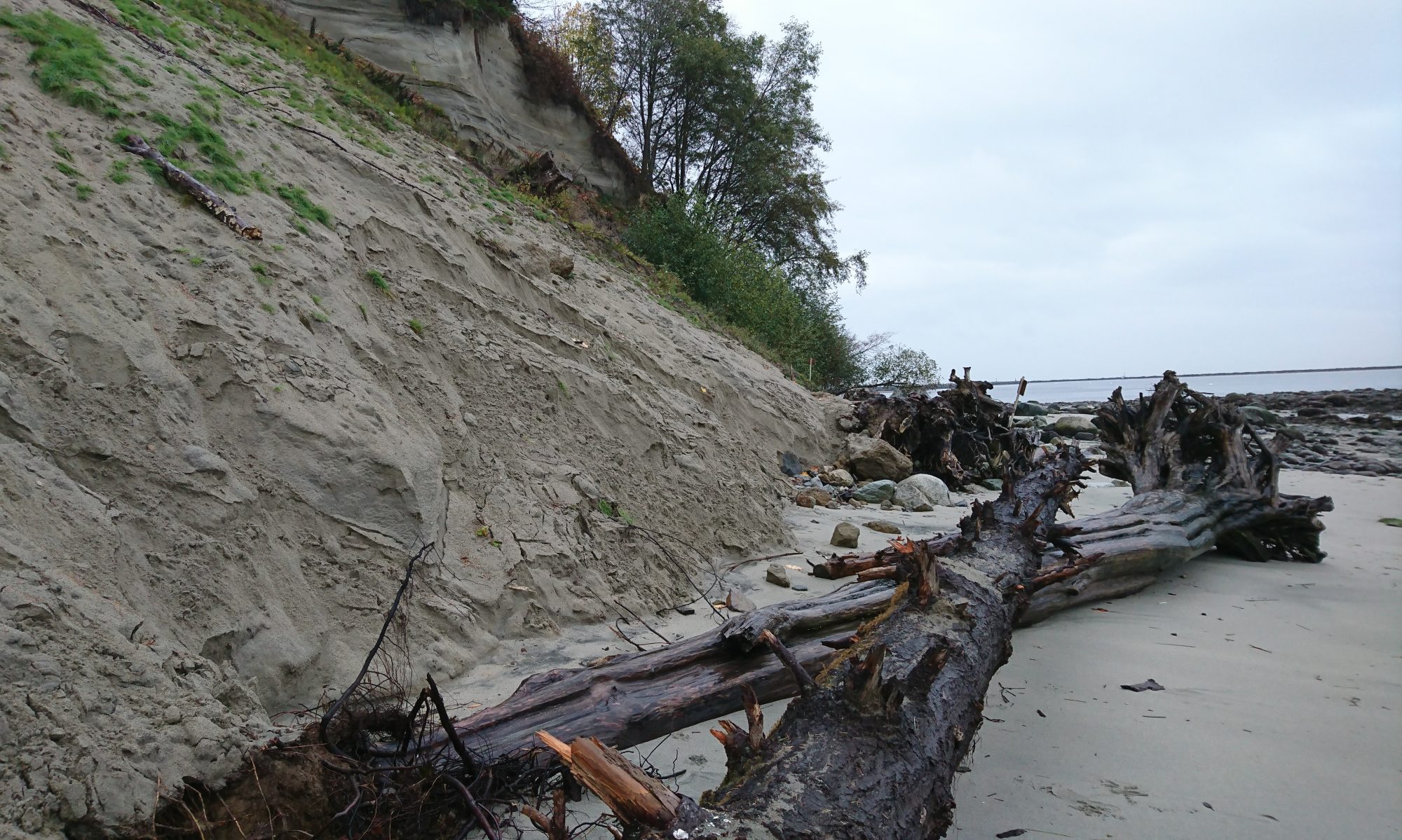
The Point Grey cliffs and its beaches have been eroding with an increased rate due to changing environmental and climatic conditions and human-activities. Erosion of the cliffs poses increased risks to social and cultural assets such as the local species, natural features, and stories attached to specific locations, as well as to physical assets such as infrastructure and buildings.
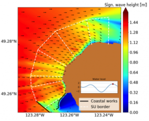
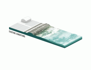
This project investigates the coastal mechanisms that contribute to the erosion of the cliffs by developing a local wave and sediment model.
Erosion of the Point Grey cliffs threatens important infrastructure and buildings at UBC.
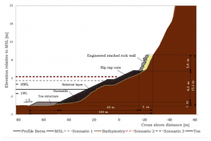
The project aims to develop a clear and holistic framework of the erosion problem at the Point Grey cliffs, both gathering and integrating existing information and contributing with innovative ideas that might open new approaches for dealing with erosion. It develops four concepts to tackle the cliff erosion and analyses their feasibility from a technical, environmental, economical, legislative and social perspective.
The Point Grey cliffs are ecologically, culturally and socially significant for the Musqueam First Nation and the visitors and residents of the Greater Vancouver region.
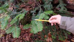
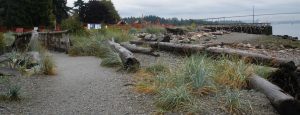
This project surveys and document the existing ecological conditions of the Point Grey Cliffs by undertaking a field survey of the three and shrub species, and vegetation densities along the five transects at different locations of the Point Grey Cliffs.
Coastal Adaptation Platform
Link to the Platform:
Nature-based Coastal Protection Projects in British Columbia
Indigenous Coastal Adaptation Practices
Low Embodied Energy ‘Habitat Blocks’
The Historical Aerial Photography Study of Greater Vancouver
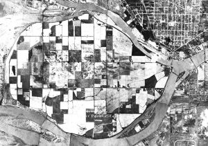
Today, with 75% of the population located in the southwest corner of the province, The Greater Vancouver region is the most densely populated area of British Columbia. Situated in glacial lowlands that is streaked and defined by the Fraser River, and westwards enclosed by its estuary and the coastline, the general vulnerability of the area to extreme weather events is evident and characterizes the historical coastal transformations of the region.
The project compiles and systematizes graphical data to help visualize key transformative processes in the Greater Vancouver region and it highlights how close the heavily urbanized the region is intertwined with, and dependent on, its marine and river environment.