Coral-eating starfish: An outbreak of Crown-of-Thorns Starfish in Kiribati


Last year, people in Butaritari Atoll, at the northern end of Kiribati’s Gilberts Islands began noticing these large spiny starfish depicted in the video above and photo below. The exotic-looking “crown-of-thorns” starfish, known as Acanthaster planci to scientists and latin-speakers in Brooklyn, is famous for preying on reef-building corals. Outbreaks of crown-of-thorns starfish can lead to drops in the amount of living coral on reefs, as has happened in places as varied as the Middle East and the Great Barrier Reef.

COTs off Betio, Tarawa

Crown of Thorns Starfish off Betio, Tarawa (S. Donner)

The Kiribati outbreak spread south to the central atolls of Abaiang and Tarawa over the past year. I filmed the shaky video above while conducting a coral reef survey in a, hmm, fast-flowing channel between the open ocean and the Abaiang lagoon (the word ‘drift’ is too passive to describe this dive; it was more of a ‘raging river’, ‘don’t hit anything’ or ‘I hope the boat can find us’ dive).

In the video, you can see the crown-of-thorns damage looks a lot like coral bleaching. One key difference is the spatial pattern. With a crown-of-thorns outbreak, as in the video, you often see isolated patches of whitened corals or large white circles on otherwise healthy looking mound or table corals.

We’re not absolutely sure what initiated this particular outbreak or any other outbreak for that matter. Marine scientists generally suspect that over-exploitation of the few predators of the crown-of-thorns, like triton or ‘conch’ shells, is the most likely cause of such outbreaks. It is also possible that nutrient pollution can indirectly promote the spread of the starfish through increased survival of their larvae. I hope that, if funding allows, we can at least track the long-term effect of the outbreak on the coral reefs of the island chain.

Look up! Bull sharks and coral bleaching

OReason #1 not to focus too heavily on studying bleached corals (lower left).

In order to collect data on the “benthic” or bottom cover of a reef, you must spend the majority of the dive swimming < 1-2 metres above the bottom and looking down. My Kiribati dive colleagues and I like to joke about what swims by when we’re not paying attention. On one dive during this recent trip, I watched a small reef shark swim wide circles – harmlessly, I should add – around my dive buddy Toaea, who was focused on taking bottom photos. On a subsequent dive, Toaea watched a barracuda – also harmless – float above oblivious me as I measured some tiny corals buried in the reef.

The photo of this bull shark was actually taken on a recreational dive in Fiji — so, at least this time, everyone saw the shark. I took advantage of the necessary layover on the way to Kiribati to test some gear and investigate a minor bleaching event. Water temperatures were elevated more than usual around most of the Fiji islands during the Southern Hemisphere summer. The temperature spike was enough to trigger bleaching warnings from the NOAA Coral Reef Watch system. A lot of corals, like the small Acropora in this photo, remained bleached in April.


Coastal rock art? Dispatch from Kiribati

This is part of a series of posts featuring stories, photos and video from a recent field research trip to Kiribati.

What explains the amazing rock formations on coasts of Kiribati?

Fluke coral growth? Ancient rock art like the Nazca Lines? Photoshop?

O

They are te ma – traditional fish traps – built from Opieces of rock or coral collected along the shoreline.

When the tide is in, fish can swim along the “shaft” or through a direct entrance into the heart- or arrowhead-shaped openings.

When the tide recedes again, fish get trapped there and are easy prey. The shaft also helps point people to the place to collect the fish.

These traps can be found at Temaiku, the SE tip of Tarawa, just south of the airstrip.


The rate of change

by Meghan Beamish

While reading through the latest IPCC reports – Working Groups II and III – one word kept popping out at me: rate. Specifically when I compared this phrase:

The overall risks of climate change impacts can be reduced by limiting the rate and
magnitude of climate change.

To this:

About half of cumulative anthropogenic CO2 emissions between 1750 and 2010 have occurred in the last 40 years (high confidence).

With this summary of adaptation plans in North America (I added the emphasis):

In North America, governments are engaging in incremental adaptation assessment and planning, particularly at the municipal level. Some proactive adaptation is occurring to protect longer-term investments in energy and public infrastructure.

And this:

Within this century, magnitudes and rates of climate change associated with medium- to high-emission scenarios (RCP4.5, 6.0, and 8.5) pose high risk of abrupt and irreversible regional-scale change in the composition, structure, and function of terrestrial and freshwater ecosystems, including wetlands (medium confidence).

And finally:

Greater rates and magnitude of climate change increase the likelihood of exceeding adaptation limits (high confidence). Limits to adaptation occur when adaptive actions to avoid intolerable risks for an actor’s objectives or for the needs of a system are not possible or are not currently available. Value-based judgments of what constitutes an intolerable risk may differ. Limits to adaptation emerge from the interaction among climate change and biophysical and/or socioeconomic constraints.

So, I suppose my question is, do our rates of adaptation and mitigation match the rates of climate change?

Will the next El Nino break a global temperature record?

by Simon Donner

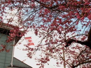
Cherry trees blossomed in Vancouver in early February during 2009-10 El Nino

Long-term forecasts say El Nino could be on the way.

This periodic climate warming of parts of the equatorial Pacific Ocean can affect weather around the world, often creating droughts and fires in Australia, Papua New Guinea and parts of Africa, heavy rains and flooding in California and parts of South America, and warmth across much of Canada and the northern U.S.

If you add it all together, forecasters often say El Nino years are unusually warm worldwide. The last strong El Nino event led to 1998 being the then-warmest year in recorded history.

Would the return of the mischievous brat of the climate system lead to a new global (surface) temperature record and an end to the “pause” in surface warming?

Not so fast. It could, yes. But not all El Nino events are created equal.

According to a recent study by my former student Sandra Banholzer and I, only “Eastern Pacific” El Nino events lead to global warmth. I’ll explain the difference.

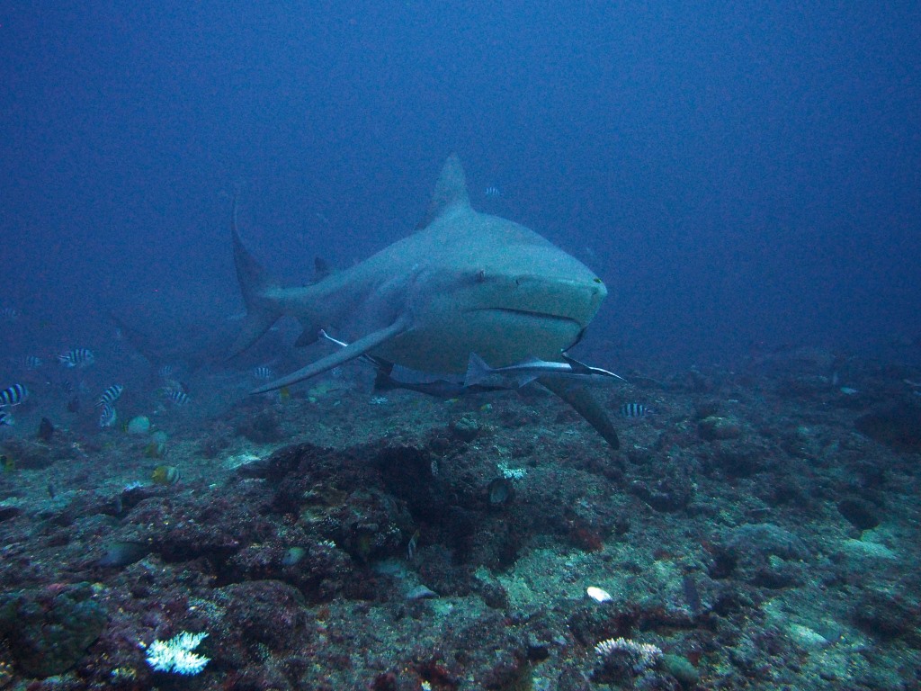
Under normal or “neutral” conditions, winds blow from east to west across the equatorial Pacific. This causes the upwelling of cold water in the east that feeds the famous coastal fisheries of South America and the amazing marine life of the Galapagos.

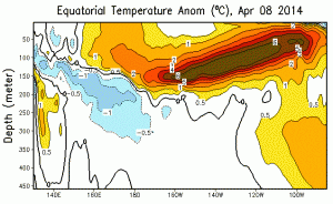
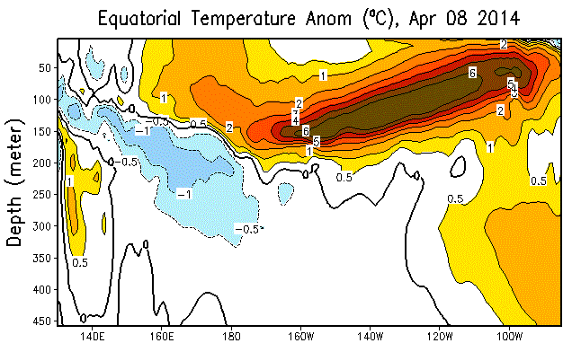
Temperature anomalies, or departures from normal, with depth across the equatorial Pacific

Whenever these easterly winds slow down or stop, the warm water piling up in the western Pacific – and I mean literally piling up, as the ocean can be tens of centimetres higher – can slosh back eastwards. This slow, long, east-moving wave of warmth is called a Kelvin wave. For an example, the image at right depicts the current Kelvin wave using temperate “anomalies” across the Pacific.

In general, if the change in the winds is strong and persistent enough, the Kelvin wave or series of Kelvin waves will be really warm and powerful, enough to cut off the upwelling in the east and dramatically warm the Pacific all the way from the South American coast across the International Dateline. This is what happens in a classic “Eastern Pacific” (EP) El Nino, like 1997/98 or 1982/83 (despite all the excitement about images like the above, the current Kelvin wave is alone not enough to trigger such an event; there would need to be continued or further gaps in the easterly winds).

On the other hand, if the switch in the winds is short-lived or happens only in the western half of the Pacific, the surface warming will be restricted to the middle of the Pacific, around the International Dateline. Scientists have been calling these events “Central Pacific”(CP) El Nino or El Nino “Modoki”.

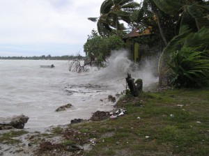
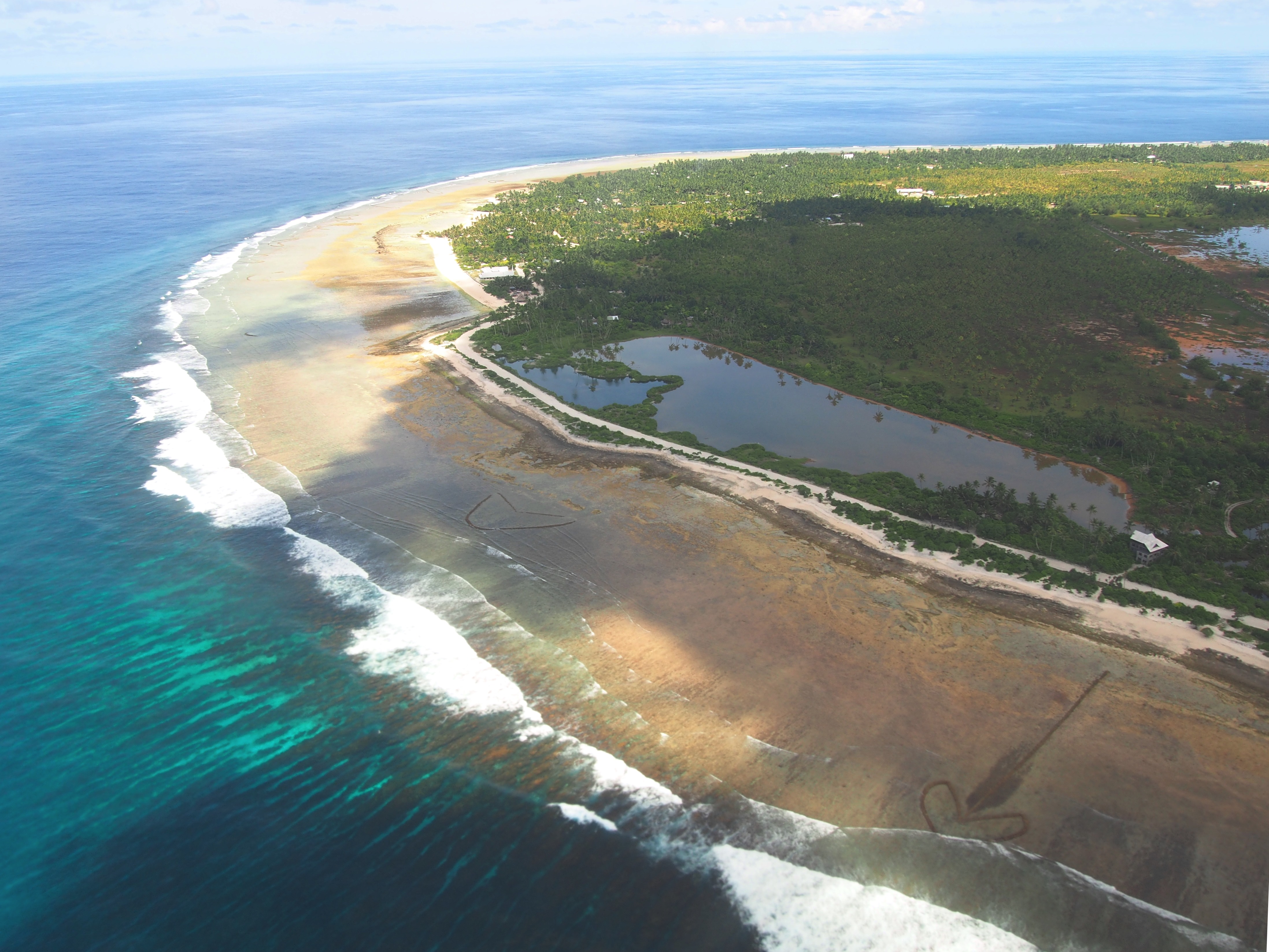
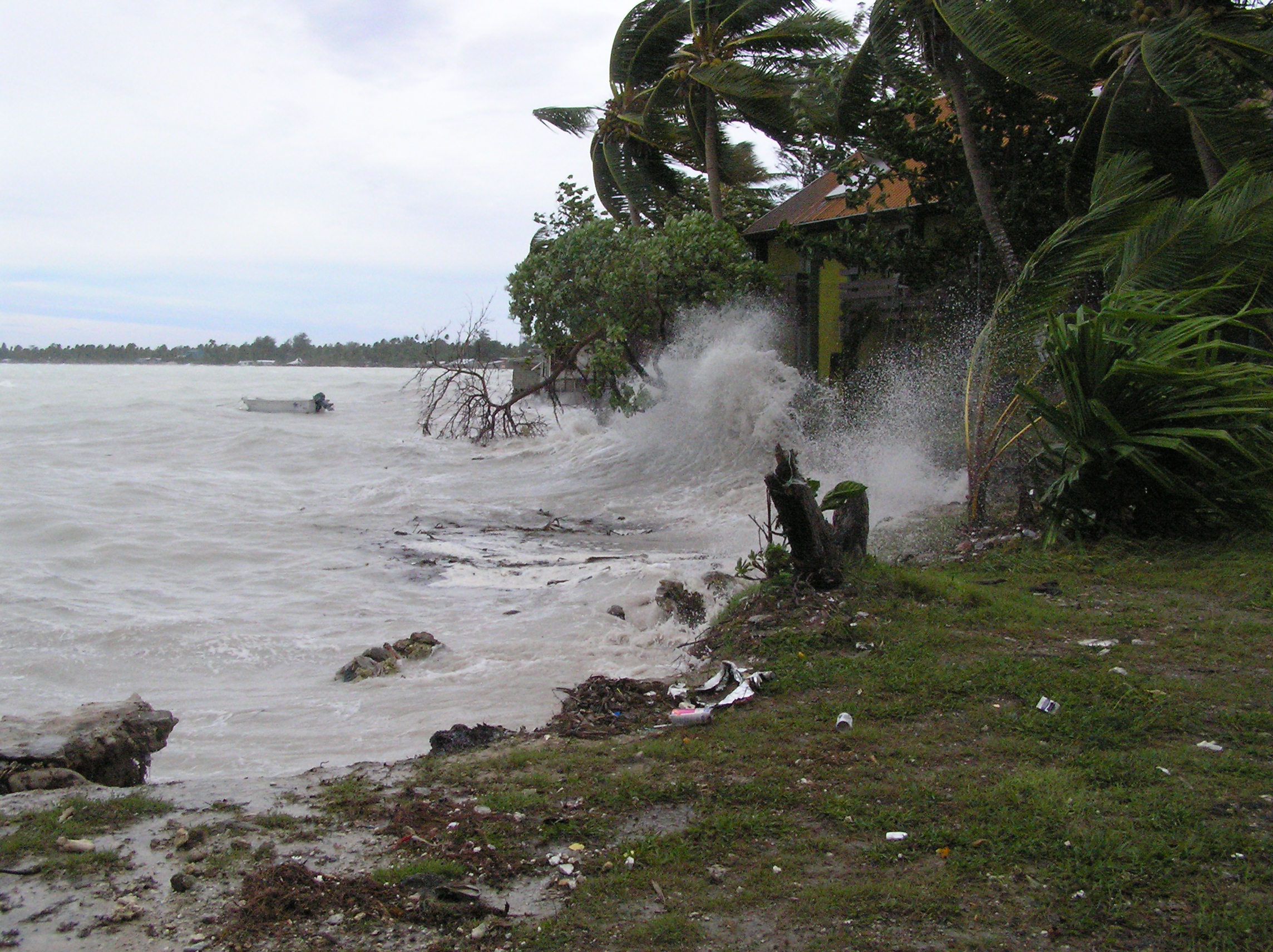
Full image from February 2005 storm in Tarawa

In fact, the header for this blog comes from a photo taken in Tarawa, Kiribati – right in the Central Pacific, 7 degrees west of the International Dateline – during the 2004/5 Central Pacific event. The elevated ocean temperatures caused bleaching of corals in Kiribati (pdf), and launched my field work. In the photo, you’re seeing a combination of high seas from the CP El Nino event, an El Nino driven westerly storm and a high tide blast the homes along the lagoon shoreline with waves.

The effects of an El Nino event on weather around the world (“teleconnections”) can depend on the type of event because of how the location and extent of abnormally warm Pacific waters affects the atmosphere. Our study showed that if you control for the other influences on global average surface temperature (like volcanoes and the human-induced trend), Central Pacific and “mixed” events are not unusually warm globally. Only the Eastern Pacific events affect the global average surface temperature.

This has important implications for the “pause” in surface warming. Over the past 10-15 years, the easterly winds have been abnormally strong, with few gaps sufficient to generate Kelvin waves. This is related to decade-scale variability in the Pacific Ocean conditions, called the Pacific Decadal Oscillation (PDO) or Interdecadal Pacific Oscillation (IPO).

It may then come as no surprise that all the El Nino events since 1998, including the 2009/10 event that made the cherries blossom early in Vancouver, have all been of the CP variety.  The same happens to be true for other “slowdowns” in the rate of global surface temperature change since the Industrial Revolution. This suggests the decade-scale variability in the Pacific affects El Nino development, and in turn, the ups and downs in the rate of human-caused global surface warming. From the conclusion of our paper:

The current mean state of the Pacific tends to restrict wind anomalies and anomalous convection to the central Pacific, and hence favours CP rather than EP events [Xiang et al., 2012]. A shift in the mean state of the Pacific back to a warm phase in a few years may allow for globally warm traditional EP El Niño events to return.

Could this coming El Nino spell the end of the pattern?

It is simply too early to say for certain. There are some telling signs. For one, the change in upper ocean heat content over the past three months is similar to that of the last two Eastern Pacific events (1997/98, 1982/83). We should be careful about reading too much into those numbers. There are other years in which such a pattern in upper ocean heat content did not lead to an Eastern Pacific El Nino event.

Unfortunately, patience is not a virtue on the internet!