The integrated GHG Research and Observations in Wetlands (iGROW) Research Program
Among the numerous ecosystem services provided by wetlands climate regulation is identified as one of their most important benefits to society. Wetland ecosystems play an important role in the global carbon cycle; they provide the ideal environment for long-term storage of atmospheric carbon dioxide, yet they are also the largest single source of methane. Climate change has the potential to increase greenhouse gas (GHG) emissions from wetlands, however, the consequences of rising temperatures on wetland GHG exchange remains uncertain. Furthermore, preventing further wetland loss and restoring wetland ecosystems has been identified by researchers and governments as important in limiting future emissions to help meet climate goals. The integrated GHG Research and Observations in Wetlands (iGROW) research program’, takes an interdisciplinary approach to provide a better understanding of how wetland responses to climate variability and restoration can feedback to slow or accelerate future climate change. iGROW combines state-of-the-art field-based measurements, remote sensing, and modelling to provide new insights into the controls of wetland GHG fluxes across a range of spatial and temporal scales and quantify the potential climate benefits of wetland restoration and conservation. This research is key to better predicting current and future contributions of wetlands to climate change, which is highly relevant for policies aiming to limit the level of global temperature rise. Current iGROW research projects include:
Carbon Fluxes in Restored Wetlands
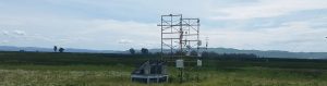
 In collaboration with several other research groups at UBC, my lab’s research is focused on measuring GHG, water, and energy fluxes over Burns Bog, a restored peatland in Metro Vancouver. This site is a raised domed peat bog that is undergoing re-wetting as a restoration management strategy following peat harvesting and associated drainage.
 While restoration can help recover important ecosystems services provided by wetlands, it can also affect the exchange of greenhouse gases, water and energy between the surface and the atmosphere. By conducting year-round eddy covariance measurements, we are assessing the biogeochemical and biophysical impacts of peatland restoration, and the impacts of forest fire smoke on carbon cycling and energy fluxes in restored peatlands. This research is also being done in collaboration with researchers and staff at Metro Vancouver who are interested in quantifying the climate mitigation potential of wetland restoration and conservation.
Collaborators:
UBC Ecohydrology Research Group
UBC Biometeorology and Soil Physics Group
Dan Moore’s Research Group, UBC Geography
Burns Bog in the news:
June 29, 2020 – CARBON NEUTRAL ACHIEVEMENT SETS STAGE FOR BOLD CLIMATE ACTION
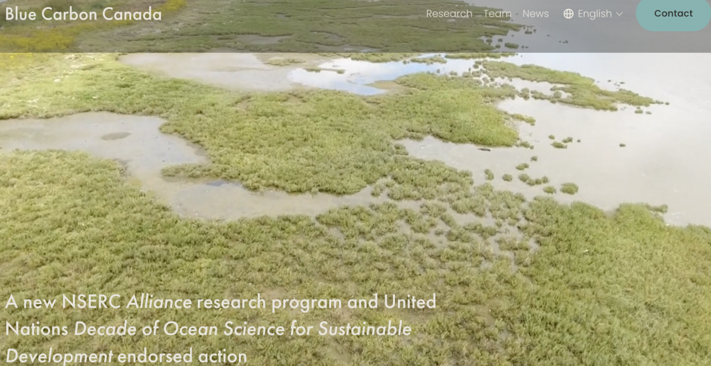
Blue Carbon Research
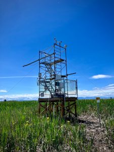
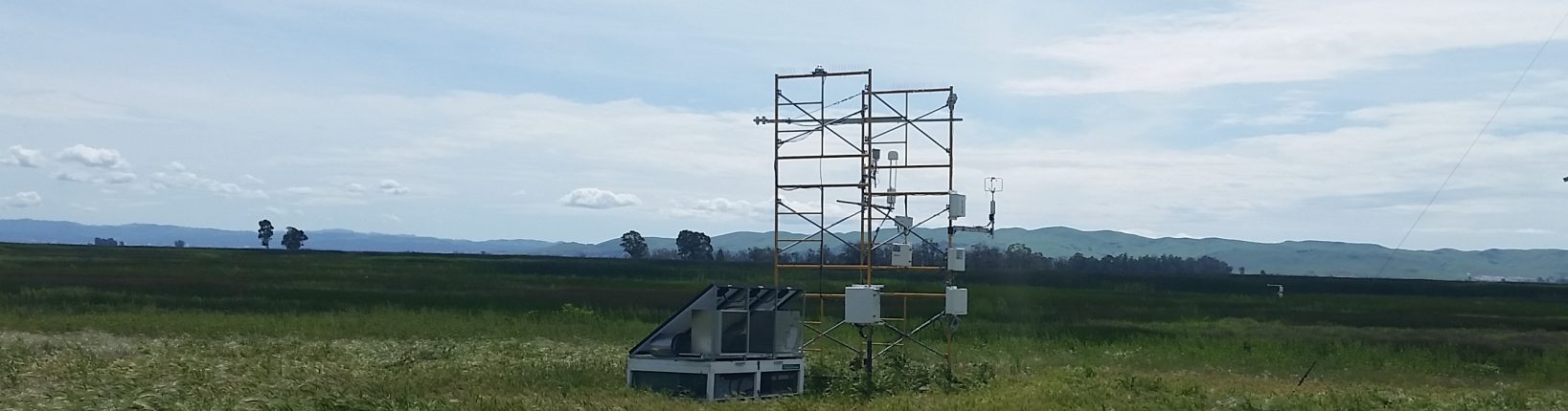
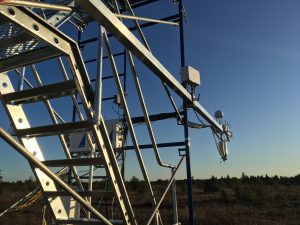
Blue carbon is the carbon sequestered and stored in coastal ecosystems including tidal marshes, mangroves, and seagrasses. Coastal ecosystems are among the strongest carbon sinks in the biosphere. This coupled with their potential for low methane emissions, has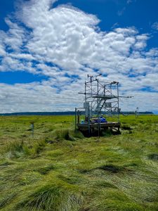 generated widespread interest in these ecosystems for climate change mitigation and adaptation. However, measuring and modelling carbon exchanges in tidal wetlands presents unique challenges due to highly dynamic atmospheric and hydrological fluxes, as well as sensitivities to both terrestrial and marine influences. Through iGROW, my research group recently installed two eddy covariance flux towers (CA-DSM and CA-RBM) in tidal wetlands along the Pacific Coast of Canada to quantify and model the net carbon and GHG balance of these marshes, which represent an important data gap in ecosystem-scale measurements of GHG exchange from tidal marshes. In partnership West Coast Environmental Law, we are also working to translate this blue carbon science into policy-relevant information for municipalities and provincial governments.
Our research group is also involved in the NSF funded Coastal Carbon Research Coordination Network. Specifically, we are involved in the Methane Working Group, which aims to compile all methane flux data from coastal habitats (excluding mangroves) in the CONUS to parameterize and validate a set of nested process-based methane models.
Additionally, we are part of a U.S. Department of Energy grant “High-frequency Data Integration for Landscape Model Calibration of Carbon Fluxes Across Diverse Tidal Marshes” focused on leveraging eddy covariance observations to improve landscape-scale models of carbon fluxes across tidal marshes. This grant brings together university and government researchers from across the U.S.
I am also a co-investigator on a collaborative research effort to model the current and future mitigation capacity of Canada’s blue carbon ecosystems, which was recently funded by an NSERC Alliance grant. The project is led by Julia Baum (University of Victoria), and includes four co-principal investigators and seventeen collaborators from across the country which are contributing to this national natural ocean climate solutions research effort. The project brings together a consortium of four universities, three government agencies, and four eNGOs.
Primary collaborators:
Oikawa Lab, California State University, East Bay
The U.S. Geological Survey
The Baum Lab, University of Victoria
O’Connor Lab, The University of British Columbia
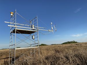
Carbon Cycling in the Prairie Pothole Region of Canada
 With growing interest in wetland management and restoration as a Natural Climate Solution, improved estimates of wetland carbon sequestration and GHG fluxes across Canadian wetland types are
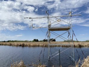 strongly needed. In partnership with Ducks Unlimited Canada, we focus on wetlands in the Prairie Pothole Region of western Canada since these ecosystems are understudied relative to other wetland types in Canada, yet they play important roles in carbon cycling and climate regulation. Specifically, this study leverages existing funding and infrastructure to investigate carbon and GHG dynamics across two wetland sites, with the aims of measuring and modeling GHG fluxes in prairie wetlands in Manitoba.
Primary collaborators:
Ducks Unlimited Canada
Pascal Badiou
Prairie Wetlands in the news:
DUC analyzing wetlands on farms and ranches for carbon capture
Project intended to demonstrate wetlands’ greenhouse gas impact
DUC Carbon Tower Project
Past iGROW Research Projects
FLUXNET-CH4 – a global database of eddy covariance CH4 flux measurements and wetland synthesis for CH4
Natural wetlands emit approximately 30% of global CH4 emissions, as their waterlogged soils create ideal conditions for CH4 production. They are also the largest, and most uncertain, natural source of CH4 to the atmosphere. Direct observations of local CH4 emissions with high measurement frequency are important for constraining CH4 budgets, for understanding the responses of CH4 fluxes to environmental factors and climate, and for creating validation datasets for the land-surface models used to infer global CH4 budgets. However, unlike well-coordinated efforts for synthesizing CO2 flux-tower observations (e.g., FLUXNET), no such network and data synthesis effort existed previously for CH4. FLUXNET-CH4 is an initiative coordinated through the Global Carbon Project in close partnership with AmeriFlux and EuroFlux, to compile a global database of eddy covariance CH4 flux measurements to answer regional and global questions related to the global CH4 cycle. Through this activity, we coordinated the collection, aggregation, standardization, and post-processing of global CH4 data from the flux tower community. FLUXNET-CH4 Version 1.0 includes data from 81 sites, representing freshwater, coastal, upland, natural, and managed ecosystems.
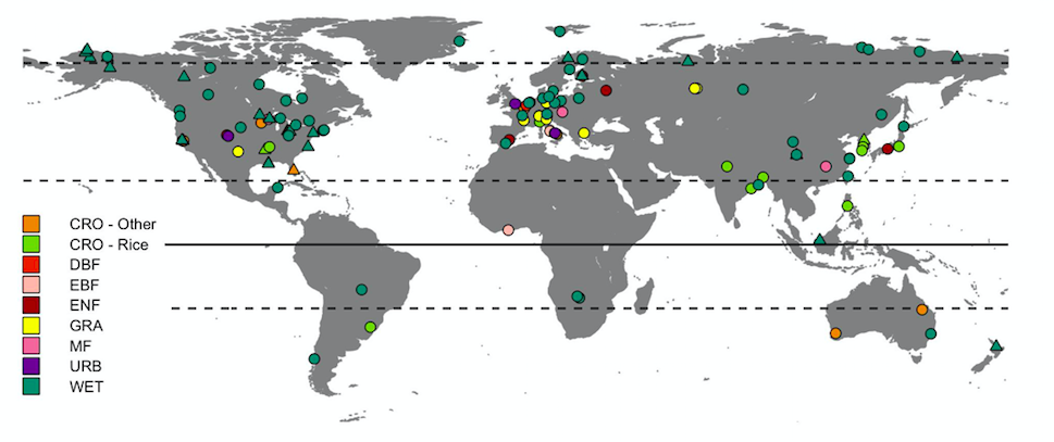
Map of tower sites that report eddy covariance CH4 flux measurements. The color of the markers indicate the vegetation type based on the International Geosphere-Biosphere Programme (IGBP) definition.
Additionally, through a USGS Powell Center Working Group, we leveraged the FLUXNET-CH4 to provide novel insights into the controls and timing of wetland CH4 emissions for North America and globally, inform and validate biogeochemical models, and upscale wetland CH4 flux measurements globally.
Collaborators:
Jackson Lab, Stanford University
NASA Goddard
Global Carbon Project
Stanford Machine Learning Group
Quantifying carbon benefits of tidal wetland restoration in the Delta: Decision support using a robust, integrated and data-driven model
 This research was funded through the California Department of Fish and Wildlife and focused on advancing remote sensing data in tidally flooded marshes and using the data to improve modeling of greenhouse gases in these systems. The modeling tool will be made publicly available through Google Earth Engine. This research was a collaboration between UBC, California State University, East Bay, UC Berkeley, and the U.S. Geological Survey.
Collaborators:
Oikawa Lab, California State University, East Bay
The U.S. Geological Survey
The Landscape Research group, UC Berkeley