Please note: the source for this material comes from the lecture slides and my lecture notes, unless otherwise stated.
Lecture 1 – Introduction to the Course
As the title mentions, this lecture was focused on the grand themes and topics that will be covered in the course, along with the components of grading within the course and general expectations. With special attention focused on ecology, health geography, and crime analysis, this course will take students through a journey of learning how and when to use GIS and various GIS techniques. Through the use of lab work, research assignments and presentations, the final project, and this class blog, this course aims to give students a practical sense of GIS in a research setting.
Lab work will help students to improve techniques learned in past GIS courses, and develop new ones within ArcGIS and other softwares, such as CrimeStat and FragStat, that can be used in properly analyzing the geographical elements of ecology, health, and crime.
The paper review assignments will expose students to the various research that has been conducted around the world using GIS technology in ecology, health, and crime. This will provide a sense of the scope of GIS and spark creative ideas for the term-end final project. Additionally, the ability to review a study and notice it’s strengths and weaknesses is an important skill to develop, so that we can emerge into the real-world as informed citizens that can evaluate science. This element of the course also develops presentation and public speaking skills during the presentation component.
The final project will enable students to work with a team and incorporate all the above mentioned knowledge and skills to create a research project on their own. Building on skills learned in this course and in previous ones, students will develop a research idea, find data, implement GIS analysis, and share their findings, all while fostering teamwork and task delegation skills. Such project work serves as a consolidated manner to showcase their learning and work, and can be presented and explained to future employers or professors as well.
Finally, this class blog serves as a platform to keep track of and reflect on every element of the course. It builds itself up to being a great way to understand the flow of the course and helps to connect all elements together such that the student can refer back to the blog to review any academic material or be reminded of the work they have done.
lecture 2 – why is “geography” important?
This lecture outlined the reasons as to why geography is an important element in all facets of life, technology, science, and society. It revolved around the fundamental issue of pattern and scale, and how there is no single scale within which all these elements operate. Because the interactions between elements change depending on the scale (ex. neighourhood or province scale), geography and GIS play a major role in being able to understand and analyze the interactions between elements and the patterns produced by these interactions, and allow one to see how big or small of a difference scale makes on these patterns. The concept of characteristic scales in animals or criminals was also discussed, as animals or criminals may select a particular resource, and use that to direct the location and spread of their behaviour.
The issues of:
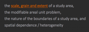
are important and always present in any analysis related to space. Therefore, the consideration of geography and the effects of problems such as the above that it produces on any ecological, health, social, or crime analysis, are crucial for proper and true results. Being able to understand and apply geography properly will allow one to understand whether the patterns and results of their analysis are dependent on the spatial nature of the data, or if they reflect the results of a process.
Lecture 3 – understanding landscape metrics: patterns and processes
This lecture focused of the importance of landscape ecology, and that the key element of landscaping ecology is the understanding of the interactions between space and spatial patterns with ecological patterns and processes on a landscape (a surface with heterogeneous characteristics that create patterns). Essentially, landscape ecology enables us to realize that maps are a visualization of discovering a process through analyzing a spatial form (ie. the structure of the landscape) or pattern. The landscape scale is also where policies are based on, and the effects of humans on the natural environment is most pronounced here as well. These processes can include things like climate, topography, soil, and natural disturbances such as earthquakes and landslides.
Under the fundamental assumption that the location of things and their relation to other things influence outcomes and processes (ex. climate, topography, soil), the important elements of understanding patterns in space were also discussed in this lecture. These included spatial auto correlation and stationarity. The different types of spatial autocorrelation (clustered, dispersed, random), play a role in how things are related to their neighbours and the patterns of ecological behaviour. If the governing processes of the spatial location of an phenomena do not change over space, then the process is said to be stationary (ie. the “process regime” is constant). Stationarity also does not have any directional bias. Lastly, some metrics of landscape ecology were explored, including relative richness, dominance, diversity, and connectivity. These can all be used to explore ecological patterns over space.
Lecture 4 – statistics: a review
In this lecture, the significant elements of statistical analysis and regression models were explored. Statistics is used within GIS analysis to summarize data, look for patterns and relationships within the data, and to serve as a way to come up with more meaningful and mathematically sound conclusions and predictions. In order to explore GIS data with statistics, we have 4 different kinds of data: nominal, ordinal, interval, ratio. All of them have different characteristics and serve different purposes. The data is summarized through the techniques of central tendency and dispersion, along with correlation coefficients, which measure the spread and relationships among the data. These spreads and relationships can then be shown using graphs and charts.
Speaking of relationships, regression models are used to analyze the relationship among data. Regression models allow us to understand why things occur in certain places on our maps, and what characteristics or factors can influence the location of phenomena. This can be done through regression analysis such as Ordinary Least Squares, which produces a global model of the variable in concern and generates a regression equation, and Geographically Weighted Regression, that produces a local model of the variable and attempts to “fit a regression equation to every feature”. These types of analyses produce p-values significance levels, which tell us if the relationships are occurring by chance or not. Multicollinearity, omitted variables and endogeneity are all effects of/on the data that may influence the outcome relationships. Once these relationships are understood, policies, laws, and other conclusions can be made. Therefore, statistics and regression allows us to understand the data we are mapping in manner that produces proper and informed results.
Lecture 5 – what is health geography?
In this lecture, we learned that health geography is a term that sums up how health care changes depending on where a person lives. The area, surrounding ecological environment, and social situation that a person is in, can all influence the various health implications that one can have, and the type of health care they receive. Therefore, an understanding of geography is essential to understanding health. As Jamie Baxter states, there are three main branches of health geography: disease ecology, health care delivery, and environment & health. Disease ecology looks at diseases that are infectious, along with the ecological (ex. climate, wind, etc.) and social factors that may influence the spread and spatial distribution of the disease. Epidemiology falls into this category. Health care delivery analyses how health care is provided to people from a spatial standpoint. Looking at the distribution of hospitals, ambulance services, and first aid respondents, all falls under this category. Baxter mentions that the behaviour of patients and the inequalities in providing health care to the public can both be explored in this category as well. Environment and health bridges concepts of geomorphological nature (ex. land hazards) and its health impacts. For example, a study in this category can explore how a large scale landslide or flood effects the physical and mental health of those affected.
In the past, medical geography was used to investigate diseases and health, however, it was seen that a more broad and diverse field was needed to look at health from all different viewpoints. Hence, health geography was created so that social, cultural, and economic factors can also be brought in to look at health and medicine, rather than the more “biomedical” perspective that medical geography served. The lecture also introduced the perspectives of more strands of health geography: humanistic approaches to “medical geography”, Structuralist/materialist/critical approaches to “medical geography”, and cultural approaches to “medical geography”, all of which can fall into or overlap between the categories mentioned by Baxter. This lecture also focused on the importance of “place” rather than “space”, emphasizing that places have “unique characteristics” which should be focused on rather than on spatial variations and interactions. The meaning of place can be implemented in physical place in world, as well as a sense of place, all of which can influence health. Scale also plays a role in health geography, as local scales and influences are usually explored rather than health in a global scale.
Lecture 6 – GIS IN health geography
Maps lead us to questions, and questions can lead us to answers. In that regard, GIS allows us to create visuals of factors than can influence health, and guide us towards conclusions about the health problem at hand. GIS plays a role in modelling and understanding the various categories and branches of health geography that were mentioned in the previous lecture. Health geography coupled with GIS allows us to investigate multiple layers of a health problem in relation to medical geography, including social, cultural, economic, and environmental factors, allowing a wholesome and comprehensive discover or analysis to be made. Maps have the potential to allow us to “understand the spatial dynamics of disease”. During this lecture, the way in which data is prepared, analyzed, and interpreted were all explored. We were made aware that the data must be normalized, analyzed using both temporal and spatial elements, and interpreted to not include ecological fallacies.
GIS can be applied in:
- Spatial epidemiology
- Environmental hazards
- Modeling health services
- Identifying health inequalities
Spatial epidemiology was an integral part of this lecture, and relies on the understanding that everything can be related together. Spatial epidemiology can be described as a concept which is used to “understand the spatial variation in disease risk” though singular data and counts for areas (ex. by dissemination areas). The use of GIS has helped significantly further the field of epidemiology, allowing health care providers to analyze where the risk of disease are and understand why certain areas are of more risk than others. One of the examples provided in lecture was that BC is a leader in geo-referenced health and population data. Every time a person visits a doctor or clinic, their data is registered under their health card number and geo-referenced, to be kept for record keeping and can be used in the future to provide better health care for the individual or a population.
Some issues that may arise in the data are spatial misalignment and uncertainty. Misalignment may occur because the government sometimes changes the spatial units of their data so that comparison to historical work cannot occur. Uncertainty can arise if there is little spatial compatibility between datasets, or certain data is not available. “confounding effects” can occur when using environmental data and social/economic data, as environmental impacts tend to be smaller in scale. Latency time is also a concept that provides uncertainty. Another data consideration mentioned during the lecture was that a trade-off between statistical stability and geographic precision exists when exploring disease in small areas.
Lecture 7 – is crime related to geography?
GIS and crime analysis have been coupled together for quite some time and have produced results that are helpful for law enforcement to better conduct their duties. During this lecture, we learned that GIS can help to visualize the occurrence and distribution of crime, which can then help law enforcement to target their interventions. GIS can also help to analyze why crime is occurring more in certain areas compared to others and to see which variables (ex. social, economic) contribute to this. My using the multi-layer approach of a GIS, crime prevention strategies can be made to cater to the cultural, social, and economic dynamics of an area as well.
The theories used in GIS and crime analysis are:
- Routine Activity Theory – based on the activity of individuals. Since landuse is not random, the routine activities occurring within residential and commercial areas is not random either. Each residential and commercial area varies (ex. homes in West Vancouver are more expensive than in East Vancouver)
- Rational Choice Theory – The offender usually makes a rational choice to commit a crime
- Criminal Pattern Theory – Their offences can create a spatial patter, which is very useful in predicting their next offence
These all encapsulate to bring the fundamental theories behind environmental criminology. Environmental criminology states that the distribution of offences and victims is not random, and that geography places a major role in the occurrence of crime. Therefore, GIS is very useful in crime analysis.
GIS can be used in the following crime analysis applications:
- Intelligence analysis
- Criminal investigative analysis
- Tactical crime analysis
- Strategic crime analysis
- Administrative crime analysis
Lecture 8 – use of gis by fire departments
This lecture was interesting, as it focused on the use of GIS by Fire Departments, based on the Calgary Fire Department (CFD) Advances in Planning for the Future presentation. The lecture informed us about the following uses of GIS in fire departments:
- Risk Analysis
- Response Mapping
- Operational Decision Making
- Station Planning
- Apparatus Deployment
- Station Relocation
By using GIS, the CFD has decreased the loss of lives and property. An interesting example of this, is that the CFD uses GIS to map out the streets that are too narrow for fire trucks to drive through. Hence, for any fires in that area, they will need to send alternative apparatus. This may increase the time it takes to respond to a fire and reduce the effectiveness of response. Another use of GIS is that the CFD plans their station locations around a map of oil and gas locations. This is to avoid can safety hazards. And of course, GIS is used to map all the fire hydrants in the city, so that the fastest and most effective response is provided for any fires. And finally, the CFD uses GIS to plan for their future by using maps that allow them to deploy fire fighters based on the need, and the department’s multi spatial and temporal scale analysis provide them with tools to serve their communities in a more efficient manner.