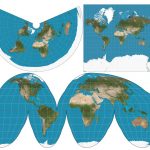
Geographic coordinate system vs projected coordinate system (Lat long vs UTM) Both vector (point, line, polygon) and raster (pixels) data rely on x, y values to situate the data in 2D space to represent where it is on the earth’s…

Geographic coordinate system vs projected coordinate system (Lat long vs UTM) Both vector (point, line, polygon) and raster (pixels) data rely on x, y values to situate the data in 2D space to represent where it is on the earth’s…

Multiple recent studies have used random forest machine learning for classifying wetlands (Liu et al. 2011; Millard & Richardson, 2013; Corcoran et al. 2015; Franklin & Ahmed, 2017; Halabisky et al. 2017; Amani et al. 2019; Bourgeau-Chavez et al. 2017;…
So far I have been working only with the LiDAR-derived DEM for calculating my topographic indices (TWI and TPI). For the Grid Statistics, I will be using the raw LiDAR point cloud (.las or in my case .laz files since…