Through the belly of the beast: Drive through BC wildfire explained
Blog post by Jack Woods; video and images by Sally Aitken
Sally Aitken and I were at our cabin in the west Chilcotin near Tatla Lake for a week prior to the lightening storm that ignited so many fires in the east Chilcotin and the corridor from Cache Creek to Quesnel on July 7th. Along with others in the area of our cabin, we monitored the status of the fires and were concerned about being able to leave should highway 20 (the only realistic exit route) close. Another fire in the Kleena Kleene area to the northwest of us was threatening to close highway 20 west bound to Bella Coola. On July 8th, highway 20 was closed in both directions due to the Hanceville fire and power to the west Chilcotin went out due the Hanceville fire damaging power lines. We packed for a quick exit on July 9th and, as there were no other options, went for a mountain bike ride. When we returned from our ride in the late afternoon we learned that Highway 20 was open eastbound as an escape route, but was still closed westbound. We made a hasty exit.
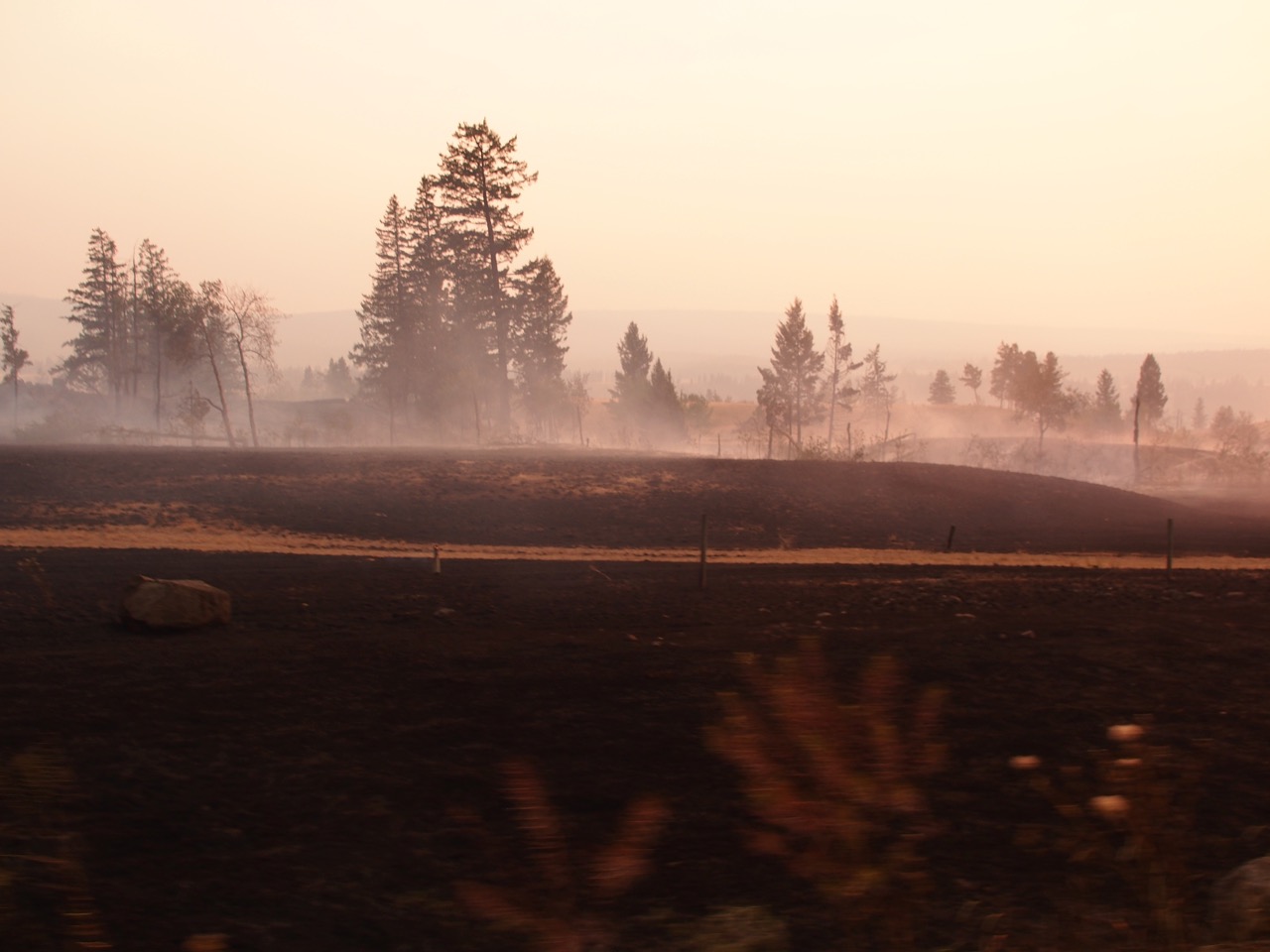
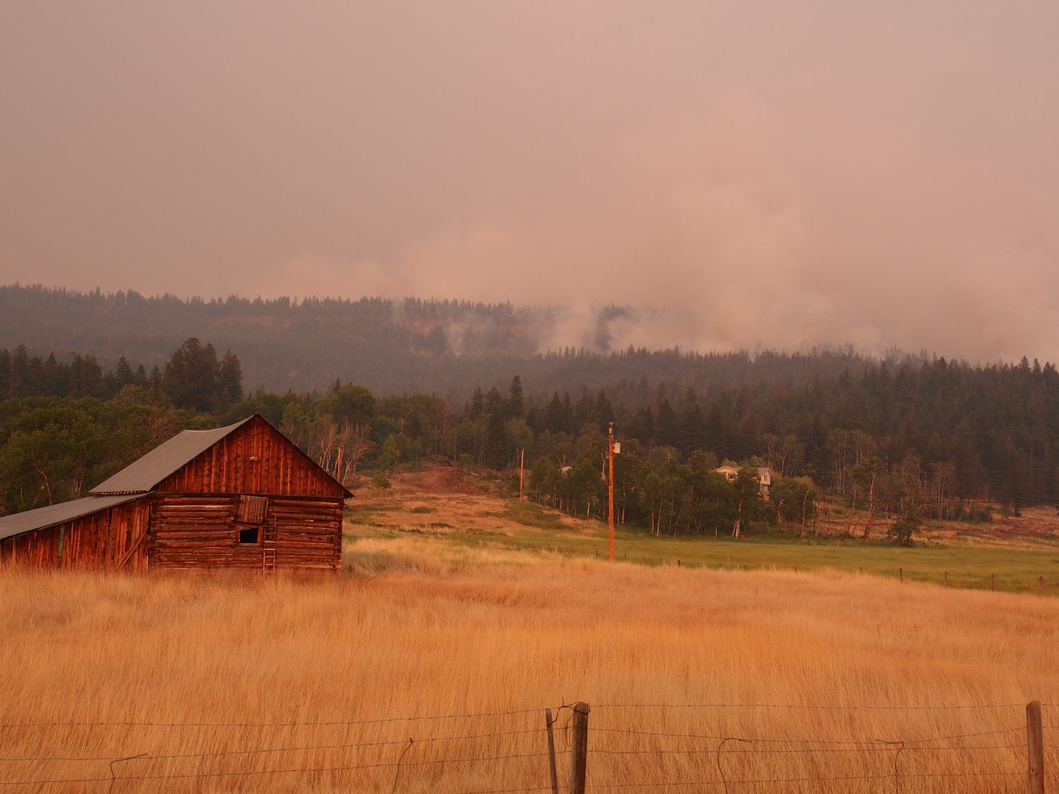 At about 8:00 pm we passed through Alexis Creek heading towards the fire. The winds were from the west blowing smoke away from us, so we had good views of the Hanceville fire on the hills to both the north and south of Highway 20. Fire crews and heavy equipment were working to put in fire guards to protect homes in the Anaham Reserve. As we drove further east, the fire came closer to the road and we drove through areas that had already been largely burned, with residual spot fires that were still active. Lee’s Corner gas station and restaurant was burned down. Proceeding further east from Lee’s corner, we drove into the active fire area, with burning on both sides of the road. This is where some of the video begins.
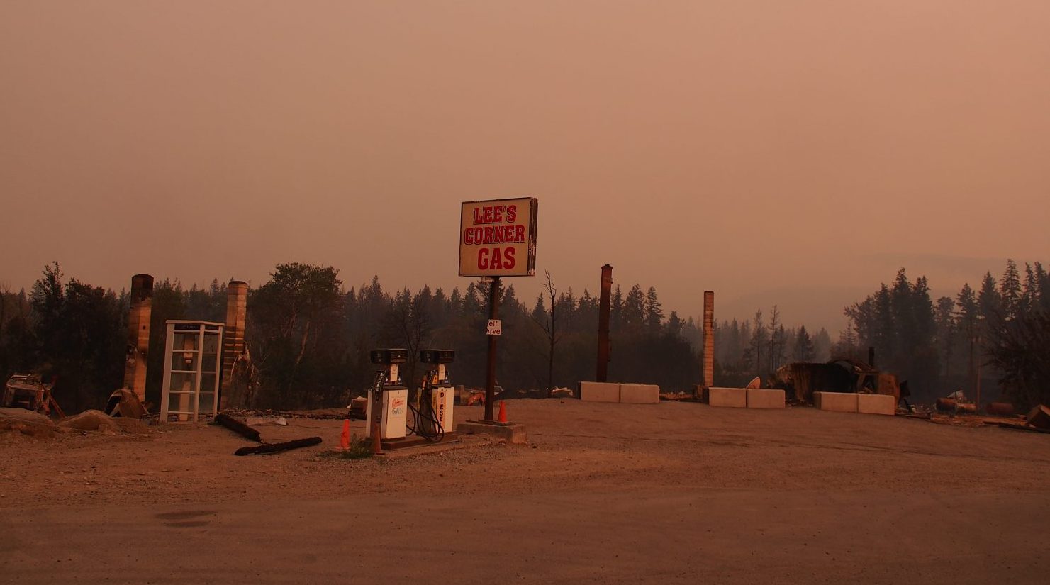
Visualize for a moment a massive fire that is many square kilometers in size working it’s way through a somewhat open conifer forest and grasslands that are tinder dry. A westerly wind is pushing a plume of smoke to the east. The plume is thin on the west edge and rises like a massive wedge as you move to the east. We were driving from the thin edge of the smoke wedge into the thick edge. It got steadily darker.
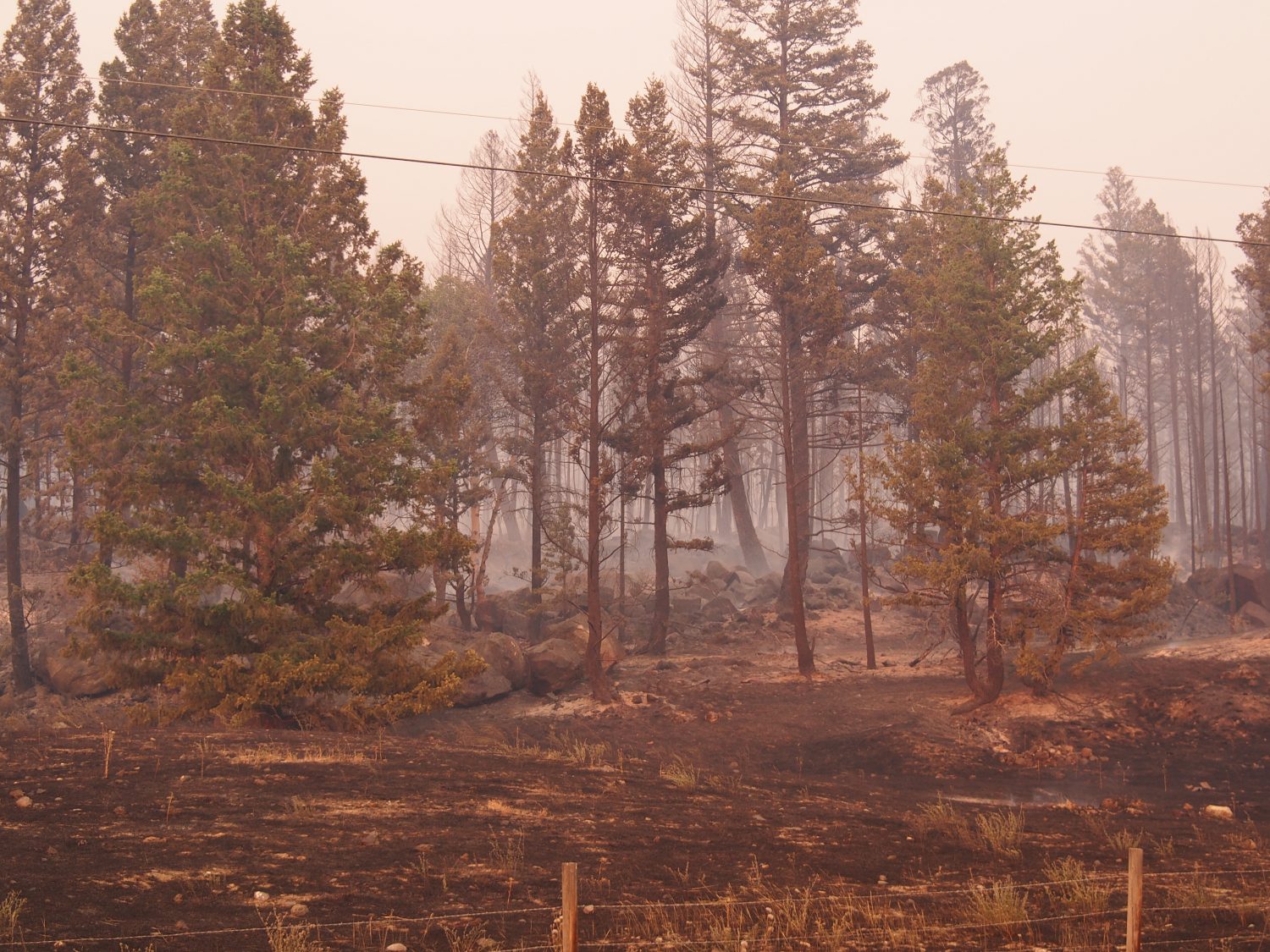
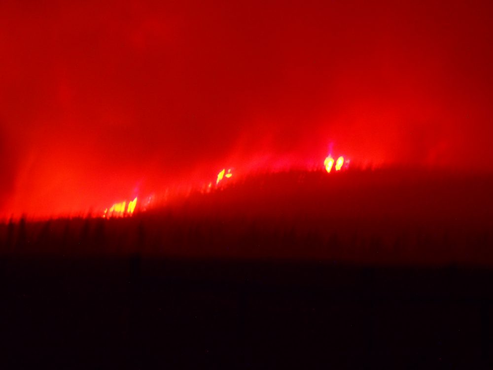
The fire was burning to the road edge on both sides and there was some crowning visible (for non-foresters, crowning is when the fire burns explosively through the foliage in the upper part of a tree). As it got darker the flames appeared more orange. Proceeding further east the darkness became complete and we forgot that the sun had not yet set. We saw periodic crowning, burning stems, and ground-level fires of varying intensity burning erratically on both sides of the road. Whole stands of trees in some spots had turned to red hot, glowing columns of orange light. Driving through the smoke was like driving through a blizzard. The road was only visible with the headlights on low beam and we could only see from 10 to 30 meters ahead. Several times intense fire-generated winds swept across and totally obscured visibility. Sparks and embers were common.
View video here: https://www.youtube.com/watch?v=860OpMy8kYc&t=2s
We proceed east through the dark with the fire on either side for about 20 km (from just after the old mill at the top of the Hanceville hill to about Harper Lake). At Harper lake the smoke began to clear somewhat and the fire was further from the road. It was still very dark, but we were able to use high beam and see further ahead. Ominous glows appeared here and there through the smoke and we were very concerned that we might drive into still more of the intense part of the fire. Finally a brighter orange glow appeared ahead and on both sides. Our first reaction was fear that the worst of the fire still lay in front of us. We were relieved, however, when we realized that this new glow was daylight and we were finally emerging from the fire.
Why didn’t we turn back early on? The trees in this area are not large (few over 20 m in height) and the sides of the road are cleared back some 20 or more meters. The chance of the road being blocked by a fallen tree was very small. We knew that the darkness was due to the thickening of the smoke wedge above us, and although the fire in the darkness looked frightening, it was in reality no worse than what you see in the early part of the video. We monitored the external temperature as we drove. It was about 22C as we entered the fire and increased to about 25 to 27 degrees. A couple of times it spiked to about 35 degrees and we considered turning around, but each time it quickly returned to the mid to high 20’s. As ominous as it all seemed, we were not in serious danger as long as we drove carefully and the outside temperature stayed reasonably low. So, we pushed forward and after what began to seem like an interminable amount of time, emerged on the east side of the fire. Our dog slept in the back, completely unaware of anything but the bag of treats in the glove box. Similar to a small group of cows we saw grazing in a small field, apparently oblivious to the fire all around them.
The video of a small part of our drive is here. Unfortunately, perhaps, Sally was so focused on the fire she lost focus on capturing more of it on video. Priorities.
There are many victims of this fire and the many other fires burning in central BC. This is the real issue. Please consider a donation to the Red Cross or another organization working to help people through this. In addition to our personal donations, we will also donate any funds we receive through commercial use of this video to the Red Cross relief effort. https://donate.redcross.ca/ea-action/action?ea.client.id=1951&ea.campaign.id=74010&_ga=2.234106270.1847245054.1499898622-97910928.1499898622