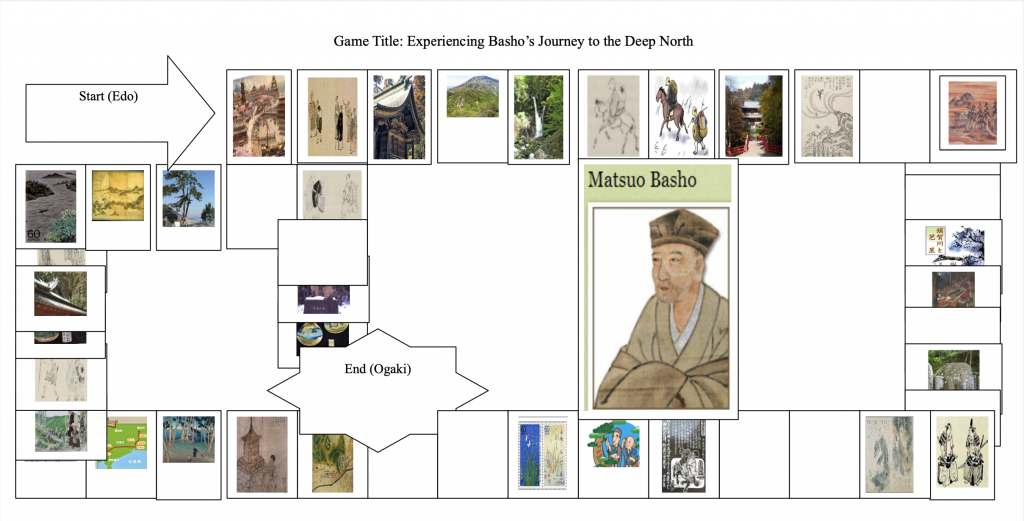
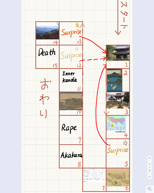
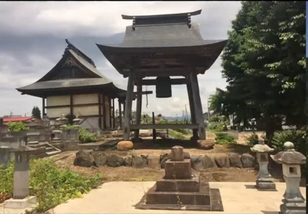
Category Archives: Uncategorized

Tsuneno’s Travel

by Ziying

  1. Rinsenji temple
    The place was where Tsuneno born. In Stranger in the Shogun’s City, once the baby lived for seven days, then it would be time to celebrate and to give her a name (Stanley, 2020).

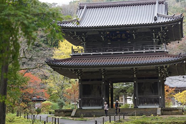
Rinsenji temple [Digital image]. (2018). Retrieved March 29, 2021, from
https://www.google.com.hk/search?q=rensenji+temple&newwindow=1&safe=strict&hl=z
hTW&source=lnms&tbm=isch&sa=X&ved=2ahUKEwiHwMXU3NTvAhXBJzQIHeryBP
8Q_AUoAXoECAEQAw&biw=1440&bih=739.

  1. The Oishida in Dewa province
    In 1816, Tsuneno left Rinsenji for the first time. She was headed to an inland river town called Oishida in Dewa province, in the north. In the winter, the fir trees, encased in heavy snow, would look like grimacing monsters frozen to the hillsides. It was a difficult journey from Ishigami village to Oishida, over 180 miles. Tsuneno could get there by boat, sailing up the Sea of Japan coastline and then upriver. (Stanley, 2020). She was going to be married and she knew that girls of her status could not select their own husbands.

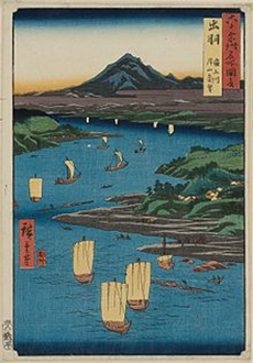
The Oishida in Dewa province [Digital image]. (n.d.). Retrieved March 29, 2021, from
https://www.google.com.hk/search?q=The+Oishida+in+Dewa+province&newwindow=1&
safe=strict&source=lnms&tbm=isch&sa=X&ved=2ahUKEwjS9YHktfvAhXLi54KHed8C
yQQ_AUoAXoECAEQAw&biw=1440&bih=739#imgrc=qYpHWlrD5tNTwM

  1. Joganji temple in Oishida

Stanley, A. (2020). Joganji temple in Oishida [Screenshot]. Retrieved March 29, 2021, from
https://www.youtube.com/watch?v=5SZl0zTZO_w.
This is where Tsuneno experienced her first divorce. A divorce wasn’t necessarily a catastrophe. Women who divorced in their twenties almost always remarried, but those who were older struggled. Tsuneno was twenty-eight and just on the edge of this possibility (Stanley, 2020).

  1. Oshima
    The village where Tsuneno’s second husband lived. Oshima Village hosted a market three times a month, and it was a stop on a minor highway leading through the mountains. In summer, when Tsuneno arrived, travelers and packhorses were still coming through, bringing news with them. It would be much quieter in winter, because the road would be impassable (Stanley, 2020).

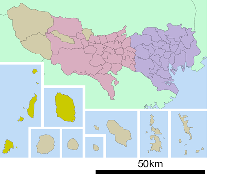
Oshima [Ōshima Subprefecture]. (2015). Retrieved March 29, 2021, from
https://www.google.com.hk/search?q=%C5%8Cshima,+Tokyo&newwindow=1&safe=stri
ct&source=lnms&tbm=isch&sa=X&ved=2ahUKEwizx7qq_NnvAhURr54KHfUNBsIQ_A
UoAXoECAEQAw&biw=1440&bih=739#imgrc=MGDTgW4M1aZZSM.
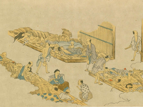
5. Surprise

  1. Tenpo Famine
    During Tsuneno’s second winter in Oshima, she watched her neighbor’s struggle. Farmers brought in less than half the usual rice crop, and the soybean harvest was so bad that no one could make miso. Tsuneno was in no danger of starving, but she wasn’t entirely sheltered. Her husband, Yasoemon, had spent all four years of their marriage waiting in vain for something to change.

Tenpo Famine [Digital image]. (n.d.). Retrieved March 29, 2021, from
https://www.google.com.hk/search?q=Tenpo+Famine&newwindow=1&safe=strict&tbm=i
sch&source=iu&ictx=1&fir=EclhumhKOH0hRM%252CfBj552VNfdGcYM%252C%252
Fm%252F08c5dp&vet=1&usg=AI4_kRXQWZhYH87X9Df_cblwaMJBemg&sa=X&ved
=2ahUKEwijhOm_dnvAhUUpZ4KHSWWBCIQ_B16BAgZEAI&biw=1440&bih=739#i
mgrc=EclhumhKOH0hRM.

  1. Inadamachi
    Tsuneno was thirty-four years old and married her third husband in Inadamachi. In midwinter, while the villages were sleepy, waiting for the thaw, Takada felt alive. The spring would be blinding, a sudden flood of sunshine after months of dim, filtered light. In the end, Tsuneno’s third marriage lasted four blurry moths. She was divorced before the last of the snow melted (Stanley,
    2020).

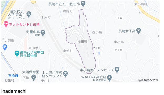
Inadamachi [Map]. (2021). Retrieved March 29, 2021, from
https://www.google.com.hk/search?q=Inadamachi&oq=Inadamachi&aqs=chrome..69i57j6
9i60l3.1349j0j4&sourceid=chrome&ie=UTF-8.
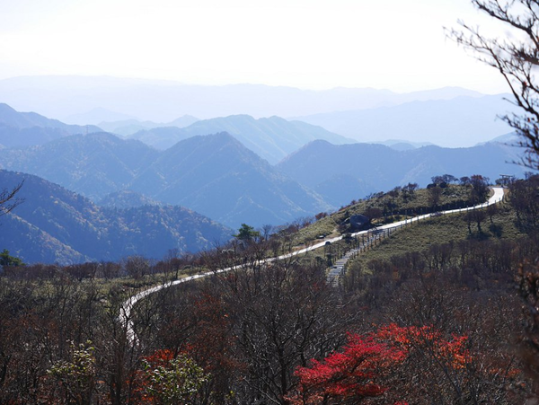
  1. Akakura
    Tsuneno and her travel partner Chikan stayed there for a few nights and prepared for the rest of their journey (Stanley, 2020).
  1. Rape
    Tsuneno didn’t have the words to describe sex with a man she would not have chosen, under circumstances she couldn’t control (Stanley, 2020).

10.The Edo
People in Edo were everywhere, carrying palanquins in the streets, fighting fires, pulling handcarts, and raising scaffolding. Theirs was the common fate of the migrant: to make the city work without ever quite belonging.


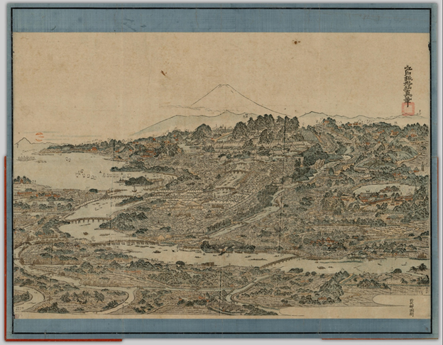
Shōshin, K. (1803). Edo meisho no e [First edition]. Cover attached. This is the first edition; a facsimile of a later edition engraved on another woodblock is reproduced in 日本古地図大成 Nihon kochizu taisei, pl. 77, exposition volume, p. 76. Cited in: WSN; 142]. Retrieved March 29, 2021, from
https://open.library.ubc.ca/collections/tokugawa/items/1.0216039#p0z-5r0f:The%20Edo

11.Inner Kanda
Tsuneno’s immediate destination lay in the western reaches of Inner Kanda, in a crowded, nondescript neighborhood that backed up against the moat of Edo castle (Stanley, 2020).

12. Surprise

13. Surprise

14.Minagawa-cho
Tsuneno spent her first night in the city. People all over Edo were remarking on the warm start to the winter, but Tsuneno had no nightclothes and no futon. She had no extra clothes. She had no money. Chikan was a useless liar, and Sohachi was threatening to send her to work as a maid (Stanley, 2020).
Minagawa-cho [Digital image]. (n.d.). Retrieved March 29, 2021, from
https://www.google.com.hk/search?q=Minagawacho&newwindow=1&safe=strict&source=lnms&tbm=isch&sa=X&ved=2ahUKEwjorojwg
9rvAhVGj54KHZFTANUQ_AUoAXoECAEQAw&biw=1440&bih=739#imgrc=04GUY7
BeuJtOJM.

15.Death
Tsuneno died a few weeks later. She had been sick for nearly three months by then. If Tsuneno had lived a little longer, she would have seen a new city, Tokyo, emerge from the destruction (Stanley, 2020).


Tsuneno died, but her momentum didn’t.

Commentary
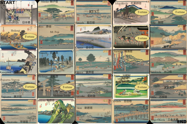
The main character in this game is Tsuneno, a figure of Stranger in the Shogun’s City. The background of this game is the early 19th century. The whole journey is designed based on Tsuneno’s travel route. To be specific, the game starts from where Tsuneno was born and ends where Tsuneno died (with some cuts within her journey for the purposes of this game).

Instructions for game play

Assuming two players in the game (it can be played with more):
Each player throws the dice in turn and the one with the highest total moves the set number of spaces based on the dice and reads the associated short paragraph (each space is accompanied by an information card).
“Surprise” spaces require a detour or a return to the start. If one player lands on a “surprise” square they receive the lowest points for that round only. The information on the cards may also include images. Meanwhile, while one player reads the information provided, the other player must carry out “burpees” (a squat thrust with an additional stand between reps; an exercise used in strength training) until the other player is done reading. The burpee is intended to convey to the player that they are consuming energy during their travels.
By retracing Tsuneno’s steps I hope you can experience both the joys and tribulations of travel and imagine what it would have been like to be a woman making her way through the floating society of her time. This is not only a tale of travel, but also a journey of one woman’s growth. On the way to Edo, her path was unknowable and it could involve detours or reversals. For this reason, the game contains “surprise” spaces–just like her life, the game may be rough or smooth. The game also highlights gender issues, historical background, marriage issues, family issues, culture and nature disasters, and how these all intertwined leading up to her death. Tsuneno is a “product” of times. Finally, the main idea shared through this game and borrowed from the Stanley book is: “The crucial and irrevocable part of the story—was that she was moving forward. Her momentum carried her” (Stanley, 2020).


Bibliography
Stanley, A., & ProQuest (Firm). (2020). Stranger in the Shogun’s city: A Japanese Woman and Her World (First Scribner hardcover ed.). New York: Scribner.

Basho’s Journey

Matsuo Basho is one the most outstanding Japanese poets of haiku – a short form of Japanese poetry (Basho, 1996; Basho & Barnhill, 2005). He was born in 1644 in Ueno, Iga Province, to a low-ranking samurai family. Basho started writing poems as early as 1662. He was part of the Danrin School, where he participated in numerous competitions. He would later become a judge of poetry competitions and acquire students of his own, become a lay monk, and establish his own poetry school. Basho’s poems were influenced by his intimate relationships, especially with friends, as well as Zen and Chinese Daoism (Basho & Barnhill, 2005).

Feudal stability characterized the Tokugawa Period (1600-1868) (Basho & Barnhill, 2005; Downer, 1989). Hence, travelers could travel safely. Improvements in social mobility facilitated the widespread of arts and throughout Japan, regardless of class, with the merchant class taking on the arts. The Haikai no renga, a comic-linked verse, was significantly popular among samurai and merchants. This is how poetry reached Basho. However, in 1666, Basho’s friend Yoshitada died suddenly, making him consider leaving secular life. The flourishing arts made it possible for gifted writers to remove themselves from their daily life and become master poets. This is the path that Basho followed (Basho & Barnhill, 2005).

In the late spring (May) of 1689, Basho set off for a 2,000-kilometer journey from Edo (currently Tokyo) to the northern interior of Japan, as indicated in figure 1 (Basho & Barnhill, 2005). This journey happened to be among the last one, and it generated the infamous The Narrow Road to the Deep North (Oku no hosomichi). When starting, Basho admits feeling old and frail, but he felt compelled to make this journey. He dressed like a monk, carrying a wide-brimmed sedge hat and bamboo staff. As a lay monk, he owned nothing, relying on friends, disciples, and admirers (Downer, 1989).

Basho traveled for many reasons, including for religious and poetic purposes. At the time, traveling or wandering the countryside was viewed as an ascetic practice that helped shape and sharpen sacred visions and poetic creativity (Basho & Barnhill, 2005). Additionally, going on such journeys helped ascetics, monks, and poets remember those who had died before them and their legacy, as observed in Basho’s visits to monasteries and graves of famous people in his historical timeline. He also traveled to acquire more disciples (as he was a master in his own school) and spread his poetry throughout Japan.

It seems that to Basho, travel was more about the experience than the destination. From his poems, one can deduce that he walked to reflect and interact with people, nature, and culture. When leaving Edo, for example, he feels burdened by the goodbyes from family and friends. Although he is old and frail, he cannot leave these memories behind as a human being; it is his responsibility to carry the burden of sustaining relationships with friends and family rather than walk alone. Even so, he is propelled to keep moving on, whether through friends or to reach places, while never forgetting memories, and creating new friends, or finding new encounters at every turn (Kerkham, 2006). Therefore, this sugoroku is intended to be a game played with friends. As players experience Basho’s journey, they learn more about Japan and various essential aspects of the journey. Drawing from Basho’s poems, these experiences are worthy particularly because they represent the temporality of life.

Game Instructions:

Start point: (Edo)

End point: (Ogaki).

Number of players: 2-4.

All boxes, regardless of size and with or without visuals, hold equal importance. Note that only one player (the first to get to Ogaki) will be crowned Basho. The game ends when the first player finishes the game. If all players are unsuccessful in any of the steps, they stay in that stage until they are able to break through and continue their journeys. 

The Shortest Way to Ogaki:

Roll numbers 1 and 3 when the game starts and jump past the Shirakawa Barrier (step 11). When successful, the player is allowed to cast the dice again. If the player gets dice number 1 or 6, they jump past the Great Gate at Date (to step 22). The player then rolls the dice again twice. Dice number 3 and 1 take the player past the Shitomae Barrier (Step 33). The player then casts the dice again. If they get dice number 2 or 5, it is game over as that skips them to Ogaki, the finishing line. 

The Long Way to Ogaki:

References:

Basho, M. (1966). The Narrow road to the deep north, and other travel sketches (Vol. 185) (N. Yuasa, Trans.). Penguin.

Basho, M., & Barnhill, D. M. (2005). The narrow road to the deep north. In Basho’s journey: The literary prose of Matsuo Basho (D. M. Barnhill, Trans.). State University of New York Press.

Downer, L. (1989). On the narrow road to the deep north: Journey into a lost Japan. Vintage. Kerkham, E. (2006). Matsuo Basho’s poetic spaces: Exploring haikai intersections. Palgrave MacMillan.

Temptations and Temples

This board game is inspired by Edo period travel and the idea of famous spaces. Today, as tourists we often travel to see the sights and have specific foods we want to try and places we want to explore. Major temples are placed on the board game like Ise Shrine and Mishima Taisha. Other iconic places are mentioned in the good luck and bad luck spaces regarding food famous to the lands. High status women in the Edo period would often travel to shrines and temples to receive blessings or to regain some sense of independence. This factor was inspiration for the premise of the trip, women travelling with attendants and trying to explore and see the places they perhaps read about in novels or in poems.

Rules

  1. You start at Nihonbashi in the top left and move down and up the board following the numbers in the top right corner of each square until you reach Sanjo Ohashi at the end.
  2. Roll a single dice to determine initial luck at the beginning of the game. You can re-roll your luck at the Fortune spaces at shrines marked on the board. 1-3 is Good Luck. 4-6 is Bad Luck.
  3. At REST spaces, you must stop.

Good Luck & Bad Luck

Good Luck

  • Kawasaki: You receive a blessing at Heikenji and feel encouraged for the journey to come.
  • Kanagawa: You stop at Sakuraya for tea. The tea stem floats upright, a sign of good luck.
  • Fujisawa: You visit Enoshima Island.
  • Hiratsuka: You pray for Okiku’s spirit from the ghost story “The Dish Mansion at Bancho” and she is finally at peace.
  • Hakone: You take a break and enjoy the onsen.
  • Mishima: You visit the abandoned Yamanaka Castle and reminisce in history.
  • Numazu: You find extra coins in your pocket. How lucky.
  • Hara: You gaze at Mt. Fuji and feel revitalized in its spiritual presence.
  • Mariko: You make it in time to get a bowl of Mariko’s famous bowl of yam soup.
  • Shimada: The weather is in your favour and low tide to cross the wading water.
  • Kanaya: You pay someone to help you across the river.
  • Fukuroi: You pass by the path to the 3 major temples are feeling content.
  • Mitsuke: Your soba is just as delicious as expected. It was worth the trip.
  • Arai: The winds are on your side as you sail. Move +1 move on next turn.
  • Yoshida: You appreciate the sights over the bridge. It is one of very few thanks to the Tokugawa regime.
  • Chiryu: You admire the pine trees growing along the Tokaido.
  • Narumi: You buy one of Narumi’s famous tie-dye fabric.
    Miya: You arrive in time to witness the Atsuta Festival and have a lovely time.
  • Ishiyakushi: You purchase some manjuu and are inspired to write a tanka.
  • Seki: Ise Shrine, the home for Amaterasu, you receive a blessing, and the rest of your journey is filled with sunshine.
  • Sakashita: The wind is behind you and you make it through the Suzuka Pass with ease.
  • Minakuchi: You stop by Daitokuji and visit the rock that Tokugawa Ieyasu sat.
  • Ishibe: You stay at the Kojima honjin and relax before the last stretch.

Bad Luck

  • Kawasaki: You trip, and your sandal strap breaks. A worried feeling follows you.
  • Kanagawa: You stop at Sakuraya, the tea house but the cup splits in half. A bad omen.
  • Fujisawa: You’re refused access to Enoshima Island. What a shame.
  • Hiratsuka: You are haunted by Okiku’s ghost from “The Dish Mansoin at Bancho” ghost story. Your shoulders feel a little heavier.
  • Hakone: You stub your toe and are bleeding. Your trip to the onsen is cancelled now.
  • Mishima: Your guide abandons you. You’re on your own now.
  • Numazu: You see a tengu off in the distance. This could be trouble.
  • Hara: The view of Mt. Fuji is blocked by grey foggy clouds.
  • Mariko: The store runs out of yam soup right before you can get a bowl. How unfortunate.
  • Shimada: The rains flood the river, and you have to wait at the inn for another night. Skip 1 turn.
  • Kanaya: Your belongings are washed away in the river.
  • Fukuroi: You reach the temple gates but are turned away.
  • Mitsuke: Your soba is soggy and you’re disappointed.
  • Arai: The winds are against you and the travel is slower than normal.
  • Yoshida: Construction on the bridge makes you lose a day of travel. Skip 1 turn.
  • Chiryu: You attend the horse market but do not have enough to buy one.
  • Narumi: You spill tea and ruin the tie-dye fabrics you were hoping to bring home.
    Miya: You’re pickpocketed during the Atsuta Festival and lose your spending money.
  • Ishiyakushi: Your stomach feels unsettled, perhaps the manju from the stall gave you food poisoning.
  • Seki: You are stopped at the Ise Suzuka Barrier and your food supplies are taken from you by officers in an inspection.
  • Sakashita: The weather in Suzuka Pass is too intense and your progress is slowed down.
  • Minakuchi: You are stopped by soldiers on your way past Minakuchi Castle.
  • Ishibe: The weight of the trip has tired you out and you rest an additional day at the honjin.

Nihonbashi as a starting place felt to be key as it was seen as the center of Edo. Nihonbashi was positioned at a central crossroad for those entering and exciting the city. Its presence as a popular urban space grew in the late Tokugawa period and images of the bridge came to include people crossing and also the movement of goods into the city (Yonemoto, 1999). I thought this would be fitting to the start of this journey. Mount Fuji has been a point of cultural focus and seen as a sacred mountain for Japanese people. Climbing the mountain for religious enlightenment became popular during the Edo period (Sugimoto & Koike, 2015). It had been a place of worship from a distance and very revered by people in the city of Edo. Rather than going themselves, people would pay others to go in their stead and climb the mountain for their blessings. This religious pilgrimage is suggested as the roots for the modern travel to visit Mount Fuji (Matsui & Uda, 2015). Mitsuke-juku was a place known for its lodgings and restaurants. People would come from far away to have soba in Mitsuke before taking the ferry across the water. Atsuta Shrine close to Miya-juku is another important shrine for Japanese mythology. The shrine houses the sword of Susanoo no Mikoto, Amaterasu’s brother who is the god of storms. Atsuta Shrine is a cannot miss stop for those who wish to reminisce about Japan’s mythology, and it is an important stop right before Ise Shrine. Ise Shrine has been a very important religious place in Japanese history. Seki-juku is very close to the shrine and as this game’s main focus is to visit shrines along the Tokaido, I thought it would be a must-see place to visit for any traveler. The pilgrimage to Ise has been taken for centuries with poems written on the subject such as A Journey to Ise (1686). The Ise shrine is dedicated to the sun goddess Amaterasu among others. There were bustling tea stores, inns, and shops around the shrine in the Edo period that were thanks to the high pilgrimage culture at the time. Ise mandalas were placed at the shrine to show how to perform prayers for pilgrims and depict maps of the shrine area (Hardace, 2017). Sanjo Ohashi, like Nihonbashi in Edo, is another centre of cultural importance. Bridges as a symbol of connecting spaces and connecting people felt like the ideal end point for the journey. It was built in 1590, over the Kamo River which divides Kyoto in two. It held significance to Tokugawa Hideyoshi who had it built with stone pillars to replace the old, unreliable timber bridges (Stravos, 2014). It is an important landmark in Kyoto and a point of crossing to get to the other places of interest like the imperial palace or Nijo Castle.

References

Hardacre, H. (2017). Edo-period shrine life and shrine pilgrimage. Shinto: A History. Oxford University Press.

Matsui K., & Uda, T. (2015). Tourism and religion in the mount fuji area in the pre-modern era. Chigaku Zasshi, 124(6), 895-915.

Sugimoto, K., & Koike, T. (2015). Tourist behaviors in the region at the foot of mt. fuji: An analysis focusing on the effect of travel distance. Chigaku Zasshi, 124(6), 1015-1031

Stavros, M. G. (2014). Kyoto: An urban history of japan’s premodern capital. University of Hawaiʻi Press.

Yonemoto, M. (1999). Nihonbashi, edo’s contested center [ie centre]. East Asian History (Canberra), 17(17-18), 49-70.

The appreciation of the map Tōkaidō bunken nozu


Quoting from the Traganou:

The major characteristic of the map is its combining precise topographical descriptions with vigorous details of life. Indeed, the illustrations added by Moronobu transformed the map into a vivid pictorial illustration of the culture of traveling in the Edo period. Such illustrations focus on the celebrated ‘floating’ aspects of the culture of the road, elements that are ephemeral and changeable. The map depicts various types of travelers, including daimyō processions and commoners traveling back and forth, as well as incidents for which the Tōkaidō was well known in popular culture. It is interesting to note the close similarities in the ways figures of travelers are drawn between this map and the Dōchūki of 1655, a guidebook that was published a few years before Tōkaidō bunken ezu’s first edition, which will be examined in the following chapter (see Figure 18). The map also depicts meteorological conditions such as the Ōi River in flood, snow on Mount Fuji and rain in Hara, which is a typical preoccupation of ukiyo-e iconography. A major difference between this map and our contemporary geographical standards is the depiction of certain, important geographical elements more than once. As Nitschke has noticed, Mount Fuji appears on the map more than ten times at spots from which it is visible (Nitschke 1993:54). To this we should add the repeated appearance of Mount Ōyama, famous in the popular mythology of Edo (Traganou, 38).


The Tōkaidō as a megalopolis plays an essential role throughout the history of Japanese cultural geography and anthropology. Therefore, many maps depict the route information of the Tōkaidō, which provides travel information for people and easy to carry on the road. Despite maps that guide the route for people on the road, it has another type of maps that highly meticulously make with the painting of details. This kind of map is usually a kind of painting artwork and very lengthy, which is not easy for people to carry on the road. Tōkaidō bunken nozu is a proportional map of the Tōkaidō, which is one of the most popular maps of the Edo Era. Tōkaidō bunken nozu is a map that uses the description of the terrain as the background depicts the details of people’s lives. The whole map is divided into five folded volumes with the continuity of art appreciation. Although the rivers, mountains, and other essential landmarks are carefully marked on the map, it is still perceived that this map’s goal is not to help people find the route, mainly based on there is no minutia depict of streets and alleys. In particular, this map is more like a guidebook that provides local entertainment and traditional customs for tourists. For example, the map accurately marks the four directions and tagging all the local famous scenic spots, such as post station, rivers, mountains. The local entertainment buildings, such as teahouse, temples, and shrines, are also marks on the map.

Moreover, there are many impressive figures of vivid people drawn on the map. Some of them are passers-by in a hurry walking on the road alone. Some wealthy people were carried along the road in sedan chairs by servants. On the docks, some people are moving their luggage for the boat. These vivid and detailed depictions tell the real-life of traveling in the Edo era and convey culture and convention to people through the map.

Furthermore, these elements make this map more likely to be a travel guidebook, promoting local customs and practices to tourists, such as point out beautiful scenery, highlight the recreation facilities and the local way of life.  Besides, another detail is the repeated appearance of Mount Fuji on the map. First, it might because there were no many high buildings and large mansions at that time, and due to the height id Mount Fuji, it is more likely for people to see it from different directions. The more reasonable guess is selecting these places corresponds to Mount Fuji’s stereotypical representations as seen in meisho literature and arts (Traganou, 38). Therefore, this map combines the accurate description of the terrain and the vivid detail of people’s lives, making the map an artwork with delight to view and cultural diffusion.

An Itinerary map of the Tōkaidō Highway (1654)

Tokaido michiyuki no zu (Itinerary map of the Tōkaidō Highway) doi: http://dx.doi.org/10.14288/1.0167749

“Mandala maps show the routes as curved lines and include scenes of the road as if they were viewed from a distant high viewpoint. Mandalas prioritize the temporal and symbolic dimension of space, being thus clearly ‘meta-traveling’ artifacts. They often impose elements of geometrical order on the flowering landscape (Lee et al. 1983:144) and bring together distant landmarks through the use of the cloud-pattern, the technique of reversed perspective or of variable viewpoints. Their curved schemes may also reflect the Chinese doctrine of attributing malign influences to straight lines (Yee 1987:154). Tōkaidō michiyuki no zu (Itinerary map of the Tōkaidō road) (Figure 3), the oldest surviving printed road-map of the Tōkaidō, is a mandala thought to have been published in 1654 (Unno 1987:422). Although accuracy is not its main concern, practical information such as distances between post-stations and lists of fares for travelers using horses is provided. Late Edo period panoramas such as Katsushika Hokusai’s (1760–1849) (Plate 4) and Kuwagata Shōi (?–1855) (Figure 9) are also considered by Unno as belonging to the mandala category. They present a much stronger awareness of cartographic precision, however, as will be explained later in this chapter.” (Traganou, 28)

Tōkaidō michiyuki no zu is a map categorized as a mandala. Mandalas present the area in long curved lines from a distant view from an angle from above. The aesthetic art style is clear in the design of this map. The use of space and landscape are elaborate to demonstrate the just vast distance of the Tōkaidō. The winding and curving road looks as if it could go on forever. The actual distance from start to end is not clear but the names of the stops and prices listed demonstrate that the focus is on the locations along the road rather than the final destination. In some ways it reminds me of a guidebook for a city. Traganou likens dōchūki to a similar guidebook. Listing the prices for food at a cute café, or a recommendation for a place to stay the night. However, the Tōkaidō michiyuki no zu lacks the more elaborate text a guidebook might have. While mentioned earlier in the chapter, the interest in curved lines is linked to Chinese aesthetics rather the security concerns that Tokugawa took into consideration during the building of the road. The way the road branches and splits only to rejoin later on is quite unexpected for me. I would have assumed for this to be considered a different road. In addition, the map shows this bright red highlighted section of the road, this representing the Tōkaidō, yet at points it is obscured thanks to the mountains or perhaps valleys, and I find the aesthetic choice of aerial view but obscured to be a little strange. The use of colour as well is interesting. Other than the main road, the mountains are coloured brown with green tops while the water bays are a light blue. The folds in the scan imply the map was to be folded several times, and there doesn’t seem to be any cut offs or different saturation in colour which indicates a wood block print. I wonder if each of these maps are drawn by hand? It seems a little impractical however if it is seen more of a piece of art rather than a functional map, the practicality is less of a concern. Traganou does discuss practical aspects of this map such as the prices provided and the distances between post-stations on the other hand so perhaps my thoughts are lacking. The only standard type facing looks like the stampings of the cardinal directions and the map title at the top in a border.