The Port of Vancouver (POV) is “the most diversified port in North America,” operating across five business sectors (automobiles, break-bulk, bulk, container and cruise), facilitating trade with more than 170 world economies, and handling nearly 140 million tons of cargo valued at $200 billion (POV 2016). Sea level rise could cause major disruptions to the flow of these goods and the livelihood of people directly or indirectly employed or benefiting from port-related activities. At the same time, POV operations significantly impact marine and terrestrial ecosystems as well as communities in the Fraser River Delta.
Visualizing the Future Port was developed to support the Port of Vancouver with long-term planning and decision-making processes in the context of sea level rise (SLR) and its potential impacts on POV infrastructures and operations.
The report contains the following sections:
- literature review of current studies on climate change/SLR adaptation planning for ports;
- discussion of existing spatial strategies in the context of SLR adaptation;
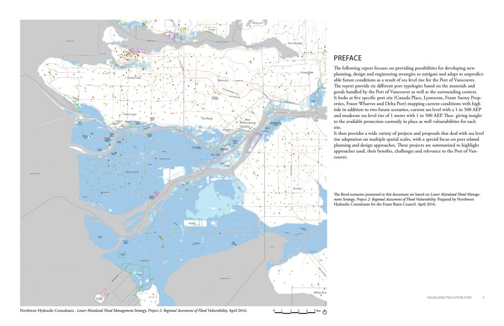
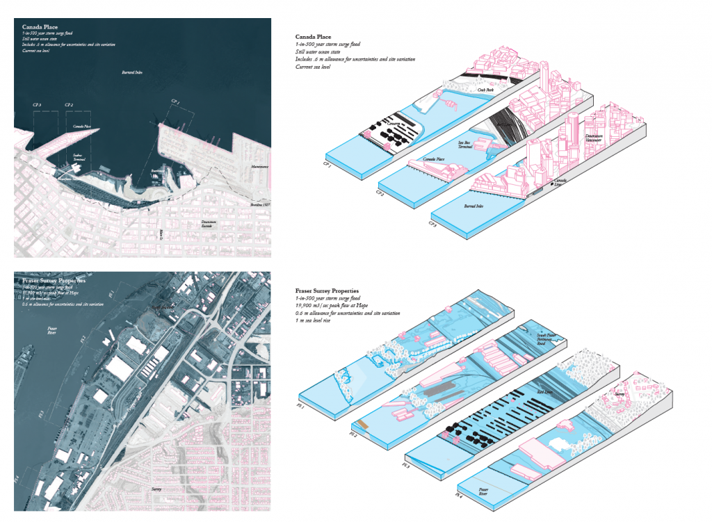
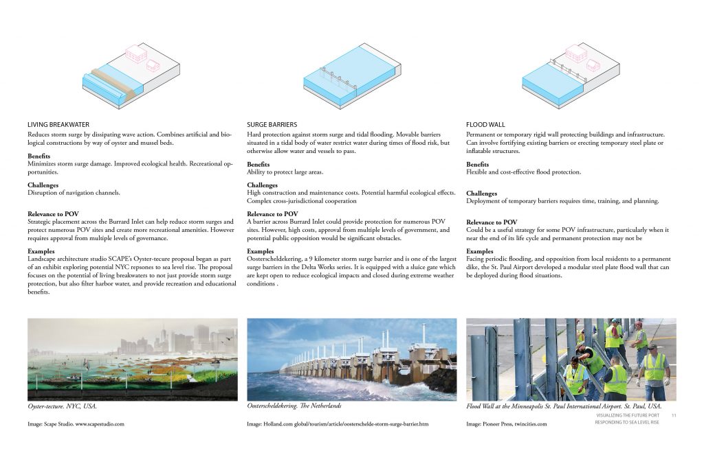
- visualization of flood vulnerability of several POV locations based on recent SLR projections by the Fraser Basin Council’s Lower Mainland Flood Management Strategy—Phase 1 and;
- identification of key questions and directions for future research in the context of POV’s planning efforts to adapt to SLR.
Funding: Port of Vancouver
Research Collaborators
Patrick Beech, UBC School of Architecture and Landscape Architecture
Dina Dudokh, UBC School of Architecture and Landscape Architecture
Dave Flanders, Urban Systems