
The distinctive topography of British Columbia is in large part due to the presence of massive volumes of ice during the last ice age. Locally, this last major glacial advance is called the Fraser Glaciation. Although there have been at least four major advances of ice since the beginning of the Pleistocene (1.8 million years ago), each successive advance has wiped out evidence of the previous advance. Most of the erosion and depositional landforms we see today are the result of the last, Fraser Glaciation.
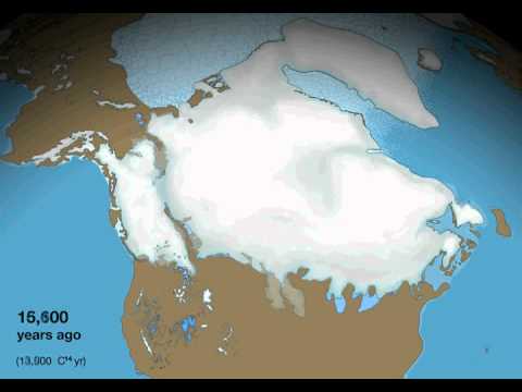
Glaciers erode, transport, and deposit clay, silt, sand, and gravel, forming many different landforms. The study of these deposits is called Quaternary geology. The gradual advance of ice started in southern BC about 25,000 years ago and climaxed at about 15,000 years ago in Washington state (see figure). This ice was part of the larger Cordilleran Ice Sheet, which formed as valley glaciers advanced downhill and coalesced to form a large ice mass that covered almost all of BC. A piedmont glacier is also called an expanded foot glacier. It is a continuous sheet of ice at the base of a mountain range and resting on land that is formed by spreading out and coalescing of valley glaciers from the highest elevations of the mountains.
-

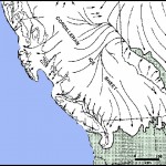
- Source: http://web.viu.ca/geoscape/the_big_freeze.htm
-
- source: http://web.viu.ca/geoscape/the_big_freeze.htm
To the west advanced into the Pacific Ocean, although there may have been ice-free corridors at times. To the east the ice joined up with the Laurentide Ice Sheet (see video) that was advancing from Hudson Bay. At times there may have been an ice-free corridor between the sheets along the Rocky Mountains. This is important to archaeologists, as either the coastal or interior corridors may have provided migration routes for ancestral North Americans during this time. By 10-11,000 years ago the ice had left the Fraser Valley.
As the ice advanced to lower elevations throughout the mountain ranges of the Cordillera, the spectacularly rugged scenery was formed. Small river valleys became filled with ice that gouged out large U-shaped valleys separated by narrow knife-edged ridges and triangular peaks. The local Capilano and Seymour Rivers and Lynn Creek all begin in U-shaped valleys, although their lower reaches include narrow gorges and glacial drift deposits. Steep sided circular depressions high in the mountains on the Cheakamus map sheet are called cirques and are the birthplace of mountain glaciers.
As the ice advanced, large volumes of outwash sand were spread out in front of the glaciers by meltwater rivers. In southwest BC, as the ice moved down the Georgia Depression from north to south, over 500 metres of sand, silt, and gravel were deposited in this fashion. It is probable that in the northern part of the Georgia Strait, dry land existed across the strait. The sands that filled up the depression are called the Quadra Sands and can be seen in the sea cliffs at UBC and at Point Roberts.
References:
Siegert, Martin. Ice Sheet and Late Quaternary Environmental Change. London: Wiley, March 2001.