Urbanization, the gradual-to-rapid increase in the proportion of people living in urban areas, has been a universal economic and social phenomenon taking place all around the world. It has subsequently brought about fundamental changes in land use and landscape pattern through human-induced changes in addition to natural factors. More specifically, rapid urbanization in conjunction with exploitation of natural resources have had significant impacts on ecosystem structure, function and dynamics. This is most evident in economic development regions (i.e., the dramatic urban expansion and land use change have induced serious environmental issues threatening urban sustainable development.
In Canada, urban expansion has caused loss of quality agricultural land, including large forested areas. While forest loss is more common than forest gain worldwide, it imposes significant adverse effects on Canadians as the forestry industry is a major contributor to the Canadian economy. Forest dependence also has significant cultural, social, and environmental impacts, such as community well-being and quality of life of all Canadians. Therefore, it is critical, and within our interest, to monitor, assess, and manage the changes in land use and landscape pattern, especially where agricultural land-use dominant landscape gradually converts to urban land-use dominant landscape.
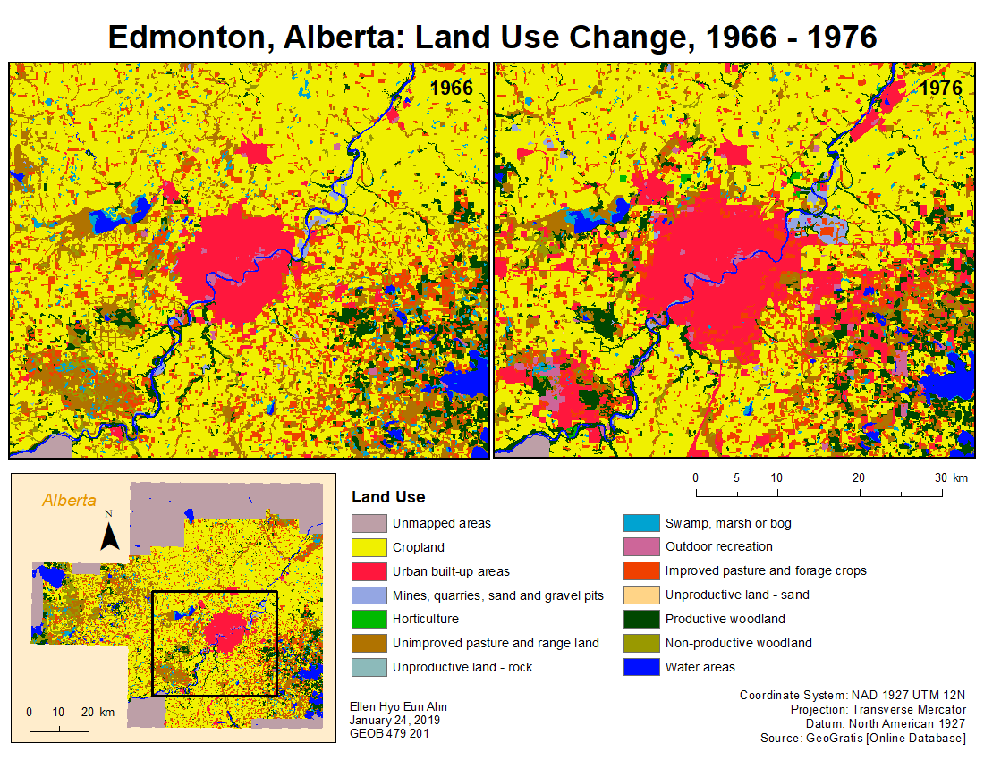
Urban area has crept onto some of Alberta’s best agricultural land through processes of urban sprawl for decades. The City of Edmonton and surrounding regions have undergone dramatic urbanization, for which is suspected to have affected the availability of quality agricultural land, including forested areas. As a result, the focus of this study will examine the effects of urbanization on the City of Edmonton and surrounding regions.
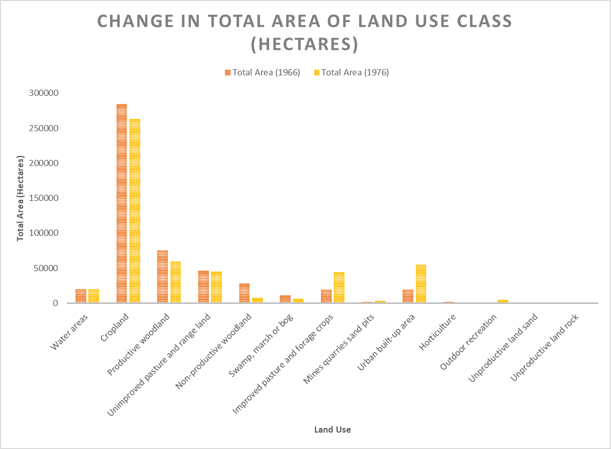
From 1966-76, the most noticeable land use changes in the Edmonton region was demonstrated by urban-built up areas, increasing in total area from 19 596 to 54 995 ha (an approximate difference of 35 400 ha), along with horticulture. This is shown by Figure 1, where urban-built up area shows a dramatic increase from 1966-76. Considering that land is a finite resource, aforementioned changes were coupled with a ‘redistribution’ of total area across other land use classes. For example, a decrease in total area of cropland (21 559 ha decrease) and productive woodland (21 124 ha decrease) were also observed. In addition, productive woodland was found to have dramatically decreased, by approximately 50% in number of patches.
Combining the land use attribute data of 1966 and 1976 in ArcMap, it was easy to determine what types of land use classes transitioned from productive woodland over the decade. We are also able to infer that a large percentage of other land use classes, notably non-productive woodland and unimproved pasture and range land, transitioned into productive woodland. This suggests that even with the changes of other land use classes to productive woodland, productive woodland experienced a total decrease (decrease < increase). When visualized, we can see that these land use changes largely occurred around the southeastern edges of the Edmonton region (Map 1). These changes are reflective of the overall trend in the City of Edmonton that is experiencing rapid urbanization with increased population that is largely driven by immigration.