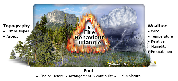
Fire Behaviour Triangle [1]
Mountain Pine Beetle infestation
Mountain pine beetle infestation that occurred 3, 6 and 9 years prior to the fires (i.e. in the year of 2001, 2004, and 2007) were tested in the model. MPB_2007 is the only mountain pine beetle infestation that significantly contributes to the model. The positive coefficient of MPB_2007 indicates that locations with higher infestation intensity (i.e. higher number of affected trees by mountain pine beetle) tend to have a higher fire spreading potential.
Similar studies found that newly attacked forests are more likely to have larger fast-spreading fires than severely-attacked stands (Page and Jenkins 2007; Simard et al. 2011). In newly attacked forests (especially the red-attack stage when needles start falling down), more canopy and ladder fuels become available that allows fast-spreading and high-intensity crown fires (Page and Jenkins 2007; Simard et al. 2011; Page et al. 2013). On the other hand, coarse fuels accumulate on ground in latter stage of attack due to higher understory regeneration and dead trees falling. More ground and surface fires are initiated at this stage that usually spread at a much lower speed and thus have a lower chance to develop into a large fire (Page et al. 2013; Jenkins et al. 2014).
Climatic Conditions
![]() Among all the seasonal temperature variables (average, maximum, minimum temperature for spring, summer, autumn, and winter), minimum and average temperatures in spring are found to fit the models best. The spring average temperature is positively related to fire spreading potential (the higher the spring average temperature the larger the fire size), while a negative relationship was found between spring minimum temperature and fire spreading potential. We suspect that increased average temperatures in the spring accelerate the melting rates of glaciers and snow. For example, a higher average spring temperature leads to more rain-on-snow events that generate more freshet. This leaves a drier summer with less water to melt and thus a higher fire spreading potential.
Among all the seasonal temperature variables (average, maximum, minimum temperature for spring, summer, autumn, and winter), minimum and average temperatures in spring are found to fit the models best. The spring average temperature is positively related to fire spreading potential (the higher the spring average temperature the larger the fire size), while a negative relationship was found between spring minimum temperature and fire spreading potential. We suspect that increased average temperatures in the spring accelerate the melting rates of glaciers and snow. For example, a higher average spring temperature leads to more rain-on-snow events that generate more freshet. This leaves a drier summer with less water to melt and thus a higher fire spreading potential.
Among all seasonal precipitation variables, only summer precipitation fits the model. A negative correlation is found between summer precipitation and fire spreading potential. This is consistent with previous studies showing precipitation in the spring and summer as a primary determinant for forest fires intensity (frequency and size) (Bourbonnais et al. 2014; Ali et al. 2012; ). Lowered summer precipitation facilitates the occurrence of large fires followed by late-season burning in spring (Ali et al. 2012).
Topographic factors
![]() Topography is one of the most important factors in predicting fire spreading potential (Taylor, 2000; Flannigan et al. 2000). Two topographic variables are included in Model 1, aspect and slope. Aspect, consisting of four variables (Southing, Easting and their transformations), is the most significant factor in the model (the four variables have Type III F-value range from 25.2 to 70.7 and associated p-values < 0.001). Southing and sqrtSouthing with higher coefficients have more significant contribution to the fire size than Easting and sqrtEasting. The eight different coloured layers illustrate the influence of aspect on fire spreading potential. Northwest aspect tends to have larger fires and south aspect tends to have smaller fires, ceteris paribus. It was expected that east facing areas would tend to have larger fires due to the rain shadow zone effect on moisture availability. However, the linear regression model suggests a higher fire spreading potential in west facing aspect areas. One possible explanation for this is that BC’s latitude (49° ~ 60º N) is in the prevailing westerlies region of global surface wind pattern. Although wind power is not found to be a significant predictor variable of fire size, its pattern and direction might still be important.
Topography is one of the most important factors in predicting fire spreading potential (Taylor, 2000; Flannigan et al. 2000). Two topographic variables are included in Model 1, aspect and slope. Aspect, consisting of four variables (Southing, Easting and their transformations), is the most significant factor in the model (the four variables have Type III F-value range from 25.2 to 70.7 and associated p-values < 0.001). Southing and sqrtSouthing with higher coefficients have more significant contribution to the fire size than Easting and sqrtEasting. The eight different coloured layers illustrate the influence of aspect on fire spreading potential. Northwest aspect tends to have larger fires and south aspect tends to have smaller fires, ceteris paribus. It was expected that east facing areas would tend to have larger fires due to the rain shadow zone effect on moisture availability. However, the linear regression model suggests a higher fire spreading potential in west facing aspect areas. One possible explanation for this is that BC’s latitude (49° ~ 60º N) is in the prevailing westerlies region of global surface wind pattern. Although wind power is not found to be a significant predictor variable of fire size, its pattern and direction might still be important.
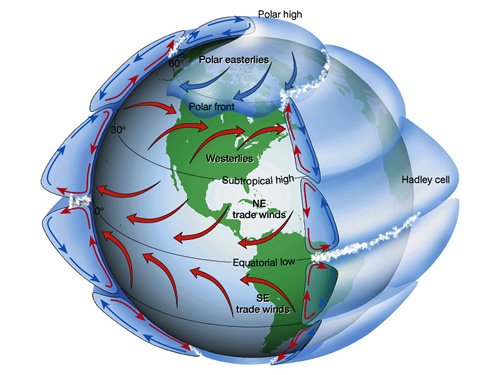
Idealized Global Wind Pattern [6]
Similarly, south-aspect slopes were expected to have a higher fire spreading potential because of greater available solar energy for evaporation and hence lower moisture content in soil and in burning materials (Grey and Blackwell 2005; Wilkinson and Humphreys 2006; Beaty and Taylor 2001). But again the model suggests otherwise, a higher fire spreading potential is found in north facing areas. One possible explanation is that moisture in north facing areas is lower because of less glacial water and snowmelt due to lower solar radiation in spring and early summer. Since there is more melting at high elevation in south facing areas, vegetation at low and mid elevation regions have sufficient amount of water for transpiration in the summer. The higher vegetative moisture content reduces the potential of fire spreading in south facing areas. In addition, aspect in the model may reflect the integrated impacts of other variables such as wind direction and elevation. The combined effects of topographic features create various micro-climates that are highly variable and hard to generalize at a large scale (Heyerdahl 2001).
Slope is positively correlated with fire spreading potential, i.e. steeper slope facilitates fire spreading and thus leading to a larger fire. This is consistent with previous studies (Albini 1976, Rothermel 1983, as cited in Heyerdahl 2001).
Assumptions and Limitations:
1. Fuel Load
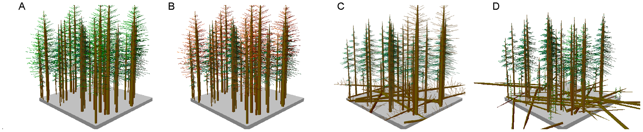
- Idealized diagram of MPB attack stages: A: Immediate after MPB attack, B: early-stage of MPB attack, C: mid-stage of MPB attack, and D: late-stage of MPB attack [4]
![]() Fuel load is expected to be an important factor in predicting fire spreading potential. , The likelihood of fire ignition and the spreading of fires varies depending on fuel loads and types. Unfortunately, such datasets are not accessible to the public. Instead, one assumption made here is that different stages of mountain pine beetle infestation (3, 5, 9 years prior to fire) can be considered as an approximation of fuel loads as mountain pine beetle attacks greatly change the forest structure and fuel complex (Bourbonnais et al. 2014).
Fuel load is expected to be an important factor in predicting fire spreading potential. , The likelihood of fire ignition and the spreading of fires varies depending on fuel loads and types. Unfortunately, such datasets are not accessible to the public. Instead, one assumption made here is that different stages of mountain pine beetle infestation (3, 5, 9 years prior to fire) can be considered as an approximation of fuel loads as mountain pine beetle attacks greatly change the forest structure and fuel complex (Bourbonnais et al. 2014).
2. Effects of Fire Management
Another improvement needed for the two models is to include fire suppression data. It is assumed that the spread of fires at a specific location is only controlled by mountain pine beetle and environmental factors. This assumption can be violated if some fire are suppressed by fire management. For example, a fire started at a location with higher fire spreading potential (steep slope, dry environment etc.) but put out by firefighters before it has the chance to spread. This creates variation in our fire data that cannot be explained by environmental factors such as topography and climatic conditions.
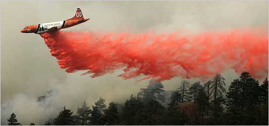
Aerial firefighting [2]

Ontario Fire crews put out smoldering embers [3]
![]() Unfortunately, we were not able to obtain fire suppression data. We have been told by Dr. Valerie LeMay in UBC Forestry that such data exists but it is not available to the public and it is not in a format that can be quickly processed in 2 month (Dr. LeMay has a post-doc fellow working on this dataset but it is not ready to be used). It is expected that local fire chiefs have higher incentives to protect infrastructures like roads and road-adjacent areas that are more accessible to fire management crew, it is reasonable to assume that fires started near roads have a higher chance to be put out in the early stages. In order to limit at least some of the human fire suppression effects, we created a 1 km buffer area around roads in BC and excluded any road-adjacent fires in the data set. The effectiveness of this procedure is not known.
Unfortunately, we were not able to obtain fire suppression data. We have been told by Dr. Valerie LeMay in UBC Forestry that such data exists but it is not available to the public and it is not in a format that can be quickly processed in 2 month (Dr. LeMay has a post-doc fellow working on this dataset but it is not ready to be used). It is expected that local fire chiefs have higher incentives to protect infrastructures like roads and road-adjacent areas that are more accessible to fire management crew, it is reasonable to assume that fires started near roads have a higher chance to be put out in the early stages. In order to limit at least some of the human fire suppression effects, we created a 1 km buffer area around roads in BC and excluded any road-adjacent fires in the data set. The effectiveness of this procedure is not known.
3. Limited scale of research and available data
![]() Both models are developed based on data collected over a short period that is insufficient to fully understand the interaction among fire regime, climate and mountain pine beetle outbreaks (Ali et al. 2012). Not all stands in B.C. affected by mountain pine beetles are recorded, especially at the epidemic level (Bourbonnais et al. 2014). Current available mountain pine beetle infestation data is a mixture of historic records and estimation based on those records (V. Lemay, personal communication, November 26, 2014). This creates uncertainty and reduces the precision of model prediction.
Both models are developed based on data collected over a short period that is insufficient to fully understand the interaction among fire regime, climate and mountain pine beetle outbreaks (Ali et al. 2012). Not all stands in B.C. affected by mountain pine beetles are recorded, especially at the epidemic level (Bourbonnais et al. 2014). Current available mountain pine beetle infestation data is a mixture of historic records and estimation based on those records (V. Lemay, personal communication, November 26, 2014). This creates uncertainty and reduces the precision of model prediction.
Conclusion
![]() The goal of this project is to identify variables that are influential in estimating fire spreading potential and project areas with a higher risk of fast-spreading fires in BC. By integrating weather, topography and mountain pine beetle infestation into a MLR model (Model 1), we have found a hierarchy of variables based on their contributions to fire spreading potential estimation. Minimum and average temperatures in the spring are the dominant factors in the model, followed by precipitation in the summer and slope. Mountain pine beetle infestation is the least influential variables in predicting fire spreading potential. The second model (Model 2) only includes environmental factors. Without including mountain pine beetle infestation, Model 2 is able to explain 55.7% of the variation (only 5% less than Model 1 with two extra variables). However, Model 2 violates normality assumption.
The goal of this project is to identify variables that are influential in estimating fire spreading potential and project areas with a higher risk of fast-spreading fires in BC. By integrating weather, topography and mountain pine beetle infestation into a MLR model (Model 1), we have found a hierarchy of variables based on their contributions to fire spreading potential estimation. Minimum and average temperatures in the spring are the dominant factors in the model, followed by precipitation in the summer and slope. Mountain pine beetle infestation is the least influential variables in predicting fire spreading potential. The second model (Model 2) only includes environmental factors. Without including mountain pine beetle infestation, Model 2 is able to explain 55.7% of the variation (only 5% less than Model 1 with two extra variables). However, Model 2 violates normality assumption.
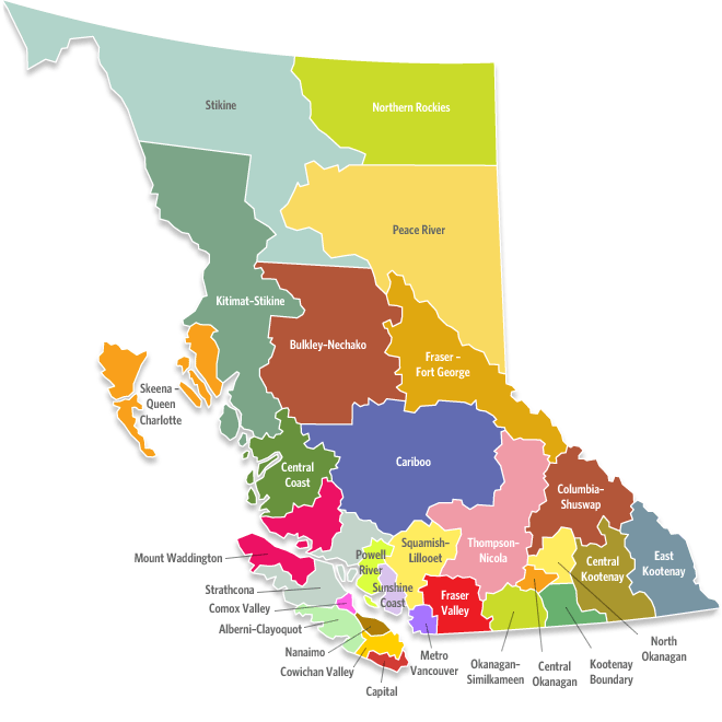
Regional District of BC [5]
The two models were able to explain 56~60% of the variation in fire size (See Result section) The Cariboo, Columbia-Shuswap, East Kootenay, Northern Rockies, and Stikine regions are identified as high fire spreading potential regions by both Model 1 (with mountain pine beetle) and Model 2 (without mountain pine beetle). The coastal areas are generally lower in fire spreading potential.
Acknowledgement
Here we want to thank Dr. Brian Klinkenberg & Joel Trubilowicz for instructing the GEOB370 advance GIS course and providing useful guidance & suggestions throughout this project. We also want to acknowledge the tremendous amount of help we received from Joe Yu (PhD candidate in Forest Hydrology), Adam Polink (PhD candidate in Silviculture), Dr. Val LeMay (Professor in UBC Forestry), and Nick Barry (UBC Forestry). Thank you!
[1] The Government of Alberta: http://wildfire.alberta.ca/wildfire-prevention-enforce ment/images/GFX-ESRDx-WildfireBehaviourTriangle.jpg
[2] The New York Times: http://thelede.blogs.nytimes.com/2007/10/26/was-help-from-the-air-too-slow-to-arrive/
[3] The Government of Ontario: http://news.ontario.ca/mnr/en/2011/05/ontarioprovi des-forest-fire-fighting-assistance.html
[4] Schoennagel, T., Veblen, T.T., Negron, J.F., and Smith, J.M.: http://www.plosone.o rg/article/info%3Adoi/10.1371/journal.pone.0030002
[5] Swtich The Stats: http://www.switchthestat.ca/eng/participants-bc.php
[5] Swtich The Stats: http://www.switchthestat.ca/eng/participants-bc.php
[6] Tarbucks and Lutgens: Earth Science. c. 2000: http://www.lsrhs.net/departments/science/faculty/brandesa/atmosphere.html
This was excellent! Is there a paper associated to this blog and/or a Github repo storing the code or the dataset? Thanks!