In this lab I determined the areas of Metro Vancouver that would be most severely impacted by flooding in the event of a storm surge by mapping out the elevation levels of all of Metro Vancouver using data from Open data Canada, as shown in Figure 1. It was previously determined that areas with both an elevation of less than 5 meters and that were within 1 kilometer of shorelines were considered at risk of flooding in the event of a storm surge; this can be seen in Figure 2. Roadways, particularly highways, expressways, and major roads are a highly important method of transportation, both into and out of Metro Vancouver. As such, Figure 3 analyzes and maps out these major roadways that fall within the flood risk zone (as shown in Figure 2). In Figure 4, all roadways, Vancouver schools, and the proposed new location of St. Paul’s Hospital in False Creek were mapped out. Higher resolution data from the City of Vancouver data base was used for this map, allowing a more detailed analysis of this area. This map indicates the elevation levels of False Creek, a highly populated area with relatively low elevation levels. Overall, I found that there is quite a bit of land that is at risk of flooding in the event of a storm surge, however, through a more detailed analysis of False Creek I found that the large majority of high-density buildings were not located within the risk zone.
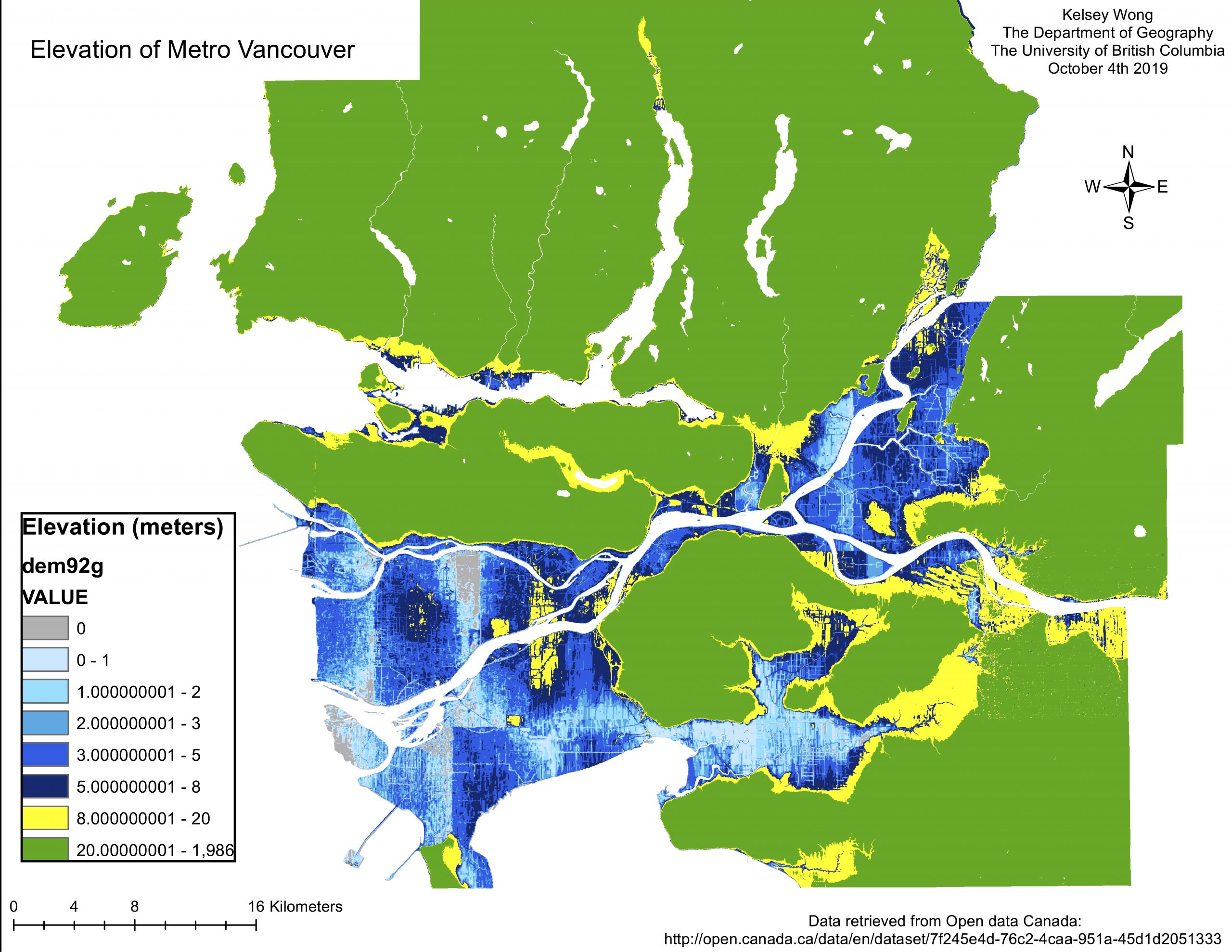
Figure 1. This map shows the varying elevation levels of Metro Vancouver.
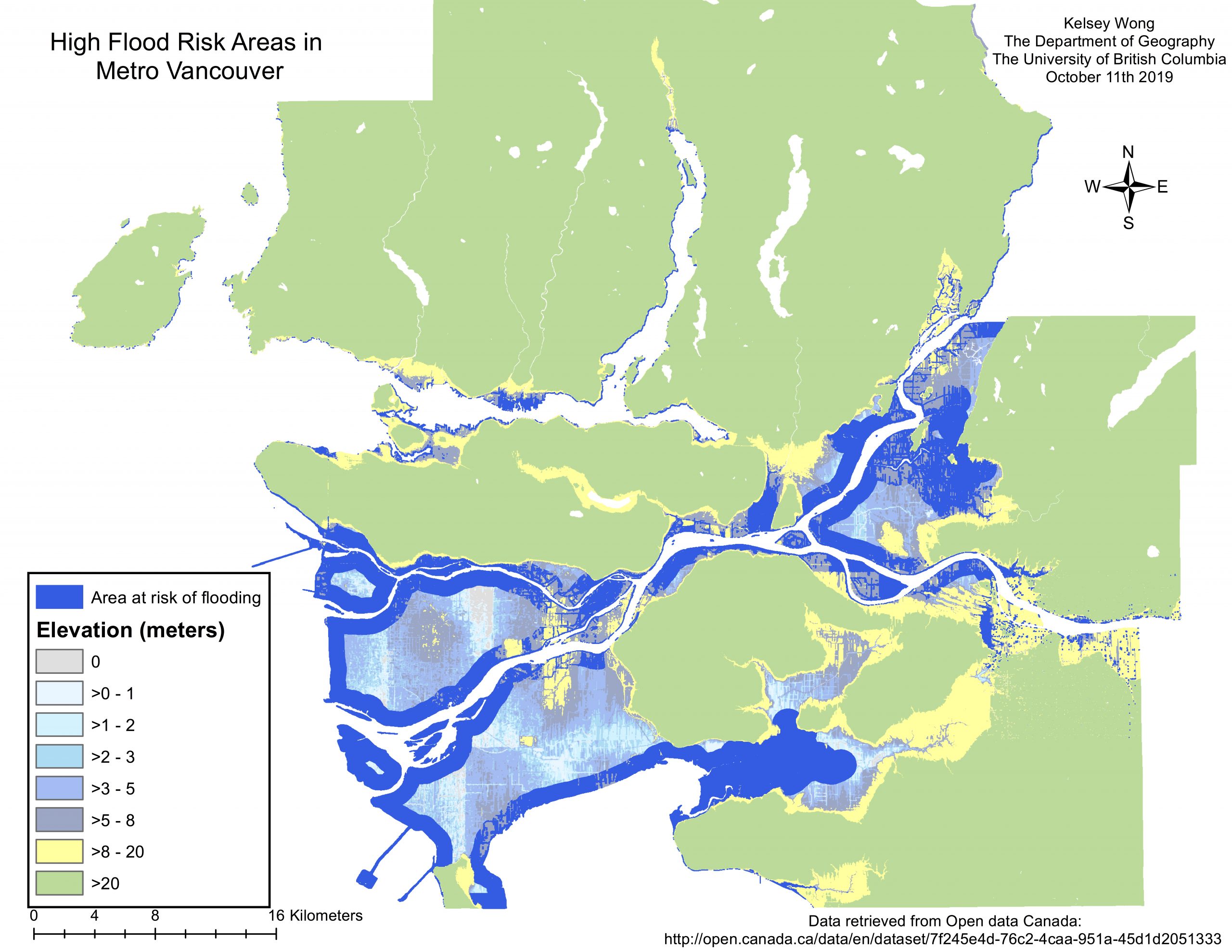
Figure 2. This map shows the elevation of Metro Vancouver, as well as the areas that are potentially at risk of flooding. Areas at risk of flooding were considered to be areas that were lower than 5 meters in elevation that were within 1 kilometer of shoreline.
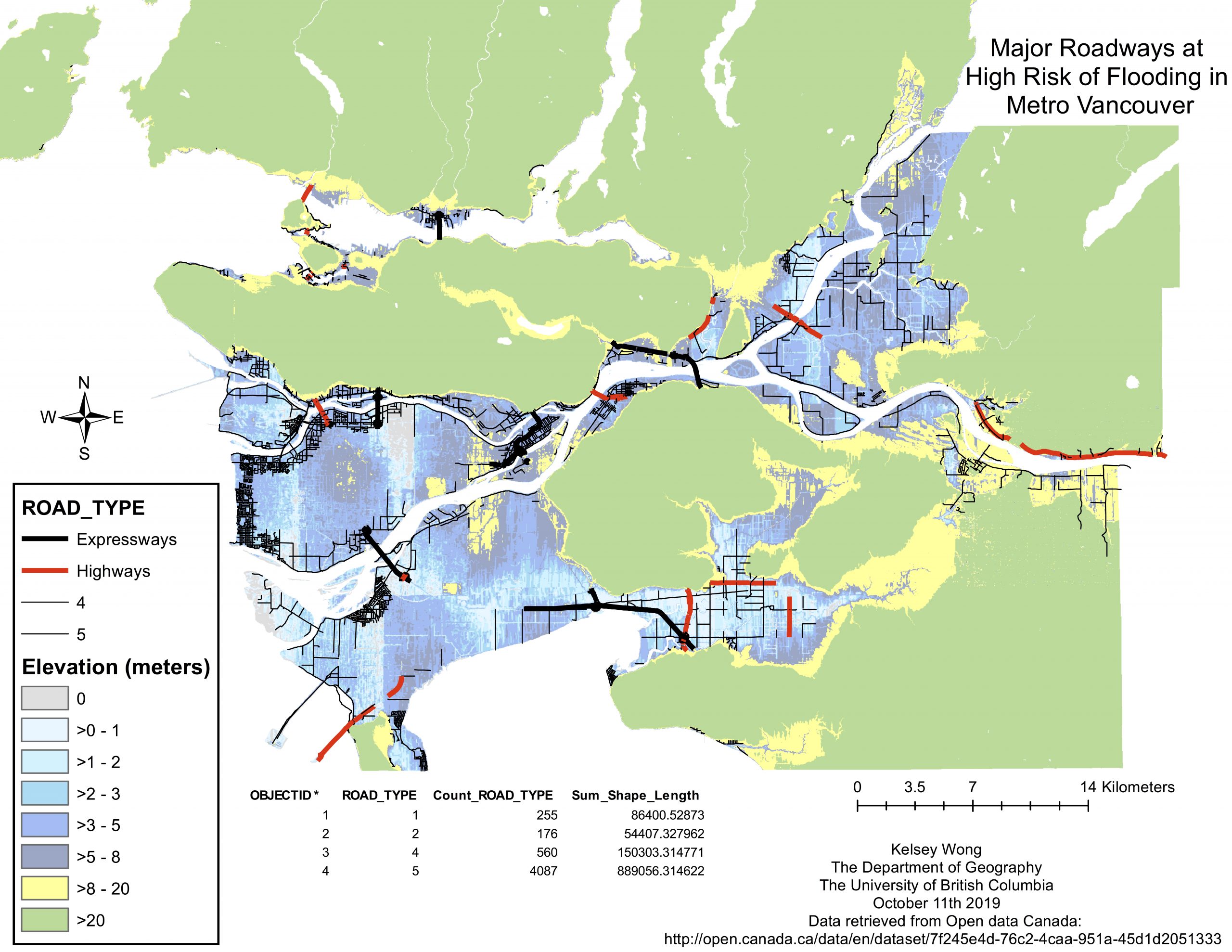
Figure 3. This map shows the elevation of Metro Vancouver, as well as all major roadways (expressways, primary highways, secondary highways, and major roads) that are located within the flood risk zone (areas that are less than 5 meters in elevation and are located within 1 kilometer of shoreline).
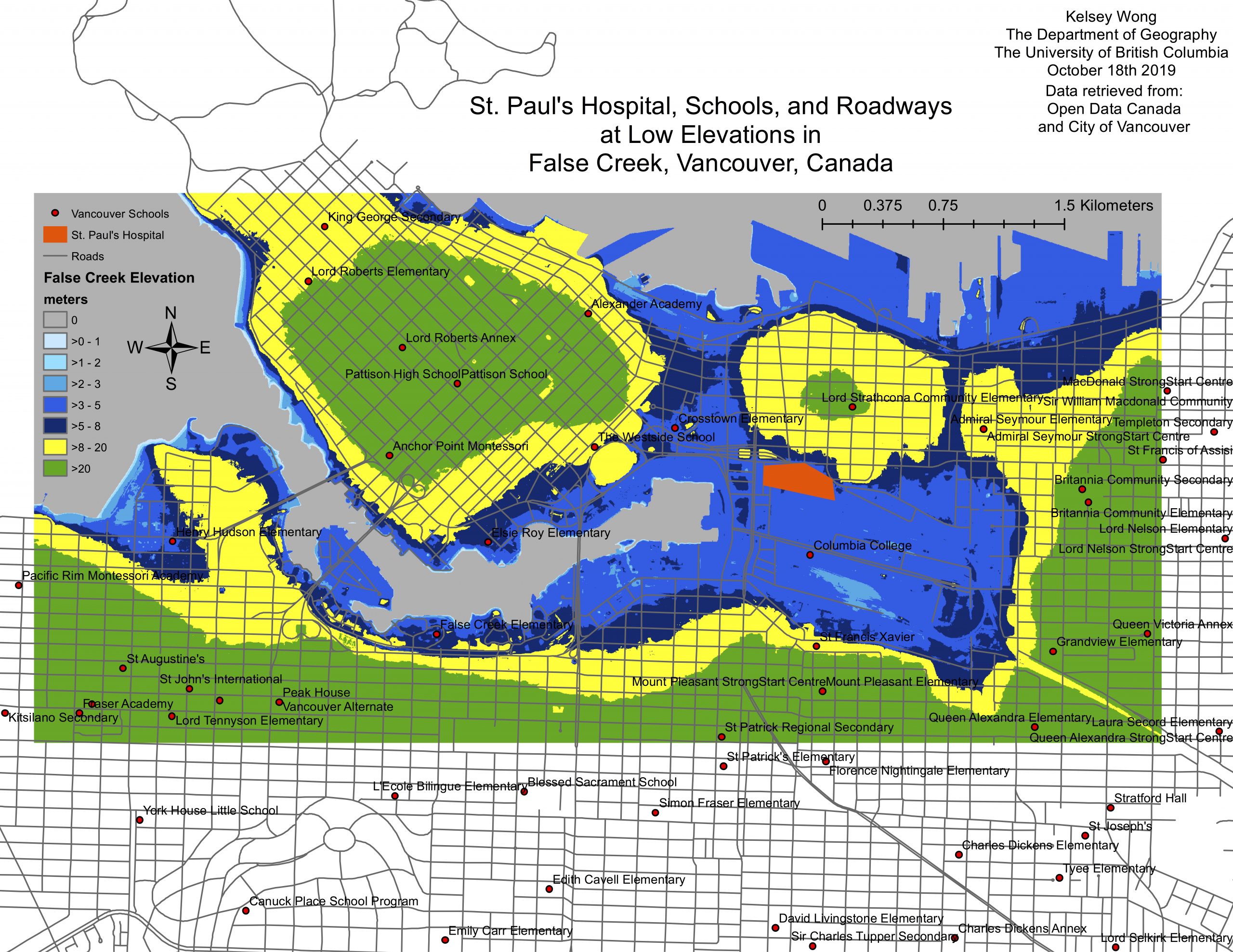
Figure 4. This map shows the elevation of False Creek, a neighbourhood within Metro Vancouver, as well as all local schools, the proposed location of the new St. Paul’s Hospital, and all major roads.