Final Project: Implementing a New Fire Hall in the City of Chilliwack
My Experience:
In our project, we are UBC Arts Co op Students on a work term with the Fire Department and the City of Chilliwack. Currently there is a lack of fire halls in parts of the region and a slower response time to those who live in the suburbs of the city. We are looking to input a new fire hall to increase fire safety in the region and improve a faster response time for residents in need of help from 911. Our main goal is to find an appropriate location for the fire hall that will not disrupt previous land use.
I took on a leadership role, ensuring that logistically, we had enough time to compile our data, create a final map and write our report. This meant planning out times outside of our scheduled lab to meet up, and assigning individual roles to group members. We ran into some roadblocks, including a major one which involved us remaking the entire scope of our project and starting over, however, myself, along with my group mates all were able to collaborate really well and put in equal amounts of effort into our project.
I think some of the biggest things I learned in this project was how complicated it is to find the data that you want, especially proprietary data, which is something I underestimated up until this point. It also generally opened my mind about the power that GIS has on making local, corporate, or even state decisions. Lastly, I learned that one of the most important parts of collaboration is ensuring that everything is recorded, similar to metadata. By recording each of our steps, I was able to not fall behind on our groups processes, and this is something that is underestimated with mapmaking.
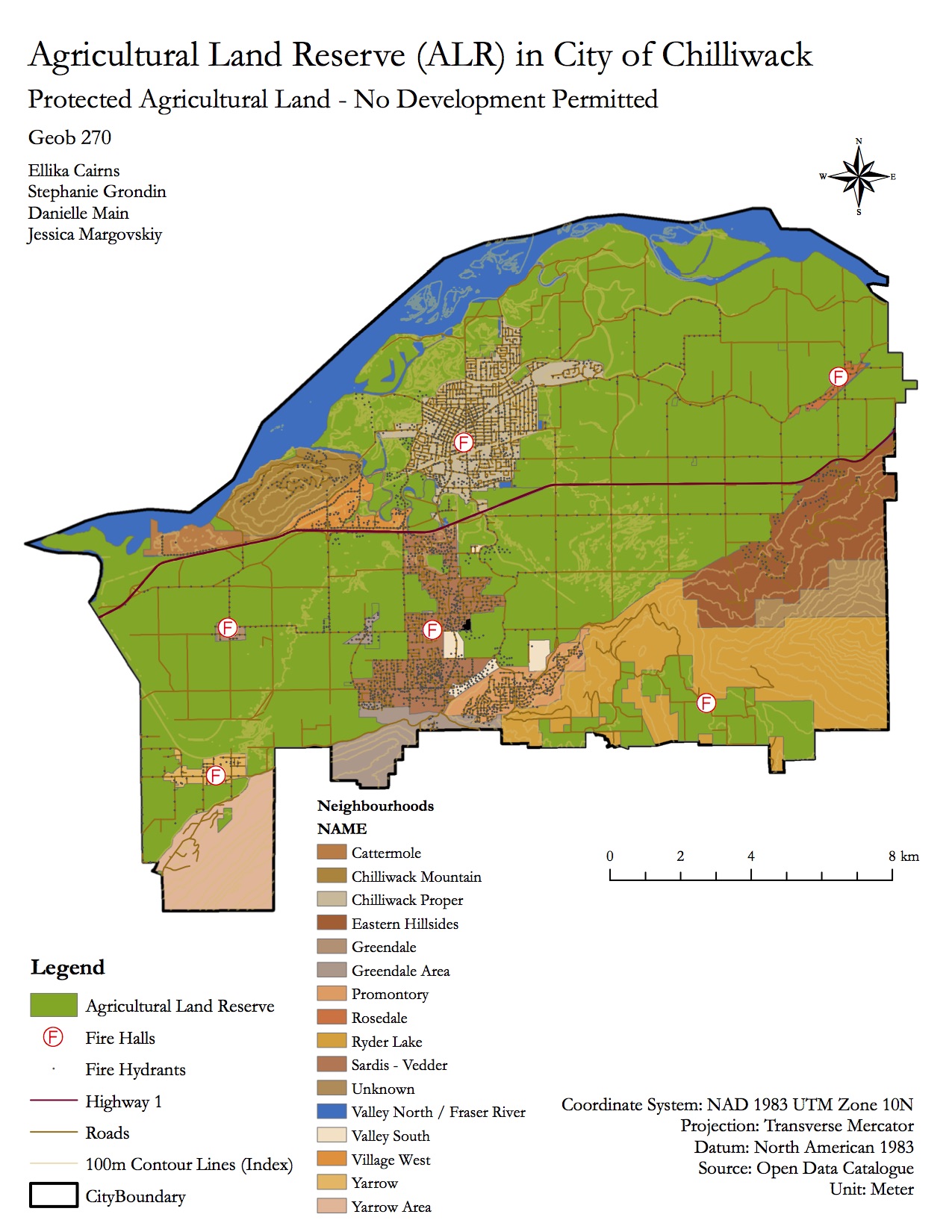
Agricultural Land Reserve (ALR) in Chilliwack
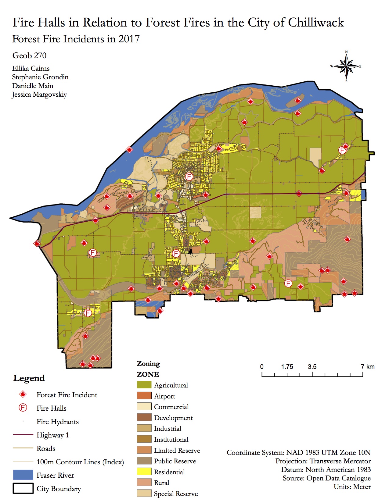
Fire Halls in Relation to Forest Fires in Chilliwack
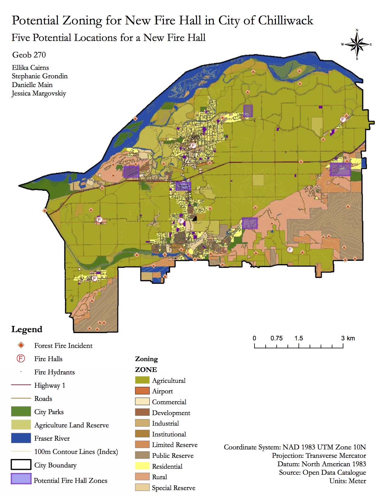
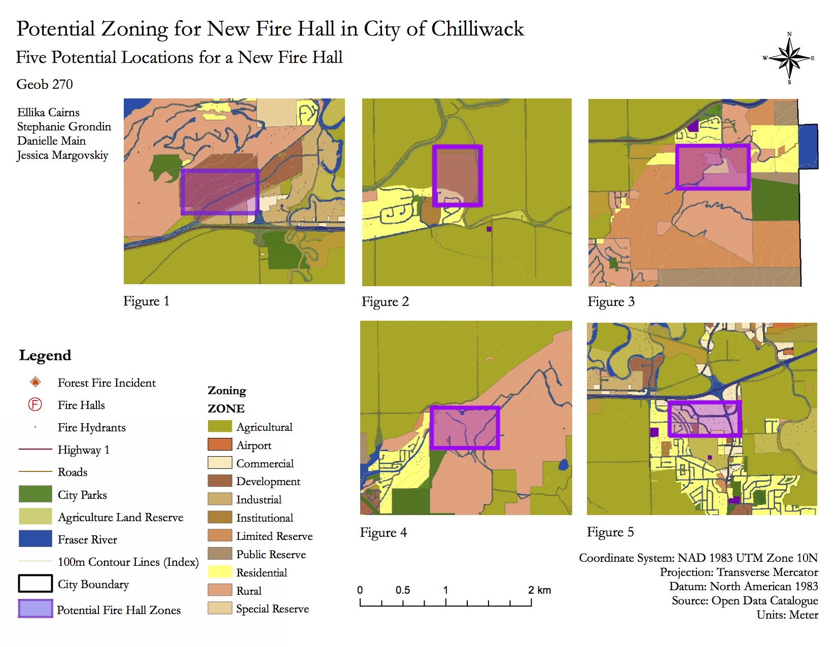
Potential Fire Hall Spot Map – Polygon Detail View