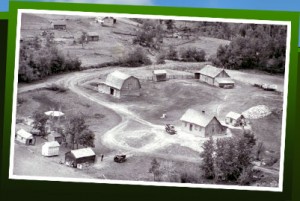
 Aerial photography has been around for a long time ~ indeed there was a time living on the Canadian prairies where aerial photographers took pictures and then sold them to farmers, a sort of self-portrait of their homestead. My grandparents proudly displayed such a photograph in their living room and as a child I found it a fascinating perspective.
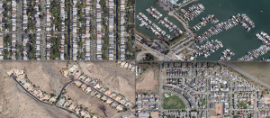
Google Maps provides an interesting resource for using the aerial perspective to examine constructs such as land use and housing patterns. For example, John Hill in this blog post looks at housing patterns, particularly suburban housing patterns that show an evolution from the sterile grids of suburbia characteristic of early suburban development, a pattern Thomas Jefferson laid down in the 18th century. His analysis of housing patterns illustrates an evolution that considers issues of density, community, and aesthetics based on the housing patterns (grids, fairway housing, fly-in homes, canal homes, cul-de-sacs, gated communities, tract mansions (what some folks call McMansions) and so on) we see in aerial photographs. This analysis clearly illustrates changes over time, concluding with suburban planning that reflects a contemporary interest in being ‘green,’ developments that encourage transit use, walkability, mixed-use spaces, and energy efficient construction.
See also Context and Perspective

 Follow
