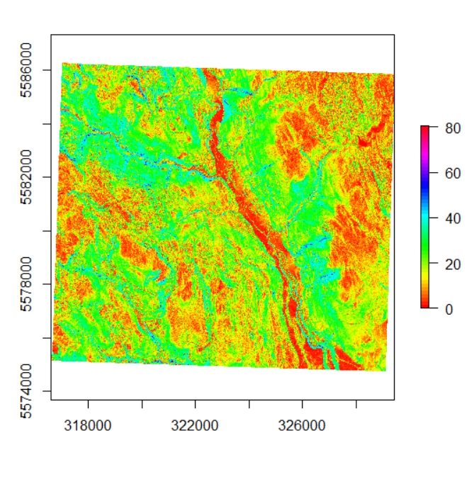
That’s a lot of data… (parameters)
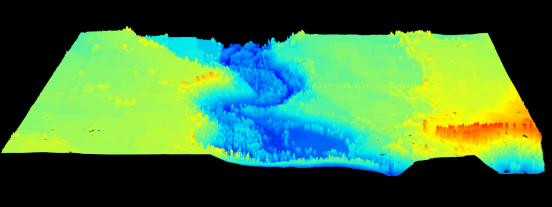
In my last post I briefly mentioned a few broad datasets I will be using: Multispectral data, radar, and LiDAR. I will begin my quest to making a predictive wetland map by digging into the LiDAR data since it will…
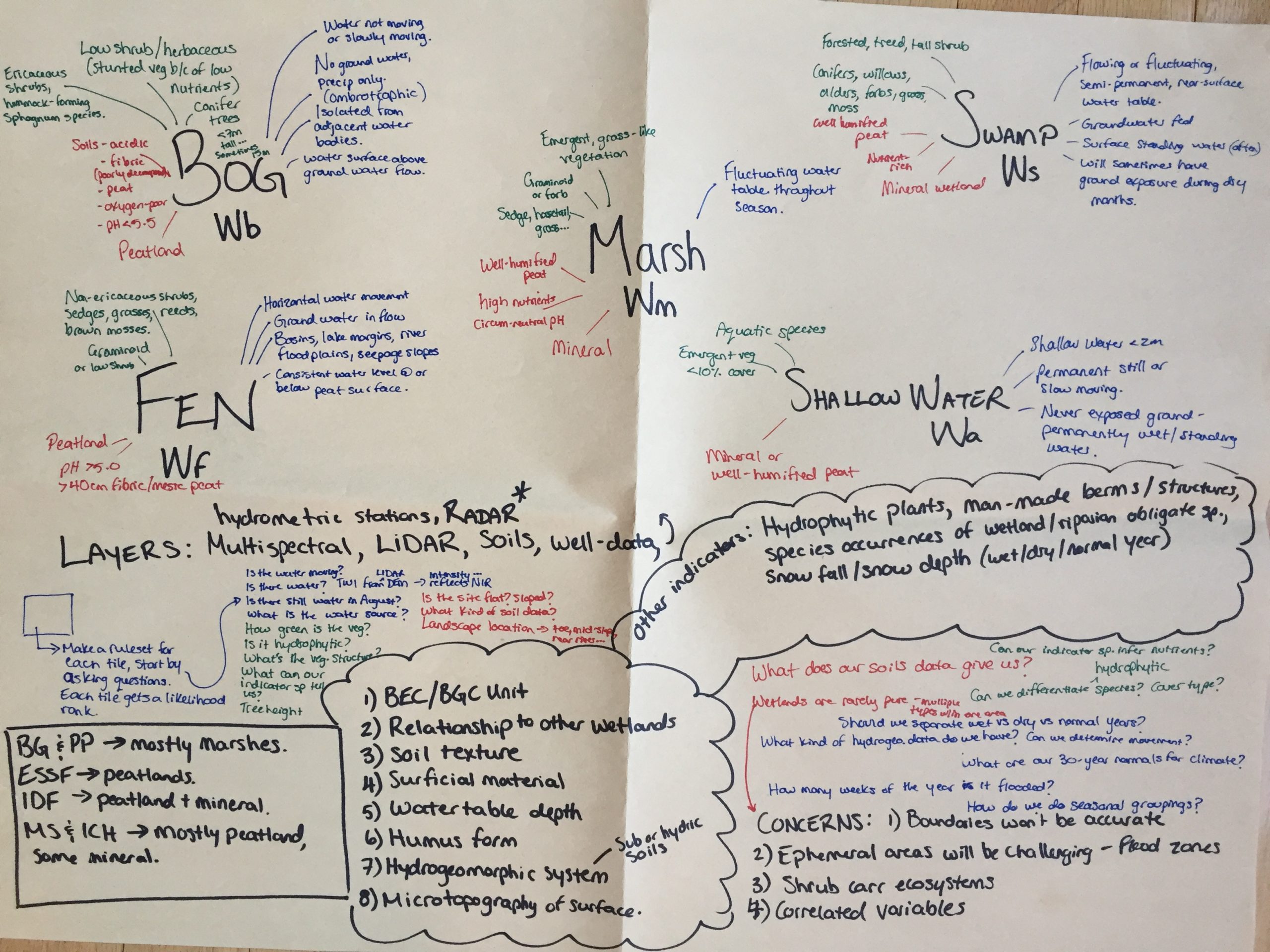
How do you begin to map a wetland?
First of all, what even is a wetland? It seems there is not a universally agreed-upon definition; however, it is generally understood that a wetland is where a terrestrial ecosystem meets an aquatic one. If you think of a wetland…
Poster presentation
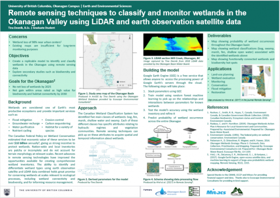
Sadly, the poster symposium scheduled for early April has been cancelled due to COVID-19. I have included a copy of my poster here and hope that one day it will come to life through a printer and I will be…
OBWB Presentation March 12, 2020
I will be presenting my research proposal at the Okanagan Basin Water Board meeting on March 12, 2020. The agenda can be found here: 2020-03-12_Agenda Pkg and my presentation can be found here: Remote Sensing of Wetlands – March 9,…
Welcome!
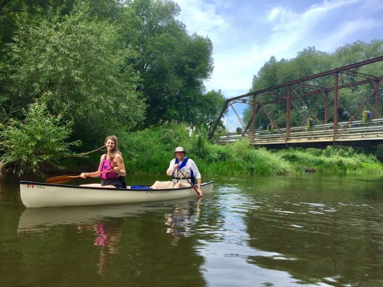
I am very excited to have this platform to share my research. I hope to build an archive of fun and exciting facts and photos on my current research and interest areas. This photo was taken on the Beaver River…