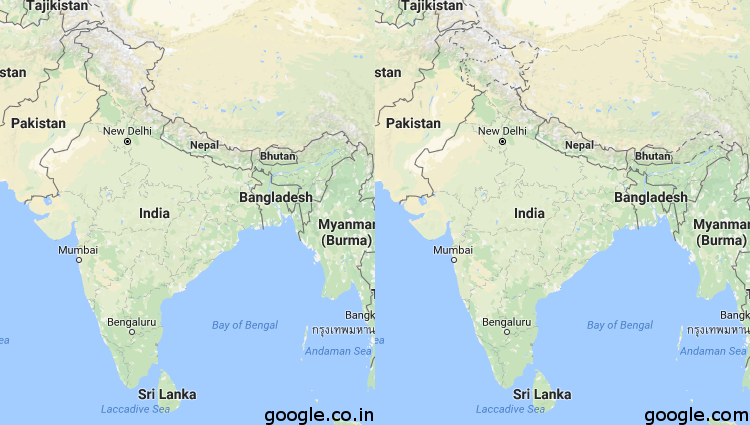
These two maps reflect the Indian Northern Border as depicted on Google.com (the American reflection of Google Maps) and Google.co.in (the Indian reflection of Google Maps). This ambiguity is hugely important and affects huge amounts of people. What are the implications when we take maps the Google maps to be objective and true?
Sam
https://i.redditmedia.com/Y9_kGExGF1M8Rjx_KdiRQgG9aeOO8dPuUoGaR5YiSfg.png?w=750&s=7503e960fa5b2fb16d751900801cc6e2
 Follow