My analysis up to this point has used spatial variation in climate normals at 1600-m grid points. Time series analysis on the full 1600-m grid is impractical because each point would have a set of climate observations for each year over the period of the time series. This creates a lot of data, and a lot of redundant variation. An alternate approach is to use the BEC variants to define the ecologically appropriate scale of climate differentiation, and then use the climatic centroid of each BEC variant for time series analysis. The easiest way to do this is to find the 1600-m grid point whose climatic attributes are closest to the actual climatic centroid of the variant. I call this spatial location the climatic “centroid surrogate” for the BEC variant.
Mahalanobis distance vs Standardized Euclidian Distance
To find the “closest” grid point to the climatic centroid, one first has to select a distance measure. Simple Euclidian distance is not appropriate since climate elements have different units (e.g. oC vs. mm) and variables with large variance will dominate the distance measurement. The most straightforward approach is to standardize all the variables by subtracting the mean from each observation and dividing by the standard deviation. This converts all variables to units of standard deviation and a mean of zero, and facilitates a balanced measure of Euclidean distance. Another approach is to use Mahalanobis distance which also accounts for the correlation between variables. however, in practice I found mahalanobis distance to be difficult to implement in climate space due to the high collinearity between variables. For the purpose of finding a climatic centroid surrogate, standardized Euclidian distance and mahalanobis distance are likely to be equivalent. For this reason, I used standardized Euclidian distance.
Visual validation in climate space and map space
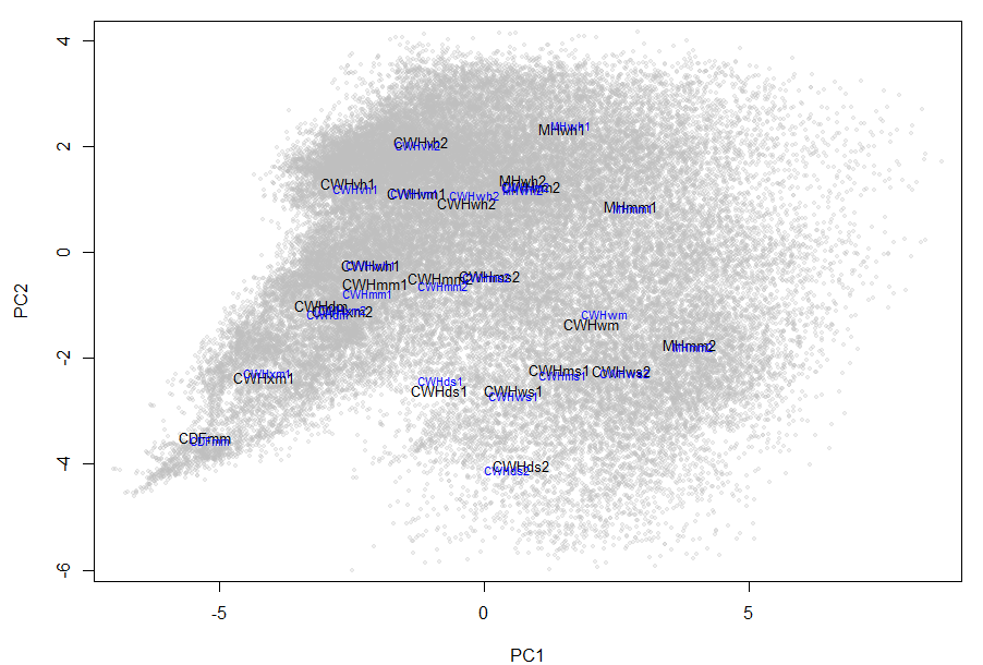
Figure 1: PCA climate space for the BC coast. BEC variants are labeled at their 2D pseudocentroids in black and full-dimensional (12D) centroid surrogates in blue. The close proximity of the labels provides visual validation that the centroid surrogate is at the climatic centroid.
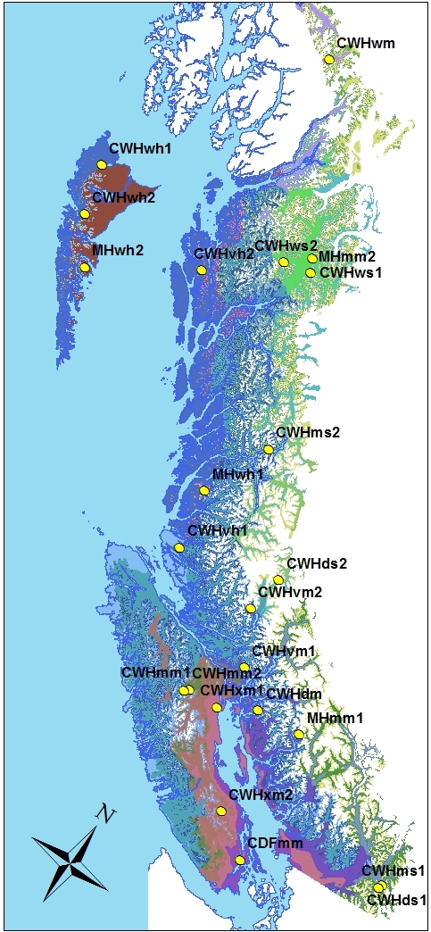
Figure 2: locations of the climatic centroid surrogate for each coastal BEC variant.
The centroid surrogates are located very close to the BEC variant pseudocentroids of a two-dimensional PCA climate space representing 91% of the variance in the data (Figure 1). This strongly suggests that the calculation was correct and the centroid surrogate is the grid point with minimum distance to the climatic centroid. A map of the centroid surrogates (Figure 2) indicates that they are generally located in representative locations. However, there are several idiosyncrasies:
- The centroid surrogate for the MHmm2 is located near Terrace in the northern portion of the variant’s geographic range, which extends all the way down to the U.S. border. This is problematic, since historical climate variability is likely to be different in the northern and southern areas of the MHmm2. Climate change forecasts are certainly very different for these two regions. This result suggests that more than one centroid surrogate may be required for variants with large geographic ranges (e.g. CWHvm1, vm2, MHmm1).
- The centroid surrogate for the CWHwh1 is located in the mapped range of the CWHvh2. This is simply the result of using the BEC7 variant map for classification of the 1600-m grid points and the BEC8 map for mapping. This error will be corrected.
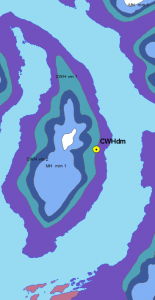
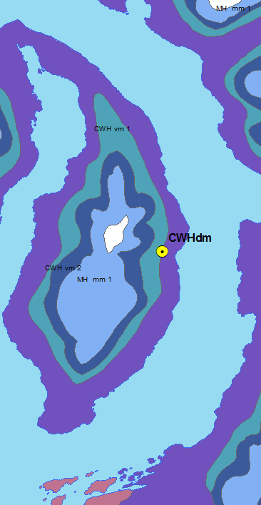
Figure 3: close-up of the centroid surrogate for the CWHdm. It is located on the upper elevation limit of the CWHdm on East Redonda Island. While this location may represent the average climate of the CWHdm, it is not located in a core area of the variant. This result suggests the centroid surrogate selection method needs refinement.
- The centroid surrogate for the CWHdm is located at the upper elevation limit of this variant’s occurrence on East Redonda Island (Figure 3). Intuitively, centroid surrogates should be located at approximately the geographic core of the BEC variant, rather than in transition zones. I attempted to prevent this problem by restricting centroid surrogate selection to grid points that are within one-half of a standard deviation of the mean elevation of each BEC variant. However, the same grid point was selected for the CWHdm, and resulted in poorer centroid surrogates for for submontane variants. As a result, the original solution shown in Figure 2 will be used for now. the potential for this issue should be kept in mind for other regions of the province as well.
Conclusion
The selection of centroid surrogates highlighted the important point that climatic zones that are considered now to represent relatively uniform climatic conditions may not have divergent historical and future variability. While centroid surrogates are useful for examining climatic differentiation in current conditions, they are not sufficient by themselves for characterizing climate change in BEC variants. Geographically extensive BEC variants likely need to have several centroid surrogates representing different regions of their distribution.