Slope stability is highly affected by change in relief or slope gradient caused by anthropogenic activities such as artificial machinery (Alexander. D, 1992). Indeed, the subtraction of lateral or underlying support of the slope may cause instability. Roads and rivers are important factors in the removal of those type of support (Alexander. D, 1992).
In our analysis, we assumed that areas where roads and rivers at a distance of 50m or less from unstable areas. We buffered roads and rivers to a distance of 50m. We then merged these over 40 000 polygons (time consuming) and assigned it a value of one. Using the Vancouver Island polygon, assigned a value of 0, we clipped the roads and rivers and then converted both into a combined raster. The rasters of both the roads and rivers were used in both the deterministic and the general MCE.
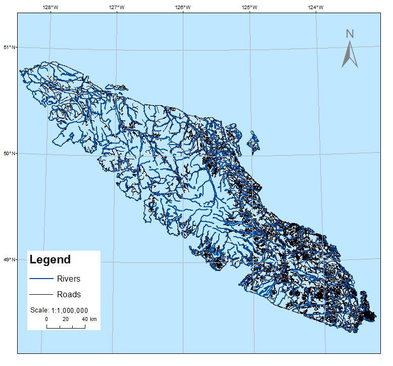
The image above illustrates the distribution of roads and rivers on Vancouver Island. The roads and rivers used in our deterministic and general MCE 50m or less close from potentially unstable areas.