We calculated the slope directly from Vancouver Island DEM using Spatial Analyst Tools, Surface, Slope operation. We then conducted a fuzzy membership analysis with a linear membership type (obtained normalized data from 0 to 1).
In order to facilitate visualization of the landform, the slope factor were divide into 5 categories. In order to do so, we changed the values in properties: symbologies> under classified> 5 values.
| slope factor | angle | elements | % |
| flat slope | 0–5 | 1104791 | 20.38 |
| rolling terrain | 5–15 | 1721830 | 31.77 |
| mountainous | 15–25 | 1181521 | 21.80 |
| escarpment | 25–45 | 1321238 | 24.38 |
| cliff | 45–74 | 90623 | 1.67 |
| Total | – | 5420003 | 100 |
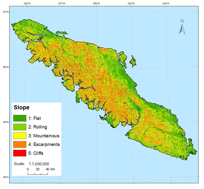
Image above illustrates the landforms. The slope factor has been divide into 5 categories to enhance the visibility.