General MCE
The general MCE shows that an intermediate level of landslide potential dominates (0.2-0.6) across most of Vancouver Island (Figure 1). There is very few areas where there is a high potential (0.6 – 0.85) of landslides on Vancouver Island. The areas of low landslide potential (0.0 – 0.2) also seem relatively small.
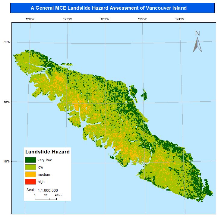
Figure 1: General MCE
Deterministic MCE
The deterministic MCE map of landslide potential is dominated by extremes (Figure 2). Either areas seem to be at high potential of landslides (0.6-0.85) or low potential (0.0 – 0.2). There seems to be fewer areas of intermediate potential compared to the general MCE.
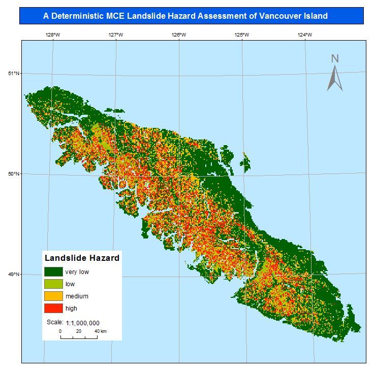
Figure 2: Deterministic MCE
Sensitivity Analysis
The map of the equal weighting MCE sensitivity analysis for the deterministic MCE shows a far lower landslide potential across Vancouver Island (Figure 3). Previous areas that were high or intermediate potential are now designated as intermediate and low potential respectively.
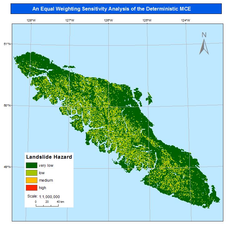
Figure 3: Equal weighting sensitivity analysis