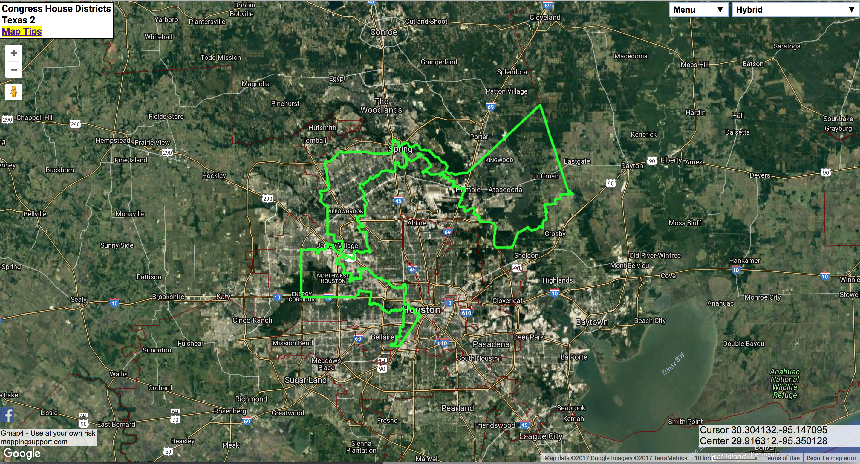
Mapping Support’s 2017 USA Congressional District Map uses GIS with Google to highlight current gerrymandered electoral districts in the US (the interactive map is worth checking out). In some states politicians (as opposed to independent or judiciary groups) redraw voting districts to compose an electoral district that would align in the incumbents’ favor. The map above is a district that dilutes urban (more likely minority and democratic-leaning) voters with suburban and rural voters (more likely white and republican). Not surprisingly, these maps are contentious. The US Supreme Court has ruled earlier this month that districts drawn in republican controlled North Carolina are based on race and therefore unconstitutional. The Court will also hear another important trial in which the justices may finally clearly lay out the limits of gerrymandering. The NYTimes puts it more eloquently in an editorial why politicians shouldn’t make maps.

Save
Save
Save
 Follow