Epiphytic Retrofits – Kristina, Cole, Zach

The West End’s modern apartment complexes overlook and owe their high real estate value to Stanley Park and its picturesque forest just across Lost Lagoon. The park is home to ancient Douglas firs and red cedars, their age marked by ferns, mosses, lichen, and other epiphytes clinging to their bark. Residents of the West End can walk through the park to take in this natural complexity, but the buildings they live in, constructed on land previously occupied by the same wildness, lack any sense of intrigue or ecological value. West End buildings constructed from the 1950s-1970s are especially rigid, with completely flat and unarticulated facades marked by repetitive rectangular windows.

Our intervention, a modular system of facade additions, aims to reintroduce fragments of lost ecological complexity to the West End. Organic forms of fabric stuffed with rough dead plant material invite birds and epiphytic plants to colonize the facades of previously blank buildings. Residents could look out their windows not only to the canopy across the road, but to pieces of tree trunks and suggestions of the forest floor right next to them. Repeatable, low-cost, and implementable on existing structures, these ecological meshes will help break down the binary of nature and urbanism that currently characterizes this neighborhood and many other parts of Vancouver.


Socioecological Boardwalk at Lost Lagoon | Hannah Baird, Thea Johannus, Dalia Schiliro

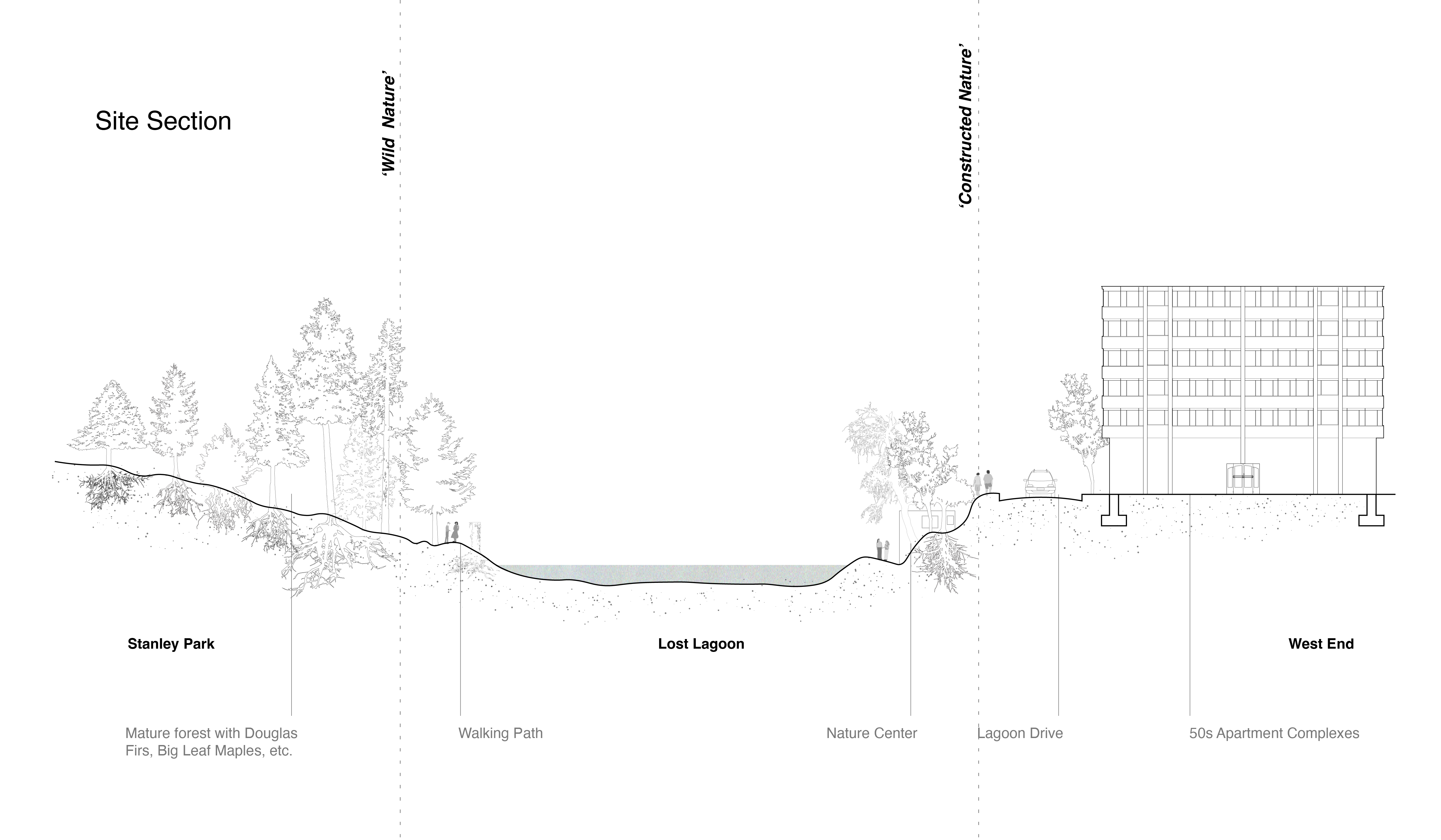
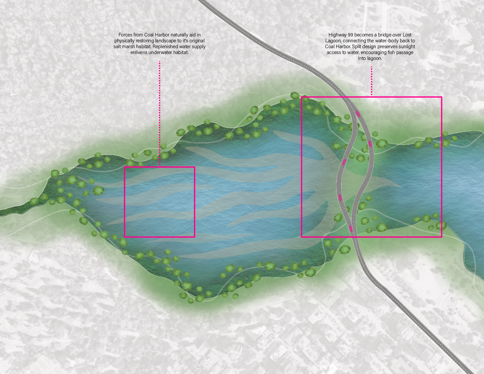
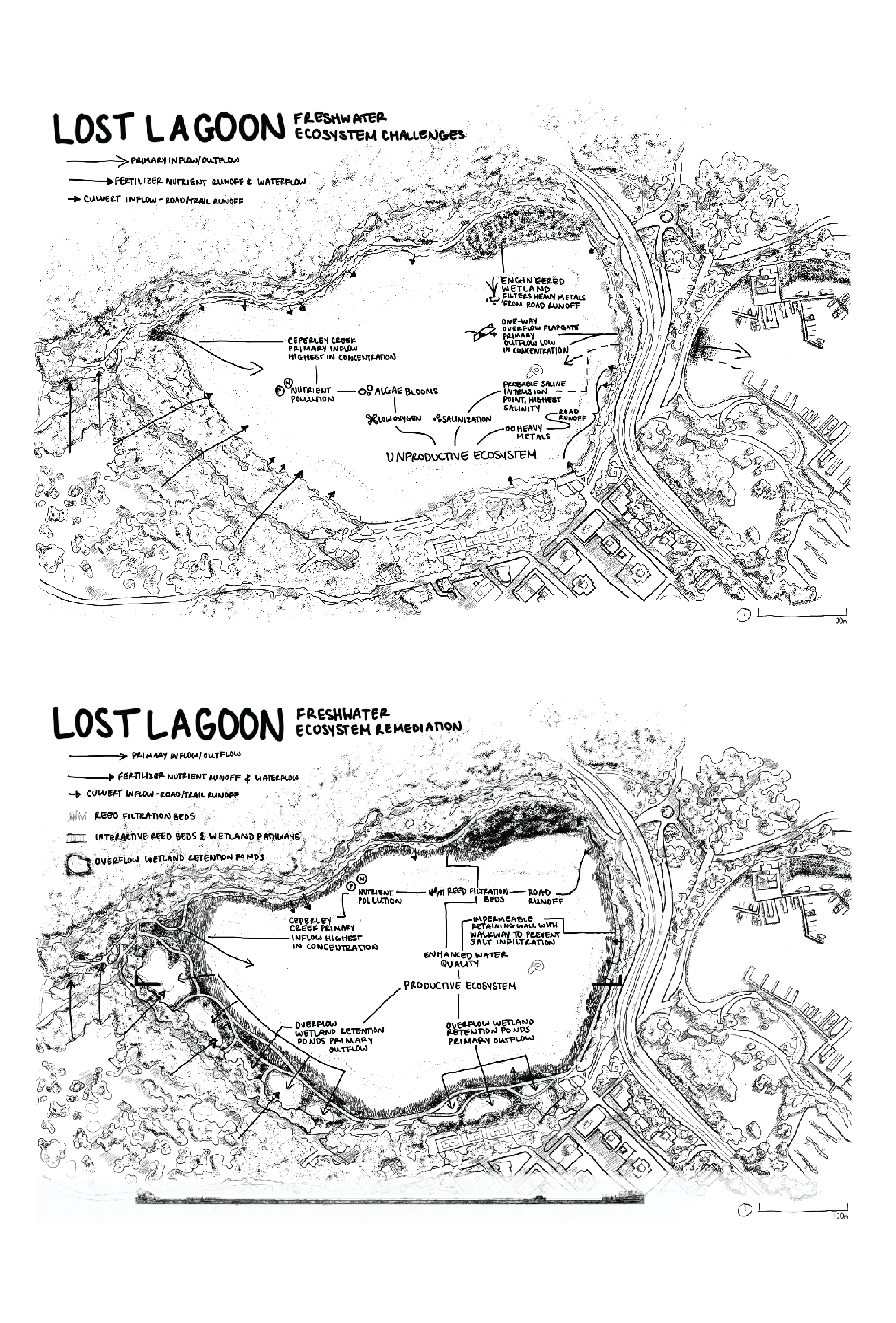
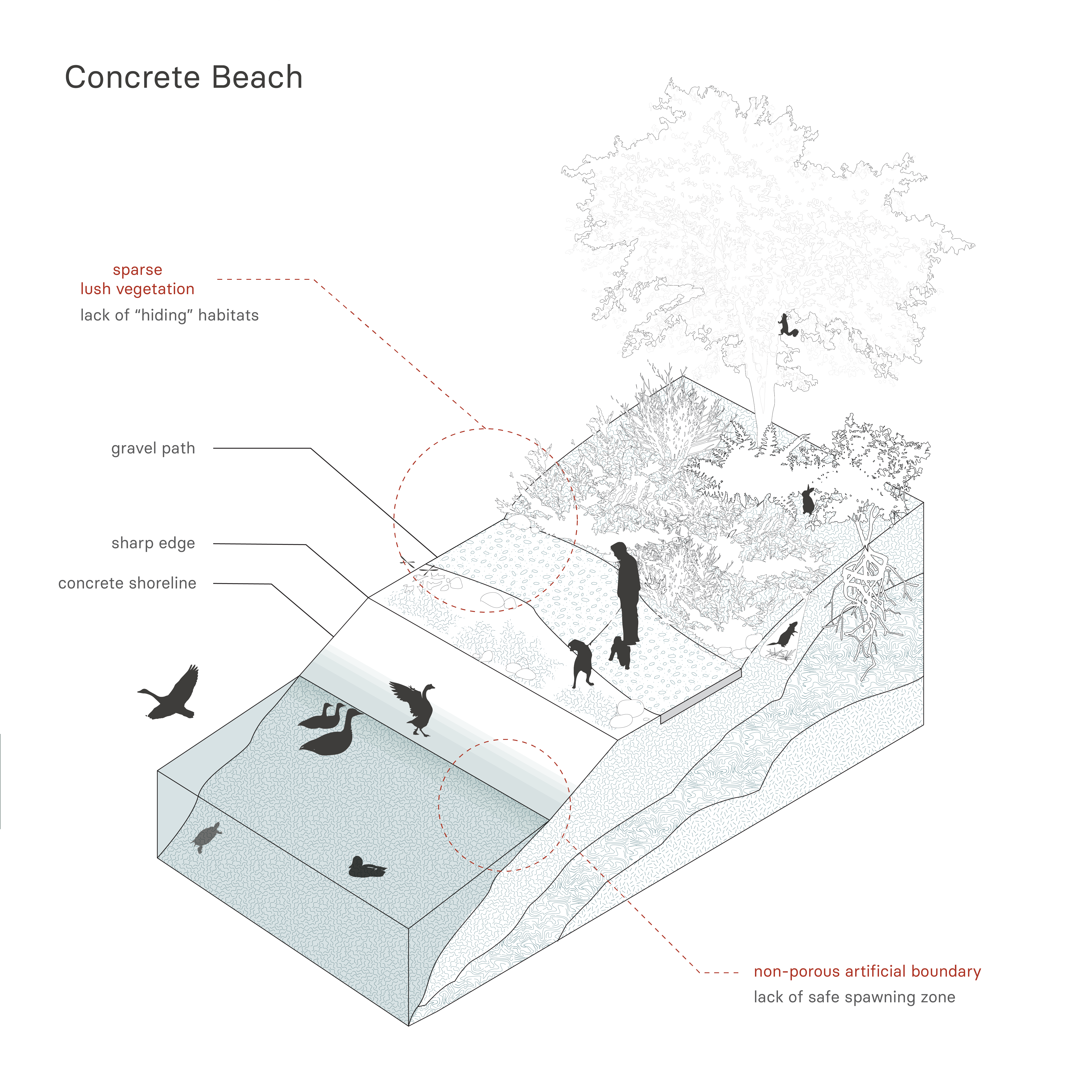
Acknowledging the ecological damage at Lost Lagoon as result of social events, as well as the ecological activism to repair these damages, encourages the need to not only design for ecological repair, but for the repair of ecological and social relationships. In this way, human visitors can acknowledge the histories present at Lost Lagoon and actively move forward simultaneously with sustainable ecological futures.

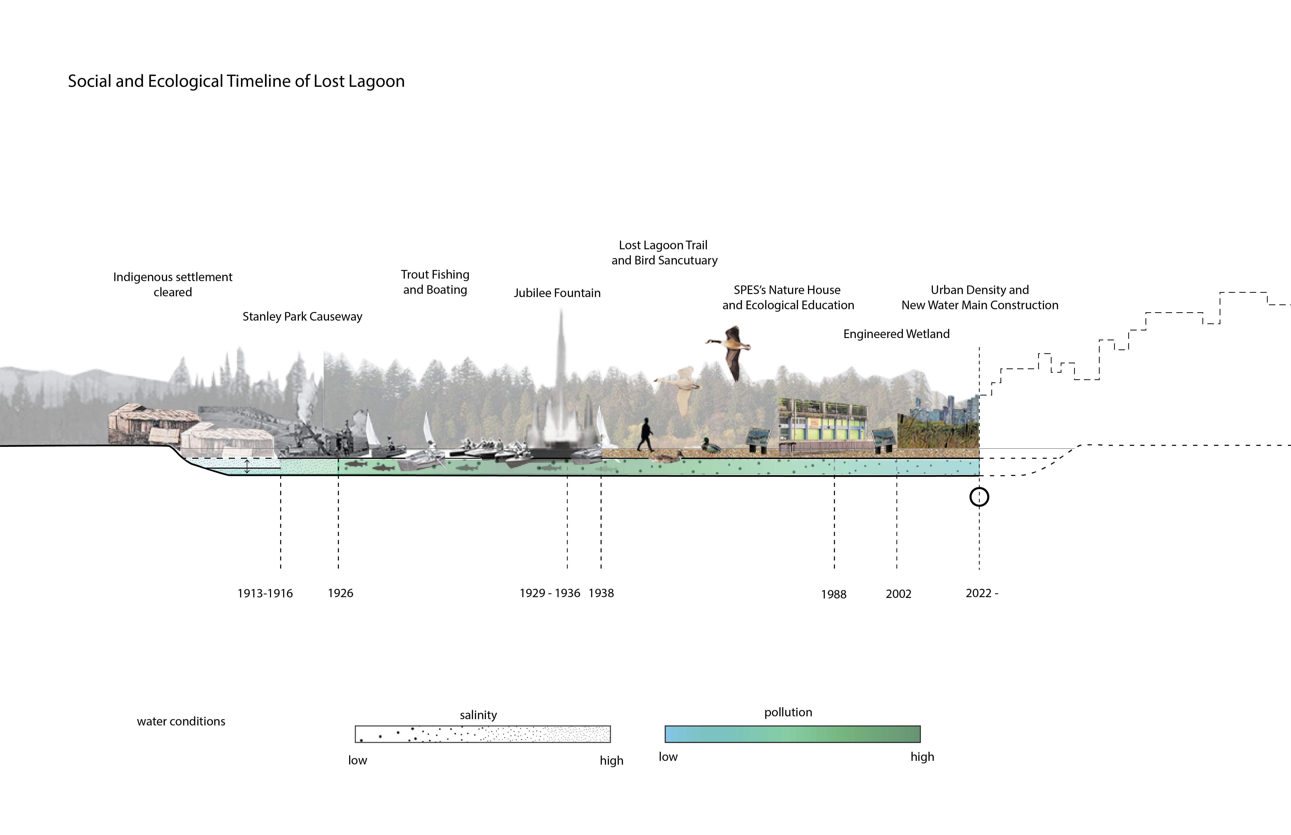
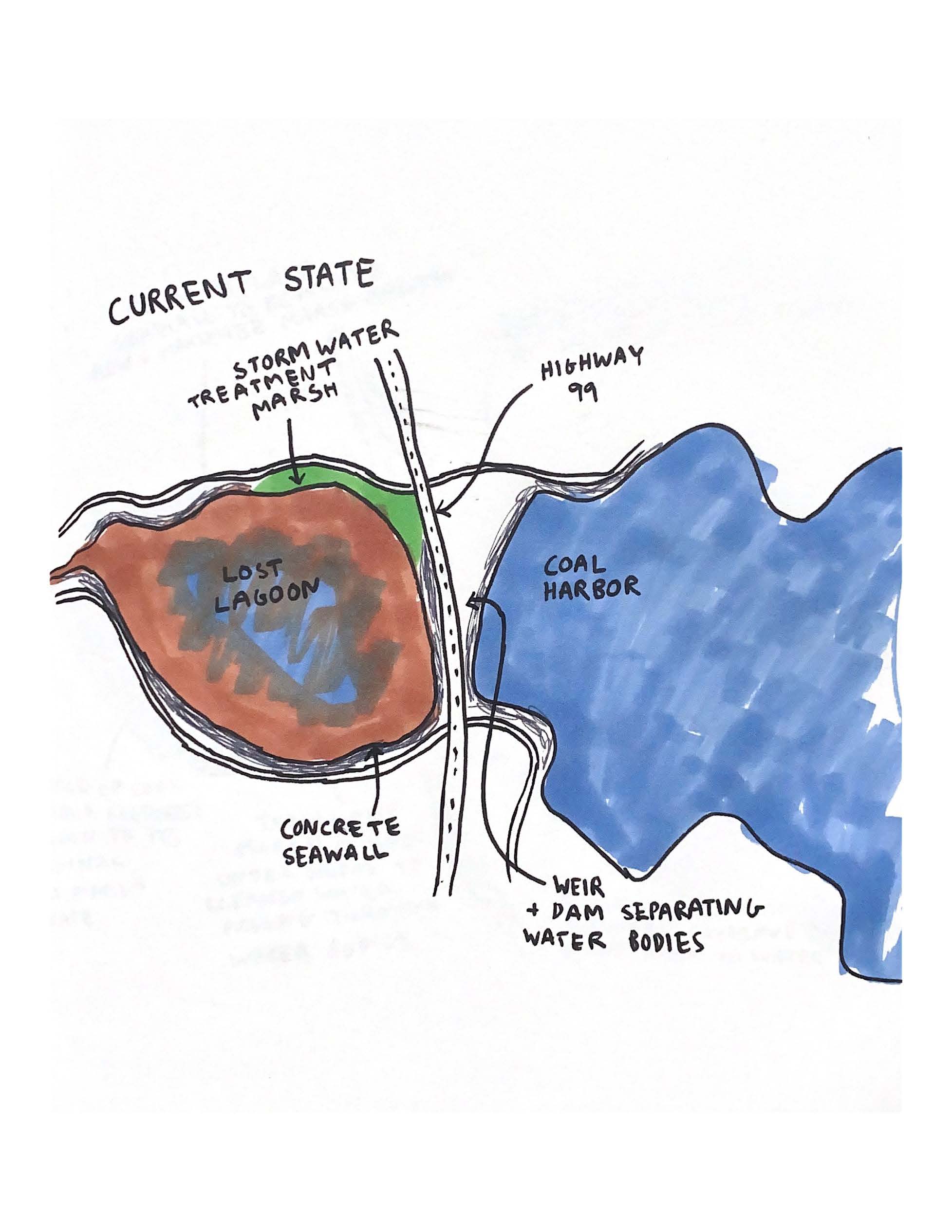
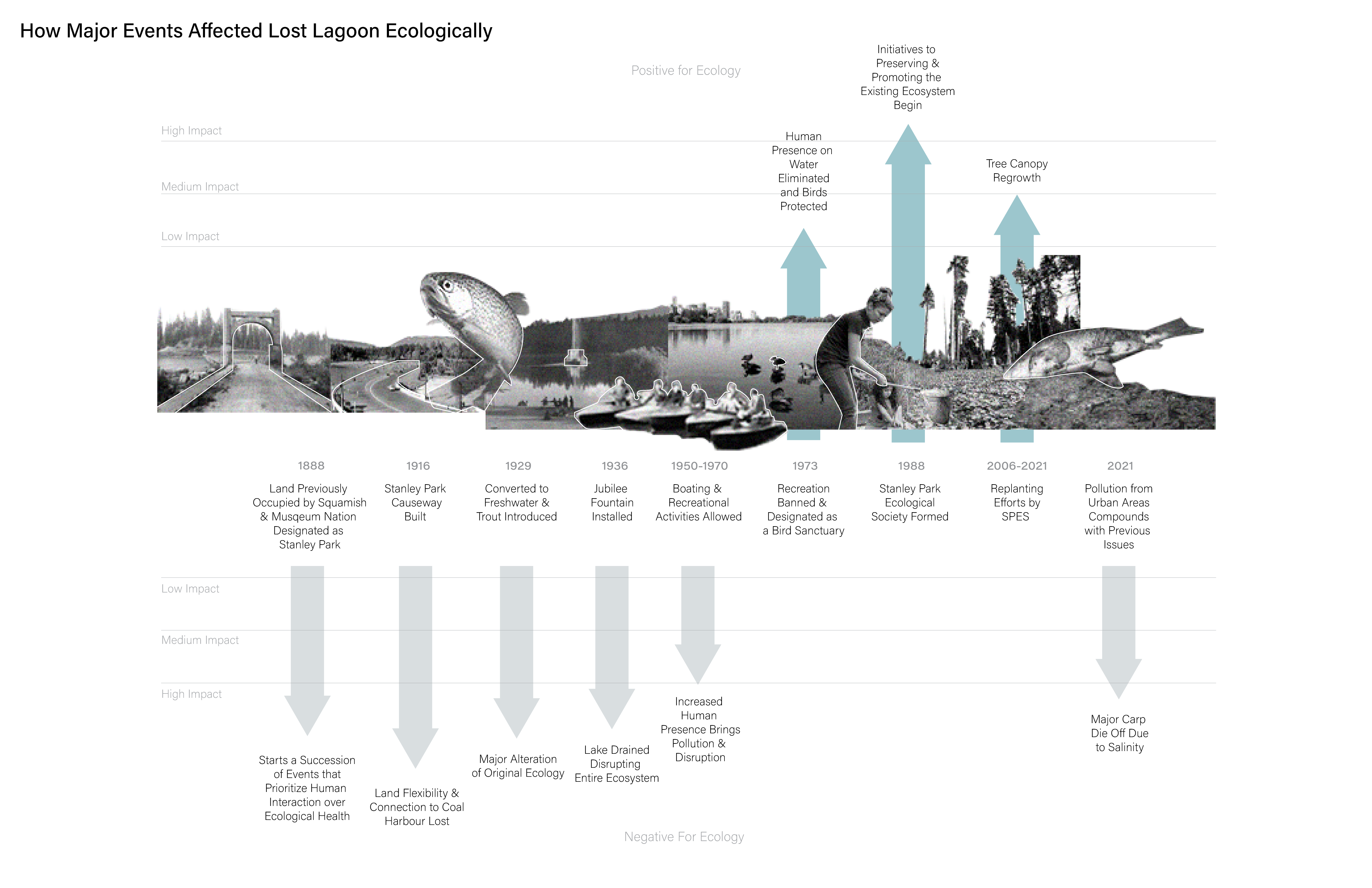
Lost Lagoon Timeline: An exploration of the history of Lost Lagoon shows the relationship of the social and ecological events of the site. It can be used as a tool to see correlations (or missed correlations) between social and ecological events, to examine patterns of this relationship, and to speculate the future relationship of social and ecological features at Lost Lagoon.

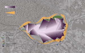
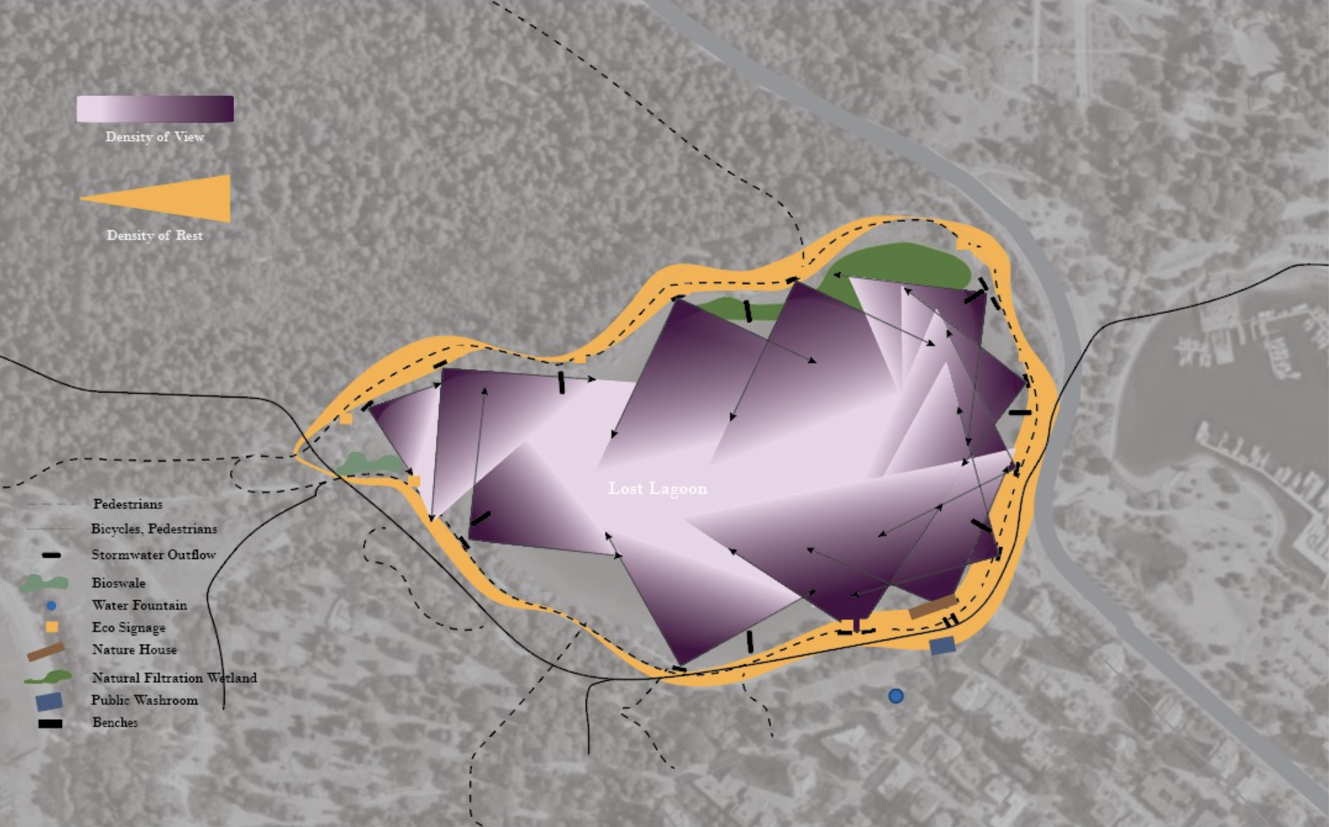
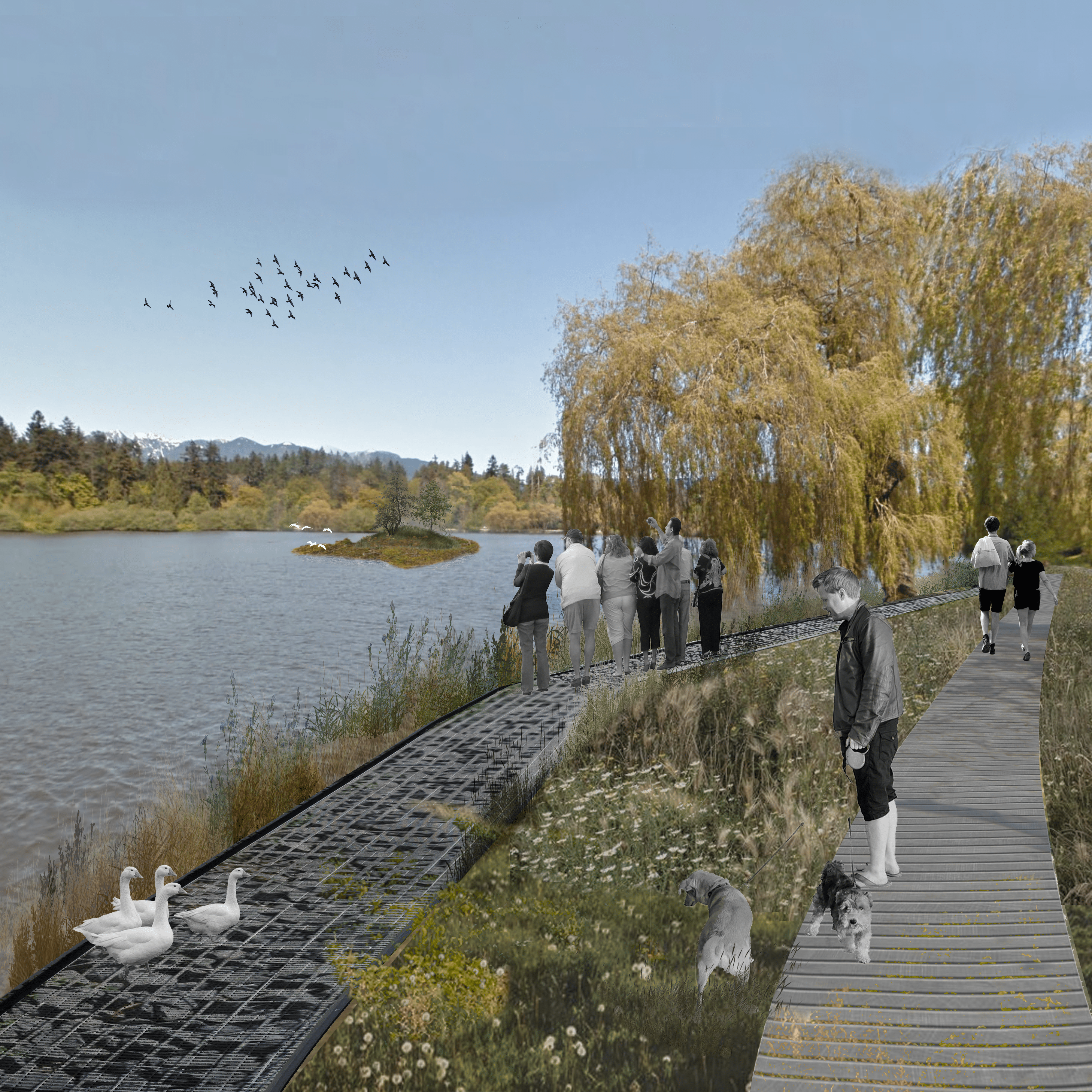
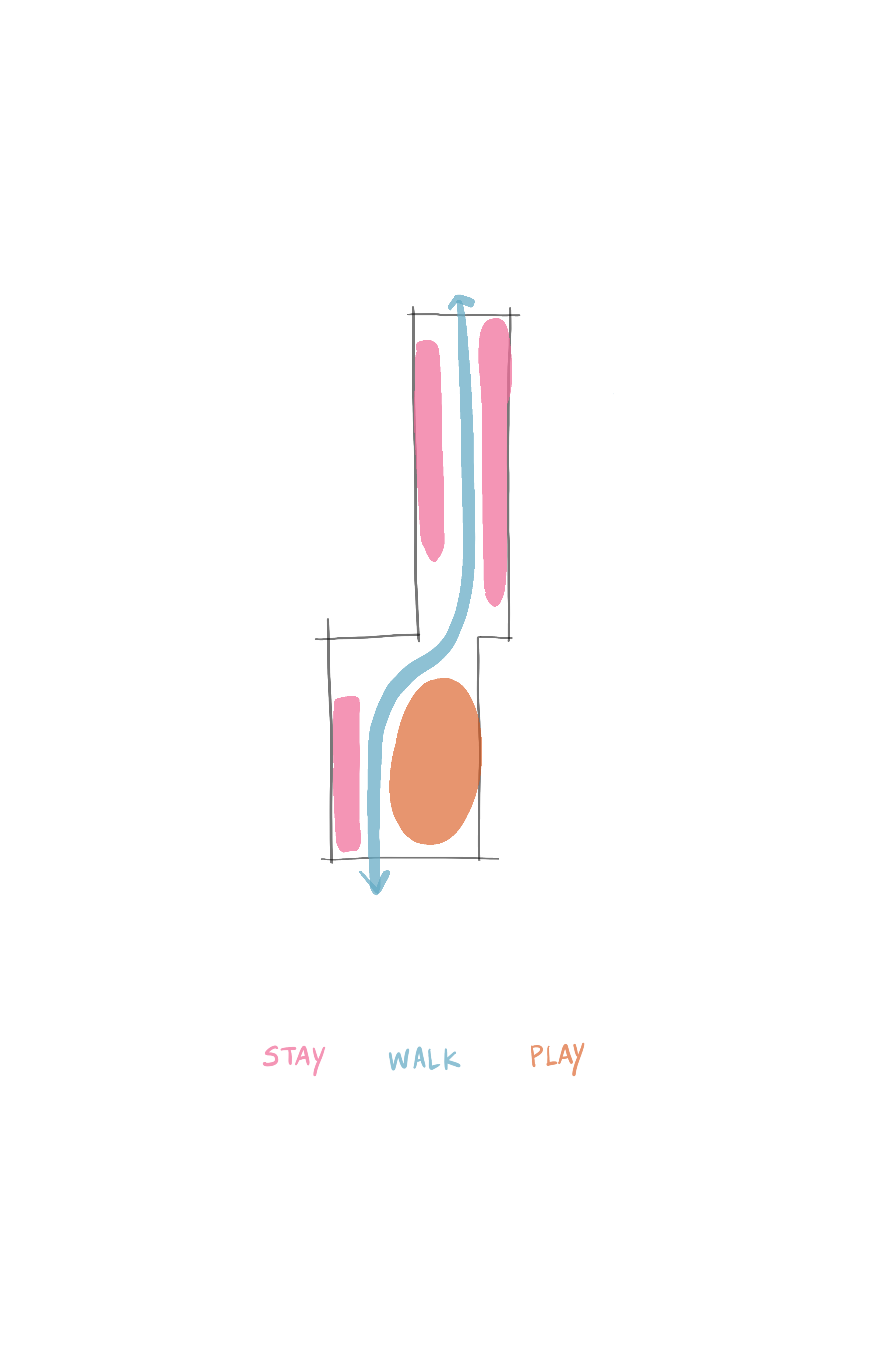
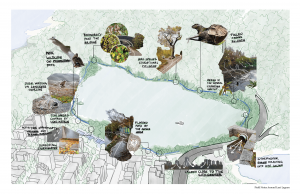
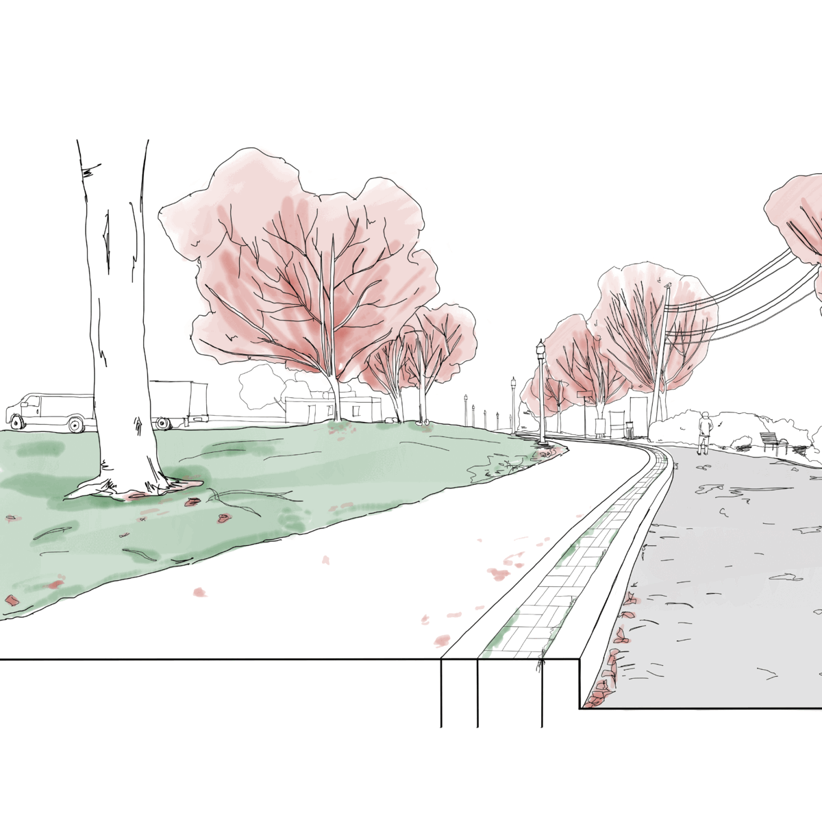
View Cones and Places of Rest: Analyzing the density of views and density of rest to understand the characteristics of spots along the Lost Lagoon trail where places of viewing the lagoon and resting overlap.

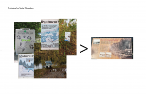
Ecological vs. Social Education at Lost Lagoon: Most educational stops are displayed by signs and ecologically focused education is more present than socially focused education. There is an opportunity to design education that integrates both ecological and social aspects of Lost Lagoon.

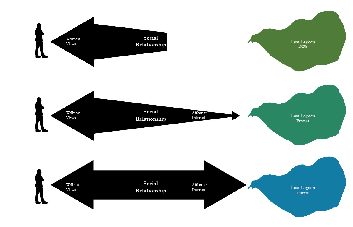
Relationship between Social (Human) and Ecological (Lost Lagoon): The evolution and predicted evolution of the relationship between humans and Lost Lagoon calls for reparation toward a more reciprocal relationship.


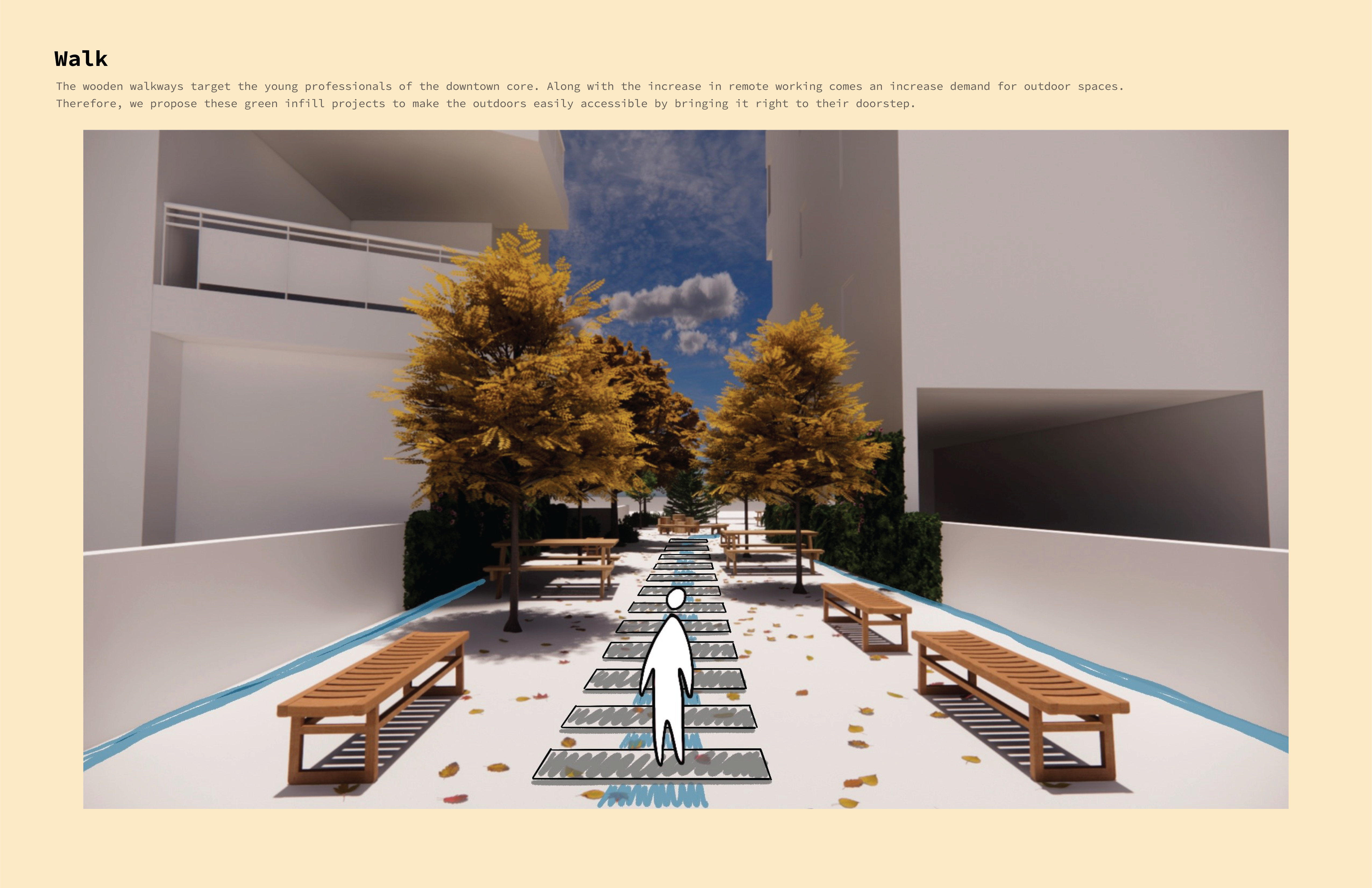
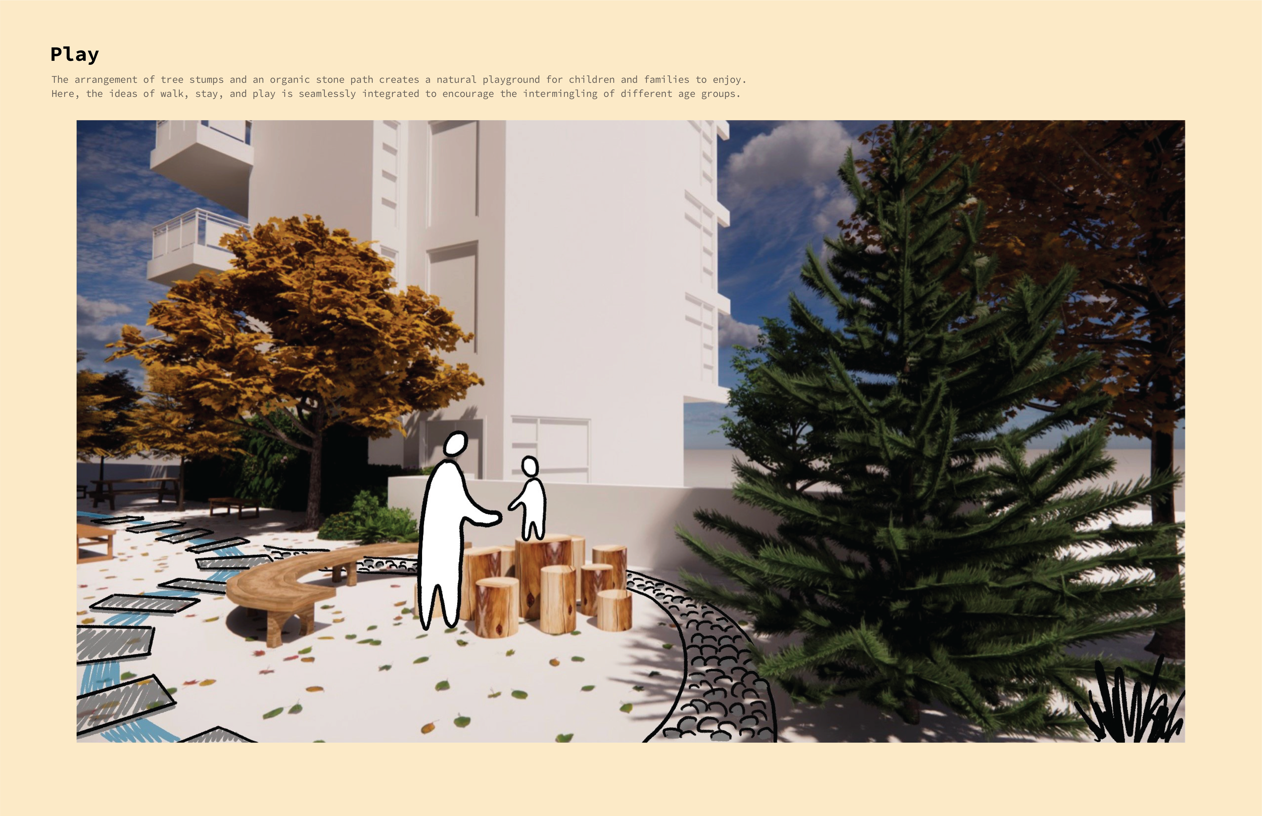
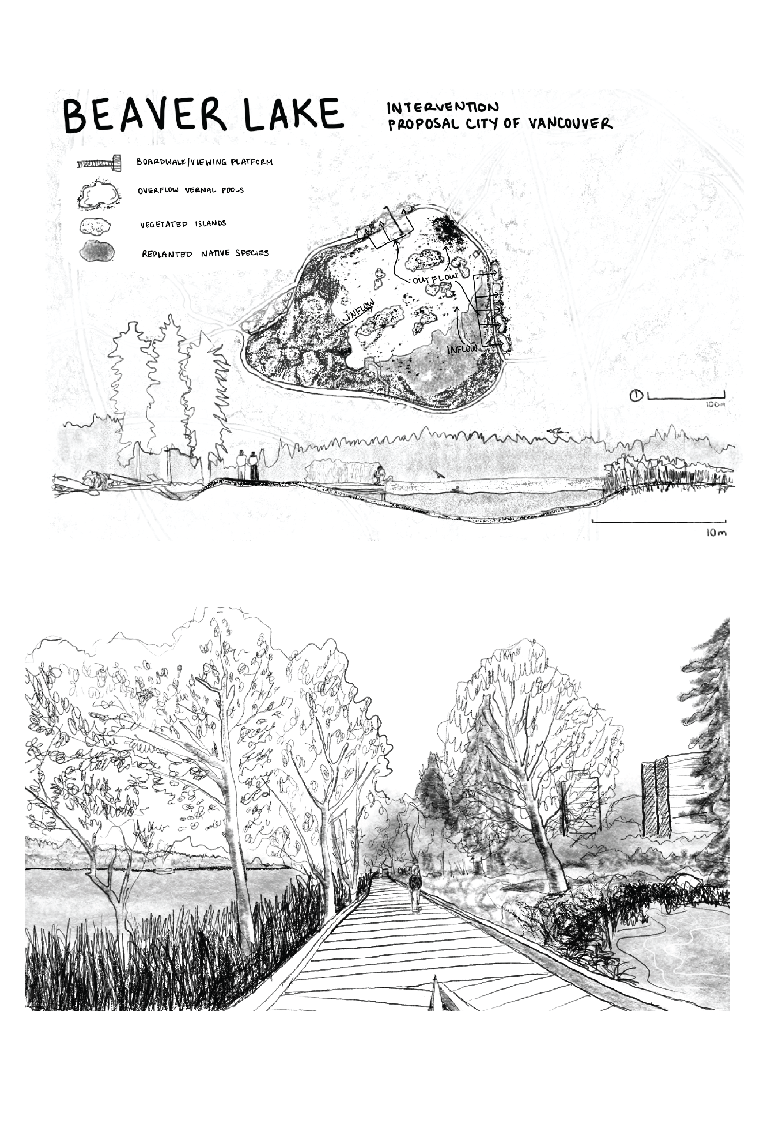
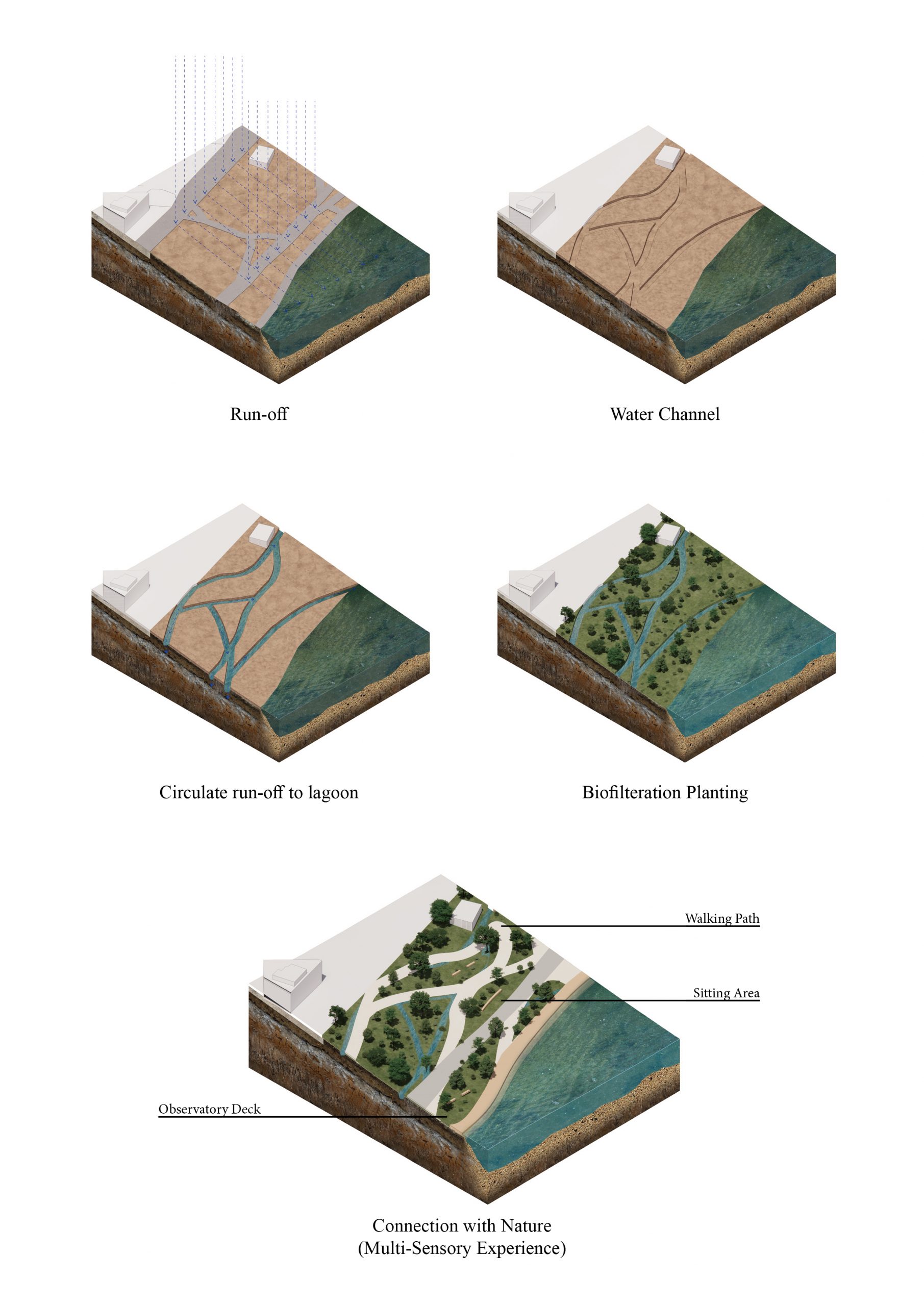
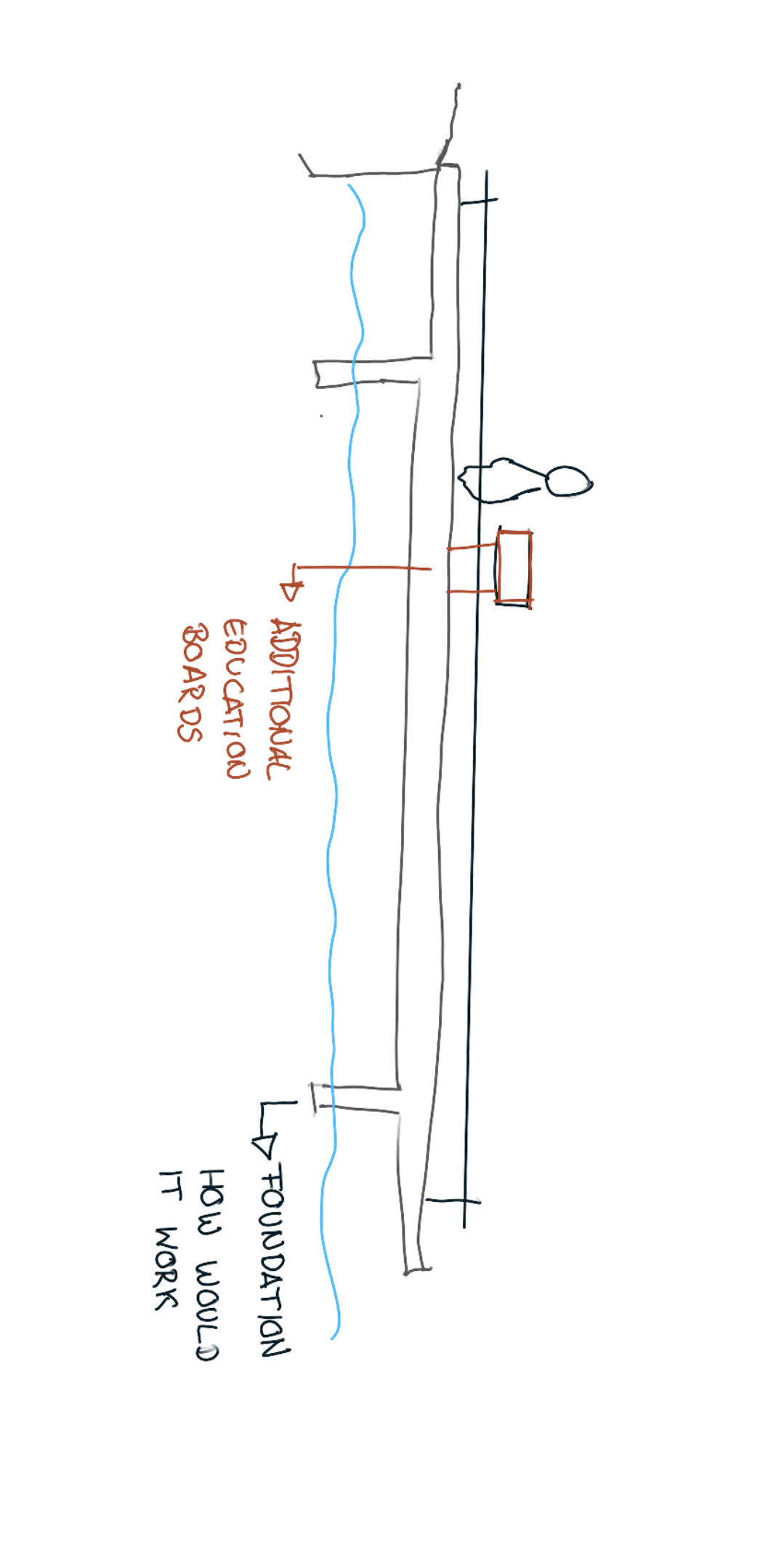
Designing a Socioecological Boardwalk across Lost Lagoon:

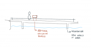
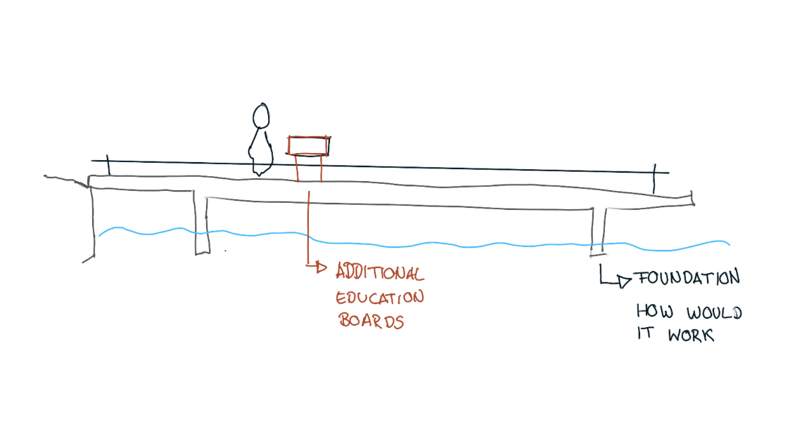
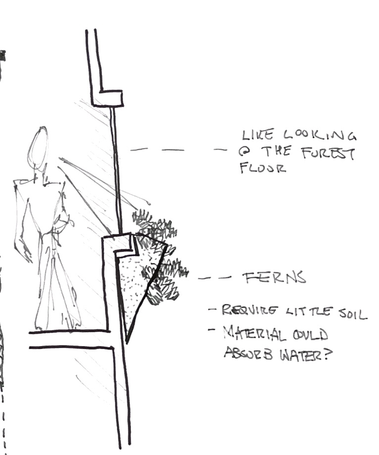
sketch ideas of educational boardwalk: How can we engage people with the social educational aspects of Lost Lagoon? What methods can we explore to share this information? How will the boardwalk engage with the Lagoon?

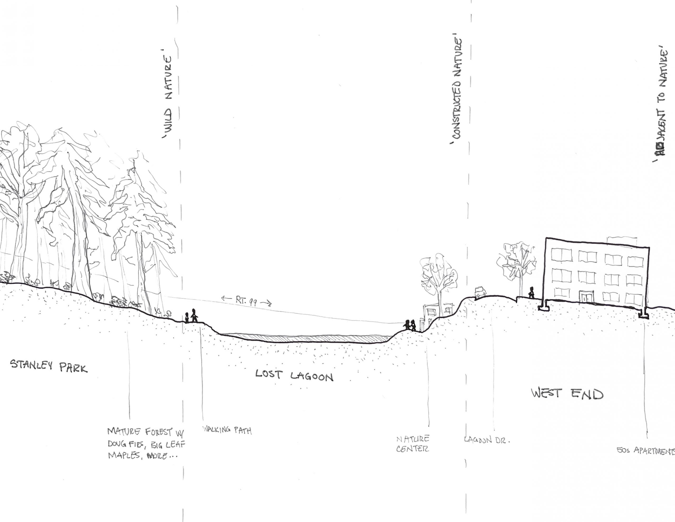
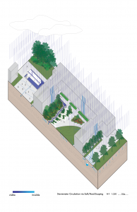
Map of Proposed Boardwalk: The boardwalk starts by the Nature House south east of Lost Lagoon and has 7 proposed stops that span northward across the Lagoon to the manmade wetland. The stops correspond to a timeline of Lost Lagoon and act as social education spots of these events.

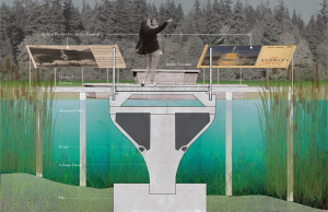
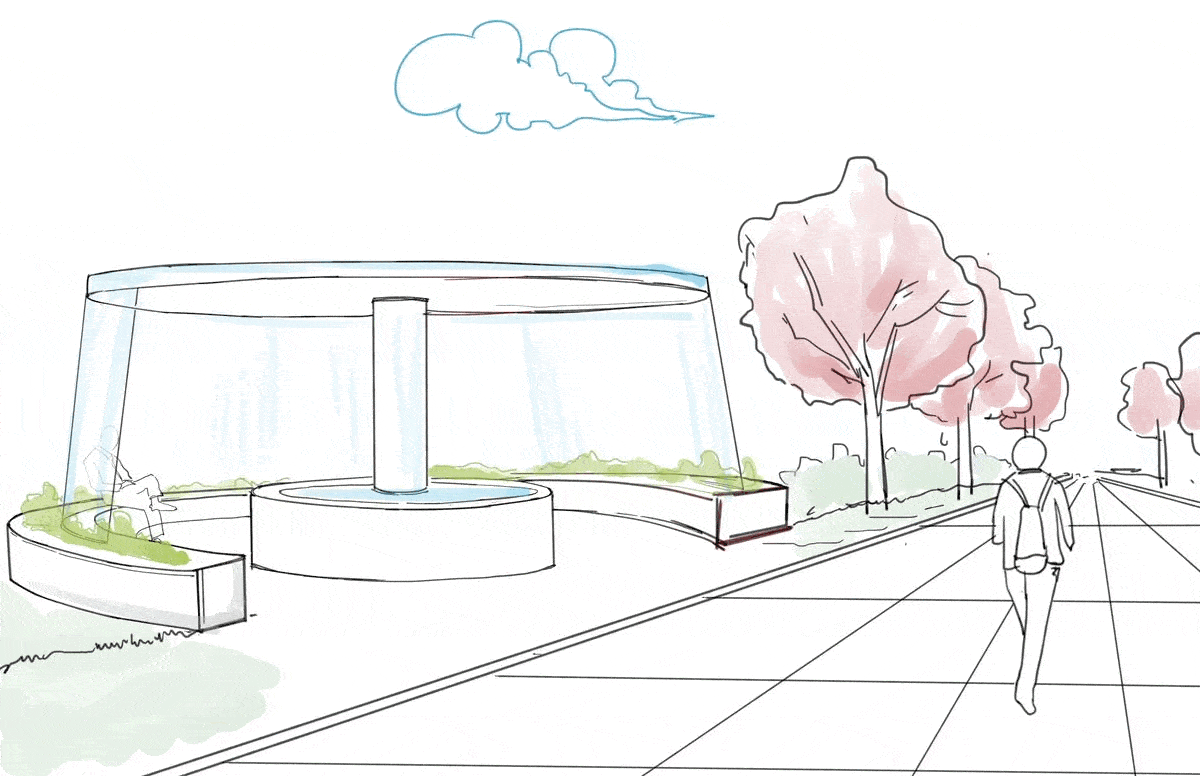
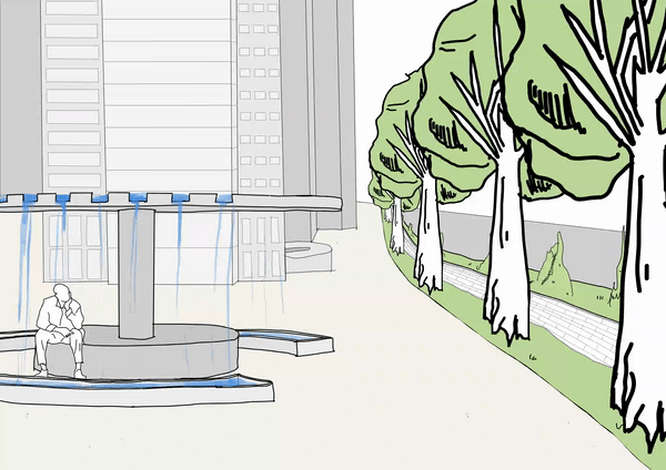
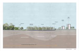
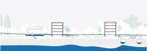
Section at Fountain: The paths mid point meets at the old fountain, at the centre of the existing trails view and a symbol of the human-centric relationship we have had with the lagoon for the last century, prioritizing our views over the lagoons health. Now, it holds a timeline of the constructions on the lagoon paired with the ecological effects they had, up to this present path, creating a deeper connection for the visitor and the lagoons shared history.

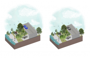
South Entrance of Boardwalk Perspective: Experiential view of the educational stops south of the fountain, including the Lost Lagoon poem engraved onto the deck to acknowledge Indigenous histories along the Lagoon, a concrete section of the platform to allude to the construction of the causeway, and the bird watching pavilion to mark the creation of the bird sanctuary around the Lost Lagoon trail.

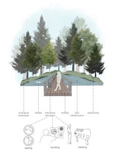
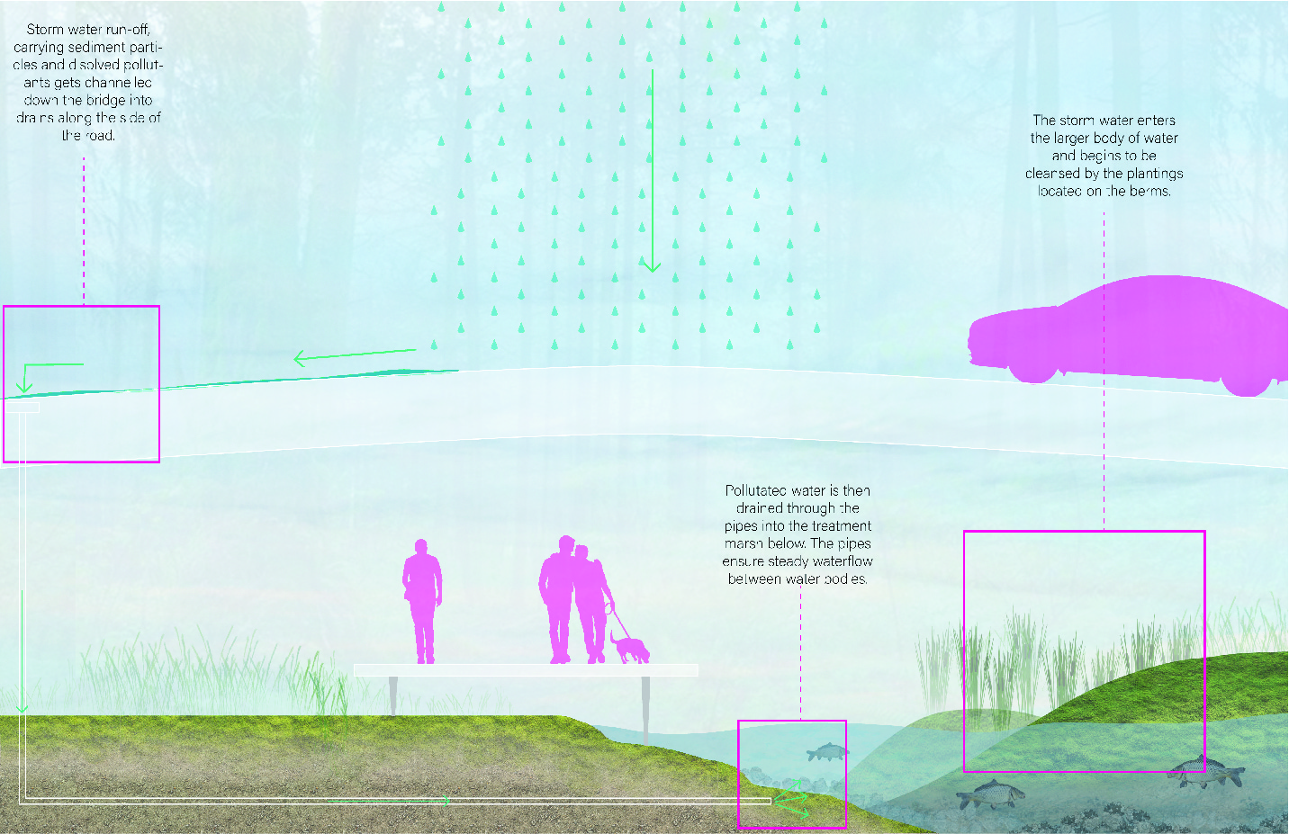
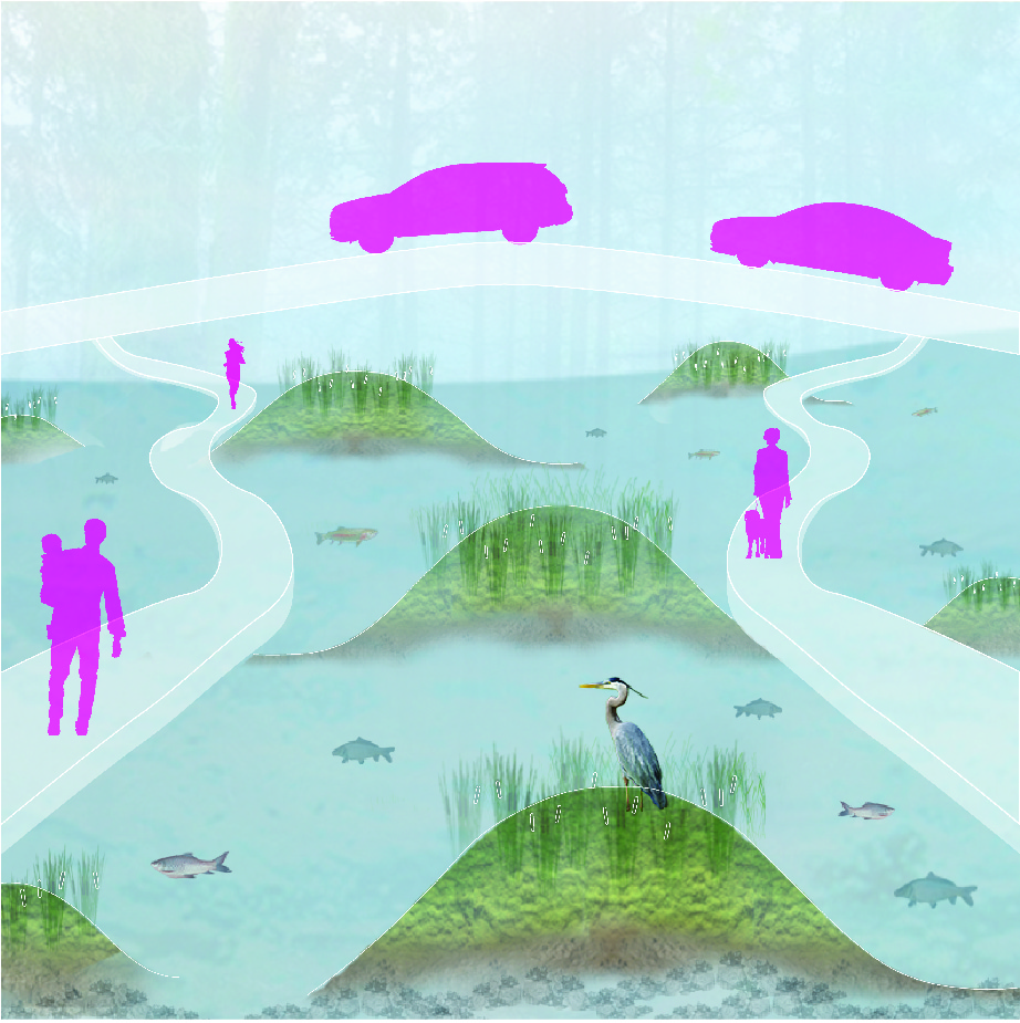
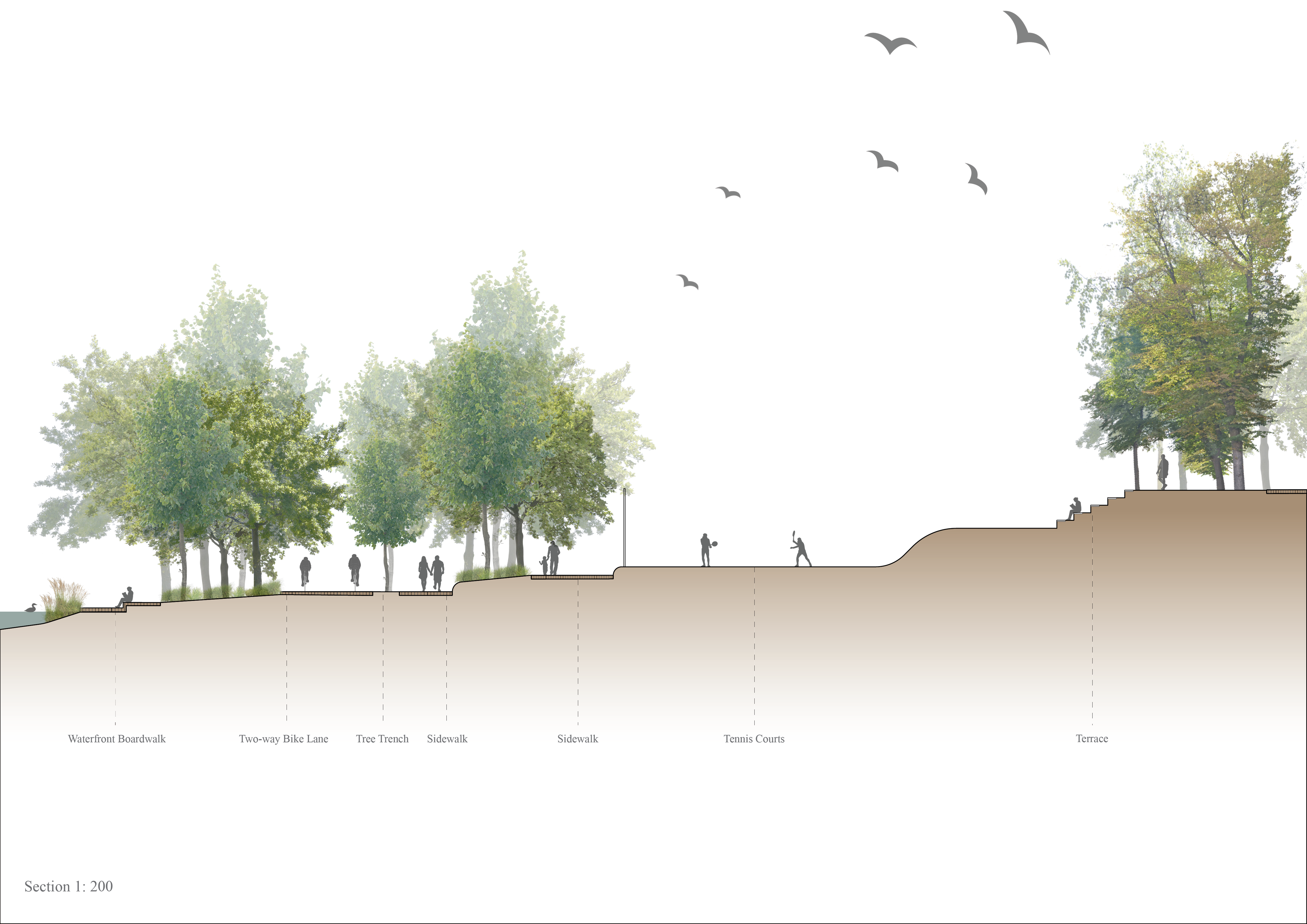
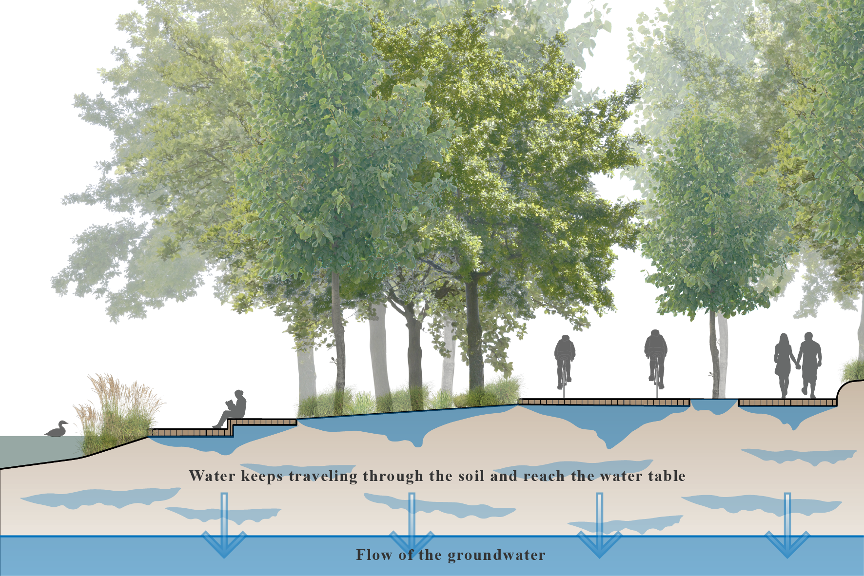
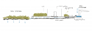
Section of Boardwalk North of the Fountain with Experiential Education: The walk over the Lost Lagoon develops a relationship between human and nature with interactive educational boards. It creates a new urban space without compromising the eco-system. The educational boards are interactive using multiple senses, creating a multi-sensory walk.

A6| Brittany, Andrew, & Ploy

For this design project, we redesigned Lost Lagoon’s lake bed and shoreline to ameliorate many of the ecological issues associated with the water body. Some of these issues include regular algae blooms, stagnant, highly polluted waters and foul odors due to decomposition via anaerobic bacteria. Our design intervention proposes a deepened lakebed and the addition of berms to increase oxygen levels and pollutant filtration within the Lagoon ecosystem. In addition, to increase the depth of the lagoon, we would add a solar powered aeration system to aerate the water within the lagoon. Adding oxygen fights foul smelling anaerobic bacteria and replaces them with aerobic bacteria which also decomposes organics, just without the smell. The berms would not only increase the wildlife habitat for non-aquatic species, but also increase wetland areas surrounding the lagoon. These wetlands are extremely important for filtering pollutants entering the lagoon as well as for the many wetland species that call the area home. These berms would be mostly off limits to human foot traffic, however, there would be certain locations in the circumventing path that would allow humans to interact directly with the shoreline through boardwalks. We hope this limited access will be beneficial for nesting birds and local animals hoping to raise young without worrying about human disturbances.

Analysis

Intervention

GIF of shoreline change

Assignment 06 | Jenny, April, Nicola, Soyeon

Animation


Site Plan


GIFs

1) A big section, showing the overall systems and designs

2) The roof system for the stormwater management

3) Water flow towards the underground drainage system

4) Bike lane and green infrastructure improvement

5) Water recycling

6) Permeable road surface

7) A section of the water installation

8) An adult’s perspective

9) A child’s perspective

Assignment 5 – April, Jenny, Nicola, Soyeon

Site map


Site map with observations.


Rainwater runoff carries pollutants on the street surfaces entering open water.


Waterlogging problems on sidewalks.


Limited distance between bike land and bus lane on Georgia st.


Water accumulation on blocking water catch basins.


Traffic noise problems.


Insignificant landscape design features.


Vision+Goals+Objectives