On Monday, August 1, we will celebrate British Columbia (BC) Day, a civic holiday. According to the Protocol and Events Branch of the British Columbia government, the “British Columbia Day Act, R.S.B.C. 1996 c.34 was first introduced in 1974 as Bill 61 by the Hon. Ernie Hall, the Provincial Secretary under Premier Dave Barrett. The explanatory notes prefacing the bill states: “The purposes of this Bill is to recognize the pioneers of British Columbia by declaring the first Monday of August in each year to be a public holiday known as British Columbia Day.”

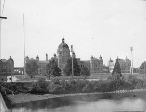
The decision to make BC a holiday was debated during the 4th session of the 30th Parliament in 1974. This debate took place in the chamber of the British Columbia Parliament building.

Image credit: Chung Collection, CC-PH-02031

Image credit: Chung Collection, CC-PH-02031

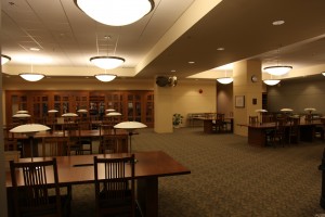
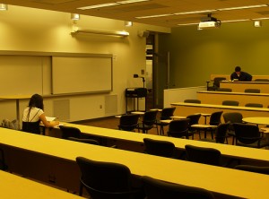
The Parliamentary Room, room 155 in the Irving K Barber Learning Centre, was modeled after this room in the British Columbia Parliament. This room is quite different from a traditional lecture hall and is intended to support collaborative student learning and debate.

Image credit: UBC Library

Image credit: Parliamentary Room, UBC Library

All of the staff in Rare Books and Special Collections wish you a happy and restful BC Day! Just a reminder that all of the UBC Library branches, including Rare Books and Special Collections, will be closed for BC Day. For more information on hours, click here.

Interestingly, many of the group study rooms in the Irving K Barber Learning Centre are named after rivers in British Columbia. Room 416, a group study room on the fourth floor of the Barber Centre, is named after the Muskwa River, a river that runs 257 kilometres through northern British Columbia. The Muskwa River, a major tributary of the Fort Nelson River, flows east and north to merge with the Prophet River, before joining the Fort Nelson River.

Using some of the place name resources mentioned in the previous blog post on Keremeos, we are able to trace the different names that have been applied to the Muskwa River throughout the years; the “official” name of the river has changed a number of times since the beginning of the 20th century.

According to BC Geographical Names , on Gotfred Emile Jorgensen’s 1895 Map of the Province of British Columbia, it was labeled the “Sicannie River.” The Sikanni (Sekani) people, “dwellers of the rocks,” traded, hunted and lived near the river for hundreds of years. To read more about the history of the Sekani people of British Columbia, you may wish to read Sekani Indians of British Columbia, by Diamond Jenness.

However, what is now called the Muskwa River was labelled “Sikanni River” on BC Land’s map 1A, 1912 and then, in 1917, labeled the “Musqua River” on BC map 1H. It seems that there is some disagreement as to why the river was finally given the name Muskwa. According to George Philip Vernon and Helen Akrigg’s British Columbia Place Names, Muskwa is the Cree word for “bear.” Described by BC BookWorld as “self publishing pioneers”, the Akriggs first published their “landmark’ 1001 British Columbia Place Names in 1969; many editions followed through the years.

Other researchers believe that since the “custom apparently is for a separate band of the Sikanni Indians to hunt on [one and only one] of these rivers, […] the rivers receive the names of the leaders in each band…..thus Musquah’s River, Prophet’s River, Sikanni Chief’s River and Fantasque’s River” (BC Geographical Names http://archive.ilmb.gov.bc.ca/bcgn-bin/bcg10?name=8364).

Tracing the history of the name of the Muskwa River is a good reminder that one should consult multiple sources when doing research!

The Skeena River Room, room 317 in the Irving K Barber Learning Centre, is a group study room that is named after the Skeena River, the second-longest river entirely within British Columbia’s borders (the largest being the Fraser River). Six-hundred and twenty-one kilometers long, it flows south and west through the Skeena and Coast Mountains, reaching the Pacific Ocean at Prince Rupert.
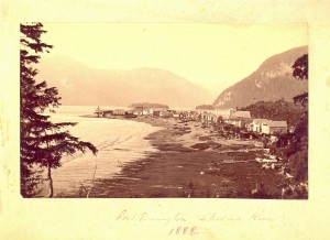
Port Essington, Skeena River, 1888, BC124

Port Essington, Skeena River, 1888, BC124

For thousands of years, the Tsimshian (“People of the Skeena”) have lived along the river; the Coastal Tsimshian live near the lower part of the river and the Gitksan live on the upper part of the Skeena River. George Vancouver visited the mouth of the Skeena River in July, 1793, but it wasn’t until the 1860s and 1870s that persons associated with the Gold Rush and railway began to travel to and settle along the river. In 1876, salmon canneries were built along the Skeena River. Operating along the river from the late 1870s to the mid-1980s, at one time there were as many as 18 canneries along the Skeena.

In Rare Books and Special Collections, we have various records and plans of salmon canneries that operated in British Columbia, and in particular along the Skeena River. For example, in the Inverness Cannery fonds, there are plans, financial records and correspondence relating to this cannery constructed along the Skeena River in 1873. The J.H Todd and Sons fonds also contains records concerning the Inverness Cannery.

It is also very interesting to consult the 1924 fire insurance plans of Skeena River salmon canneries in the collection of Plans of salmon canneries in British Columbia together with inspection reports on each, that are part of the records of the British Columbia Fire Underwriters’ Association. This collection includes the plans of 12 canneries that operated along the Skeena in the early 1920s: Inverness Cannery, North Pacific Cannery, Dominion Cannery, Sunnyside Cannery, Cassiar Cannery, Haysport Cannery, Alexandra Cannery, Balmoral Cannery, Port Essington Cannery, Carlisle Cannery, Claxton Cannery, and the Oceanic Cannery.

Fire insurance plans are detailed large-scale maps of cities, smaller municipalities, and industrial sites that were produced from the late 1800s to the mid-1960s. The object of these maps was to show the character of any insured building. These plans were compiled by the fire insurance underwriters to assist their agents in assessing and controlling the risks of fire. Various symbols and colours were used to indicate the following characteristics: the shape and size of a building; the type of construction used; the existence of fire protection facilities; and the use of the building (e.g., a restaurant, a laundry, etc.).

The fire insurance plan of the North Pacific Cannery is revealing for a number of reasons. In addition to documenting the number and types of buildings of this cannery originally established in 1889, the plan shows, for example, that in 1924, the Japanese, First Nations and Chinese cannery workers were housed in separate buildings:
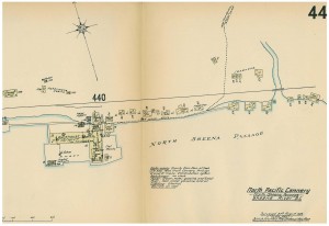
Sheet 44, North Pacific Cannery, RBSC-ARC-1272:F9-8
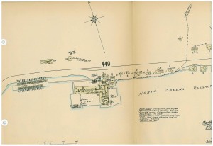
Sheet 44, North Pacific Cannery, RBSC-ARC-1272:F9-8


Sheet 44 (part 2), North Pacific Cannery, RBSC-ARC-1272:F9-8

Sheet 44 (part 2), North Pacific Cannery, RBSC-ARC-1272:F9-8
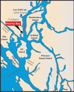
This week, we are taking a closer look at the community of Hartley Bay — the community that the Hartley Bay Meeting Room (room 266), in the Irving K Barber Learning Centre is named after.

Image Credit: Map of Hartley Bay, from http://www.gitgaat.net/place/enlargemap.htm

Hartley Bay is the home of the Gitga’at First Nation, members of the Tsimshian cultural group. A village of 200, accessible only by air or water, Hartley Bay is located at the mouth of Douglas Channel, about 630 kilometres north of Vancouver and 145 kilometres south of Prince Rupert.

On March 22, 2006, the people of Hartley Bay were the first responders to the passengers aboard the sinking BC Ferries Queen of the North. The community was recognized for their heroic actions by the Governor General on May 3, 2006 and received the Governor General’s Commendation for Outstanding Service.

The XWI7XWA LIBRARY, located at 1985 West Mall has a variety of material on the community of Hartley Bay, including material in their special collections. Contact Ann Doyle, head of XWI7XWA LIBRARY, for more information on accessing material in the special collections.

The Kootenay River Room, a large, bright and airy group study room (room 422) on the 4th floor of the Barber Centre, is named after the Kootenay River, one of the tributaries of the Columbia River. It is a major river that runs through southeastern British Columbia, Canada and the northern part of Montana and Idaho. Throughout the history of British Columbia, many people from various backgrounds have lived and traveled along its banks.

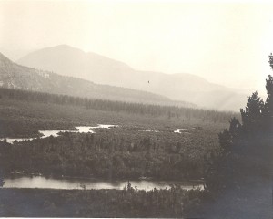
The very source of the Columbia River, looking south across Canal Flat toward the Kootenay river, ID # BC-146

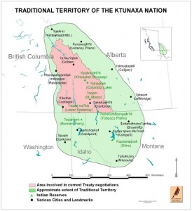
The people of the Ktunaxa (Kootenai) nation have lived, fished and hunted along the river for thousands of years.

Image Credit: http://www.ktunaxa.org/who/popup_tradterritorymap.html

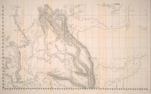
In the early 19th century, the first European explorer to visit the area, David Thompson, explored and surveyed the Kootenay’s banks, calling it “McGillivray’s River” on his 1814 map (the original map is in the Archives of Ontario and is part of F443, the David Thompson fonds ). Rare Books and Special Collections has a reproduction of Thompson’s 1814 map, published by the Champlain Society in 1916 : Map of the north-west territory of the province of Canada.

Image credit: Champlain Society Digital Collections: http://link.library.utoronto.ca/champlain/search.cfm?lang=eng

In the late 19th century, the Doukhobors, a “Spiritual Christianity” sect that originated in Russia in the late 16th-17th century and rejects organized government and the church, left Russia and travelled to Canada. Various groups settled in Manitoba, Saskatchewan and British Columbia. In 1908, the group that settled in British Columbia, called the Community Doukhobors, purchased 2,700 acres of land along the Kootenay River. Their leader, Peter Verigan, called the settlement “Brilliant,” after the sparkling waters of the river.

In Rare Books and Special Collections, there is a large body of archival material related to the Doukhobors. You may be interested in consulting the Doukhobor research collection , the Peter Faminow fonds and the Jim Hamm research collection.

In 2010, the Irving K Barber British Columbia History Digitization Program funded a digitization project by the Touchstones Nelson: Museum of Art and History, Changes Upstream: Along the Kootenay River North of the 49th Parallel Before and After the Libby Dam, 1969-72. Visit this digital exhibition to view images of the homes, lifestyles and lands of communities along the Kootenay River during the summers of 1969-72.

In mid-November, our featured place was Moresby Island. It was interesting to learn that there are actually two Islands with the name Moresby in British Columbia.

One of those Islands named Moresby Island is located in the Queen Charlotte archipelago. Our featured place this week is Sandspit, a small community of approximately 400 people, located on the northeastern tip of Moresby Island, near Spit Point. Situated between two beaches– Shingle Bay Beach to the west and Shell Beach to the south-east– Sandspit is the only settlement on Moresby Island.

Located on a long peninsula of sand and gravel, Sandspit has been home to the Haida people for thousands of years. The town today is sustained by logging, transportation (it has the largest airport on Haida Gwaii) and tourism.

In Rare Books and Special Collections, we do not have a lot material on Sandspit. So, to search for archival records related to Sandspit, or other small communities in British Columbia, we recommend that you try searching MemoryBC.ca, a portal where you can access descriptions of archival materials preserved in repositories throughout the province.

If you search for the keyword “Sandspit”, you will retrieve records from the Haida Gwaii Museum at Qay’llnagaay, located on nearby Graham Island.

Room 381, the Sandspit Meeting Room, is named after this important community in British Columbia. Located on the third floor of the Irving K Barber, this meeting room is part of the Gateway Programs: Arts One, Science One, Coordinated Science and Coordinated Arts.

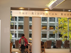
This week, we thought that we would post on the Ridington Room, a room in the Barber Centre that is not named after a place in British Columbia.

Photo courtesy of UBC Library Graphics, and created under a Creative Commons License

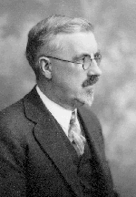
Rather, the Ridington Room (room 321)  is named after an important person in the history of the University of British Columbia Library: John Ridington.

Photo courtesy of the UBC Archives. UBC Archives photo #1.1/1510

John Ridington was UBC’s  first University Librarian. A former journalist and teacher, he started work on the library collection in August 1914 when UBC was in its temporary home at West 10th Avenue and Laurel Street (the Fairview Shacks).  By 1916, he had been appointed University Librarian, a position he remained in until his retirement at the age of 72 in April 1940. According to information gathered by the UBC Archives, Ridington was known as a rigid authoritarian and was nicknamed ‘King John’.

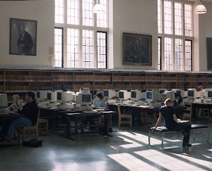
In the former Main Library, there was also a room named after Ridington. Photo courtesy of UBC Archives. UBC Archives photo #76.1/22

The University Archives is responsible for collecting material related to the University and, therefore, holds the papers of John Ridington and his family. If you are interested in learning more about the life of UBC’s first University librarian, take a look at the finding aid (“an aid for finding items in an archival collection”) to the collection that is available on the University Archives website.

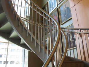
The Ridington Room is definitely worth a visit if you haven’t already had the oppportunity to see the space. It is often called the “Harry Potter Room” by students, due to the winding staircase and the portrait-covered walls. A portrait of John Ridington, painted in 1912 by his brother-in-law Malcolm Charleston, hangs in the Ridington Room.

Photo courtesy of UBC Library Graphics, and created under a Creative Commons License

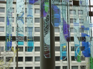
There is also a magnificent art installation by Vancouver artist John Nutter, who was commissioned by Jean Barber to to design a 45-panel glass sculpture that is intended to “flow like the Northern Lights,” and features intricate etchings designed around a series of compasses. Nutter felt the Library, like a compass, should be used “as a tool of discovery.”   It is an ideal space for quiet study, but be sure to arrive early because the comfortable chairs fill up quickly!

Photo courtesy of UBC Library Graphics, and created under a Creative Commons License

This week our featured place is Fort Fraser, British Columbia.  Today, Fort Fraser,  named by the explorer, Simon Fraser in 1806,  is a community of about 1000 people that is active in the tourism and forestry industries.

Mill at Fort Fraser

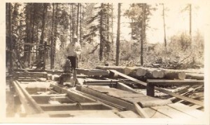
Mill at Fort Fraser, BC-1456-2-11. This photograph of a lumber mill in Fort Fraser comes from the B.C. Historical Photograph Album Collection . RBSC collects photographs both individually and as parts of larger collections. On our website you will find tutorials on how to search for photographs in our collections.

Historically, Fort Fraser played an important role in the development of British Columbia for a number of reasons, including:

  • It is found near the geographical centre of British Columbia, 44 km west of Vanderhoof on The Yellowhead Highway.
  • Originally established in 1806 as a North West Company fur trading post by the explorer Simon Fraser, it is one of present-day British Columbia’s oldest permanent European-founded settlements. The area around the community is also recorded as the site of the first land in British Columbia cultivated by non-First Nations people.
  • The present community is located at the site of the last spike of the Grand Trunk Pacific Railway, driven on April 7, 1914.

The Rare Books and Special Collections (RBSC) reading room is named after the community of  Fort Fraser. We think that it is a very fitting name for our reading room. Similar to the way in which Fort Fraser is located near the geographical centre of British Columbia, physically, the RBSC reading room is located at the heart of the Barber Learning Centre.

Fort Fraser Reading Room

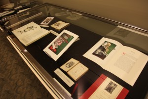
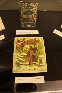
If you have some extra time before we close for the holidays at 3pm on December 24, please drop in to visit the RBSC Fort Fraser Reading Room and a take a look at ‘Tis the Season, a winter holiday-themed exhibition.


Holiday exhibition in the Fort Fraser Reading Room

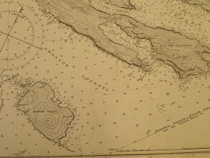
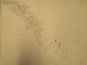
Our second featured place is Moresby Island. During the course of doing research for this blog post, we discovered that there are actually two Moresby Islands in British Columbia; one island is located in the Queen Charlotte archipelago and one island is located in the Gulf Islands. Our collection of early British Columbia Admiralty charts includes charts of both islands.

Moresby Island, shown on Admiralty chart 3619, is the name of one of the BC Gulf Islands and is located on the west side of Swanson Channel and east of the southern end of Saltspring Island. A small island (it is 3.7 km long and 2.2 km across), it was first settled in 1863 and was named after Rear Admiral Fairfax Moresby R.N., who was the naval commander-in-chief of the Pacific Station of the Royal Navy between 1850 and 1853.

Moresby Island (Gulf Island)

Moresby Island, shown on Admiralty chart 1923b, is also the name of one of the 150 islands that make up the Queen Charlotte archipelago, and is much larger. It is actually the 175th largest island in the world, and the 32nd largest island in Canada. Interestingly, this island was also named for Rear Admiral Fairfax Moresby, by Moresby’s son-in-law, Commander James Prevost.

Moresby Island (Queen Charlotte archipelago)

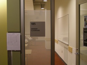
In the Barber Centre, the Moresby Room is room 185 and is located on the first floor of the Barber Centre.

Room 185, Barber Centre

Due to a special event, Rare Books and Special Collections will be closed to the public from 9:00 a.m. to 2:00 p.m. on Monday, August 9, 2010.

We thank-you for your understanding and regret any inconvenience this closure may cause.

If you have any questions, please contact us by email spcoll@interchange.ubc.ca or by phone at 604-822-2521.

a place of mind, The University of British Columbia

UBC Library

Info:

604.822.6375

Renewals: 

604.822.3115
604.822.2883
250.807.9107

Emergency Procedures | Accessibility | Contact UBC | © Copyright The University of British Columbia

Spam prevention powered by Akismet